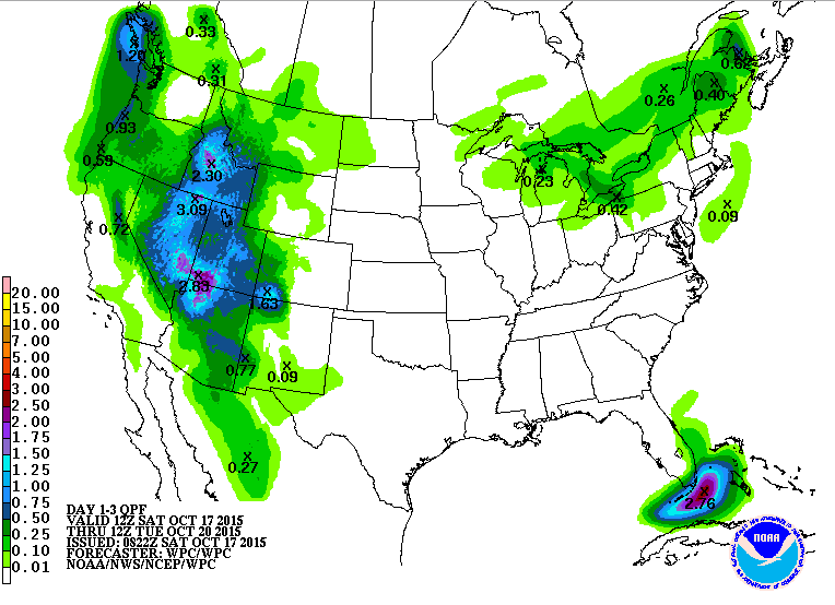
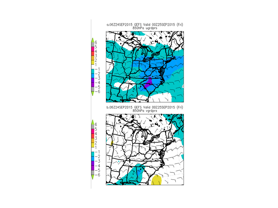
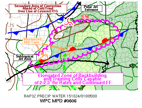
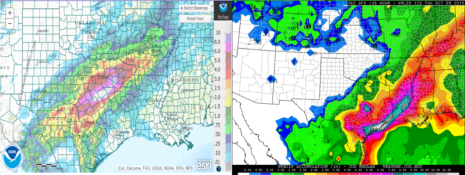
As much as 10 or more inches of rain fell south of Dallas, Texas on Friday, resulting in widespread flooding. This occurred as moisture was able to be pulled inland from the Gulf of Mexico along a low level jet that had a strength that was at times 2 to 3 standard deviations above normal. Also, surface moist convergence resided within an area that contained plentiful amounts of moisture in the form of precipitable water that was 2 to 3 standard deviations above normal. This all took place over the same area for most of the day. Additionally a cold front approached from the north and thunderstorm chances rose to the north of the area of convergence. As that cold front approached from the north, upper level divergence occurred in the right entrance region of the upper level jet allowing for large-scale upward motion. Consequently many cells were able to back-build and resided in the same place for long periods of time allowing for an over-saturation of the ground in those places and standing water for flooding.
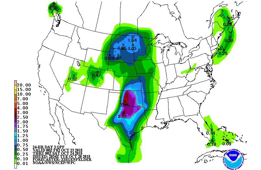
Moving forward, model projections have plenty more flooding moisture coming into the Southern Plains, but it should remain further south this time. Major Hurricane Patricia, which rapidly weakened, but was above Hurricane status just before reaching landfall in Mexico, will have an effect on the Southern Plains. Patricia’s remnants will get drawn into the aforementioned jet stream and will add moisture to the rainfall along the southern shores of Texas. The upper level jet and its dynamics move away from the region, so the bulk of the precipitation will now be a result of the remnant low pressure system from Patricia. Precipitable waters will be up to 3 to 4 standard deviations above normal, which is higher than what was in North Texas. But, while the storm should have heavier rainfall rates with strong low level winds bringing more moisture in from the Gulf, a short time for precipitation occurrence will happen as the low pressure system moves away quicker than the stalled out boundary in North Texas. A severe weather threat also exists with increased shear paired with the strong moisture content. Generally, tornadoes occur in the right front quadrant of a low pressure system depending on the direction of movement because that is where the apex of the low level jet tends to be. So, a northward movement would allow tornadoes to occur in the northeast side of the low pressure system. The strong rain should be out of Texas by Monday morning. As the storm continues along, it will continue losing tropical characteristics and will move to the northeast and affect regions from the Gulf-bordering States to the Northeast through the middle of next week as the energy and moisture from Patricia combines with another trough to the north and swings to the north and east.
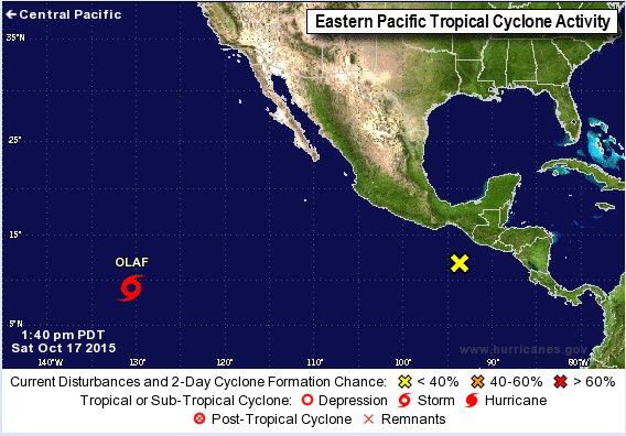
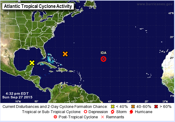
Speaking of previous tropical cyclone Patricia, there are only two named storms, including Patricia, from the Central Pacific to the Atlantic Ocean. As of late Saturday afternoon the remnants of Patricia were located about 45 miles southwest of Monterrey, Mexico. A low pressure system over southern Texas is also developing, but is expected to be non-tropical even with the remnants of Patricia being absorbed into it. The main threats continue to flooding and mud slides in Mexico and flooding and severe weather in Texas.