As Tropical Storm Erika continues to approach the Lesser Antilles, the questions remain the same as they were a few days ago: Where will Erika go and how strong will it get?
The first question is somewhat easier to answer in the storm term. As of 2pm EDT on Wednesday, Erika was centered about 245 miles east of Antigua, moving toward the west at 17 mph. It seems fairly likely that Erika will impact the islands of the northeastern Caribbean. As a result, Tropical Storm Warnings remain in effect from Puerto Rico and the Virgin Islands eastward to Montserrat, and a Tropical Storm Watch is in effect for Guadeloupe. A warning means that tropical storm conditions are likely within the next 36 hours, while a watch means that tropical storm conditions are possible within the next 48 hours.
How strong Erika will be when crossing the islands is still a big question. Currently, Erika has winds of 45 mph. The official forecast from the National Hurricane Center, is for Erika to maintain its current strength or strengthen slightly over the next 48 hours. However, there are some indications that it may actually weaken before then.
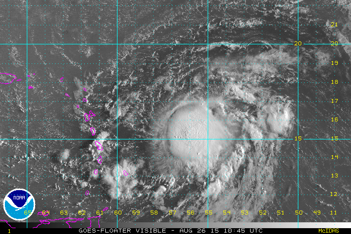
In the last few frames of the satellite picture, if you look closely, you can see the lower-level circulation of Erika pulling away from the western edge of the thunderstorm activity. This is a tell-tale sign that wind shear is still impacting the storm. For Erika to strengthen, the wind shear will need to lighten up, and allow the thunderstorm activity to redevelop near the center of the storm. Until that occurs, Erika will not gain strength. Some of the computer models are showing the possibility that Erika degenerates into a tropical wave as it nears or passes the Leeward Islands, similar to Tropical Storm Danny a few days ago. This would bring some much-needed rainfall to the drought-stricken region, without the sustained strong winds that normally accompany a tropical storm.
In the longer term, things become a bit murkier in terms of the track and strength of Erika. It seems fairly likely that what’s left of Erika will continue on a west to west-northwest track and could start to strengthen (or redevelop, if Erika dissipates), as it nears the Bahamas this weekend. At this point, there is no consensus as to what will happen.
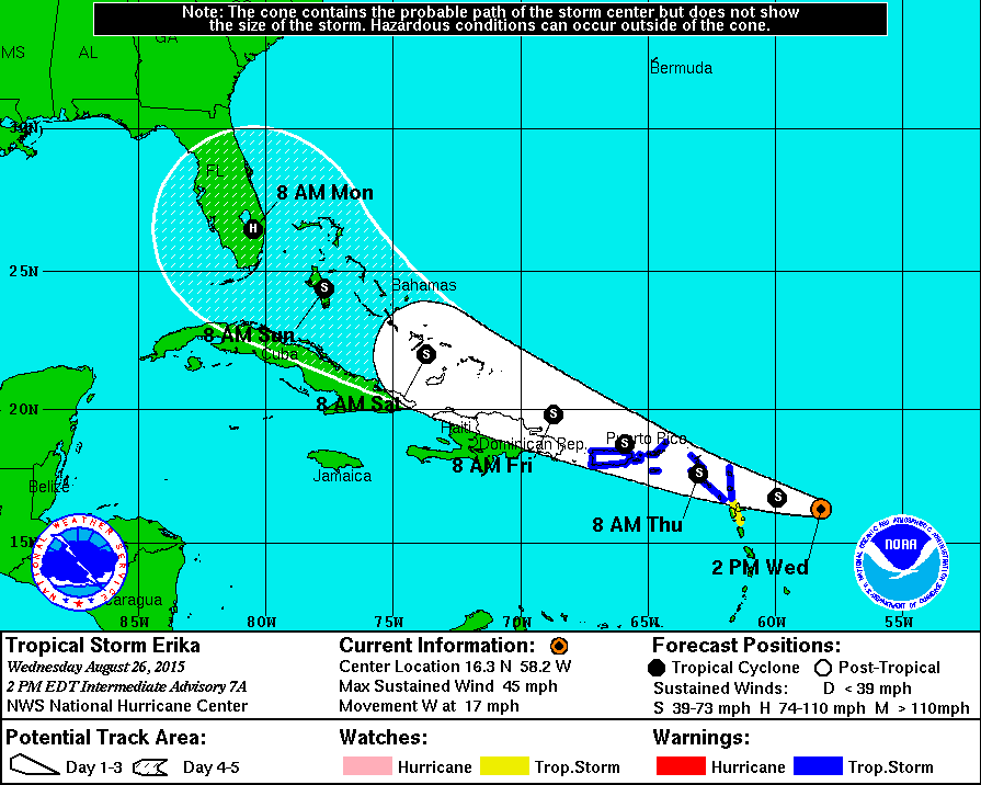
The National Hurricane Center forecast (pictured above) brings the storm into South Florida as a weak hurricane early Monday. However, on the various forecast models, the solutions range from a track into the Eastern Gulf of Mexico to one the keeps it near or east of the Bahamas and then out to sea. There are some that show a potential threat to Florida or the Southeast, but since this is still at least 5-7 days away, the odds are fairly low at this point. Still, residents of the region should keep an eye on Erika, as it could have some impact early next week.
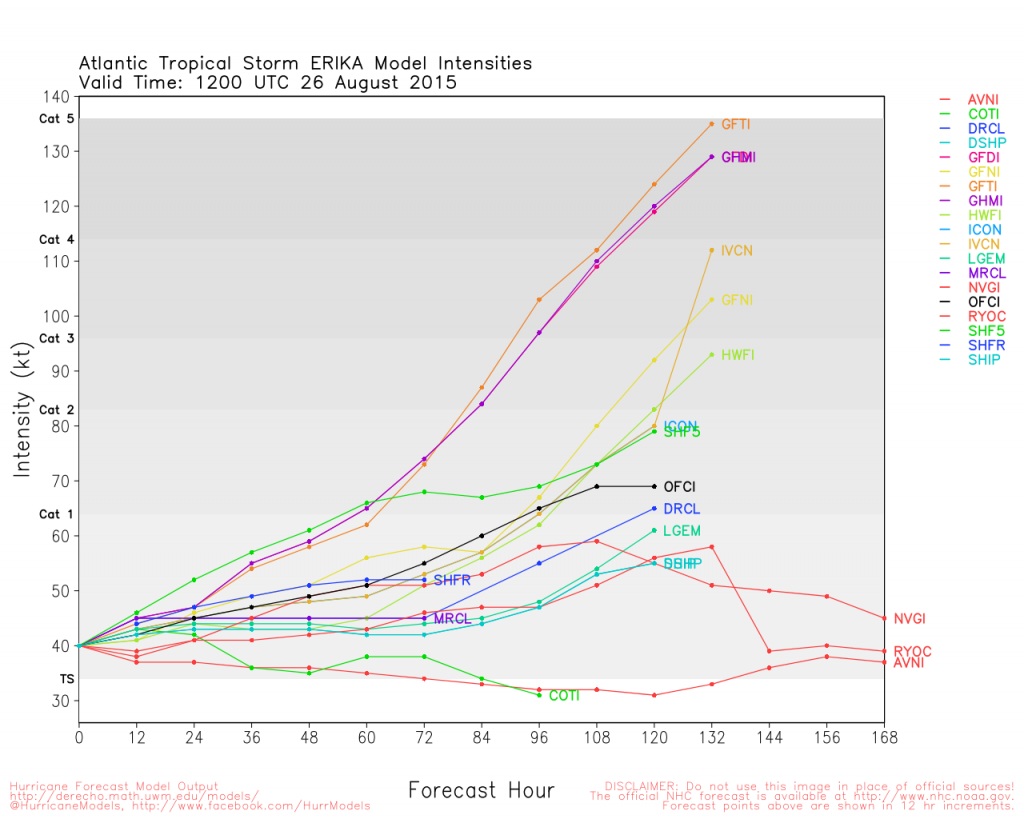
In addition to the track questions, there are plenty of questions as to how strong Erika will get. Erika should remain a weak tropical storm for the next 48-72 hours (unless it dissipates into a tropical wave). Beyond that, the uncertainty becomes large. Many of the forecast models keep it a tropical storm, while some strengthen it into a hurricane, in some cases a very powerful hurricane (see image below). Assuming it survives the journey toward the Bahamas, conditions should be favorable for Erika to start to strengthen towards the end of the week. The track it ultimately takes will determine if it is able to get there.
If Erika does make landfall in Florida as a hurricane, it will be the first storm to do so since Hurricane Wilma did on October 24, 2005, nearly 10 years ago. In the hurricane database that goes back to 1851, the 10-year drought for Florida is the longest on record. The previous record was 6 years, between 1979 and 1985. While some may argue that the lack of landfalls is a good thing, in many ways, it’s also bad. Reports have indicated that over a million people have moved to Florida since 2005, and the vast majority of those people have likely never experienced a hurricane, let alone a major hurricane. They may not know how to prepare for a storm that could leave them without power for a week or more. They may not know what a mandatory evacuation means or if they are in a mandatory evacuation zone. They may not know where the nearest shelter is located. Now would be a good time for residents of the region to brush up on this, in case Erika does threaten the region this weekend.
8-26-2015 2:41pm EDT