Chief Meteorologist Rob Carolan appeared on Bloomberg TV earlier this week to talk about the bitterly cold weather and snow from Texas into the Plains states.
Category: HFS in the News
Massive storm sparks blizzard warnings from Colorado to Minnesota
This article originally appeared in the Los Angeles Times on April 10.
A potentially record-breaking storm is squeezing the warmth from spring as it brings snow and howling winds across the U.S. Great Plains and threatens to flood rivers from Canada to the Gulf of Mexico.
The giant system, set to strengthen Wednesday, has sparked blizzard warnings from Colorado to Minnesota and could drop more than 2 feet of snow in South Dakota and as much as 8 inches in Minneapolis, the National Weather Service said. Severe thunderstorms will hit Texas and the Mississippi Valley. The system threatens to delay wheat and corn planting.
“It is pretty extensive,” David Roth, a senior branch forecaster at the U.S. Weather Prediction Center, said by telephone.
The storm, which will pack near-record low pressure, could be on par with the massive system that triggered flooding across Nebraska and Iowa last month. Snow and rain area already falling across the Great Plains and Midwest. The storm will build over Wyoming on Wednesday, cross Nebraska on Thursday and then hit Minneapolis, said Rob Carolan, owner of Hometown Forecast Services.
Farther south, the storm will push dry winds across Kansas, Oklahoma, New Mexico and Texas — raising the risk of wildfires.
The Mississippi River is already at moderate-to-major flood stage in Wisconsin, Illinois and Iowa. The Red River is at major flood stage in Fargo, N.D.
“Because the Mississippi is flooding — none of this is welcome,” Roth said.
Nonetheless, the Mississippi should be able to handle this week’s storm, because water levels are currently falling, said Matt Roe, spokesman for the Army Corps of Engineers in New Orleans. The Corps has begun to close the Bonnet Carre spillway upstream from New Orleans, designed to prevent flooding.
High water has restricted Mississippi barge traffic to daylight and has limited the amount of freight that can be hauled, said Austin Golding, president of Golding Barge Line in Vicksburg, Miss. Right now, the river is entirely navigable, but the hardest parts to traverse are the bridges in Vicksburg and Baton Rouge.
“May will be nasty if it gets hot up north and the snow melt accelerates after this winter system they are encountering now,” Golding said.
This system’s icy reach won’t extend to Chicago, which will get rain and have a low of 39 degrees Wednesday before temperatures rebound into the 60s by Thursday. Detroit and Toronto will also be spared, Carolan said.
As the storm passes, weather will whiplash between extremes in many places. On Tuesday, Denver’s temperature reached 78 degrees. Wednesday, however, the city is under a blizzard warning with readings set to plunge to 21, the weather service said. Cheyenne, Wyo., will go from 71 on Tuesday to 18 degrees late Wednesday.
While the storm bulldozes across the central U.S., mild air on the East Coast will keep temperatures in New York in the high 50s and low 60s through the rest of the week, the weather service said.
The snow and rain across the northern Midwest will delay corn and wheat planting, said Dan Hicks, a meteorologist with Freese-Notis Weather Services in Des Moines, Iowa. Farther south, from Kansas to Southern Illinois, planting is unlikely to be interrupted.
HFS in the News: Rob Carolan on Bloomberg TV Talking About Hurricane Florence
When Hurricane Florence was closing in on the Carolinas, Bloomberg TV turned to HFS Chief Meteorologist Rob Carolan for an update:
(Video provided by Bloomberg)
HFS in the News
With back-to-back-to-back Nor’easters hitting the Northeast in March (and possibly more on the way?), HFS Chief Meteorologist Rob Carolan has been quoted in several news stories for his expertise on each storm:
When a Nor’easter slammed New England with devastating coastal flooding on March 1, Bloomberg turned to Rob Carolan with some questions:
“The slow speed of the storm will make matters worse, said Rob Carolan, a meteorologist with Hometown Forecast Services in Nashua, New Hampshire. Its progress will be blocked by other weather patterns, preventing it from slipping quickly away into the Atlantic so the storm will be able to pound against the coast.”
The full article can be found here:
https://www.bloomberg.com/news/articles/2018-03-01/nor-easter-set-to-rake-u-s-east-coast-with-floods-high-winds
When a second storm buried the Northeast in heavy snow a week later, again, Bloomberg turned to Rob:
“Ocean and elevation — the combination of both,” said Rob Carolan, a meteorologist with Hometown Forecast Services Inc. in Nashua, New Hampshire. “As you go inland you are going up in elevation and it made all the difference in the world. It was snowing there when it was raining in the city and it gave them a head start.”
The full article is here:
https://www.bloomberg.com/news/articles/2018-03-07/second-nor-easter-in-a-n-y-week-strengthens-as-rush-hour-nears
Finally, when a third storm dropped up to 2 feet of snow on New England on March 13, Bloomberg again turned to Rob:
“This is not a big deal for New York City, but maybe a decent storm for eastern Long Island and the Connecticut coast east of New Haven,” said Rob Carolan, meteorologist with Hometown Forecast Services Inc. in Nashua, New Hampshire.”
Full article: https://www.claimsjournal.com/news/east/2018/03/12/283551.htm
Q&A with Meteorologist Rob Carolan (Repost from NH Business Review)
(The following article originally appeared in the September 2nd edition of New Hampshire Business Review)
Q&A with Meteorologist Rob Carolan
BY MIKE MORIN
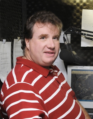
PHOTO BY JODIE ANDRUSKEVICH
The public knows who their local radio and TV meteorologists are, but who feeds critical weather information to airports, hospitals, ski resorts and local DPWs?
A growing number of forecasting companies are providing key weather information that saves private industry billions of dollars annually. From aviation to rum production, meteorologists have the answers that business needs to avoid weather-related losses.
Meteorologist Rob Carolan started Hometown Forecast Services in Nashua in 2001 with six radio station clients. That list has grown nationally to 60. Weather is big business. There’s more high pressure to getting the forecast right than you might think.
Q. Where are your radio stations located?
A. Well, we have about 60 radio stations. They’re located here in New England as well as across the country as far west as California. Also the Caribbean – Jamaica, Virgin Islands and Puerto Rico. In New Hampshire, we have stations on the seacoast, central New Hampshire, NHPR, as well as occasionally doing some work for stations that just want information concerning severe weather.
Q. So you are heard all over the country.
A. A good example is at 8:45 a.m. I’m live in Boston. Five minutes later, I’m live in Jamestown, S.D. Three minutes after that, I’m live in the Virgin Islands in St. Croix. Then I’m out in San Francisco 10 minutes later. For me , a game. I have to know where I am; I have to sound like I’m local, pronouncing names (of communities) correctly. After doing it for almost 30 years, it’s become second nature.
Q. Those local listeners think you live there?
A. That’s right. Exactly. I’ll listen to the air personalities and hear what they’re talking about locally and throw that back into the forecast, and it starts to sound like you live there. That’s the radio magic side of things.
Q. Talk about how weather events cost private industry billions every year.
A. In the summer season, it might be that we’re dealing with high winds, downed power lines, the potential that a facility such as Manchester-Boston Regional Airport may have to contend with flights that have to be diverted from other airports. Also, we deal with a lot of the cities and towns across New Hampshire that are interested from a DPW standpoint whether or not they’re going to have to send crews out clean up debris after a storm. Are they going to have areas where they have power outages due to downed trees? Are they going to have storm drain issues? Are they going to have flooding? Do they have events taking place?
In the winter, it’s a completely different kind of forecasting. We want to let them know whether or not they can keep their schools open, when they have to start plowing, how much snow they’re going to get. Are they going to get ice? Will there be issues with trees to bring down power lines.
From an operational perspective, there’s Dartmouth-Hitchcock Medical Center, the largest employer in northern New England. They actually have a rush hour at 5 in the morning when they change shifts with 30 acres of parking lot. We help them maintain those lots so they’re cleared so staff and patients can get in.
When we started working with the airport they said to us, ‘We never close. You need to understand that.’ We’ve briefed their airport when Air Force One is coming in. We’ve made sure they do what they’ve promised they’d do and act as the first point of diversion from Logan in Boston and for Albany, N.Y.
Q. What was it like forecasting Superstorm Sandy for clients in late October, 2012?
A. That was a scary storm. It was a weekend when the models started to forecast about 10 days out. One of the guys called me at home and said, “You gotta look at the European model. It looks like the end of the world.”
I, to be honest, had never seen anything like that on a weather chart. It actually scared me to look at that and say, “If that happens, there’s going to be huge ramifications.” So we watched it for the next three days, and still seven days out the European model was forecasting this storm. So we made a decision as a group that we were going to contact all our clients ahead of time and let them know about the potential.
I told Bloomberg Radio, “I’m afraid the subway tunnels are going to flood. I’m concerned about the Holland and Lincoln tunnels. I remember them saying to me, “You can’t be serious.” And I said, “There is not a storm surge wall at Battery Park. It’s going to come up over the Battery and spread through the southern part of New York City, if the models are right.” And they were.
We began doing updates on Sandy seven days out until after it ended, trying to provide the best possible coverage for our clients
Q. Do certain industries that rely on visitors ever lean on you to put out a forecast that would be more likely to get people out of the house?
A. We call it forecasting chamber of commerce weather. That’s some of the things we’ve done for some of our radio clients in New Hampshire, particularly ones that are on the Seacoast, where we’ll do a beach and boating forecast. We might say, “Hey it looks like a great weekend to go out…” With clients in the winter, they always wanted us to say, “Rain’s not going to affect conditions on the slopes.” I really have a hard time doing that. When it’s 55 degrees and it’s raining, conditions are not as good on the slopes when it’s 32 and snowing. We’ve been pushed toward that sometimes. We can do it better and more effectively in the summer months than winter months unless it is a snowy winter like we had two years ago.
Q. Which other New Hampshire industries do you provide forecasts for?
A. We deal with clients as small as lawyers who are looking for forensic meteorology, which is completely different. We’re not forecasting ahead, we’re going back and looking back at weather events that occurred and then seeing if there’s some kind of impact the weather had on the claim that their clients may be making as either the plaintiff or defense.
We’re currently working on a case right now where we’re able to prove that weather conditions developed that the plaintiff said developed even though they’re not visible in any other pictures that were taken at the scene.
Q. How does New Hampshire’s topography and geography add challenges to creating a forecast here?
A. You know, I have forecasted for every state in the country, including Alaska and Hawaii, and New England, by far, is the worst because of our proximity to the Atlantic, so we’re close to a source of moisture, our proximity to the Gulf of Mexico, a source of very moist warm air, cold Canadian air masses, air masses coming from the west. All kinds of crazy things.
Topographically, there are the Monadnocks and White Mountains. If we have a southeast wind over the White Mountains, the areas in the northern parts of the state don’t get snow, but the southern part of the state gets buried. It’s a very challenging place. It keeps us on our toes and makes us better forecasters.
Q. What’s the ratio of human instinct to empirical evidence when constructing a forecast?
A. I kind of say this is like alchemy. It’s magic. It’s intuition. Experience is huge. I think that’s what sets us apart as a business.
Our forecasting staff has over 100 years of forecasting experience in this part of the country. Either you can do this do or you can’t. And it’s learning to look outside the box, not only being able to interpret the models but figuring out which models are right more often than not.
It’s the trend in the data. Our philosophy behind the forecast is we work as a group not as an individual. You find that when you look at forecasts statistically, consensus is the best. Everybody puts their input in; you come up with a forecast together and use that joint experience to come up with a solution
Q. Is that approach used for TV weather casting?
A. With TV, they’re trying to bring the viewer back to watch more commercials, so it’s the end-of-the-world situation. For us, we’re trying to save our clients money, so it doesn’t do me any good if I say, “Hey, guys! There’s going to be an 18-inch snowstorm” and they get two inches. They just spent tens of thousands of dollars on overtime. But when I say to them, “Hey, look Manchester Airport, your ground temperature is 38 degrees. The air temperature’s going to be 32; I don’t think we’re going to have freezing rain on the runways. To treat each runway costs $16,000, so we save them a tremendous amount of money by making that call.
Our job is to save them money. What bothers me is that my business is viewed as an expense. No, it’s not. We’re here to make sure our contract pays for itself not once but multiple times over, so that you have money to spend on other things. For radio stations, we hope we do such a good job that it brings sponsorships.
Q. Does it eat away at you when a forecast you send out at 6 a.m. is clearly not happening? How do you alert clients about the change?
A. We have contacts between emails, cellphone, Twitter, whatever. We get in contact with the clients and let them know the forecast is off track now and need to bring it up to date. We’re carefully watching the forecast here 24/7/365 and know how to get the data out. It’s a stressful job. We’re so concerned about getting the forecast right. Summer is easy for us. We seriously sweat the winter.
Q. Forecasting weather continues to improve, thanks largely to technology. Are we approaching the day when we can expect 100 percent accuracy?
A. No. This is a very humbling business. I’ll never have a greater critic than my wife because I’ll be away with her on vacation and she’ll say stuff to me like, “You said it was going to be nice today and it’s raining. What the heck happened?” We’ve gotten better, especially in the long range. That’s where I’d say our greatest improvements have been, where 25 years ago it was a crapshoot to say in five or six days what was going to happen. We can really tell you the trend.
But 100 percent accuracy? There’s no way. The atmosphere is too complex. These computer programs run on assumptions and “When you assume, you make an ass out of you and me.”
Season’s First `Significant’ Snow Forecast for Chicago, Midwest
(This article originally appeared on Bloomberg.com)
The Midwest’s first snow of the season threatens to drop as much as 6 inches (15 centimeters) on Chicago through Saturday.
The storm was coming together Friday over eastern Wyoming and will move east before sweeping up the St. Lawrence River in Canada, where it should die out, said Rob Carolan, a meteorologist with Hometown Forecast Services Inc. in Nashua, New Hampshire. There may be flurries in northern New York State, while Manhattan remains untouched.
“It jets off to the east very quickly,” Carolan said. “A pretty good swath of snow could fall from eastern Nebraska up into Iowa and Michigan.”
This is “the first significant” snowfall across the central U.S., with 4 to 8 inches forecast for a large section of the country from Nebraska to Michigan and even more in some areas, the National Weather Service said. Winter storm warnings, advisories and watches stretch from Idaho to Michigan, including Chicago.
After the storm crosses the Great Lakes, it will start “to fizzle out,” Carolan said. That reduces the threat of any measurable snow in Toronto.
Winter storm and snow-squall watches have been posted by Environment Canada for parts of Ontario bordering lakes Superior and Huron. Toronto could have a mix of rain showers and flurries through Monday. Rain is forecast for Montreal on Sunday.
Carolan said light snow could fall in northern New York and New England from the storm.
The current forecast for next week’s U.S. Thanksgiving holiday calls for mild weather in the East and the potential for some rain along the parts of the West Coast, he said.
Tropical Storm Joaquin Tough to Forecast Off U.S. East Coast
This article originally appeared on Bloomberg.com
Forecasters are watching Tropical Storm Joaquin as it strengthens in the Atlantic near the Bahamas to see if it will become a threat to the U.S. East Coast later this week.
Joaquin was about 425 miles (685 kilometers) east-northeast of the northwestern Bahamas with winds of 45 miles per hour, up from 40 mph, as of 11 a.m. East Coast time, the National Hurricane Center said in an advisory. It was moving west at 5 mph.
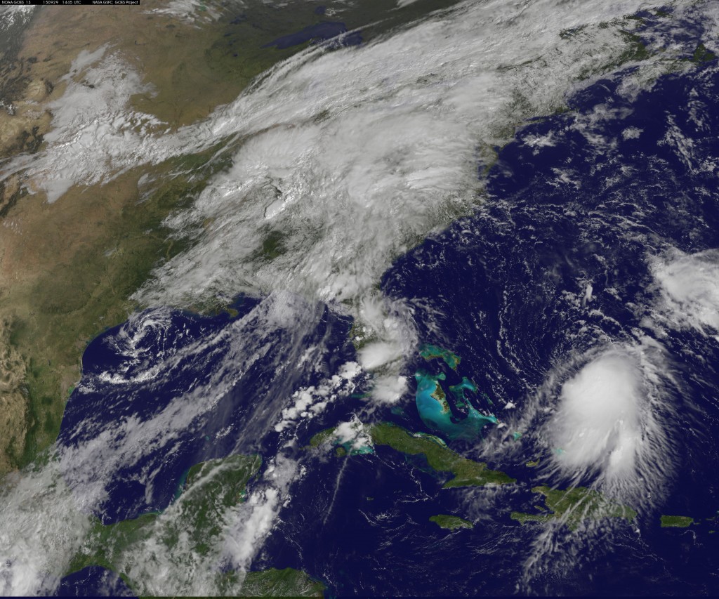
The storm has become better organized and will be entering an area of low wind shear that will allow it to strengthen further. The current forecast calls for it to have top winds of 70 mph by Friday, just below the threshold for a hurricane.
“The NHC wind speed predictions may be conservative, since some guidance suggests that Joaquin could become a hurricane in a few days,” Senior Hurricane SpecialistRichard Pasch wrote in the center’s forecast analysis.
Track Outlook
Joaquin is the 10th storm of the six-month Atlantic hurricane season that ends on Nov. 30. Current track outlooks call for it to move west toward the Bahamas, then parallel to the U.S. East Coast and be off the North Carolina coastline by Sunday.
Earlier, meteorologists at the center said computer forecast models are having trouble determining the strength of a low-pressure trough that is predicted to set up over the southeastern U.S. This weather pattern will help control where Joaquin will go.
How strong and well-organized Joaquin is will also determine its path and how it moves.
“I think you are going to see a lot of run-to-run disparity in the models,” said Rob Carolan, a meteorologist at Hometown Forecast Services Inc. in Nashua, New Hampshire.
Mixed Scenarios
Monday, some models called for the storm to drive itself into the East Coast. Carolan said that prediction has since faded. “Anyone who says they have any confidence in where it is going to go is lying to you.”
Another possibility is for a frontal system moving across the eastern U.S. to absorb Joaquin and destroy it.
What is likely is that the U.S. Northeast, including New York, will get drenched from “fire-hose precipitation,” Carolan said. This will be in addition to heavy rain falling on the area from other weather systems through Wednesday.
Through the next week, nearly 8 inches (20 centimeters) of rain is forecast to fall across northern New England, and about 7 inches in southern New York and northern New Jersey, the U.S. Weather Prediction Center said.
“I don’t think Joaquin ends up being a wind event; I think the big concern is the rain,” Carolan said.
Winter’s Final Slap will Bring Snow From New York to Washington
(Bloomberg) — The final few hours of winter in the U.S. Northeast will be marked by a quick-moving storm that’s forecast to put at least a few snowflakes in the air from Washington to Boston, and may bring as much as 4 inches to New York. Read the full article here.