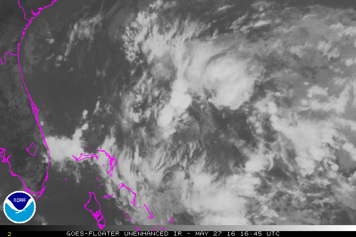
The second tropical depression of the 2016 Hurricane Season has developed in the Western Atlantic Ocean.
As of 8pm EDT Friday, Tropical Depression Two was centered approximately 400 miles southeast of Charleston, South Carolina, and was moving towards the west-northwest at 13 mph. Maximum sustained winds are near 35 mph, and additional strengthening is expected.
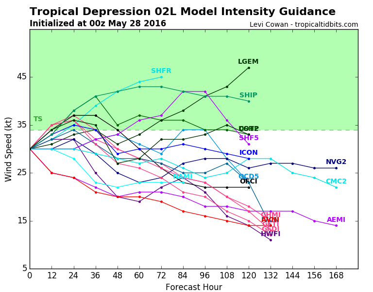
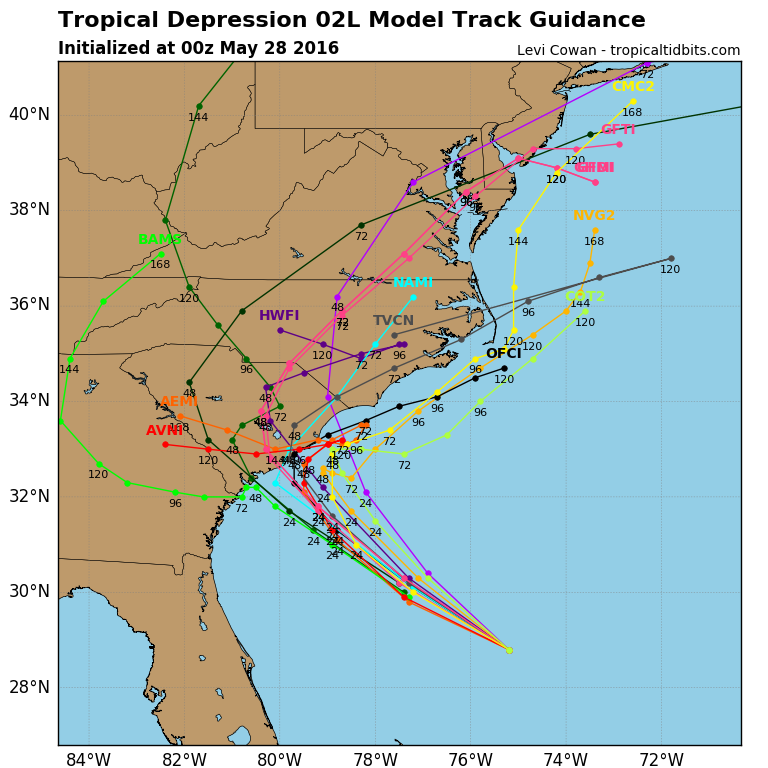
The storm is expected to continue on a general west-northwest track into Saturday, with some modest strengthening possible. If the system attains maximum sustained winds of 39 mph or more, it would be named Tropical Storm Bonnie. This may occur on Saturday. However, many of the forecast models are indicating that the system may not strengthen much over the next few days, due to a combination of, wind shear aloft, and sea surface temperatures that are only marginally warm enough to sustain a tropical cyclone. Most of these models do show a track towards South Carolina over the next 24-48 hours.
A tropical storm warning has been posted for most of the South Carolina coastline, from the Savannah River to Little River Inlet. Showers and thunderstorms should begin to move into the region later on Saturday, with some locally heavy rainfall totals expected. Wind gusts to tropical storm force will likely be confined to the immediate coast.
As the storm nears the coastline it will start to slow down as the upper-level steering currents start to weaken. A turn towards the north is possible, but if the turn occurs too early, it would prevent the storm from making landfall in South Carolina, but would make a landfall in southeastern North Carolina a bit more likely. Residents along the coast from Georgia to North Carolina should keep an eye on the storm’s progress, as it will likely have a significant impact on the holiday weekend forecast.
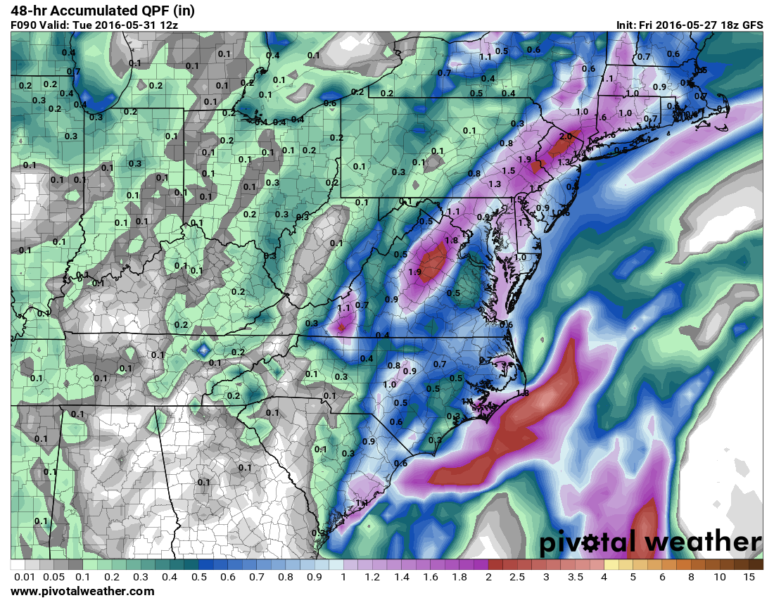
The storm will also have an indirect impact on the weekend forecast for much of the remainder of the East Coast. As the upper-level flow becomes south-to-north along the East Coast, it will take moisture from the storm and send it northward, ahead of a cold front. This will result in periods of heavy rain for the Mid-Atlantic states later on Sunday, and the Northeast on Monday. Rainfall totals of 1-2 inches or more are expected, and while it will ruin plans for barbecues and beach days, the region has not received much rain this Spring, so any moisture that does fall is needed.
The 2016 Hurricane Season got off to an extraordinarily early start when Hurricane Alex formed back in January. Alex became the first January tropical system in the Atlantic when it acquired subtropical characteristics south of the Azores on January 13. It became a full-fledged hurricane on January 14, the first January hurricane in the Atlantic since Alice in 1955. Alex crossed the Azores on January 15, before weakening to a tropical storm and then becoming extratropical later that day as it headed out in the open Atlantic.