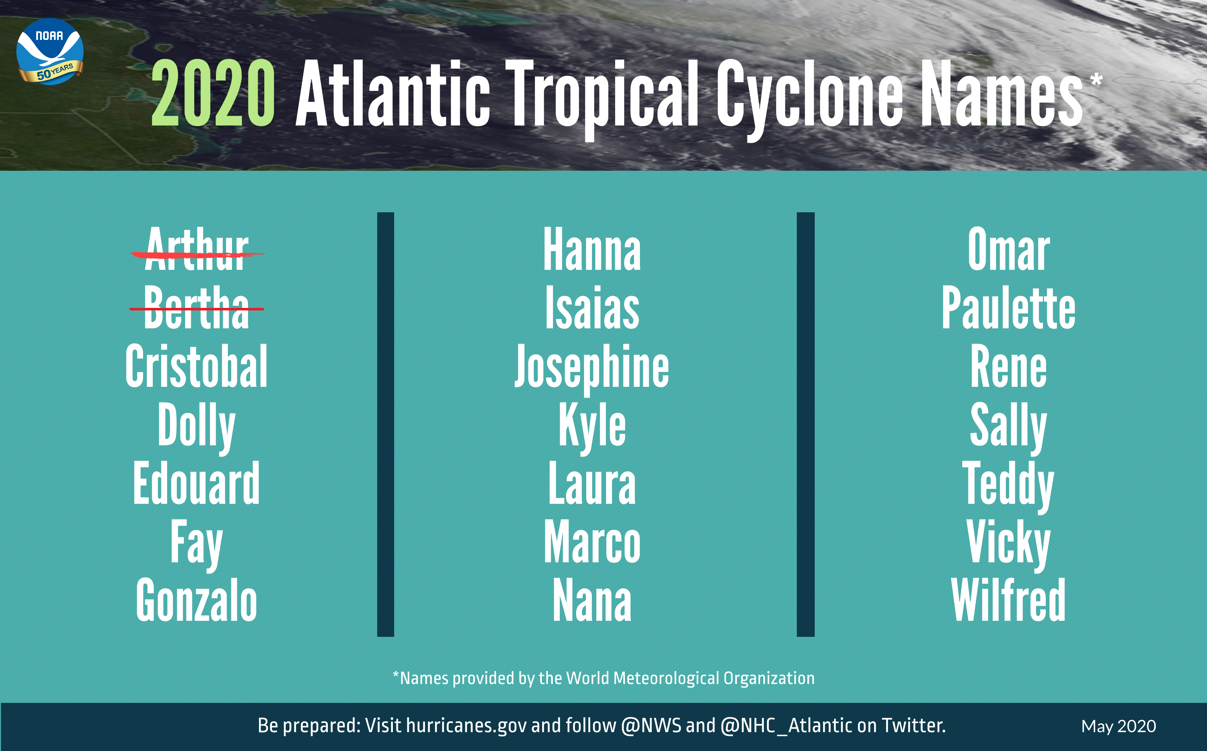
The 2020 Atlantic Hurricane Season saw two storms form during the month of May, Tropical Storm Arthur grazed the Outer Banks of North Carolina and Tropical Storm Bertha moved into South Carolina, marking the 6th year in a row that we had at least one named tropical system in the Atlantic before the “official” start of Hurricane Season, which runs from June 1 through November 30. That’s just the start of what looks to be an active hurricane season. With Tropical Depression Three forming in the Bay of Campeche Monday afternoon, our third named storm may not be far behind.
Arthur produced wind gusts of up to 45 mph across the Outer Banks of North Carolina, with rainfall of 3-5 inches resulting in some flooding on May 18. Otherwise, it was a rather unremarkable storm, which is rather typical for early-season storms. Last week, Bertha brought heavy rain into parts of South Carolina. This is the 6th time since 1851 that we’ve had 2 named storms form before June 1 (1887, 1908, 1951, 2012, and 2016 are the others). Despite the early start for the past several years, the average date for the first named storm in the Atlantic is still in late June or early July. Over 97% of all named storms in the Atlantic form between June 1 and November 30. Like our first two storms this year, most early season storms tend to be on the weaker side. A hurricane hasn’t made landfall in the United States before July 1 since Hurricane Bonnie came ashore as a minimal hurricane near the Texas/Louisiana border on June 26, 1986.
Tropical Depression Three developed in the Bay of Campeche Monday afternoon. The system is the remnants of Eastern Pacific Tropical Storm Amanda, which moved into southern Guatemala on Saturday. It has been producing heavy rainfall across portions of Guatemala, El Salvador, Honduras, and southeastern Mexico since Friday, and that will likely continue for another couple of days as the system mills around in the Bay of Campeche. Conditions are favorable for development, and the system could be upgraded to Tropical Storm Cristobal on Tuesday. Since this seems likely, the government of Mexico has issued a Tropical Storm Warning from Campeche to Puerto de Veracruz. If the system is named in the next few days, it will be the earliest we’ve ever had a “C” storm in the Atlanic. The previous record was June 5, 2016, when Tropical Storm Colin was born.
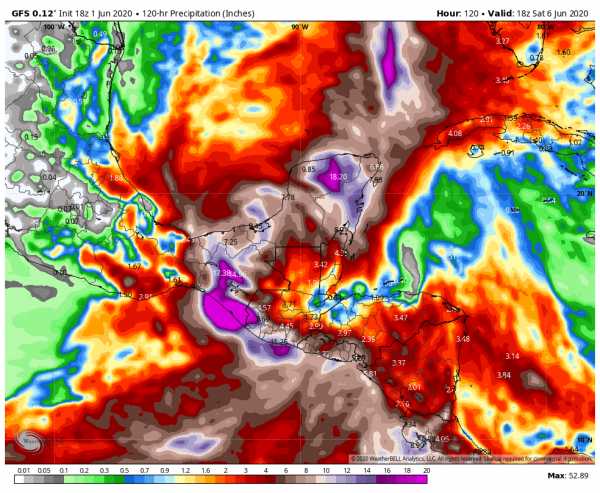
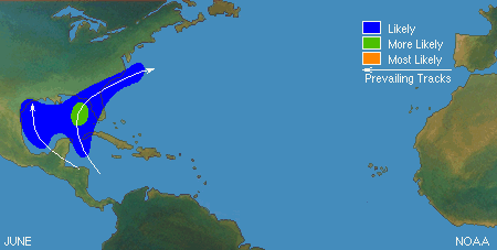
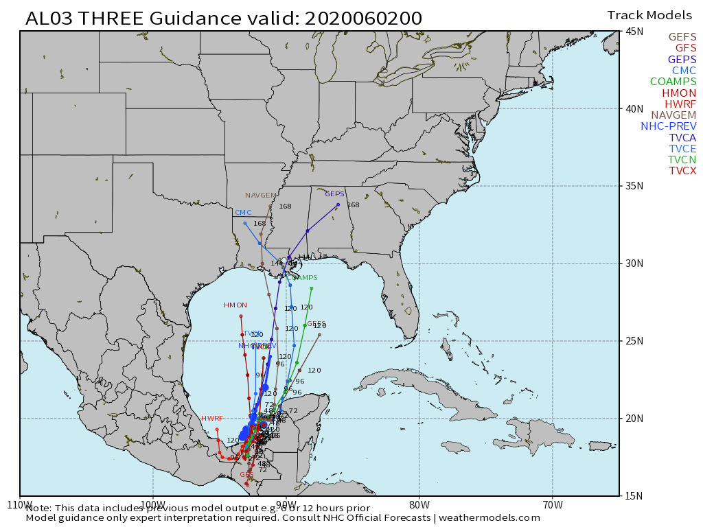
The forecast for TD 3 is fairly straightforward for the next few days. The system should mill around in the Bay of Campeche, producing heavy rainfall across southeastern Mexico, with some strengthening likely. As we get into the latter half of the week, things gets significantly more complicated. There are two distinct scenarios presented by the various computer models tonight. The first option is that the system turns northward, and moves across the Gulf of Mexico, heading towards the northern Gulf Coast towards next weekend while strengthening. The second option is that the system moves into southeastern Mexico and dissipates, then a new storm forms near or north of the Yucatan Peninsula, and heads northward later in the week. Either way, residents of the Gulf Coast should pay attention to the progress of this system as as the week goes on.
An early start is not always a harbinger of what the season will bring. NOAA issued their seasonal hurricane outlook last Wednesday, and it calls for a 60 percent chance for an above normal season, a 30 percent chance for a normal season, and a 10 percent chance for a below normal season. Many of the other hurricane outlooks issued by various outlets are also expecting a busy season, due to a number of factors. An average season consists of 12 named storms, of which 6 become hurricanes and 3 become major hurricanes (Category 3 or higher on the Saffir-Simpson scale). NOAA’s forecast for this season calls for 13-19 named storms, 6-10 hurricanes, and 3-6 major hurricanes. The Tropical Meteorology Project at Colorado State, the first group to forecast how active a hurricane season would be, originally led by Dr. Bill Gray, will issue their forecast on June 4. Their initial forecast from April called for 16 named storms, 8 hurricanes, and 4 major hurricanes. They also pegged the chance at a storm making landfall in the United States at 69% (52% is the average in any given year), and the odds of a storm making landfall along the East Coast at 45% (31% is the average). The last 5 seasons have all featured above normal activity across the Atlantic.
A busy season does not always mean that multiple storms (or any storms for that matter) will impact the United States. In 2010, 19 named storms were observed in the Atlantic, 12 of them became hurricanes, and 5 were major hurricanes. Only one storm made landfall in the United States, and that was Bonnie, which was a minimal tropical storm at landfall. On the flip side, an inactive year doesn’t mean much for landfall probabilities as well. Only 7 named storms formed in 1992, and the 1st one didn’t develop until August 16. That storm, however, was named Andrew, and it made landfall just south of Miami as a category 5 storm.