The peak of hurricane season in the Atlantic occurs around September 10 on average. As we rapidly approach that date, the Atlantic is starting to get active, with two named systems right now.
The biggest threat this afternoon is Tropical Storm Gordon. As of midday Tuesday, Gordon was centered about 130 miles south-southeast of Mobile, Alabama, moving towards the northwest at 15 mph. Maximum sustained winds were near 65 mph, and some additional strengthening is possible. Gordon could become a hurricane before making landfall along the Mississippi or Alabama coastline tonight Hurricane and Tropical Storm Warnings are in effect for much of the north-central Gulf Coast, with a Storm Surge Warning also in effect for parts of the area.
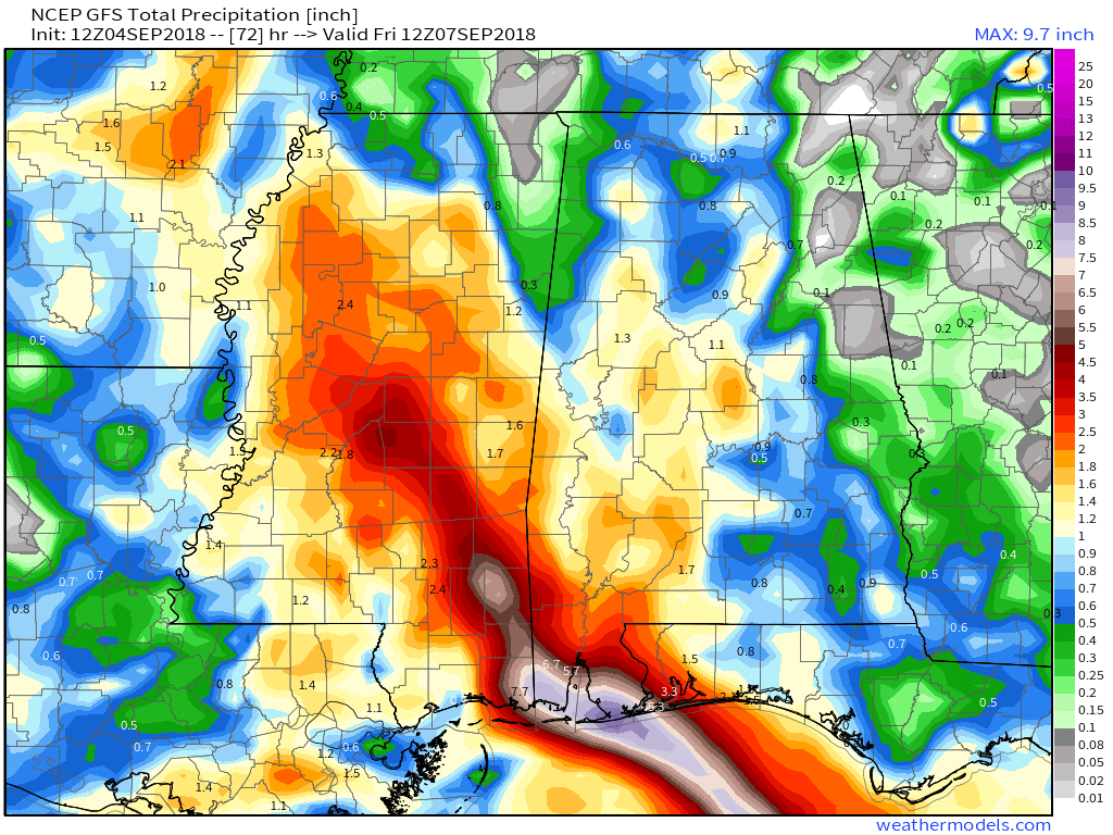
While storm surge flooding and strong winds are threats with Gordon, heavy rain will be a more prolonged threat to the region. Once Gordon makes landfall it will slow down as it moves into the Deep South and Mississippi Valley. This will keep the heavy rain threat going for a few days. Rainfall totals of 3-6 inches, with localized totals to 10 inches or more could result in flooding across much of the region. By Friday, as the system continues to drift northward, an approaching cold front will pick up the system, and send it off towards the Ohio Valley and Great Lakes.
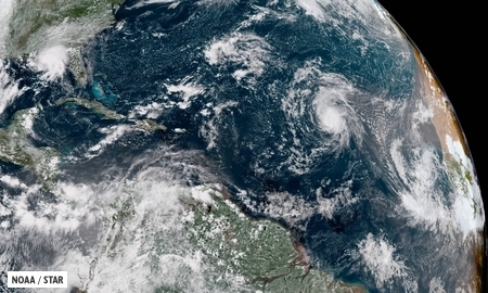
Meanwhile, in the Central Atlantic Ocean, Florence has become the third hurricane of the season. As of midday Tuesday, Florence was about midway between the Lesser Antilles and Cape Verde Islands, moving toward the west-northwest at 12 mph. Florence has maximum sustained winds near 75 mph, but the current forecast calls for Florence to weaken a bit over the next few days before regaining a little strength. Florence should continue in a general northwestward track through the week, remaining over open water. After that, things may get a little complicated.
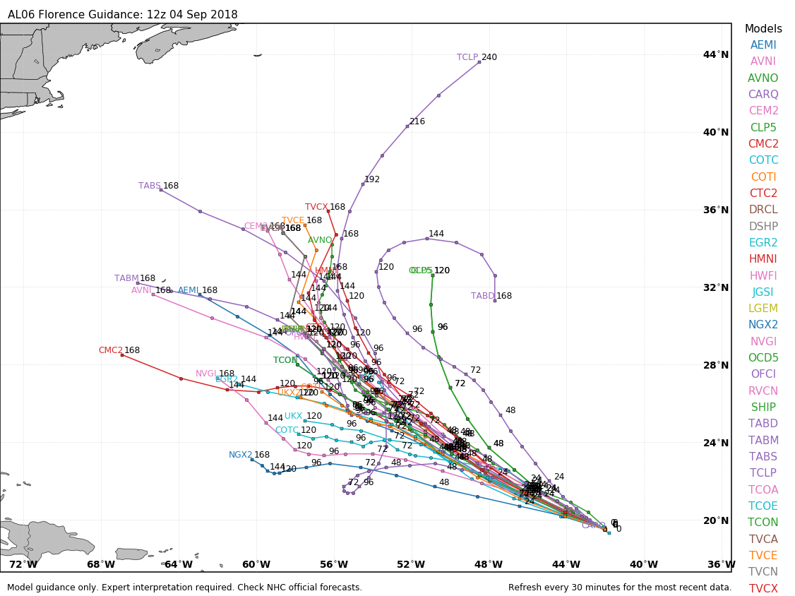
The steering currents in the central Atlantic Ocean are forecast to weaken later this week, making the future track of Florence uncertain once we get into the weekend. The more likely case is what usually happens, an approaching trough of low pressure picks up Florence and it curves northward and eventually harmlessly out to sea. However, if that trough is not strong enough to grab Florence, it could meander around for a while or start to drift westward as a ridge of high pressure builds back in to the north. While Florence would still likely head out to sea eventually, this scenario would imply a potential threat to the East Coast later next week. We won’t know which scenario is more likely until we get to this weekend at the earliest.
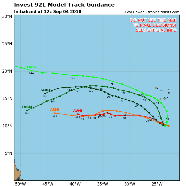
Even farther to the east, a developing low pressure system is passing south of the Cape Verde Islands today. It is expected to continue on a general west to west-northwest track over open waters for the next several days. Conditions are favorable for development, and the system could become a tropical depression later this week. It is still a week away from impacting any land areas, if it were to even get that far.
In the Pacific, Hurricane Olivia will strengthen a bit more over the next day or two as it continues to move away from Mexico and into the open waters of the Eastern Pacific. Hurricane Norman, however, is the system getting attention in that part of the world.
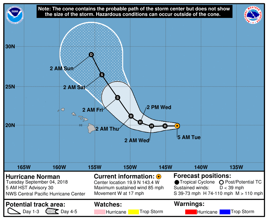
As of Tuesday morning, Norman was centered about 750 miles east of Hilo, Hawaii, moving toward the west at 17 mph. Maximum sustained winds were near 85 mph. Norman is expected to maintain its current strength for another day or two before a weakening trend begins. The system is expected to turn more toward the northwest later this week, passing safely east and north of Hawaii towards the end of the week. It will send some rough surf towards the islands, but that should be the only impact as the region continues to recover from Hurricane Lane.