For several days, most of the forecast models have been showing the potential for a tropical or subtropical system to develop in or near the Bahamas this weekend. Potential became reality Saturday evening when Tropical Depression One formed.
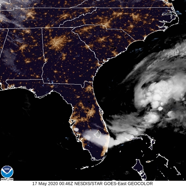
As of 8pm EDT, newly-formed Tropical Depression One was centered about 175 miles east-northeast of Melbourne, Florida, moving toward the northeast at 14 mph. Maximum sustained winds were near 35 mph. With favorable upper-level conditions and the system sitting over the warm waters of the Gulf Stream, strengthening is expected, and the system will likely be upgraded to Tropical Storm Arthur tonight or on Sunday.
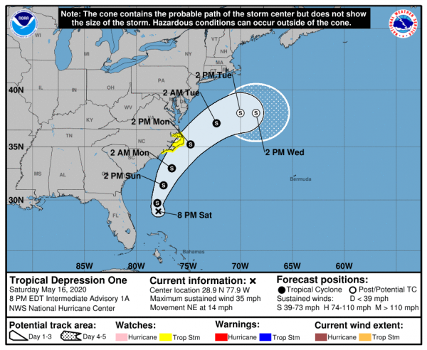
A general north-to-northeast track is expected over the next few days, which could bring the center very close to the Outer Banks of North Carolina on Monday. As a result, a Tropical Storm Watch is now in effect for the coast of North Carolina from Surf City to Duck, including Pamlico and Albemarle Sounds.
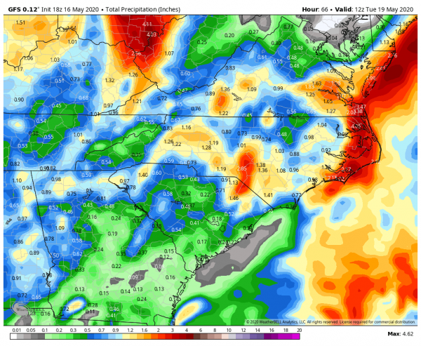
Rain and gusty winds across the northwestern Bahamas and the east coast of Florida will wind down tonight, but rain should spread into the Carolinas later Sunday. The heaviest rain is expected from eastern North Carolina into the Delmarva Peninsula Monday into Tuesday, where as much as 2-4 inches could fall, leading to some localized flooding.
Once it gets past the Carolinas, the official forecast track from the National Hurricane Center calls for the storm to turn toward the east-northeast and head out to sea while becoming extratropical, but this is far from a lock. An upper-level low pressure system will be moving into the Mid-Atlantic states and some models show the potential for the upper-low to capture the storm, and let it meander around near or just off the East Coast for several days as an extratropical system, with a large high pressure area to the north blocking it from moving farther up the coast. This would result in several days of damp and breezy conditions from the Carolinas possibly into Southern New England. Once we get towards Monday, we should hopefully have a better idea of what the storm will do.
While Hurricane Season in the Eastern Pacific Ocean starts on May 15, Hurricane Season in the Atlantic Basin does not officially start until June 1. However, as we’ve seen already several times, Mother Nature keeps her own calendar. This is actually the 6th year in a row that we’ve had a tropical system develop in the Atlantic Basin before June 1.
While Tropical Depression One will grab the weather headlines, it’s not the only tropical system that is active in the world right now. A much bigger threat has developed in the Bay of Bengal. Tropical Cyclone 01B (Amphan – pronounced UM-PUN) developed early Saturday, and is already strengthening quickly. As of late Saturday afternoon, storm has maximum sustained winds near 50 mph, and is expected to continue strengthening rapidly while heading off towards the north. Current forecasts have the storm making landfall in either Bangladesh or extreme eastern India by Tuesday or Wednesday. By that point, maximum sustained winds could be in excess of 110 mph.
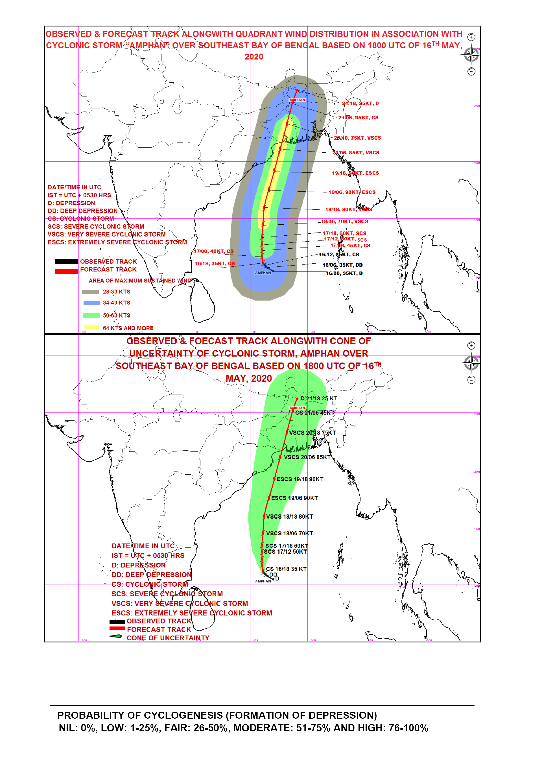
Strong winds would obviously be a significant hazard, but history has shown several times that the biggest threat with tropical cyclones in that part of the world is flooding, both from storm surge and torrential rainfall. Much of that region lies near sea-level and is very densely populated. In the past, storms that hit this area have resulted in tens of thousands, if not hundreds of thousands of deaths. Given what is already going on around the world, this would make the situation exponentially worse.