Powerful Hurricane Dorian is expected to smash the Northwestern Bahamas on Sunday before heading towards the Southeastern United States.
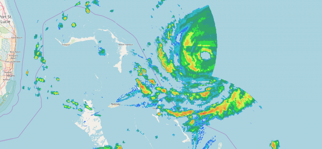
As of 2am Sunday, Dorian was centered about 95 miles east of Great Abaco Island in the Bahamas, moving toward the west at 8 mph. Maximum sustained winds are near 150 mph, making Dorian a Category 4 Hurricane on the Saffir-Simpson Scale. Hurricane Warnings been been issued for the Northwestern Bahamas except for Andros Island, which is under a Hurricane Watch. A Tropical Storm Watch has been issued for the east coast of Florida, from Deerfield Beach to Sebastian Inlet.

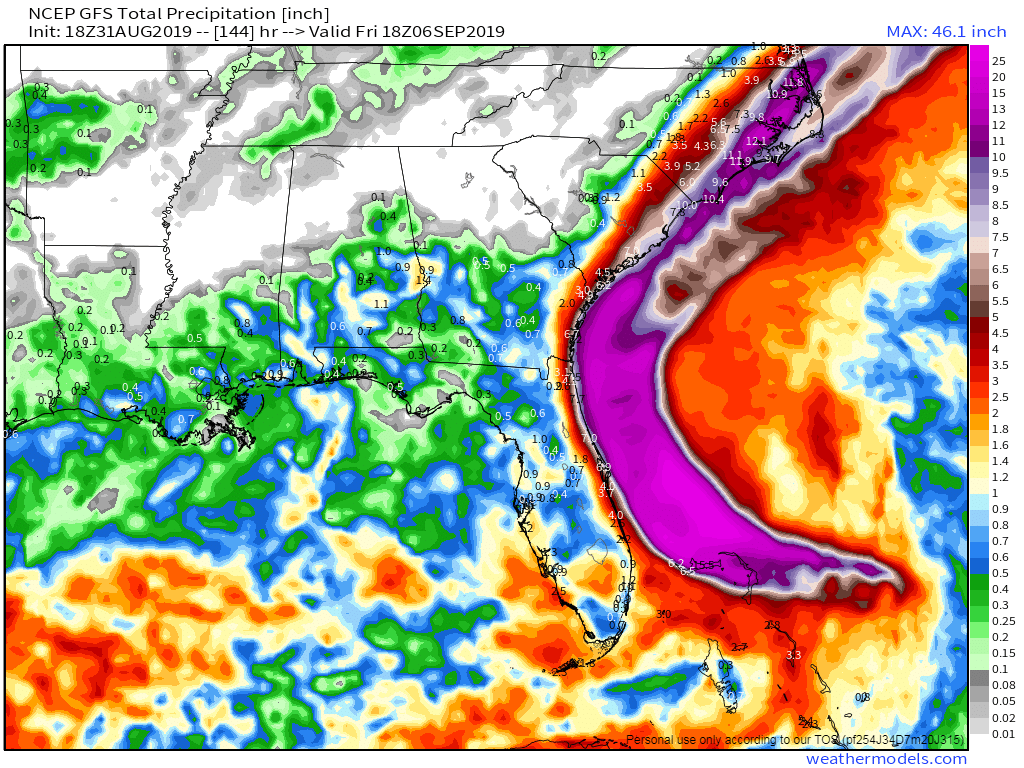
Dorian’s immediate future is fairly clear – it will continue westward overnight and into Sunday, passing very close to Freeport in the Bahamas as a powerful hurricane. Rainfall totals to 10-20 inches or more along with a storm surge of 10-15 feet will result in flooding along the coast and across the interior of the islands. While some additional strengthening is possible, some fluctuations are also possible as Dorian will likely start to undergo an eyewall replacement cycle at some point in the next 12-24 hours. The eyewall is where the strongest winds and most intense rainfall of a system are located. In an eyewall replacement cycle, the eyewall starts to collapse, and a new one forms a little farther away from the eye. This new eyewall eventually contracts closer to the eye, but in the meantime, it allows a storm to weaken. These are nearly impossible to predict, but they do occur in most hurricanes, mainly intense ones.
After Dorian moves through the Bahamas, things get very tricky. Dorian is currently being steered westward by a ridge of high pressure located to its north. As a trough of low pressure moves into the Tennessee Valley, it will erode that western edge of that ridge, leaving Dorian in an area with little flow to steer it. It may stall out or move very little late Sunday and Sunday night, which is bad news for the Bahamas, as much of the circulation may remain over the northwestern Bahamas, resulting in catastrophic damage for parts of the region. If Dorian stays in the same place long enough, it may bring cooler water up to the surface in a process known as upwelling. Hurricanes need warm water to help fuel them, so sitting over cooler water could help Dorian to weaken a bit.
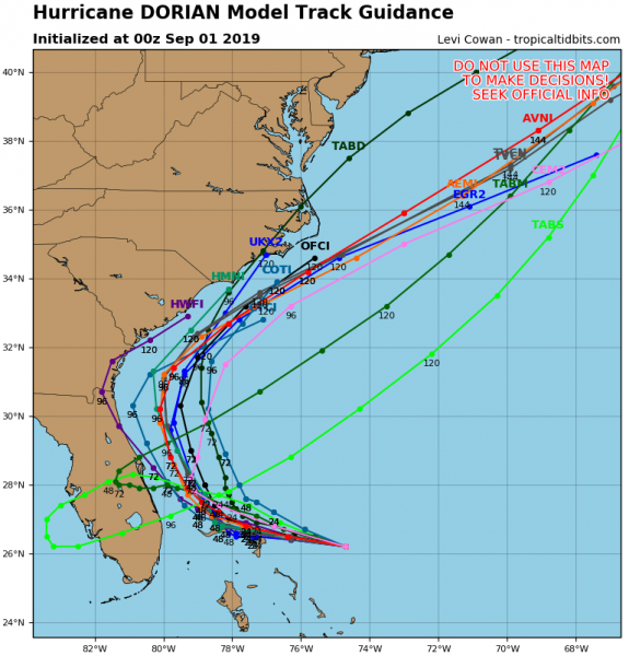
After that, as the ridge continues to erode and the trough advances eastward, a turn toward the north and eventually northeast is expected. Exactly when this turn occurs is still a rather large question mark. While the majority of the forecast models show this turn occurring offshore, not all of them do. This is mostly good news for Florida, as it would likely keep the worst effects offshore, though gusty winds, some rainfall, and rough surf are still likely along the coast. How far inland the rain and wind penetrate will be determined by the eventual track.

This is bad news for portions of the Southeast, especially coastal portions of the Carolinas. A track close to the coastline in these areas seems a bit more probable at this point, which means, strong winds, heavy rainfall, and rough surf are likely for a prolong period during the middle of the upcoming week. Although the forecasts are for the center of the storm to remain offshore, it would not take much of a deviation for the center to make landfall, which would increase the threat for damaging winds and storm surge.

After forming last weekend, Dorian crosses Barbados and Saint Lucia as a tropical storm last Monday night. After reorganizing a little to the north, it then passes just east of St. Croix in the US Virgin Islands on Wednesday strengthening into a hurricane as it moved across St. Thomas, where it produced sustained winds as high as 82 mph with a gust to 111 mph.