Stormy weather will return to the West Coast over the next few days, and could spread into the Northern Plains later this week.
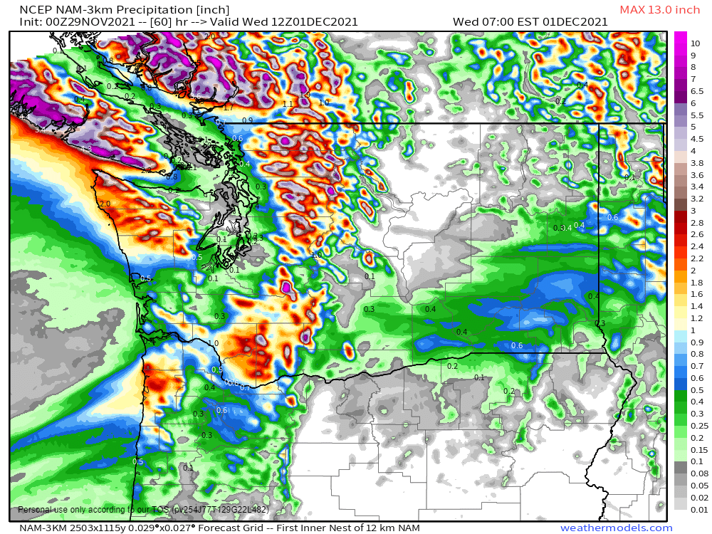
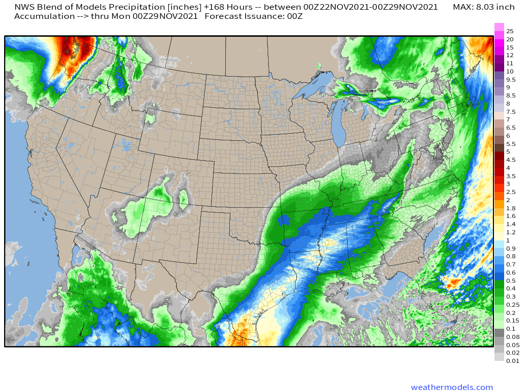
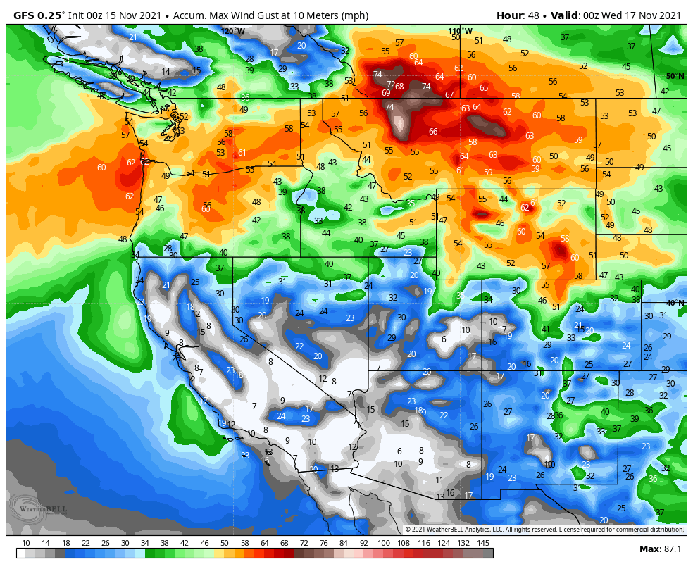
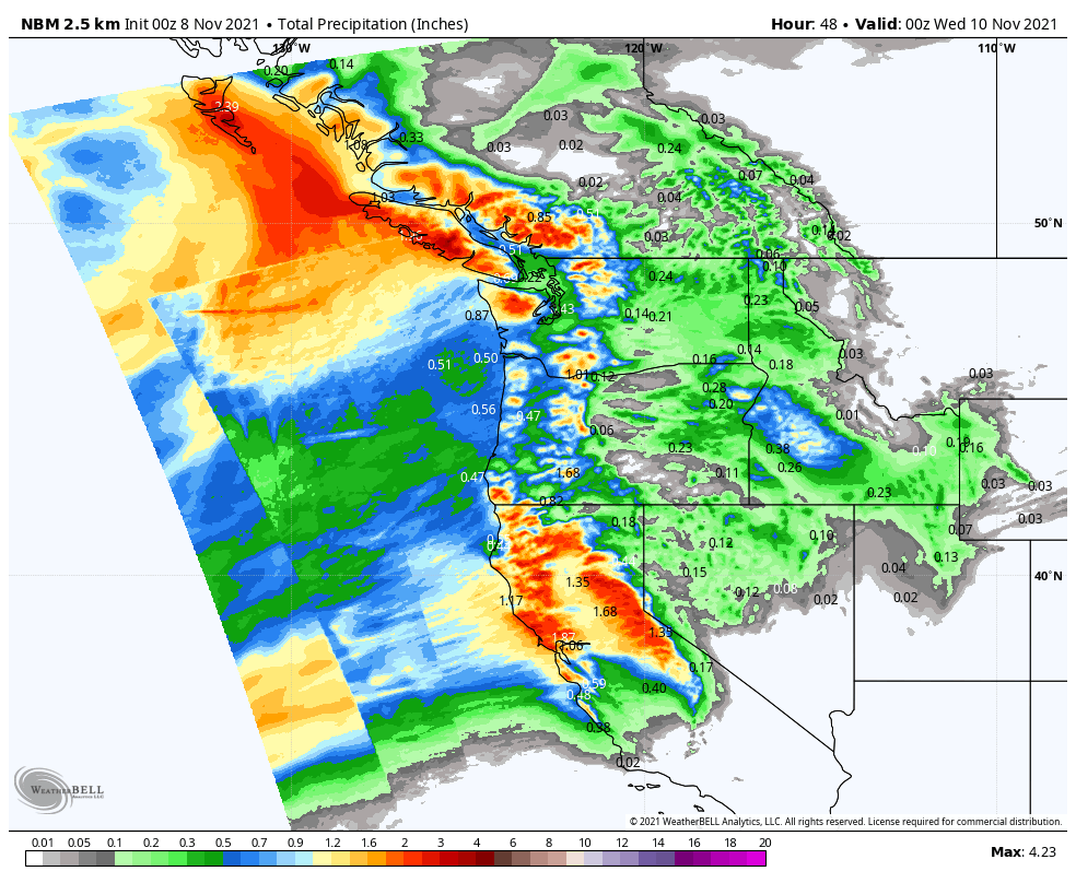
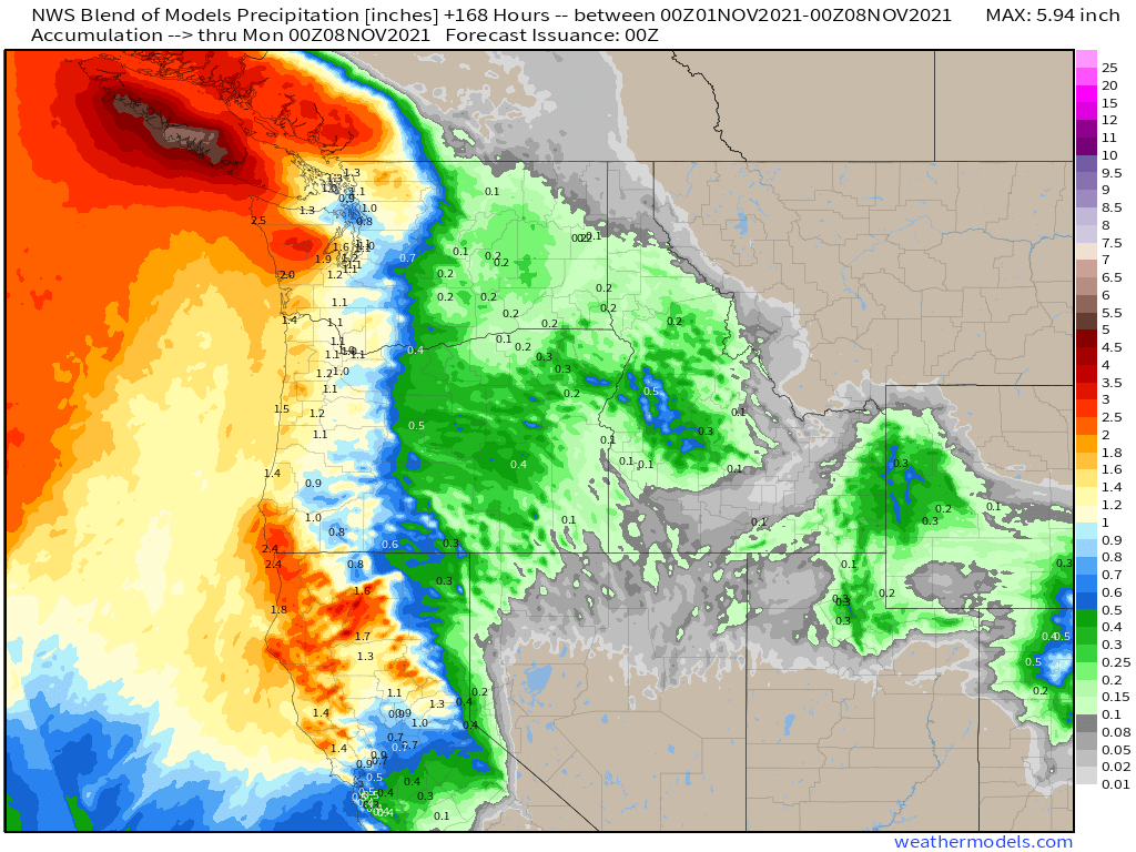
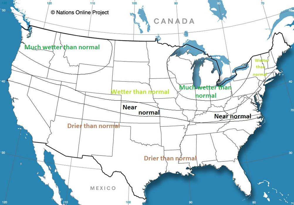
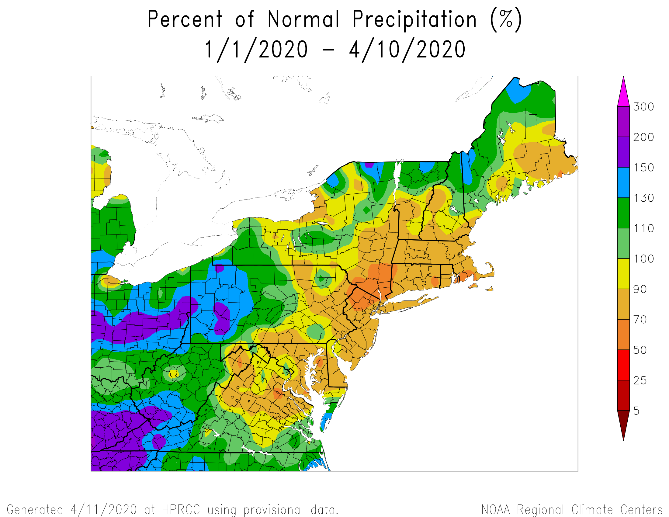
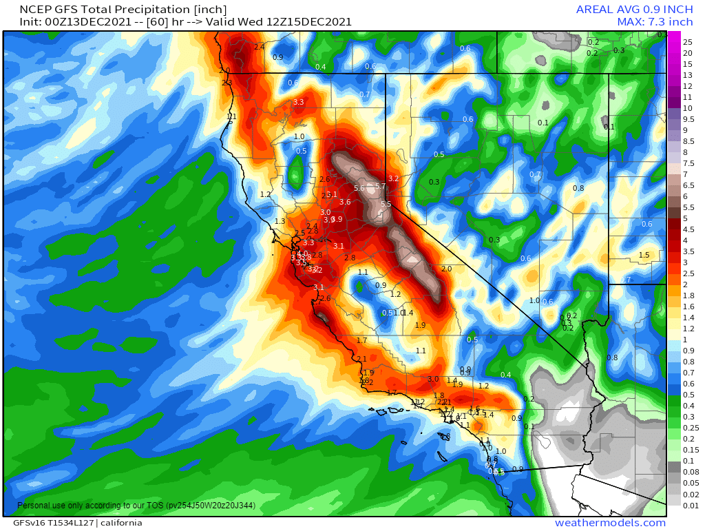
A low pressure system will bring heavy rain, gusty winds, and mountain snow to much of the West over the next few days, with a second system following for Tuesday into Wednesday. It has been relatively dry across the region recently, so the rainfall is welcome, but amounts could be excessive in spots. Rainfall totals of 1-2 inches will be fairly widespread, but some locations, especially along the California coast, could see upwards of 3-5 inches of rain. Flood Watches are in effect for parts of the Golden State. The rain will be accompanied by strong winds, which will be widespread not only along the West Coast, but well inland into the Great Basin and parts of the Southwest. Wind gusts of 30-50 mph will be common, with Wind Advisories in effect for many locations. The storm will also produce heavy snowfall across the mountains of the West, especially the Sierra Nevada, where snowfall totals of 2-4 feet or more are expected.
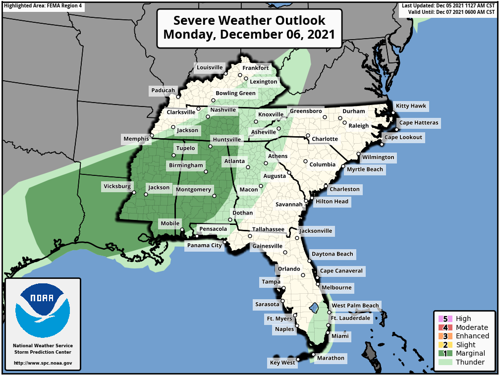
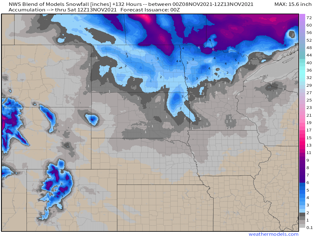
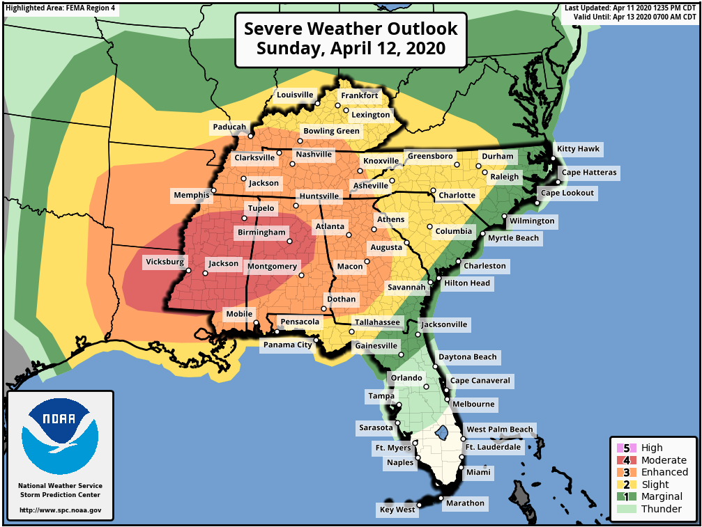
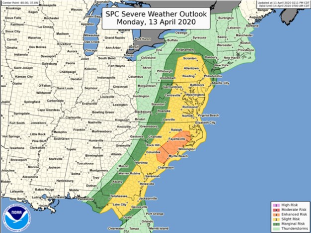
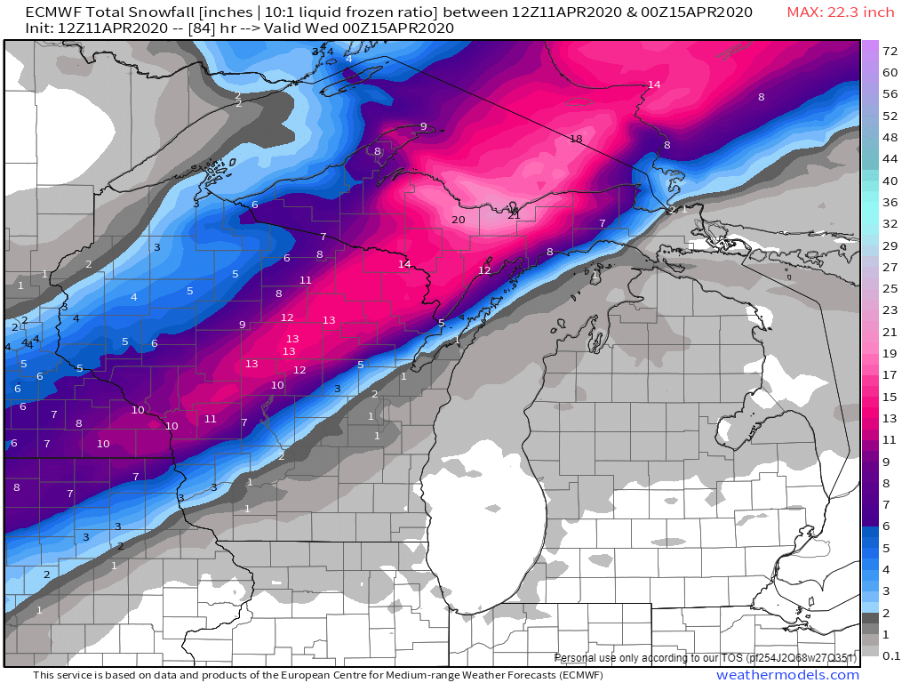
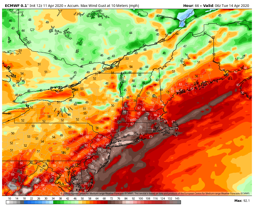
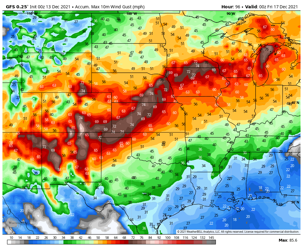
By mid-week, the storm will redevelop east of the Rockies, and head northeastward across the Plains States toward the Upper Midwest. It may produce some light to moderate snow from the Central and Northern Plains into the Upper Midwest, but the bigger story will be the strong winds it generates across the Plains States and into the Mississippi Valley. The potential exists for widespread wind gusts of 50-70 mph or stronger. In the Northern Plains, when you combine the winds with the snowfall, blizzard conditions are possible in parts of the Dakotas and Minnesota Wednesday into Thursday. The system may also generate more severe weather ahead of it from the Mississippi Valley into the Ohio and Tennessee Valleys later Wednesday into Thursday.
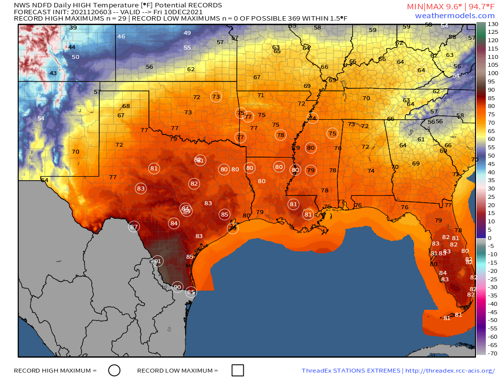
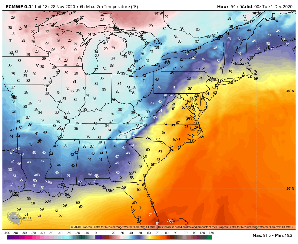
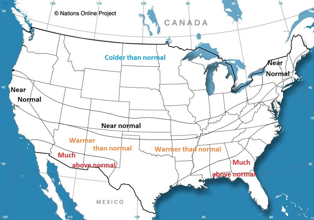
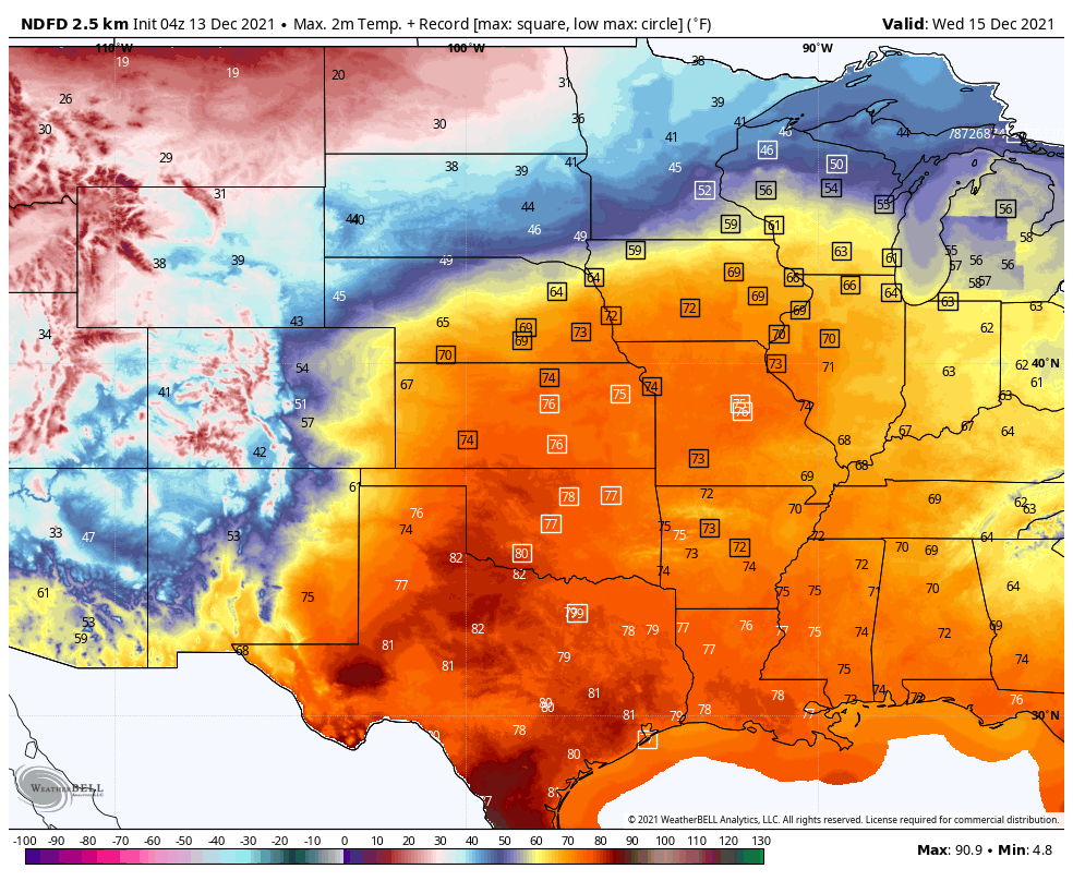
The other big story will be the temperatures on either side of this storm system. Unseasonably mild weather is already in place across much of the nation today, but that’s just a taste of what is coming. On Tuesday, temperatures will be 15-25 degrees above normal across most of the Plains States and the Mississippi Valley, with some records possible. Wednesday looks to be the warmest day in this region, with dozens of records expected. Temperatures will be well into the 60s and 70s, which is 15 to as much as 35-degrees above normal. The warm weather will shift into the eastern third of the nation for the latter half of the week, where temperatures will be 15-25 degrees above normal.
Behind the system, much cooler weather will settle into the West for Tuesday and Wednesday, with temperatures dropping to 8 to 15 degrees below normal. The cooler air will shift into the Northern Plains by Thursday, and across the rest of the Plains for the end of the week, with temperatures running as much as 10 to 20 degrees below normal.