Once again, a majority of the nation will be spared from major storminess during much of the upcoming week.
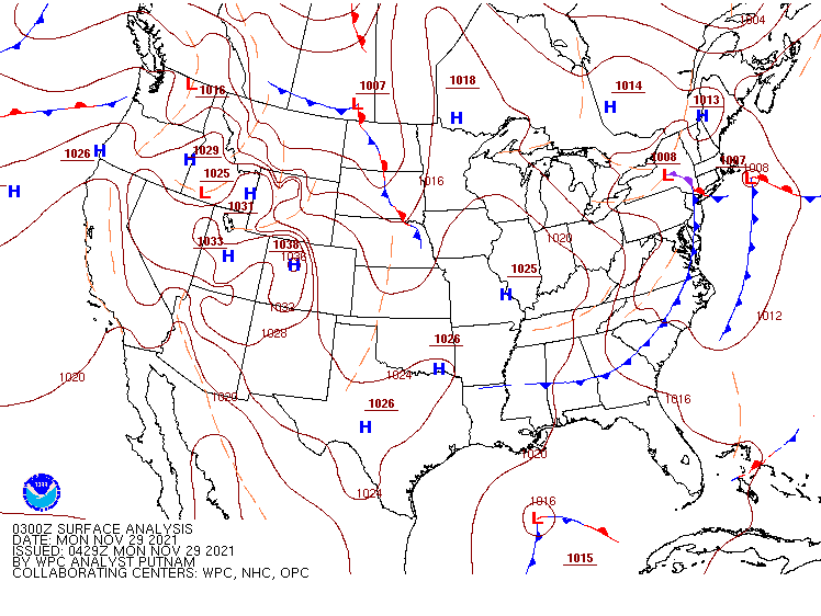
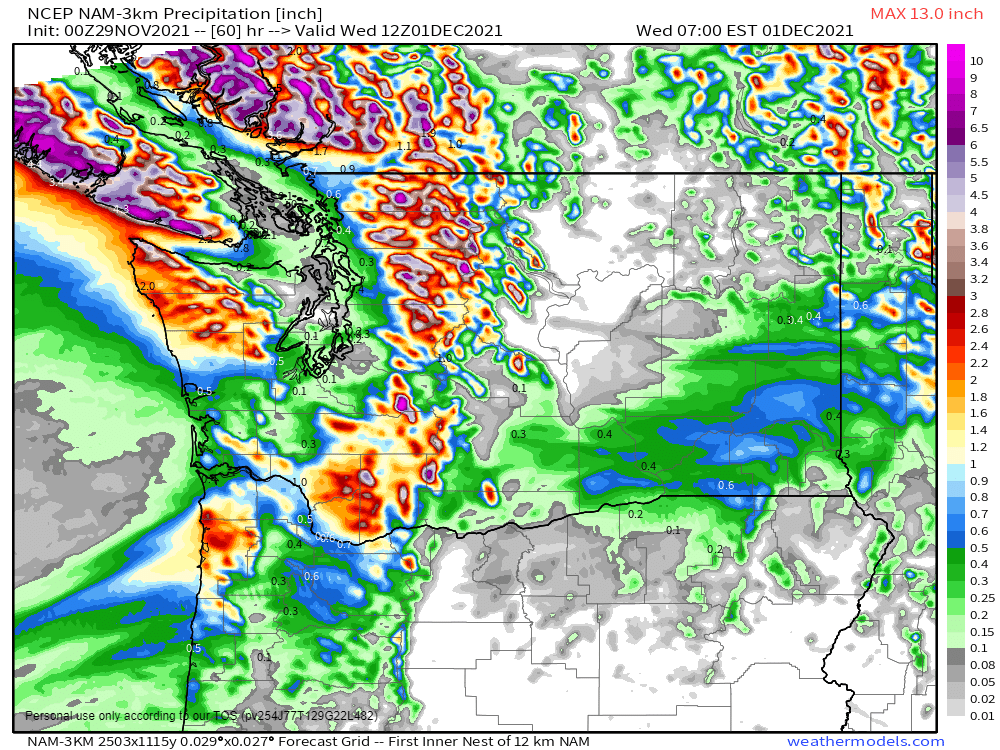
As is typically the case at this time of year, the Northwest will be the exception to the rule when it comes to quiet conditions. As one system pulls away from the region today, another one will move in from the Pacific later Tuesday into Wednesday with rain, some of it heavy, and higher elevation snow in parts of Washington and Oregon. While this rainfall won’t be anywhere near the magnitude of some recent storms, some locations, especially in the Olympic Peninsula, could see 1-3 inches of rain, which may lead to some flooding.
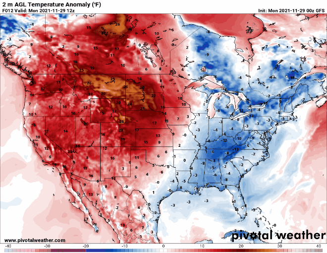
The other main story this week will be unseasonably warm weather for a large portion of the nation, especially west of the Mississippi River, for the next several days. Much of this region will have temperatures that are 15 to 30 degrees above normal through at least Thursday or Friday. Dozens of record highs are likely to be set from the Plains states into the Rockies and the Pacific Northwest, especially Wednesday and Thursday. High temperatures could top 70 as far north as parts of South Dakota and Wyoming by Thursday.
A cold front will drop southward out of Canada toward the end of the week, bringing an end to the warm spell. A wave of low pressure riding along the front may produce some light to perhaps moderate snow from the Northern Plains into the Great Lakes next weekend.