A rather strong storm system will wreak all sorts of havoc on a large swath of the nation through the weekend and into Monday.
Low pressure is moving into the Plains states today, producing some strong to severe thunderstorms from Texas into the Southern Plains. That’s just the start of what will be a busy few days. As the storm moves into the southern Plains tonight, showers and thunderstorms, some strong to severe, will spread from Texas into the Mississippi Valley. To the north, snow is expected across the Central Plains. Some locations could pick up 6-12 inches this weekend in a swath from Nebraska and South Dakota into parts of Iowa, southern Minnesota, and Wisconsin.
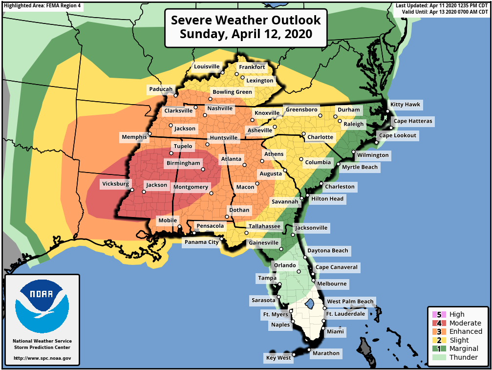
Easter Sunday is the day that will likely grab most of the headlines away from the pandemic for a day. As the system moves into the Ohio Valley, warm, moist air will be drawn northward from the Gulf of Mexico, and as this clashes with the cold air advancing southward behind the storm, the ingredients will be in place for a severe weather outbreak. Severe weather may be ongoing as Easter Sunday dawns across the Lower Mississippi Valley, but activity will spread eastward during the day across the Deep South and the Tennessee Valley. Some of the stronger storms may produce damaging winds, large hail, torrential downpours, and likely numerous tornadoes. The risk will continue well into the overnight hours, especially in Georgia, eastern Tennessee and western portions of the Carolinas.
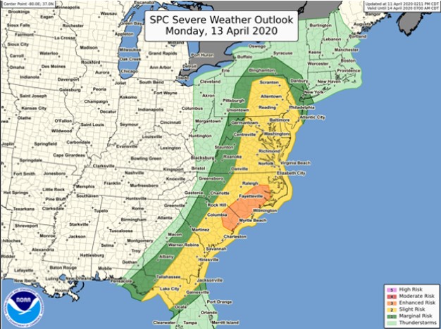
By Monday, the system will move into Ontario, dragging a strong cold front across the Eastern United States. Warm, humid air will continue to flow northward ahead of this front, triggering more showers and thunderstorms during the morning and early afternoon from northern Florida into the Mid-Atlantic states. Some of these storms could produce hail, strong winds, heavy downpours, and some tornadoes, especially from the Carolinas to the Delmarva Peninsula.
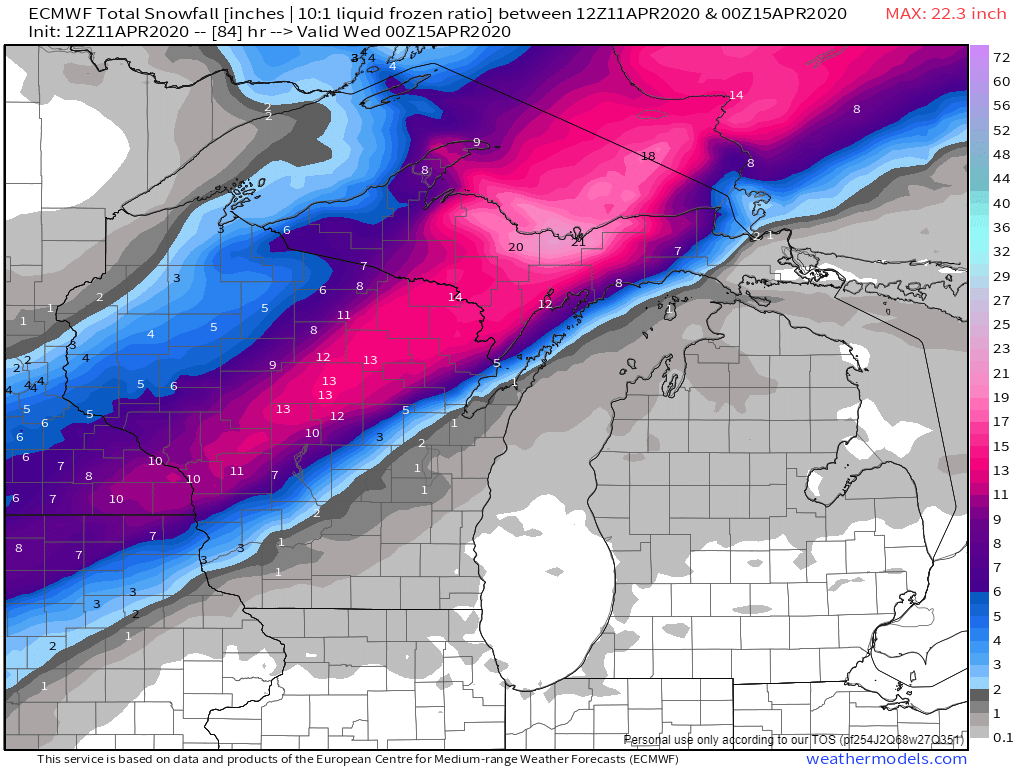
To the north, heavy snow will continue behind the storm from northern Wisconsin into the Upper Peninsula of Michigan and Ontario. Snowfall totals of 10-20 inches or more are likely. Winds gusting to 40-50 mph will create significant blowing and drifting of the snow, with blizzard conditions at times.
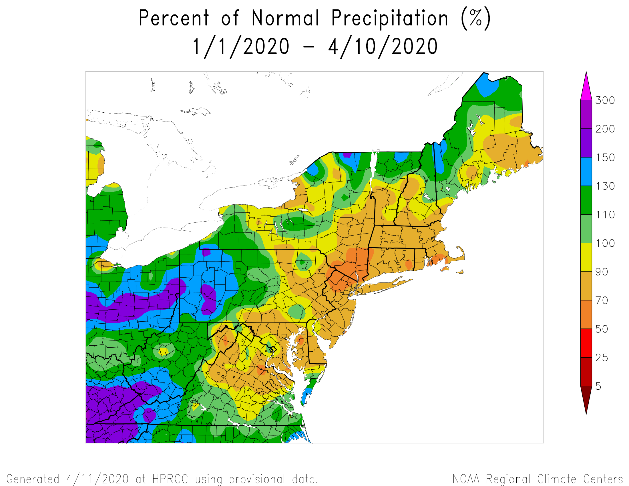
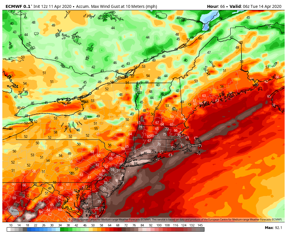
In the Northeast, the big story will be the wind. Rain will be a secondary concern, with rainfall totals of 1-2 inches or more possible across much of the region. Some embedded thunderstorms may produce heavier downpours, especially in western New England and eastern New York, but flooding isn’t much of a concern. Precipitation has been below normal across much of the area through a good chunk of the winter and early Spring, so the region needs all the rain it can get, though maybe not quite this much at once. There will be some ponding on the roadways, and some of the smaller streams may overflow, but widespread flooding shouldn’t be a problem. The wind, on the other hand, will be a major problem.
As the system gets cranked up in Ontario, strong southerly winds will develop across the region. These will bring milder air into the region. We won’t quite reach the 90s that will set records across Florida on Monday, but 50s and 60s are still a bit above normal for mid-April around here. Southerly winds will increase Monday morning, with sustained winds of 25-35 mph expected during the afternoon. Wind gusts of 60-70 mph or higher are expected as well. This will likely result in power outages as they take down trees that are starting to show their leaves, along with power lines. Winds should start to diminish during the evening as a cold front moves through, bringing an end to the rain and shifting the winds into the west.
Conditions should improve on Tuesday across the Northeast as high pressure builds in with some sunshine developing, but it will still be breezy as the now-powerful storm moves into northern Quebec, where heavy snow will likely continue.