A low pressure system moving into the West Coast today will impact the weather across much of the nation during the upcoming week.
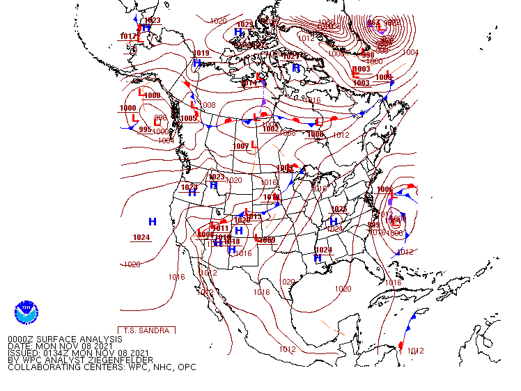
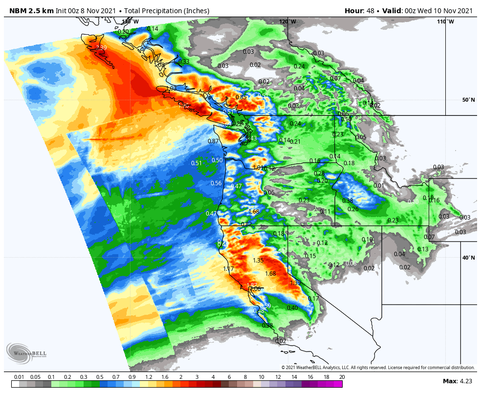
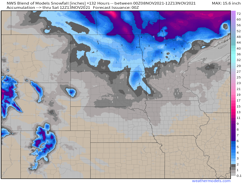
Low pressure will move out of the Pacific and into the West Coast over the next day or two, spreading rain, some of it heavy, into the Pacific Northwest as well as northern and central portions of California. While this storm will be nowhere near the magnitude of some of the storms they’ve already seen this year, rainfall totals of 1-2 inches and locally heavier in some areas may result in localized flooding. The rian will be accompanied by gusty winds. Wind Advisories and High Wind Warnings have been issued for parts of the region. Wind gusts of 40-50 mph will be common, possibly resulting in damage and power outages in some areas. Across the higher elevations of the Cascades and the Sierra Nevada, heavy snow is likely, with many areas receiving more than a foot by the time everything winds down later Tuesday.
This system will weaken a bit as it moves into the Rockies by midweek, where several inches of snow is still expected. By Thursday, the system will intensify again as it moves into the Plains states. As it draws in some moisture from the Gulf of Mexico, it could produce some severe weather across parts of the Central and Southern Plains and into the Mississippi Valley ;ater Wednesday and Thursday. To the north, it will likely produce the first snowstorm of the season across the Dakotas and into parts of Minnesota late this week. Snowfall totals of 3-6 inches will be possible in parts of the region.
By the end of the week, the low pressure system will stall out near the Great Lakes, but ahead of it, a frontal system will draw moisture northward, bringing a period of heavy rain from the Tennessee and Ohio Valleys into the Mid-Atlantic states and the Northeast from Friday into Saturday.
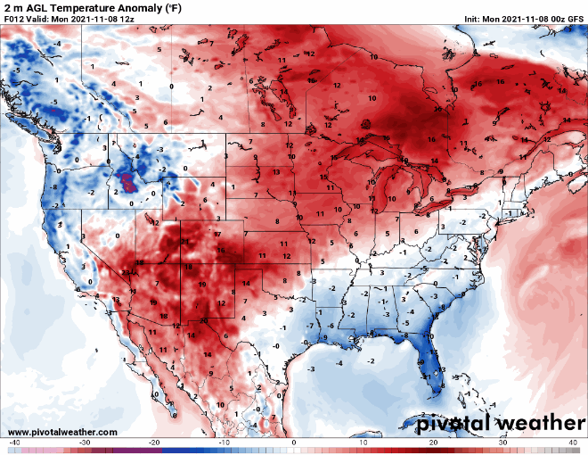
The other thing we’re paying attention to this week will be the temperature swing we’re expecting. Temperatures will run 6-12 degrees above normal across parts of the Plains states eastward to the Great Lakes over the next couple of days before the core of the milder air shifts to the East Coast later this week. Meanwhile, behind the storm system, a pool of cooler air, with readings of 4-8 degrees below normal, will move into the West during the next 2-3 days. By the time that air moves into the Plains it will intensify with temperatures running 6-12 degrees below normal across the Plains on Friday and further east by next weekend.
Taking a quick look ahead to the following week, there are some indications that a much cooler weather pattern may move into parts of the central and eastern US for the middle of the month.