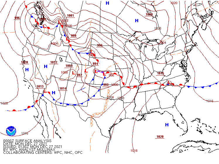
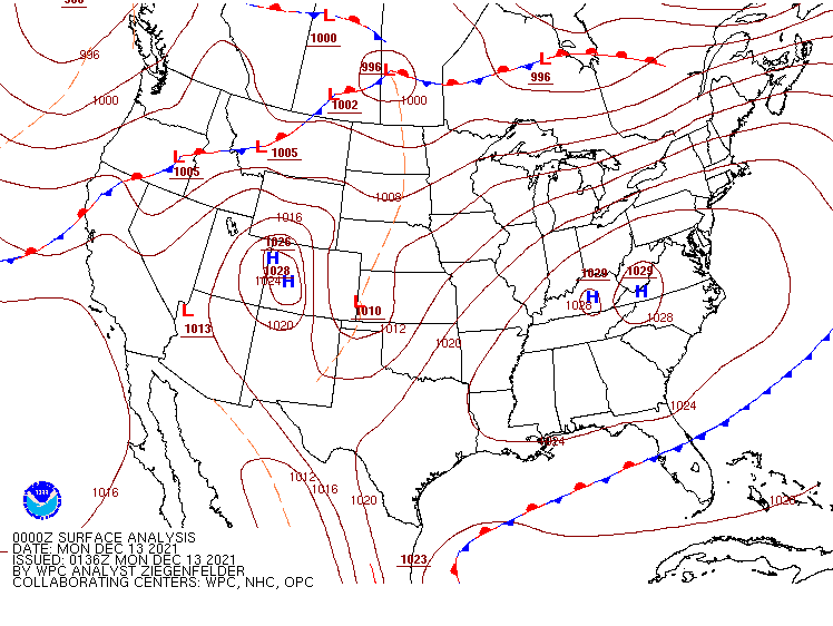
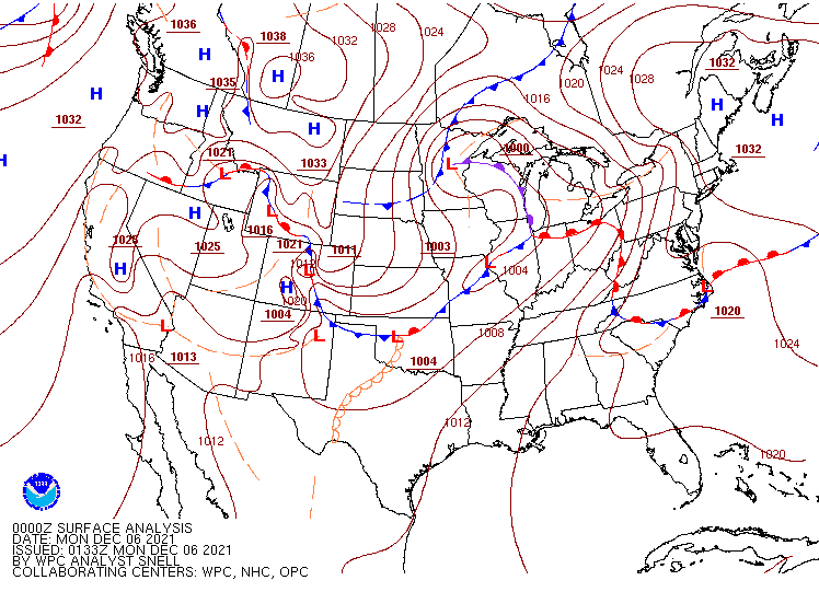
While the pattern will remain quiet for much of the nation to start the week, a significant storm may impact a large portion of the nation later this week with a variety of weather.
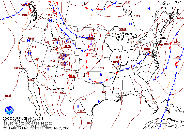
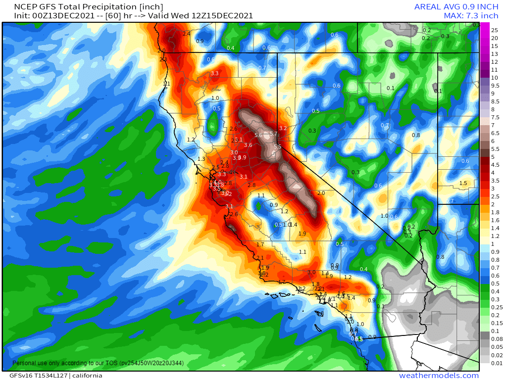
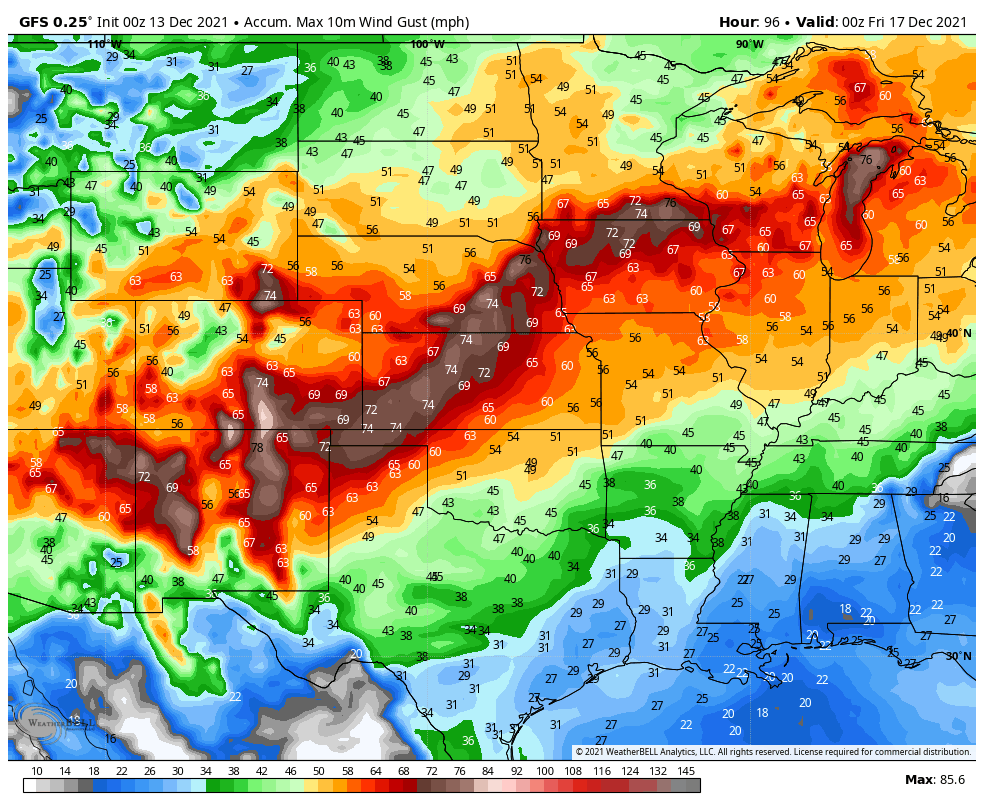
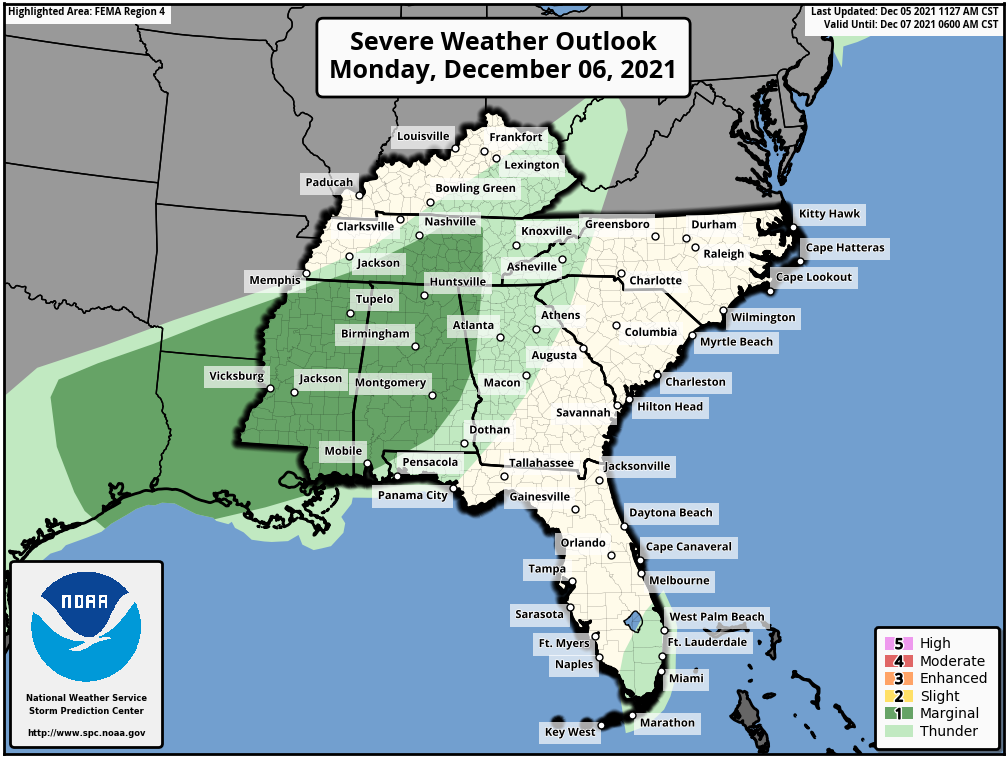
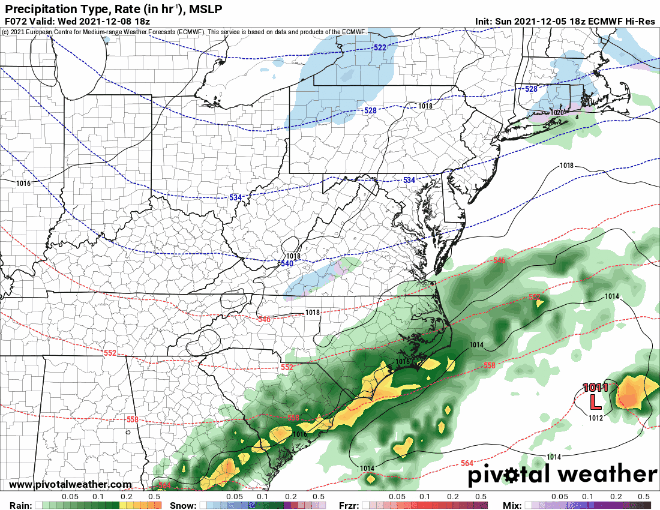
A low pressure system will bring some rain and higher elevation snow to parts of the Pacific Northwest and the Great Basin over the next day or two, but its biggest impacts will be felt later this week. as it moves into the nation’s mid-section on Wednesday, it will start to draw warm and humid air northward from the Gulf of Mexico. At the same time, a large high pressure area will bring colder air into the Northern Plains. As these airmasses clash, we could see some strong to severe thunderstorms developing ahead of the system. Severe storms are possible across parts of the Southern Plains and Texas late Wednesday, with the severe weather threat shifting into the Mississippi and Tennessee Valleys on Thursday, reaching the Deep South and the Southeast by Thursday night.
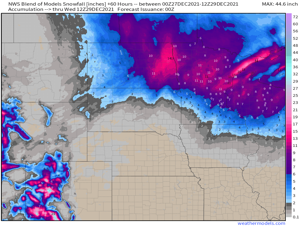
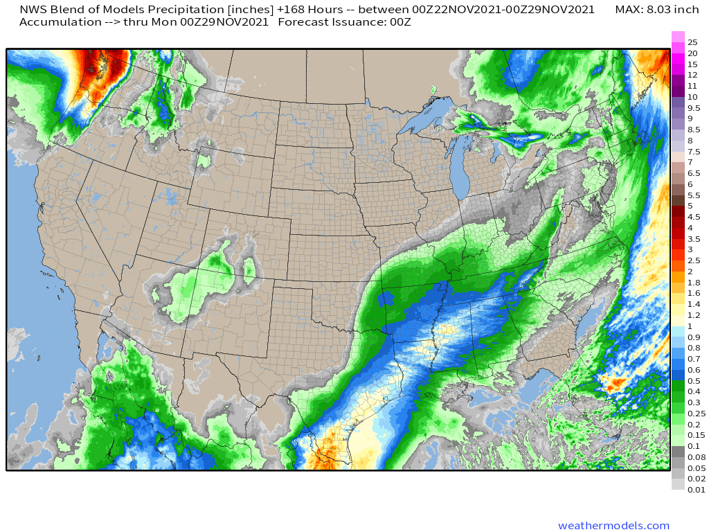
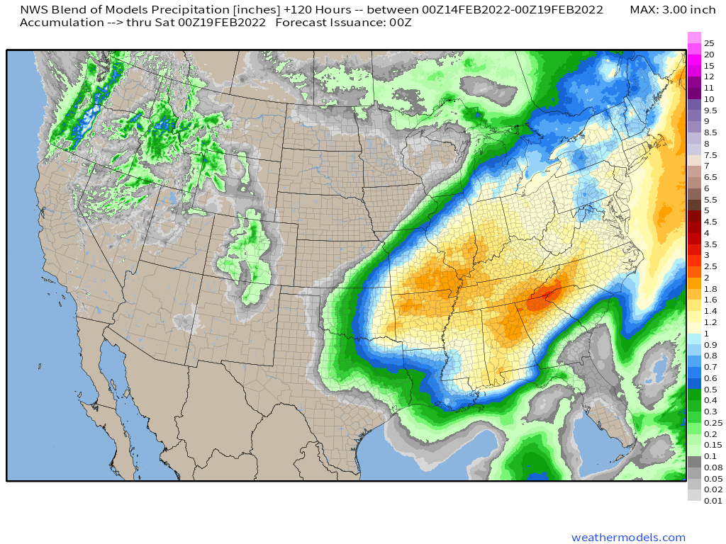
To the north of the storm, a narrow strip of heavy snow is possible from eastern Kansas into the Great Lakes, possibly including the Chicago area. Many locations in this region could see 6 or more inches of snow from storm. Ahead of the storm, heavy rain is likely across the eastern half of the nation during Thursday and Friday. Rainfall totals of 1-2 inches and locally heavier are likely from the Mississippi Valley to the East Coast, with some heavier amounts possible.
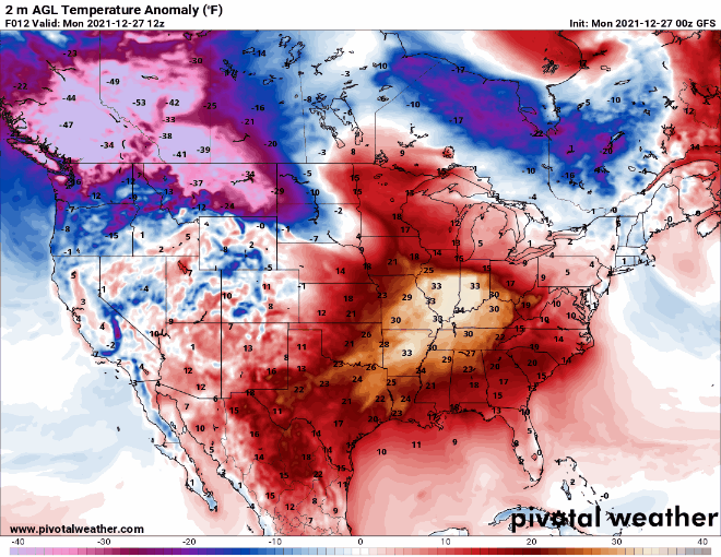
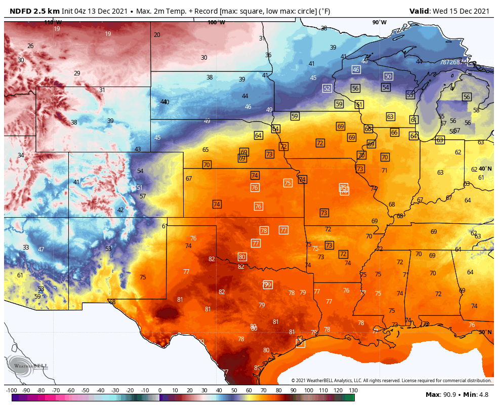
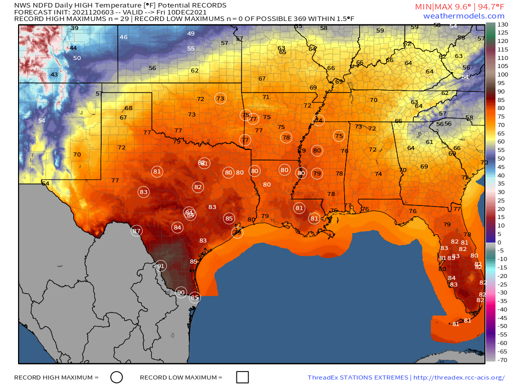
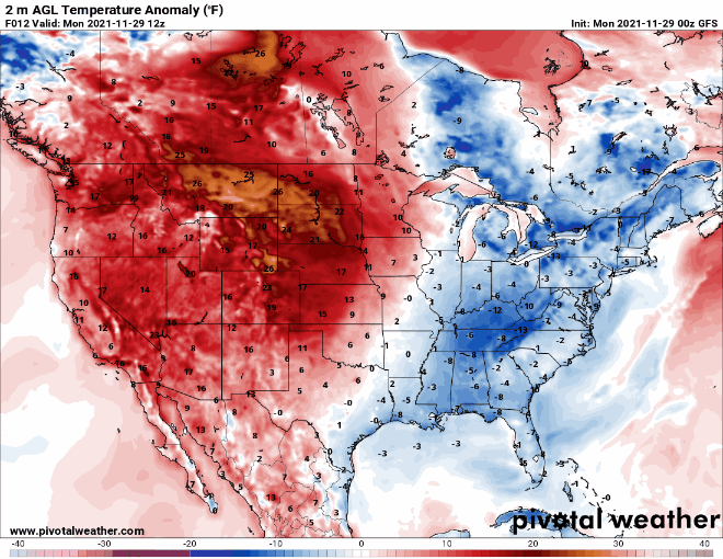
In addition to the heavy precipitation, unseasonably warm air is expected ahead of the storm. Temperatures will be 10-20 degrees above normal on Wednesday from the Southern Plains into the Ohio Valley. By Thursday, the warm air shifts to the East Coast, with temperatures likely to be 15-25 degrees above normal from the Southeast and the Ohio Valley into New England, where a few record highs are possible.
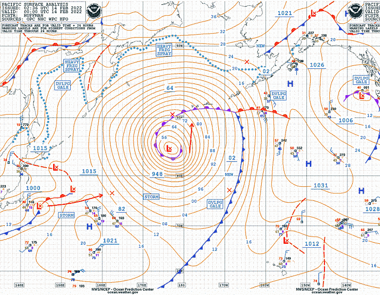
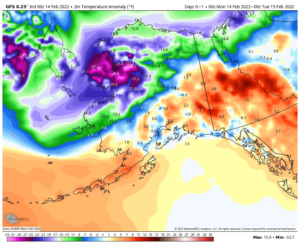
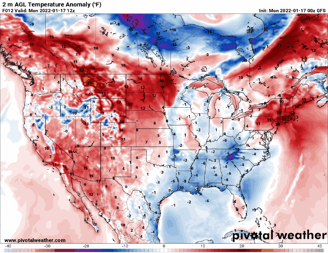
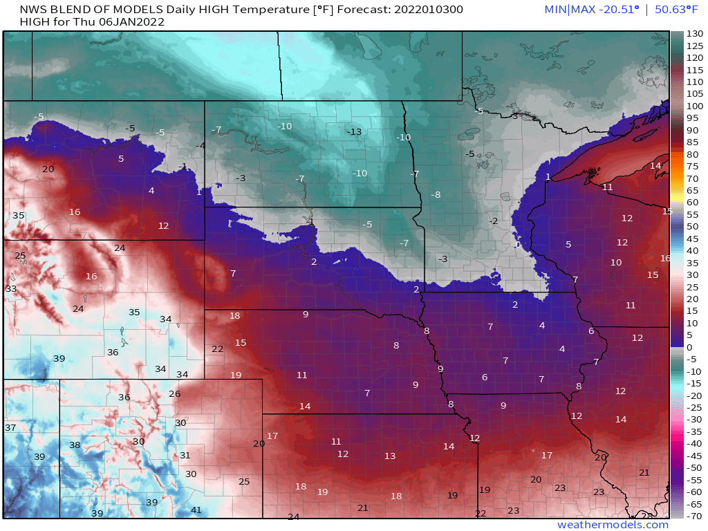
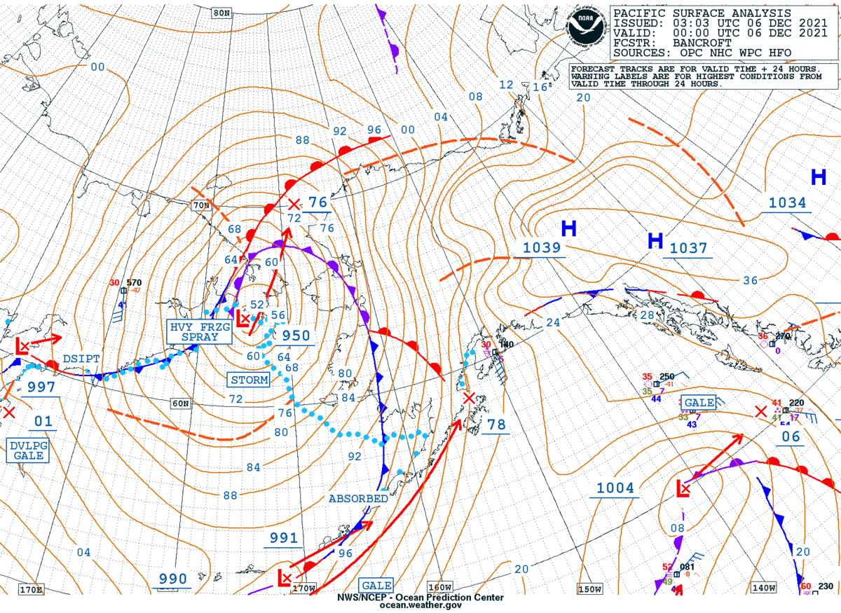
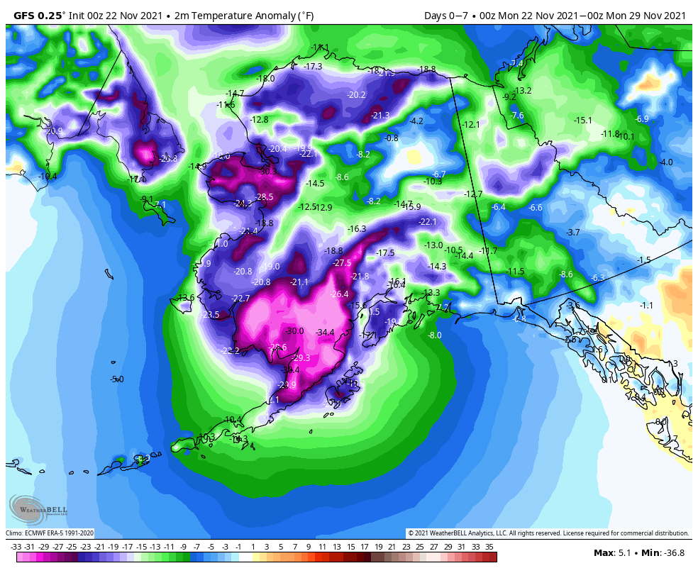
Meanwhile, up in Alaska, bitterly cold air remains locked in place across the northern half of the state. Temperatures will be 15-30 degrees below normal over the next couple of days. Wind Chill Warnings are in effect along the North Slope and the Arctic Coast, where wind chills of 40-70 below zero are possible today and Tuesday. However, changes are coming. A powerful Pacific storm will approach the state, and although it won’t be as strong as it currently is, it’s main impact will be to dislodge the cold air, and result in a significant temperature rise across the state. By the end of the week, temperatures could be 5-10 degrees or more above normal across a large portion of Alaska.