A quiet weather pattern is expected for a large portion of the nation for much of the upcoming week.
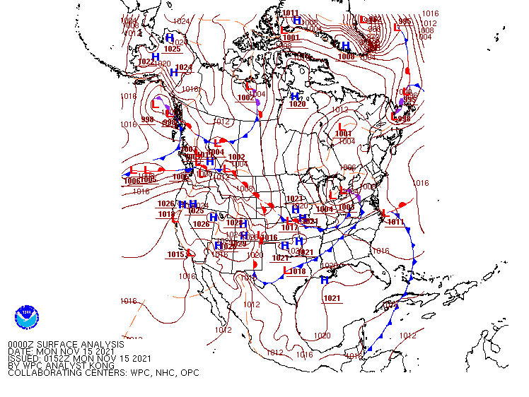
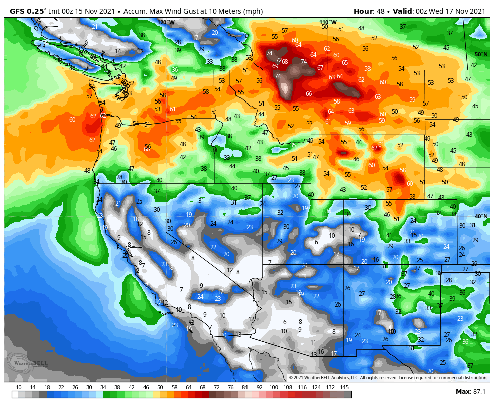
A low pressure system moving in from the Pacific will bring some heavy rain, higher elevation snow, and strong winds to the Northwest and Northern Rockies over the next few days. Flood Watches and Warnings are in effect for parts of western Washington. Rainfall totals of 1-3 inches and locally heavier are expected in parts of Washington, Oregon, and northern California. Across the higher elevations of the Cascades, snowfall totals of 1-2 feet are likely, with some heavier amounts. As the system pushes inland, valley rain and mountain snow will move into the Northern Rockies, where snowfall totals of 4-8 inches and locally heavier are possible. The bigger story here will be strong winds for Monday and Tuesday. High Wind Watches and Warnings are in effect for much of the region. Sustained winds of 20-40 mph are likely, especially in parts of Montana and Wyoming, with gusts of 50-70 mph common. Along the Rocky Mountain Front in Montana, some gusts could approach 100 mph. The system will make its way eastward along the US/Canada border during the week, with a frontal system trailing the system producing some light rain or snow, especially as it reaches the East Coast by late in the week.
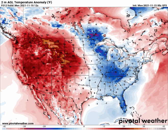
Temperatures both ahead of and behind that system will be the other big story this week. Temperatures ahead of this system will be 15-25 degrees above normal across much of the West on Monday, shifting into the Rockies and the Plains on Tuesday, the Mississippi and Ohio Valleys on Wednesday, and reaching the East Coast by Thursday. Some record highs are possible on Monday in parts on the Southwest and also in the Plains on Monday, with several records possible on Tuesday from the Southern Plains into the Texas Panhandle. Behind the system, much cooler weather is expected. While temperatures won’t be exceptionally cold, they’ll be 5-10 degrees below normal for a day or two before moderating once again.
A preliminary look at the weather for travel the day before Thanksgiving and Thanksgiving Day doesn’t show much in the way of impactful conditions at this point, but a weak system could bring some light rain or snow to areas from the Northern Plains into the Great Lakes and Northeast.