The weather pattern is fairly active across the nation right now, and there are several areas we’re keeping an eye on.
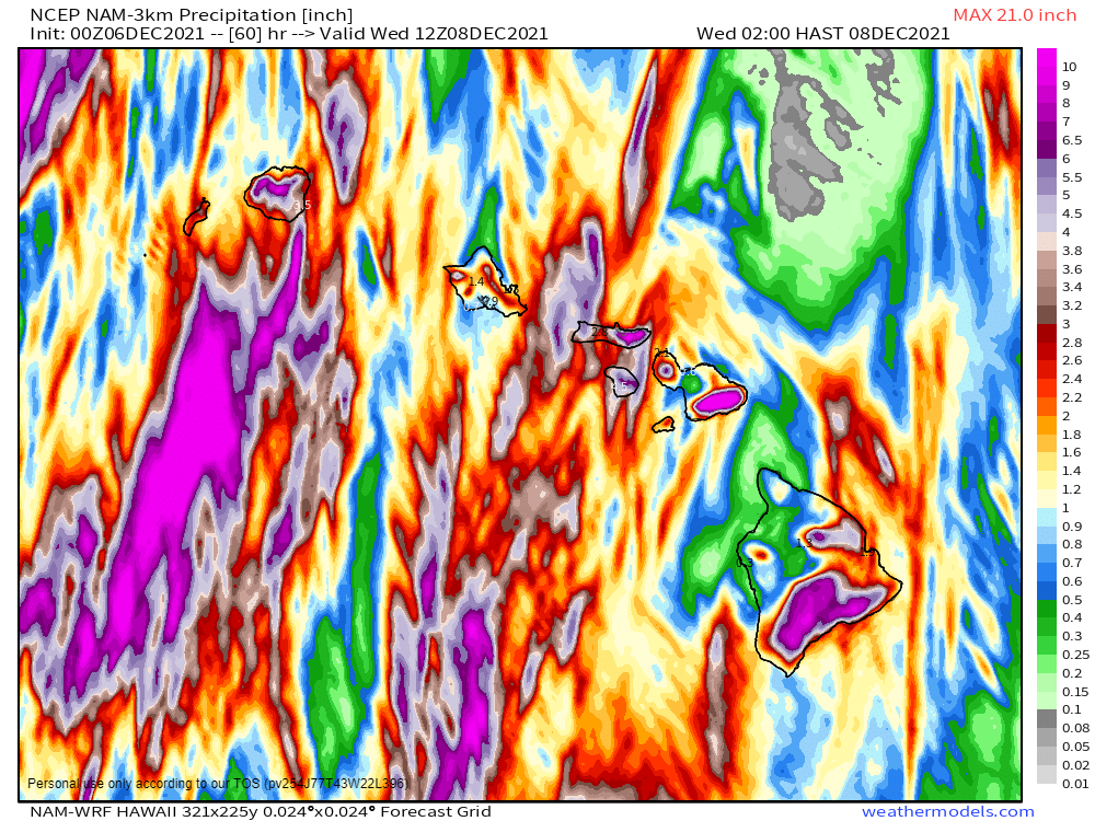
We’ll start off in the Pacific, where a low pressure system will bring a wide variety of impacts to the Hawaiian Islands today and tomorrow. Heavy rain will lead to widespread flooding across the islands, with strong winds also creating damage. Rainfall totals of 3-6 inches and locally heavier are expected through Wednesday. Flood Watches are in effect for much of the region. High Wind Warnings and Wind Advisories are also in effect, for sustained winds of 20-40 mph, with gusts of 50 to 60 mph possible. Along west-facing shorelines, waves of 8 to 12 feet will batter the beaches, where High Surf Advisories are in effect. If that wasn’t enough, across the higher summits of the Big Island, a Blizzard Warning remains in effect. Heavy snow will continue this morning with several more inches of accumulation possible. The snow will be accompanied by winds gusting as high as 80 mph, resulting in blizzard conditions.
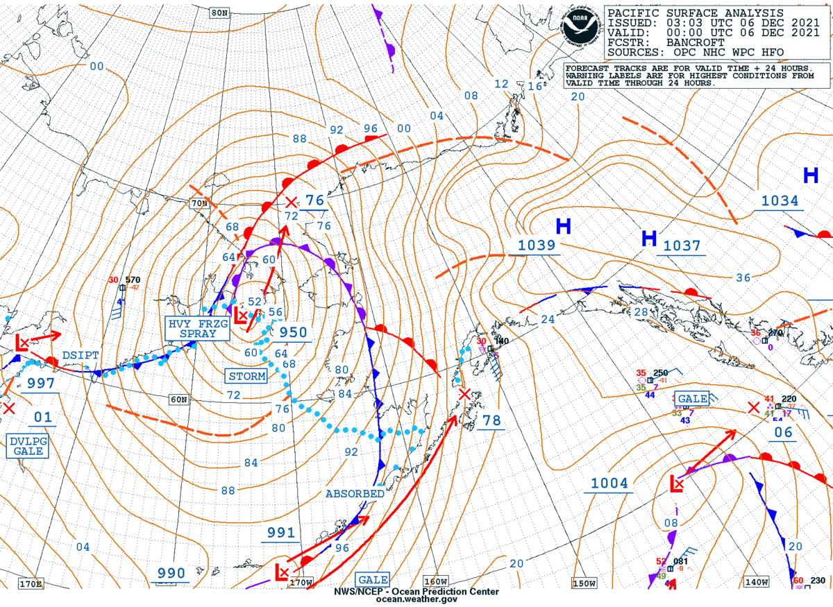
Next, we’ll stay in the Pacific, but head northward to Alaska. A strong low pressure system is sitting just west of the the state early this morning, and it is having a significant impact on the region. Blizzard warnings are in effect for parts of western and southern Alaska. Heavy snow will be accompanied by winds gusting as high as 70 mph. The strong winds, combined with astronomically high tides, will result in flooding along the coast as well. Heavy snow is also likely for many locations, with up to 8-16 inches for many areas, and even more in some spots. Across the higher elevations, several feet of snow are expected. The only positive to this is that the brutally cold weather that much of the state experienced in November has been replaced by temperatures that are well above normal, though bitterly cold air will likely return behind this storm system.
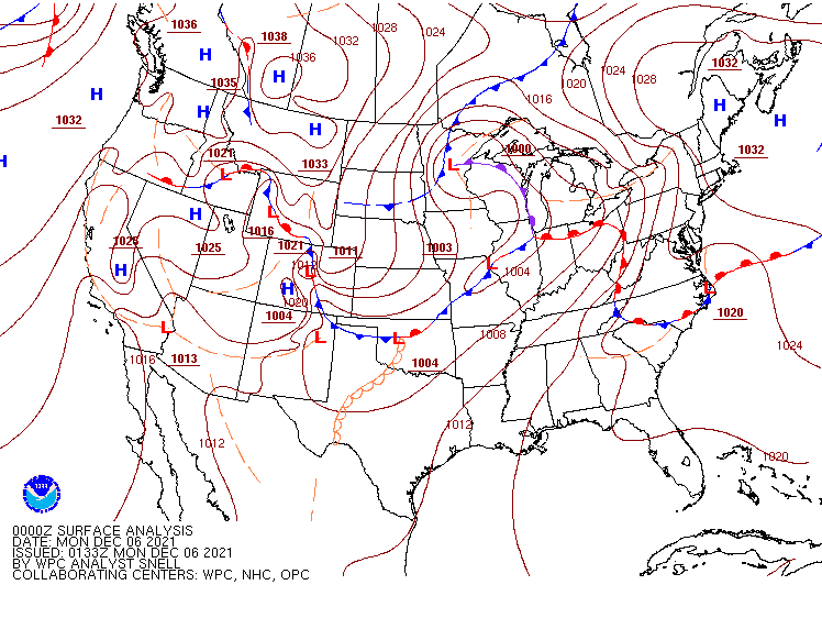
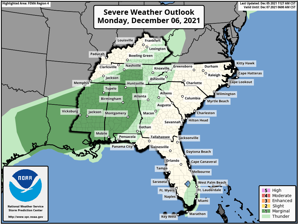
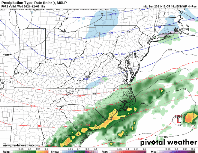
Across the Lower 48 States, the low pressure system moving into the Mississippi Valley this morning will garner the most attention today. It produced heavy snow in the Northern Plains and severe weather in the Mississippi Valley on Sunday. It will move into southern Canada today, dragging a strong cold front eastward. Ahead of the front, unseasonably mild air is expected across the East Coast, with temperatures topping 60 as far north as New England, and 70s into the Mid-Atlantic states. The warmth will be accompanied by some showers and gusty winds. Wind advisories are in effect for parts of the Northeast. Along the Gulf Coast and into the Lower Mississippi Valley, some strong to severe thunderstorms are possible ahead of the cold front. Some of the storms may produce strong winds, hail, heavy downpours, and possibly a few tornadoes.
Another system will quickly follow for the Mid-Atlantic and Northeast on Wednesday. There’s quite a bit of uncertainty with the evolution of this second storm, but it has the potential to bring the first accumulating snow of the season to the I-95 corridor. While heavy snow seems unlikely at this point, some light to perhaps moderate accumulations are possible, which would result in travel issues for the heavily-populated region.
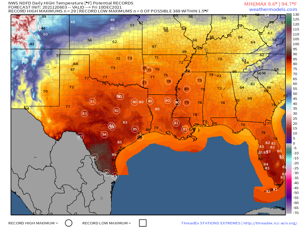
The other area we’re watching is the Southern Plains and Texas. After some record warmth over the past several days, cooler weather will settle in today and into Tuesday. However, another big warmup is expected later this week. Some record high temperatures are possible across the region on Thursday, but Friday looks to be the warmest day, with numerous records likely to be broken as highs soar well into the 70s and 80s, with 90s possible in southern Texas.
On the flip side, very chilly air will settle into the Dakotas and Minnesota today in the wake of yesterday’s snowstorm. High temperatures will only reach the single numbers for parts of the region today, with some locations possibly staying below zero all day. Temperatures should start to moderate by tomorrow across the area.