Officially, hurricane season in the Atlantic Basin starts on June 1 and ends on November 30. In recent years, Mother Nature has not adhered to that calendar, and it appears as though she won’t this year either.
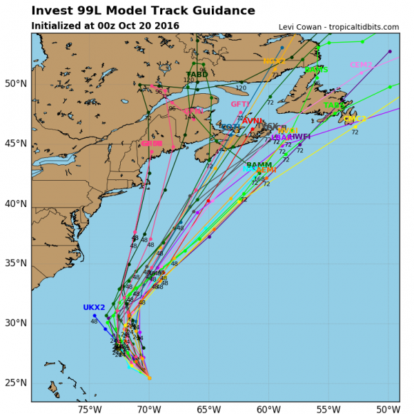
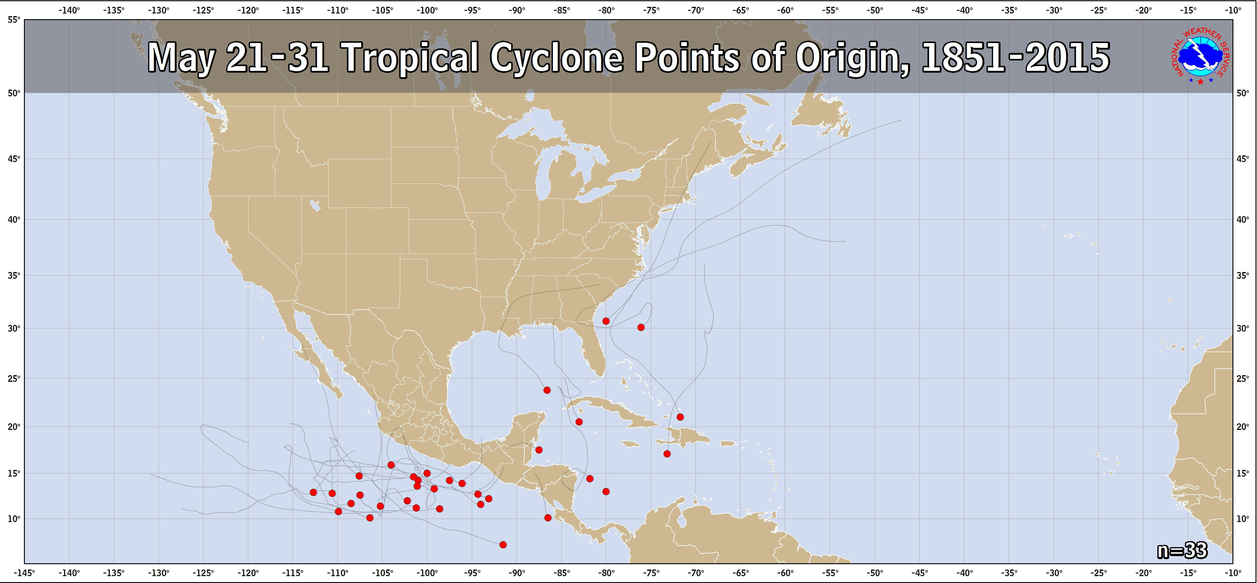
A cluster of thunderstorms centered over the Yucatan Peninsula and northwestern Caribbean Sea has been slowly organizing over the past several days. Conditions should be favorable for the system to continue to organize as it heads northward into the Gulf of Mexico over the next day or two. The system could become a tropical depression over the Memorial Day Weekend while slowly moving across the Gulf of Mexico.
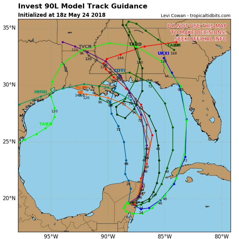
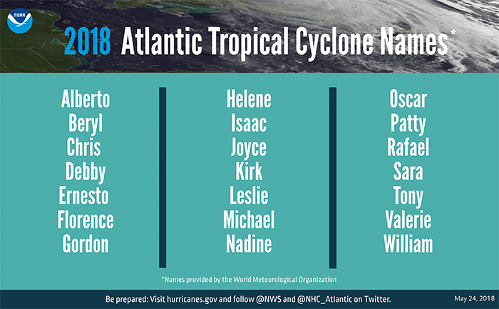
Most of the forecast models are in good agreement that the system should continue northward toward the central Gulf Coast, with slow but steady strengthening expected. If it reaches tropical storm strength, it would be given the name Alberto.
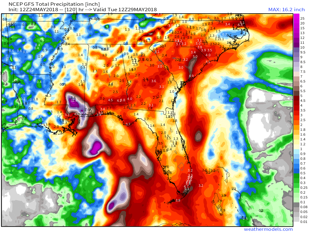
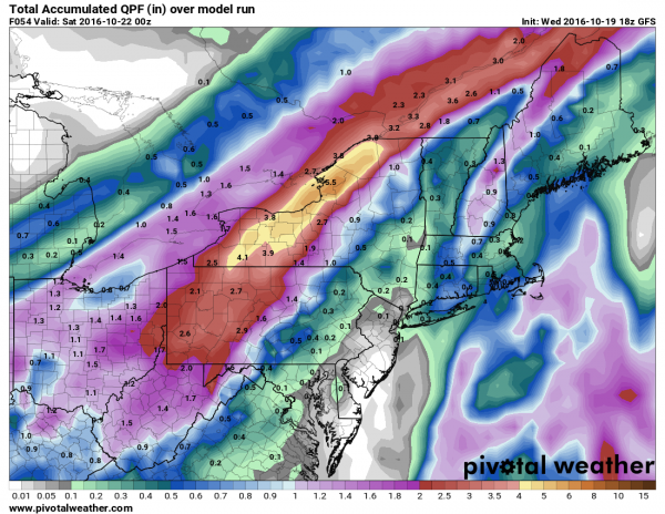
While gusty winds and storm surge are threats near where the system makes landfall, but far, the bigger threats are heavy rain and flooding. The shield of heavy rain will extend far from the center, bringing heavy rain to much of the Southeast and the Gulf Coast during the Memorial Day Weekend. Widespread totals of 2-5 inches are expected, with localized totals in excess of 10 inches possible in some areas. Flood watches have already been issued for parts of the region, and more are expected to be issued in the coming days.
Last year, the hyperactive season got off to a very early start when Tropical Storm Arlene formed in the central Atlantic on April 19. The 2016 season got an even earlier start when Hurricane Alex formed on January 14 and Tropical Storm Bonnie developed on May 27. In 2015, Tropical Storm Ana formed on May 8, and made landfall near Myrtle Beach, South Carolina on May 10, the earliest landfalling storm on record in the United States. Based on data from 1966-2009, the first named storm in the Atlantic doesn’t normally develop until July 9 and the first hurricane doesn’t develop until August 10.
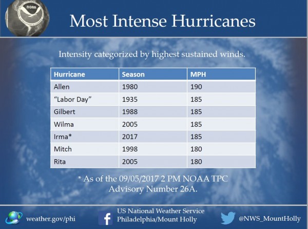
An early start is not always a harbinger of what the season will bring. NOAA issued their seasonal hurricane outlook on Thursday, and it calls for a 35 percent change for an above normal season, a 40 percent chance for a normal season, and a 25 percent chance for a below normal season. An average season consists of 12 named storms, of which 6 become hurricanes and 3 become major hurricanes. The 2017 season consisted of 17 named storms, of which 10 became hurricanes and 6 were major hurricanes. These storms produced an estimated $280 billion in damage, making 2017 the costliest season on record. Many parts of the Caribbean, as well as Texas and Florida are still struggling to recover from direct hits by Hurricanes Harvey, Irma, and Maria.