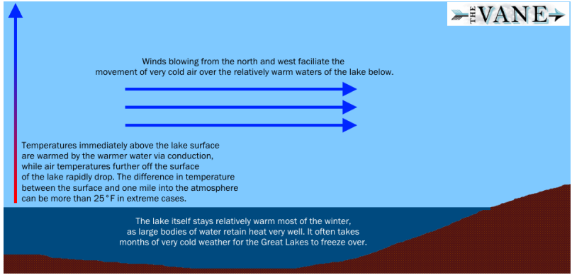
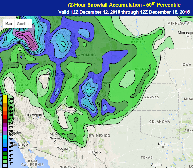
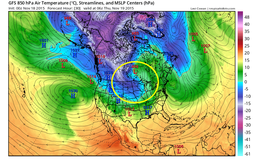
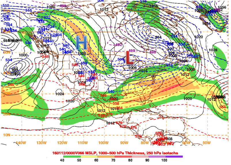
After the weekend, the next storm that the Northeast will be watching comes in the form of an Alberta Clipper late Tuesday into Wednesday. These storms are called Alberta Clippers because they come southeast from Alberta, Canada to the Northeastern United States. This means they have quite the cold punch with them. They also have a strong high pressure system closely trailing the low pressure system so that the cold air usually comes rushing in with strong winds. However, the other part of the name, clipper, gives reference to how the system generally doesn’t drop much precipitation as a result of the area of low pressure being quite dry and moving quite fast through an area.
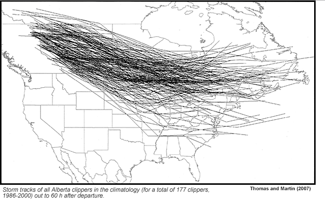
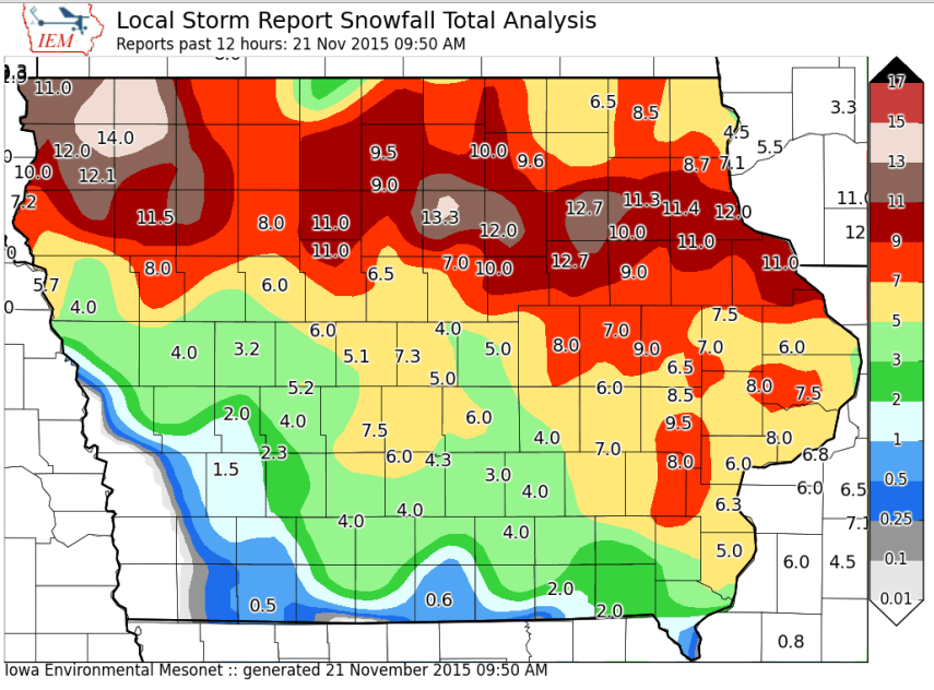
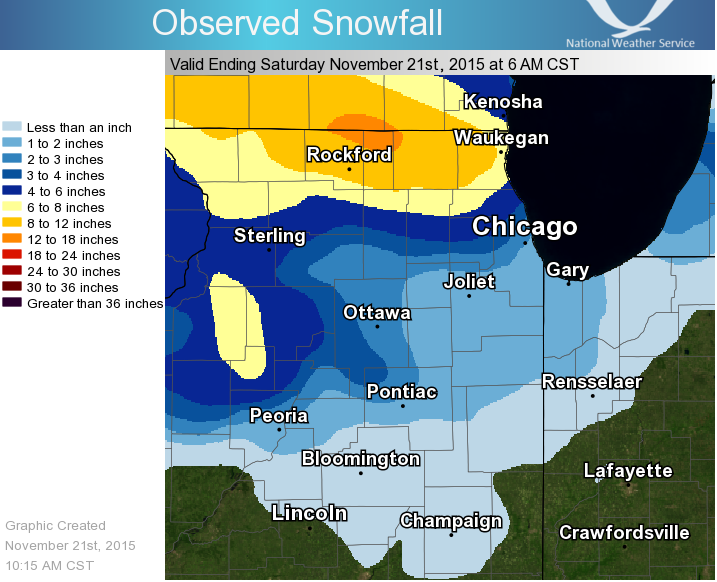
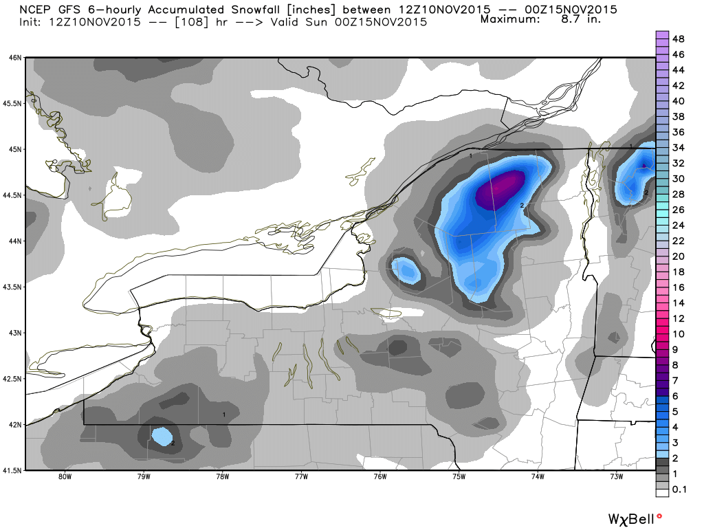
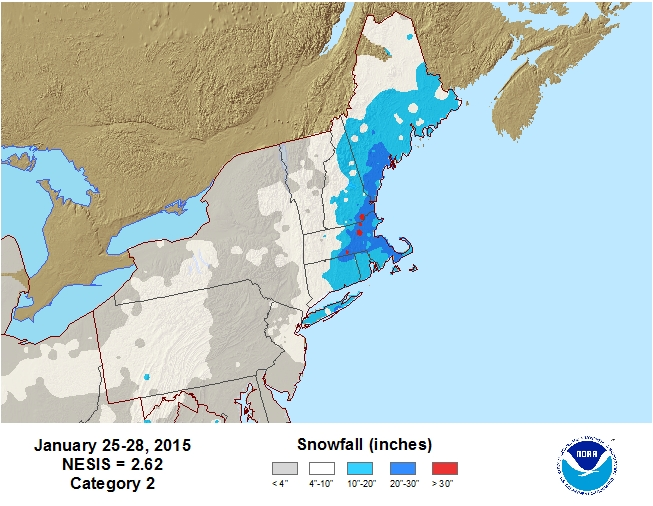
In many cases however, the Alberta Clipper can drop plenty of snow in a given region. The Alberta Clipper is known for containing plenty of cold air and an appreciable amount of energy, but a lack of precipitation. So if moisture from a low pressure system to the south is able to phase, or combine into the system, which usually occurs in the Eastern United States, the clipper can redevelop off the East Coast into a strong nor’easter. This occurred January 25-28, 2015 and resulted in snowfall over 30 inches in portions of eastern and central Massachusetts. The other way Alberta Clippers can pack a punch, which is usually weaker than when clippers phase to strengthen the system, is to have the trough that the low pressure system resides in turn negative. This means that the direction from the northern part of the trough to southern part of the trough goes from northwest to southeast. This causes a strong draw of moisture into the storm on favorable winds and can also cause a redevelopment low into a strong low pressure system in the Northeast, usually east of Massachusetts. The proximity of the redevelopment low pressure system to land can determine if the resultant storm skirts by the region with minimal snowfall or a closer track leading to higher snowfall. One other part of forecasting an Alberta Clipper is to forecast its track from Northwestern Canada to Northeastern United States. There have been plenty of times where the models have the system way to far north and end up trending it farther south over time. This can trend any negatively tilted troughs further west and have a new, stronger low pressure system develop closer to land than out to sea.
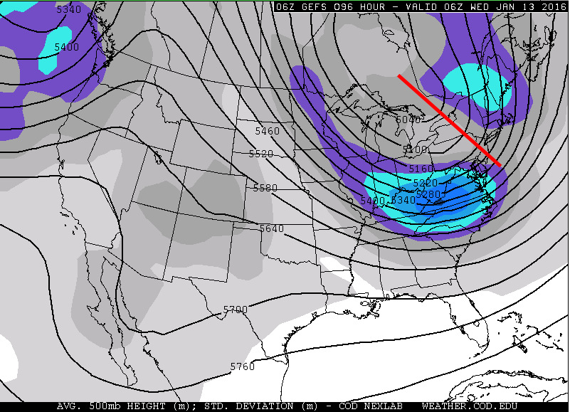
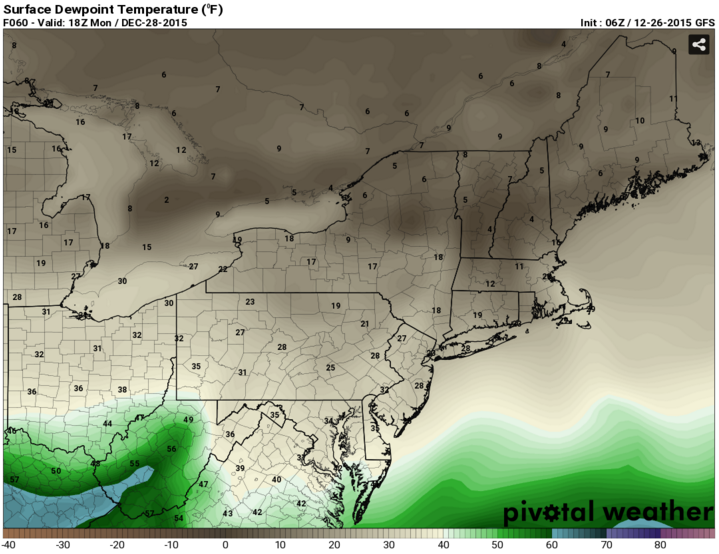
The Alberta Clipper system taking aim at the Northeast does have a negatively tilted trough and also has quite a bit of instability in the low levels of the atmosphere. Snow squalls could occur as a result of the low level instability and a stronger low pressure system does look to develop somewhere east of Massachusetts. Temperatures may be just borderline enough that precipitation could start as rain instead of snow as well. While, it is NOT anticipated that this system will become one like January 25-28, 2015 and produce high amounts of snow, it is possible that current models aren’t depicting the whole picture of what this system could become especially with possible trends south with the system and possible adjustments with the model solutions after the weekend rainstorm moves through. Currently, snow totals are expected to be light.