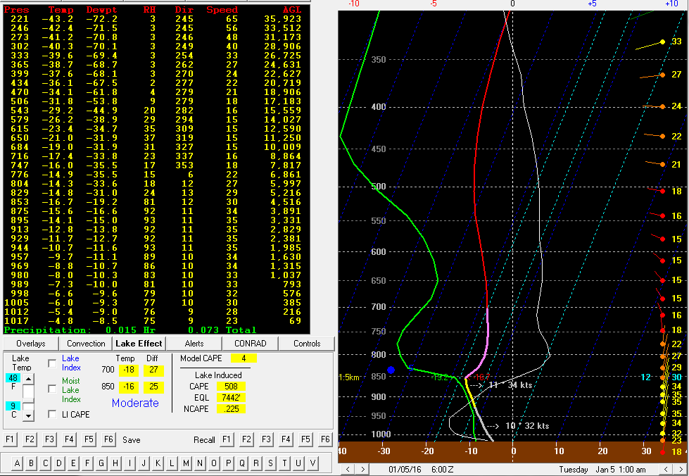
Have you ever wondered how lake effect snow develops? It works as a result of buoyancy and wind direction and is easier for it to take place in the earlier part of winter. One of the biggest pieces of the puzzle, aside from a totally below freezing atmospheric column, is the fact that lakes need to be warmer than the cooler air coming in across the lakes. In fact, it needs to be 13 degrees colder at the surface than at around 1.5 kilometers into the atmosphere. This is because there needs to be enough lift to generate the storm itself.
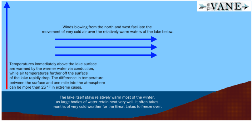
It is easier for this setup to take place in the transition from fall to winter because the area’s average air temperatures are falling while the lake’s average sea surface temperatures are falling slower, or if not, remaining the same. This is as a result of a few of water’s properties (heat capacity and thermal conductivity) which allow it to change from warm to cold or cold to warm temperatures slower than the air. Also later in the winter, the lake has a tendency to have a frozen surface, which shuts off the possibility of lake effect snow. One of the most common ways this setup works is to have a cold front come in from Canada with a vigorous piece of energy associated with it and move right over the lake. This often happens as a strong low pressure system is leaving the Northeast and cold air streams into the Northeast behind it.
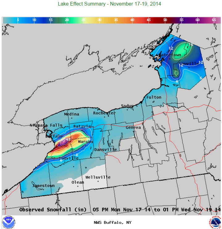
So, in our setup, the lake is warm, the air is cold, now buoyancy comes into play because the cooler air aloft is more dense and falls while the warmer air rises, condenses and creates our snow storm. The other piece that is necessary with lake effect snowfall is to have a favorable wind. This is very important because often, if the wind direction stays constant for a long period of time, the snowfall amounts can pile up within the favorable area for snowfall while the area just outside the favorable area can have minimal amounts. For example, from November 17-19 of 2014, around 5 feet of snow fell in Cheektowaga, New York off of Lake Erie while just a few miles away only received a few inches. So wind direction is important because, in some cases it can mean the difference between a few inches and many feet.
This can also work with the ocean in the same way that it does with the lake. A warm ocean compared to very cold temperatures 1.5 kilometers into the atmosphere can lead to snowfall along the eastern side of the Northeast and especially Cape Cod. Such an event is forecast to take place on Monday as a strong arctic cold front approaches from the northwest. Some of the coldest air forecast to come into the region with around -10 to -12 Celsius temperatures at 1.5 km while the sea surface temperatures just east of Massachusetts are still around 9 Celsius. That’s a temperature difference of around 20 degrees Celsius around 1PM on Monday! Of course, enough lift has to be in place and moisture within the area where growth of dendrites, the type of snowflake that allows for the highest accumulations, occurs in the atmosphere. Some dendritic growth zone moisture is available at the time of ocean effect snowfall, but lift is really lacking. So snowfall accumulations should be minimal. Sometimes Boston gets into the snowfall as well, but the wind needs to have a slight easterly component. If it does, then some snowfall could occur.