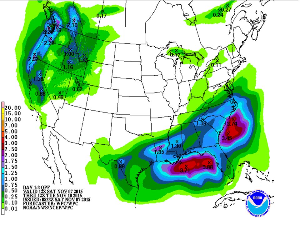
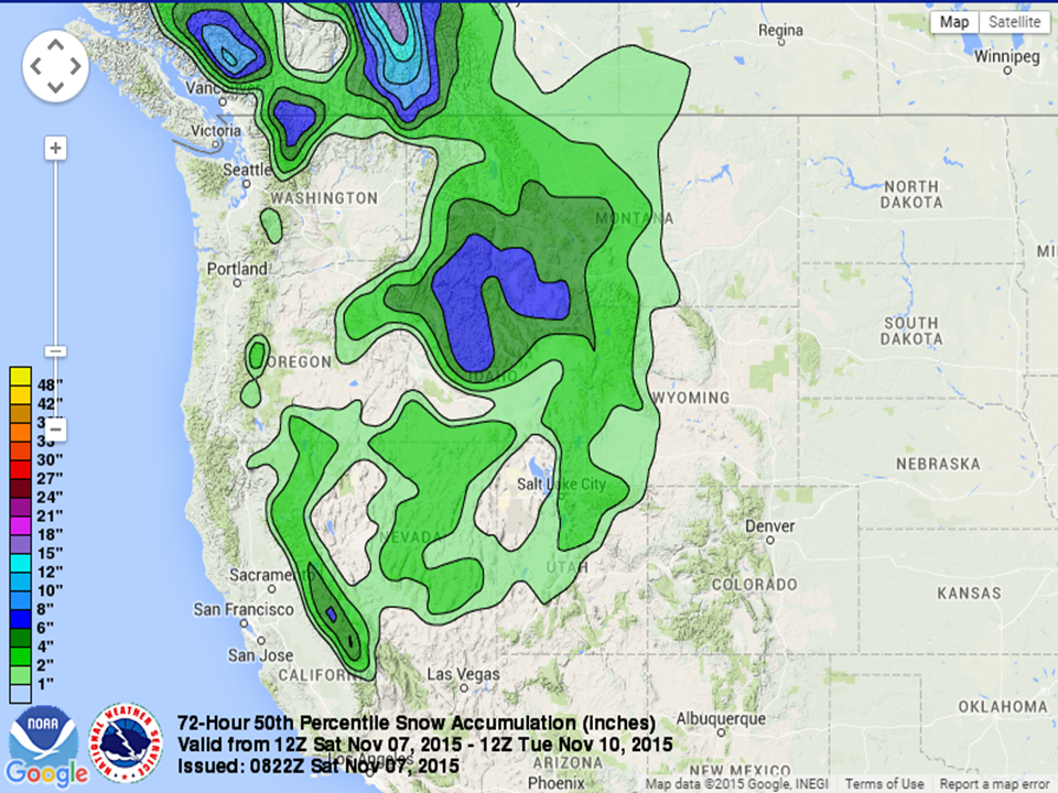
Another cold front will move into the West Coast on Saturday allowing for some showers in the Pacific Northwest during the day and then will move south overnight providing showers to California and other portions of the Western United States. The highest rainfall totals over the next 3 days will be along the coastal regions, but total projections look to be with the 1 to 3 inch range. Some snow showers are possible especially overnight and in the higher elevations of the Rockies as the front moves ashore. Many higher elevations should see 1 to 3 inches with a possibility of more through early Tuesday morning. Once again, this is good news for drought-stricken regions that are nearby mountainous regions, which can accumulate snow, so that when warmer weather comes back and allows for melting, it will create more drinking water and some of the runoff may go back into the water table and begin to replenish some lakes and streams.
It is interesting to watch the model projections for energy associated with this cold front in the future. The southern jet stream, known as the subtropical jet, has gotten going over the last week along the border of the Gulf States with the Gulf Coast, so as this cold front dives south along the northern jet stream these two jet streams will combine, which is known as phasing. Often when upper level jet streams phase, a strong low pressure system can develop with the increased wind aloft helping it to intensify or cycle. This occurs with the low pressure system that is projected to develop just east of the Rockies early Wednesday through Friday.

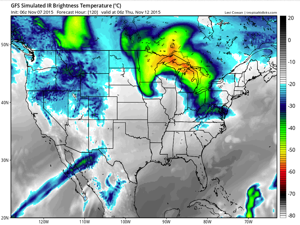
Winds rotate counter-clockwise around low pressure systems which allows for cool northerly winds to come into the United States. Sometimes the cooler temperatures can mix with more moist air and create snowfall over lower elevations especially at night when cooler temperatures can also result. This is what may happen on the west side of this system mid to late week next week in the Northern Plains. It is still too early to show model projections, but any accumulation looks to be light in the lower elevations.
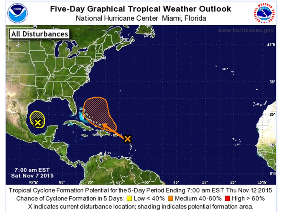
In addition to the active weather coming up over the United States, the tropics have gotten active again. This is especially true in the Atlantic, where two areas are being watched over the next 5 days for tropical development. The first is in the western Gulf of Mexico, which has a low probability of development over the next few days. A low pressure system around 300 miles southeast of Brownsville, Texas resides there and thunderstorms have become more concentrated near this low. During the day today, a cold front will come near it and the area of storms will merge with it. The other area of storms has a better chance of development. It is a large area of showers in an area from the northeastern Caribbean Sea through the Lesser Antilles and into the Atlantic. Some gradual development of this disturbance is possible by early next week, but regardless, heavy rains are possible over the Lesser Antilles, the Virgin Islands, Puerto Rico and Hispaniola over the next few days. Any development of this system will be slow over the next few days.