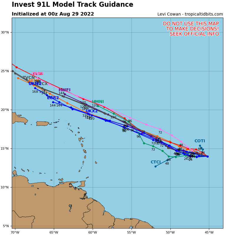
Hurricane Fiona is grabbing the headlines, but it’s not the only area we’re watching this week.
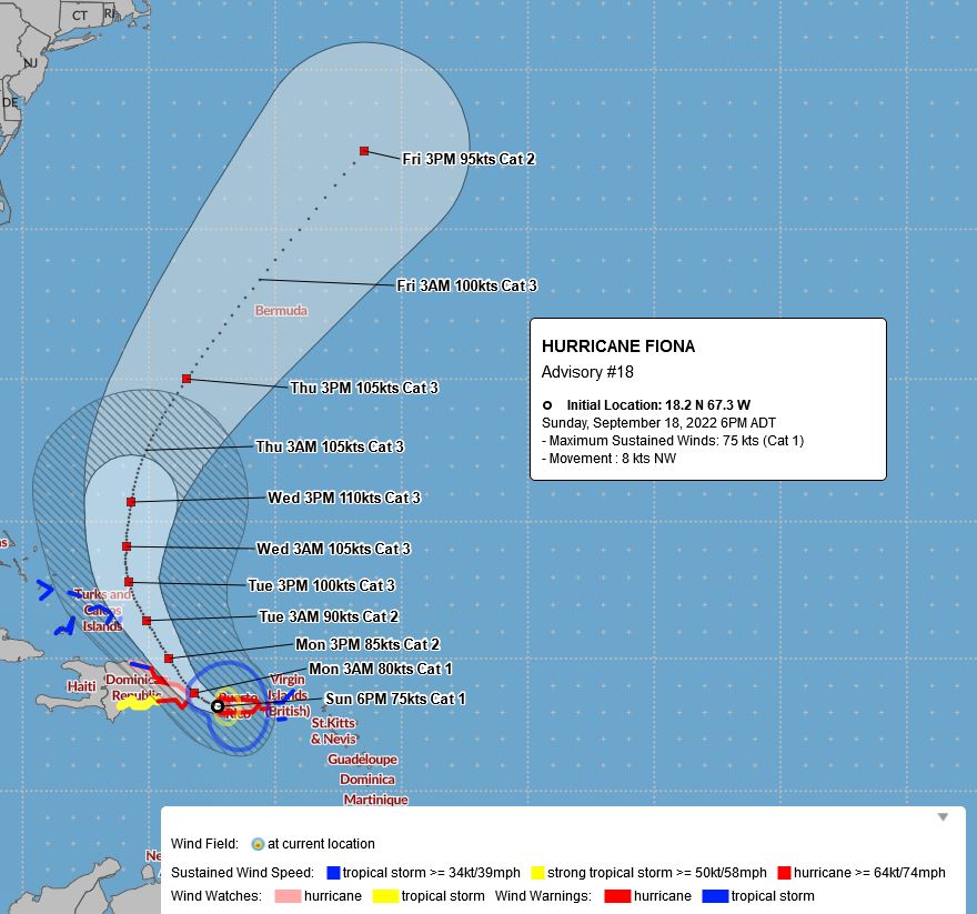
Hurricane Fiona produced strong winds and catastrophic flooding across parts of the northeastern Caribbean over the weekend, especially Puerto Rico, and today it’s the Dominican Republic’s turn. Once it moves back into the Atlantic later today, a northward track is expected for the next few days. It may bring strong winds and heavy rain to the Turks and Caicos as well as parts of the southeastern Bahamas over the next few days, but as it moves over open water, additional strengthening is expected. By the latter half of the week, it could have Bermuda in its sights. Its still too early to determine what, if any, impact it will have on Bermuda, but anything from a glancing blow to a direct hit as a major hurricane is possible. By the end of the week,, it should be heading out into the North Atlantic and starting to weaken, though residents of Atlantic Canada and Newfoundland should keep an eye on Fiona.
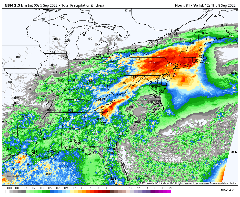
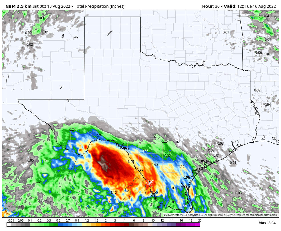
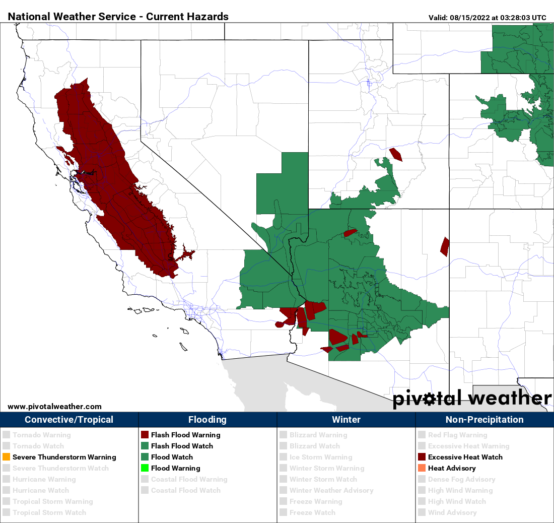
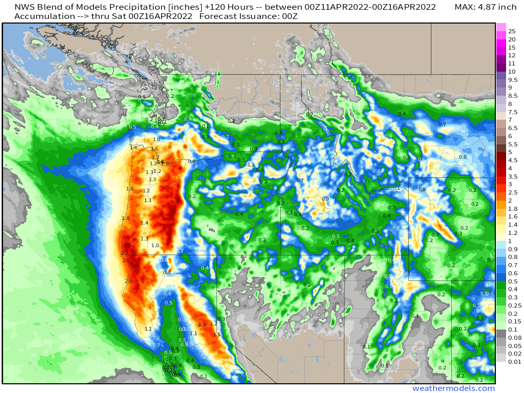
Out West, an early-season storm will bring some much-needed rainfall to parts of California over the next few days. The rain began Sunday, but will continue into Tuesday or even Wednesday in parts of the state. Some spots could pick up 1-2 inches or more by the time everything winds down. This will help put a small dent in the ongoing drought across the state, but will also be a big help to the firefighting efforts for the numerous wildfires burning across the region.

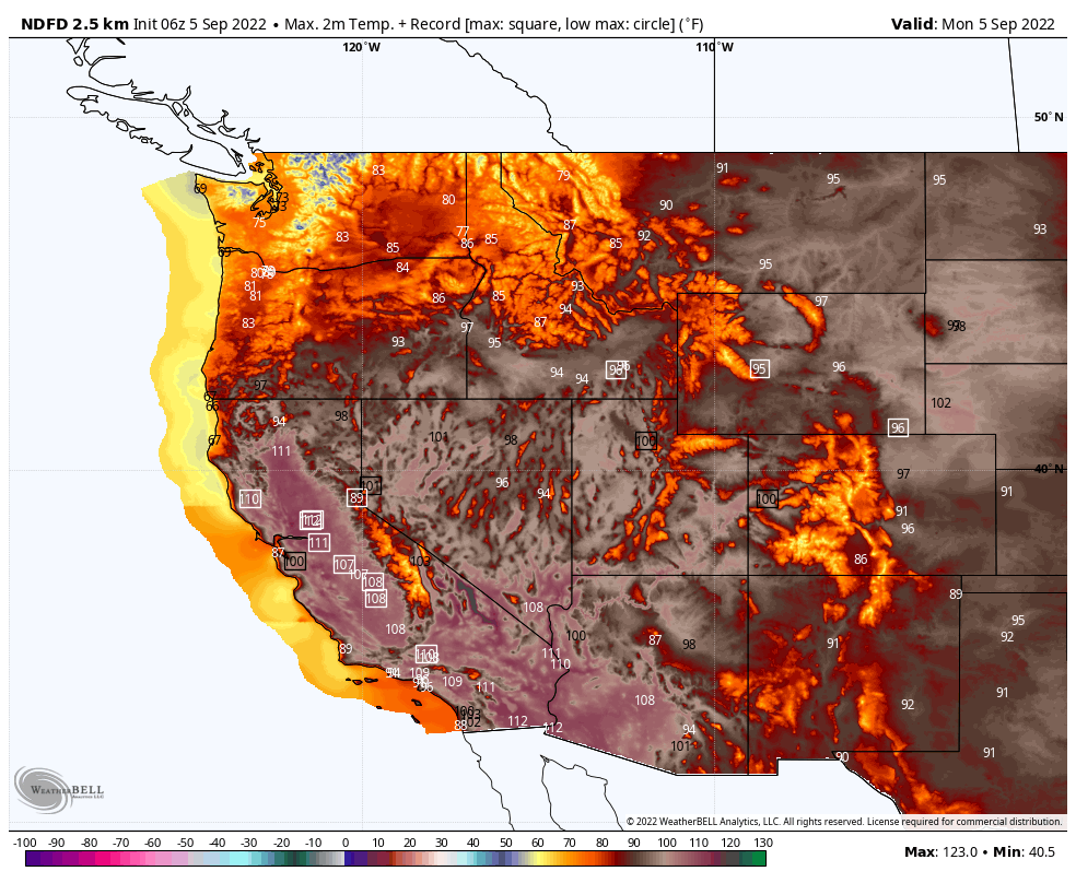
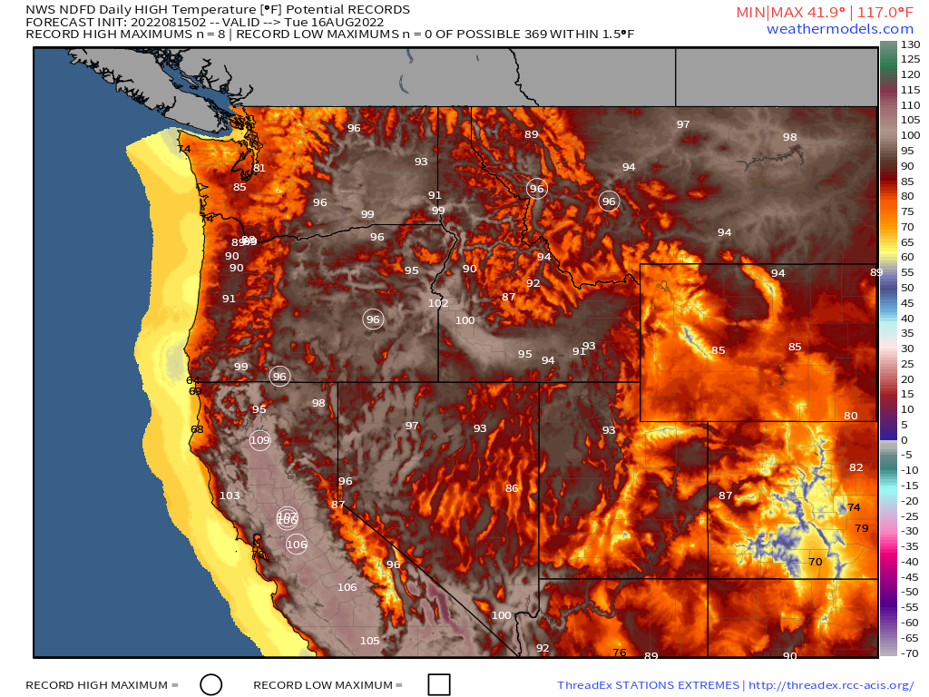
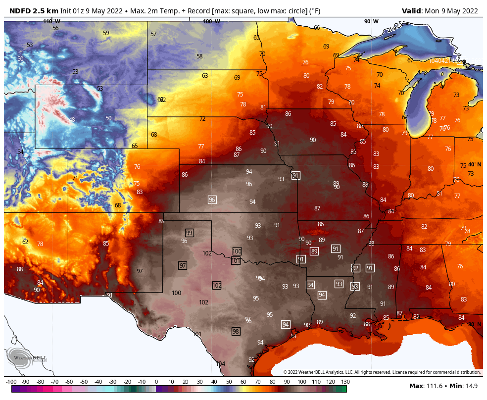
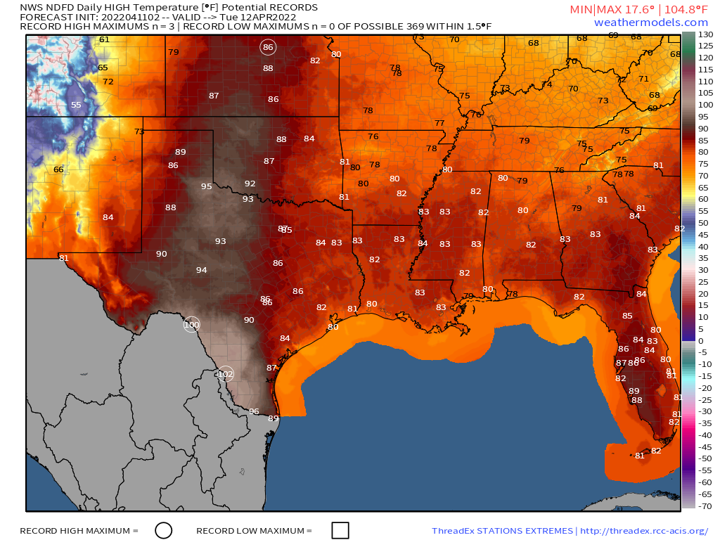
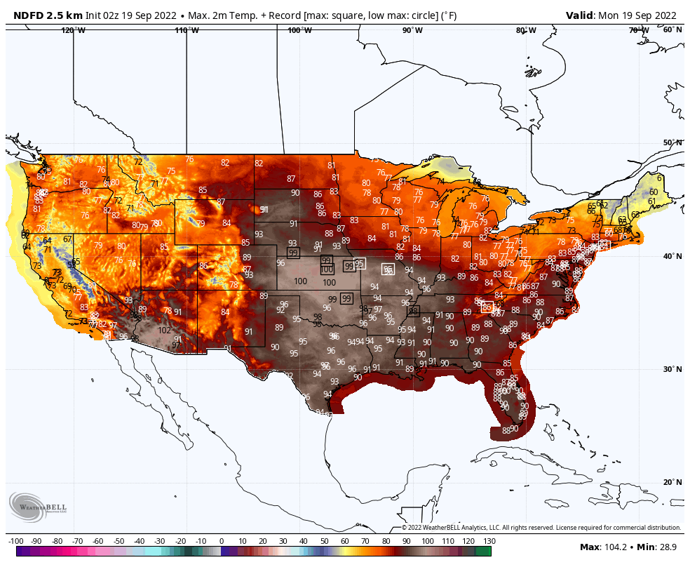
Heat will return to the nation’s midsection over the next few days, gradually spreading into parts of the Mississippi Valley and the Deep South as the week goes on. High temperatures well into the 90s and possibly lower 100s are expected, which is 10-to-20 degrees above normal for late-September. Many record high temperatures are expected over the next several days.
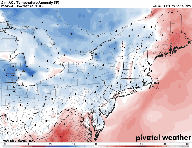
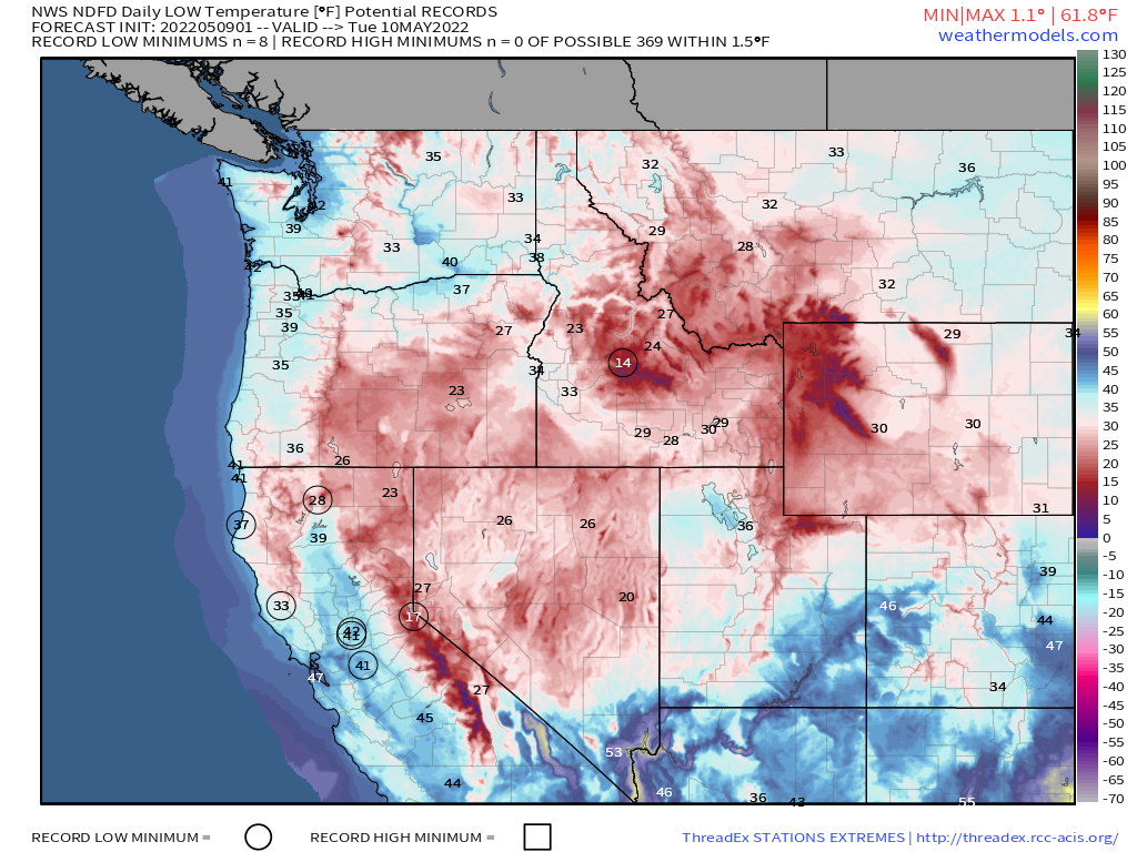
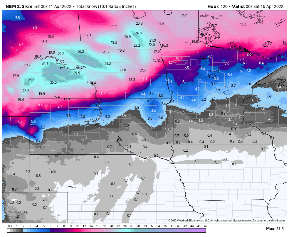
While heat covers much of the nation, late in the week, cool weather will be the story from the Northern Plains to the Northeast. A strong cold front will produce some rain across these areas during the latter half of the week, but behind that front, much cooler air will settle in. Frost and freezing temperatures may bring an end to the growing season from parts of the Great Lakes into northern New England by the end of the week. In fact, as that front moves through, the rain may mix with or even change to wet snow across some of the higher elevations of northern New York and New England Thursday night and early Friday. While this is a bit early, it’s not that unusual for some of the higher peaks to see snow in late September. Atop New Hampshire’s Mt. Washington snow has already been reported a couple of times this month.