A fairly quiet week is expected across much of the nation this week.
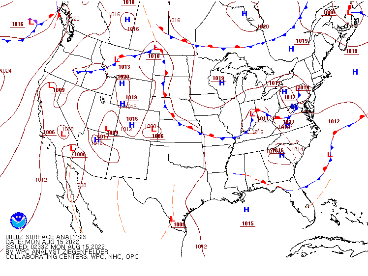
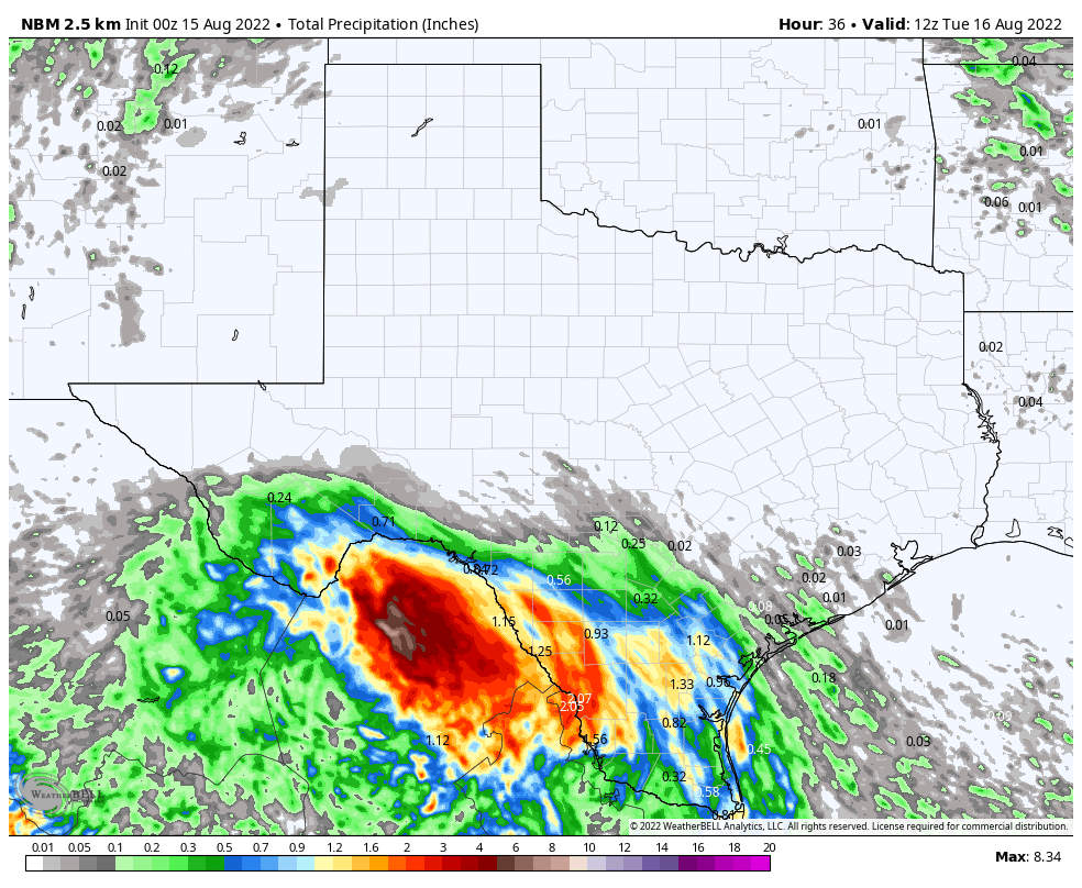
A weak low pressure system in the western Gulf of Mexico over the weekend moved into southern Texas late Sunday. If it had another 6-12 hours over water, it could have become a tropical depression. It will continue to push inland over the next few days, bringing some heavy rain to parts of southern Texas and northern Mexico. Many locations could receive 1-2 inches over the next few days, with some heavier amounts possible, especially in northern Mexico. Some localized flooding is possible, but the rain will also help with the ongoing severe drought across the region. Significantly more rainfall is needed to help put a dent in the drought, but every bit helps.
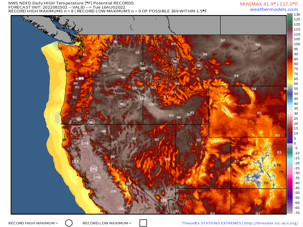
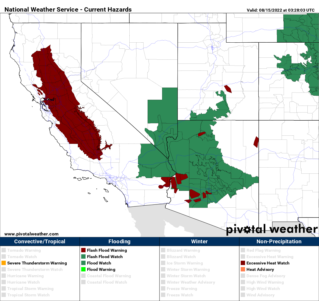
Hot weather will return to much of the West and the Pacific Northwest over the next few days as a ridge of high pressure builds in. Triple digit heat is likely across interior California, with some 90s right to the coastline. Temperatures will also soar into the 90s and 100s across the Interior Northwest for much of the week. Record highs are possible each day, with Tuesday and Wednesday the most likely days for the hottest weather. Excessive Heat Watches have already been posted for parts of the region.
While the Northwest and West turn hotter, monsoonal moisture will continue to flow into the Southwest, producing more showers and thunderstorms each afternoon. Some of these storms will produce heavy rainfall that will trigger flash flooding in many areas. Flash Flood Watches remain in effect for parts of the region. The rain will also help to keep temperatures below normal. While it will remain seasonably hot, with highs still well into the 90s and 100s in many locations, these readings will be on average 3-6 degrees below normal for mid-August through midweek. By the end of the week, some places in the Southwest could see readings that are 6-12 degrees below normal.
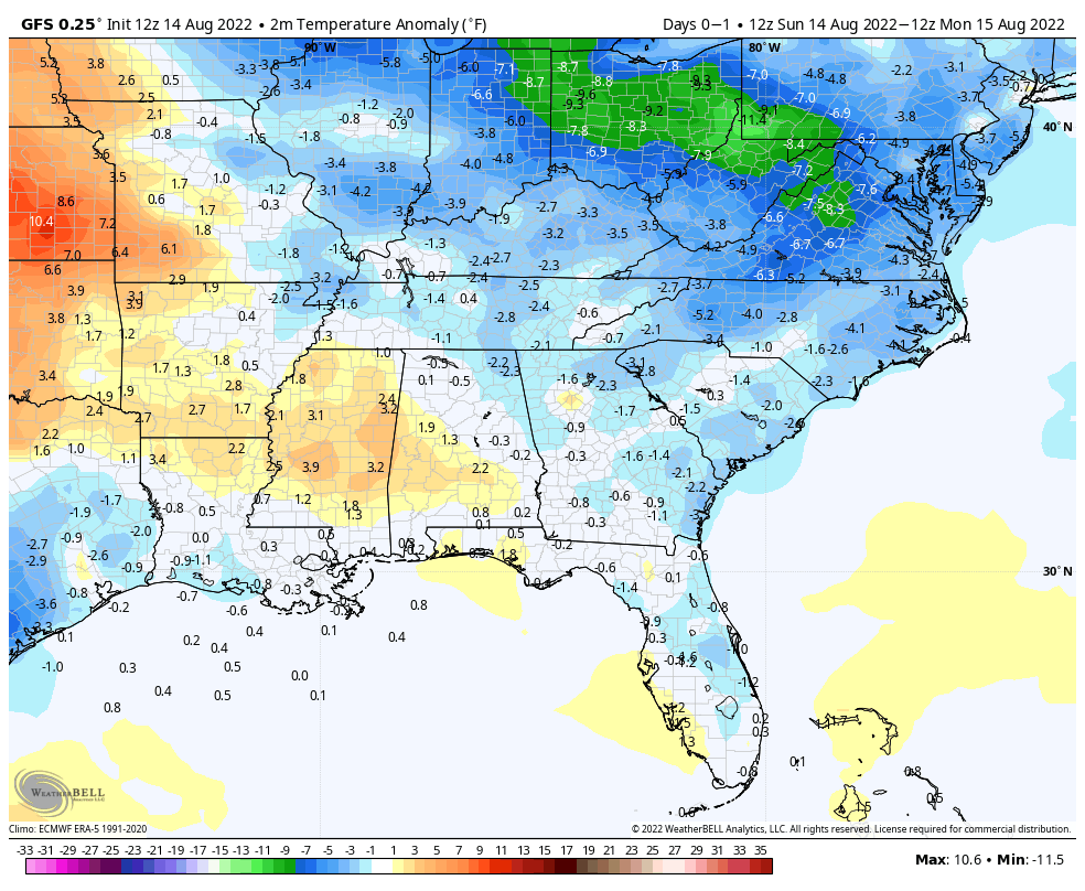
Cool and wet conditions are also likely from the Tennessee Valley and Mid-Atlantic states into the Southeast this week. A frontal boundary will drop southward before stalling out across the Deep South this week. Showers and thunderstorms are likely along this boundary each day. Some of the storms may produce heavy rain, with some localized flooding possible each day. To the north of the front, some rather cool air for mid-August will settle in and remain in place through the end of the week. Temperatures will be as much as 7-14 degrees below normal for the next several days across this region, before they start to moderate next weekend.