The weather pattern across the US isn’t that active at the moment, but the Atlantic may be starting to get active finally.
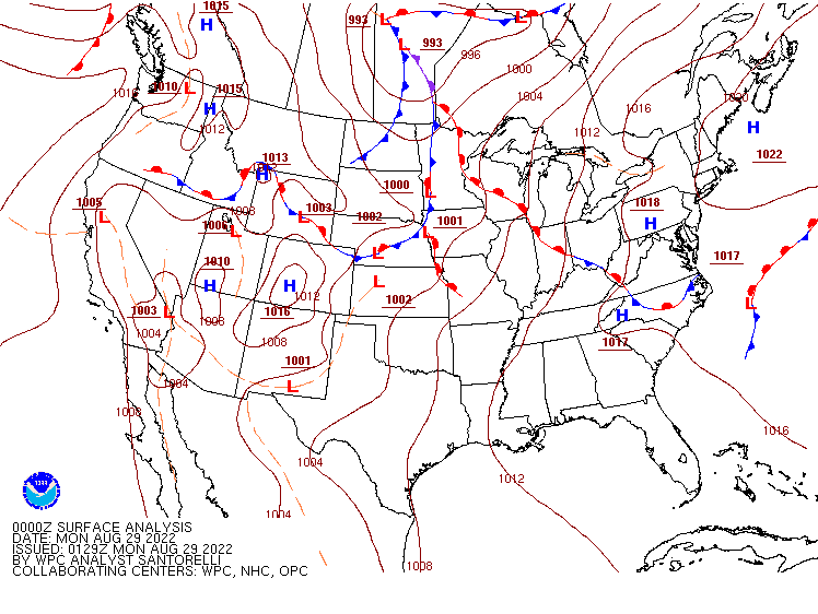
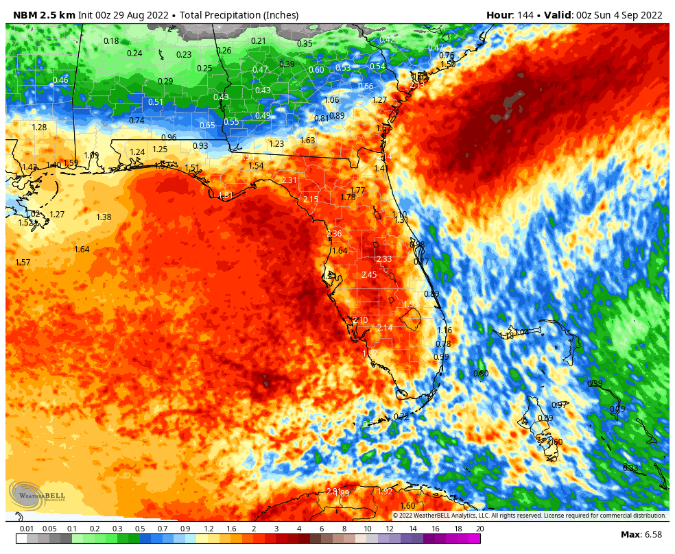
A persistent trough of low pressure will remain in place across the Southeast and Florida for the next few days. This will act as a focus for shower and thunderstorm activity across the region. Severe weather will be very isolated in nature, but some heavy rainfall totals are possible, especially across much of Florida, southern Georgia, and coastal portions of the Carolinas. Many locations will receive 1-3 inches of rain over the next several days, with isolated totals in excess of 5 inches possible in spots. This will likely lead to some flash flooding.
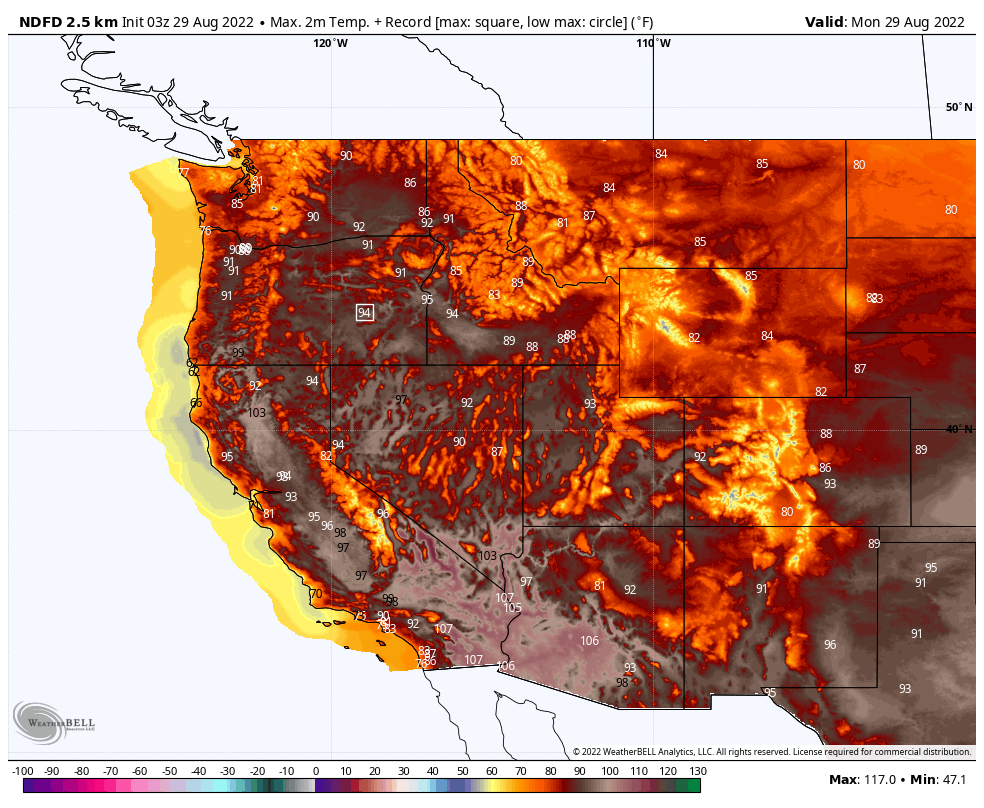
Out West, where the monsoon has been quite active this summer, it will slow down this week, allowing heat to return. Excessive Heat Watches have been issued for parts of the Desert Southwest and Southern California. Triple digit highs are likely across the Southwest and interior California several days this week, as well as portions of the interior Northwest. Highs will soar well past 90 across much of the remainder of the West through the week, with numerous record highs possible each afternoon into next weekend.
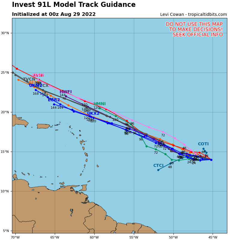
Meanwhile, as we enter the peak of hurricane season, the Atlantic appears to be awakening from its 2 month slumber. There are several areas that the National Hurricane Center is keeping an eye on, but the most immediate threat appears to be a tropical wave and associated low pressure area several hundred miles east of the Lesser Antilles. The area is showing signs of organization, and conditions are somewhat favorable for development over the next few days. Most of the forecast the system to head northwestward for the next few days, passing north of the Lesser Antilles toward the end of the week. In terms of strength, several models either keep the system very weak or don’t develop it at all, and others do allow for some significant development. It could become a tropical depression later this week, but there are still significant questions as to the future of this system or if it even has a future.
There are a couple of other tropical waves we’re keeping an eye on. One of them is in the western Caribbean, and will bring some heavy rain and gusty winds to parts of the Yucatan and Central America today and tomorrow. Once it moves into the Gulf of Mexico, some forecast models show the potential for development, but others do not, so that wave will need to be monitored. Another wave will move off the coast of Africa tonight, and take its time crossing the Atlantic this week. Again, there are some models that show the potential for development, but others that don’t, so it will need to be monitored as well.