Extreme temperatures, both hot and cold, will grab most of the attention this week.

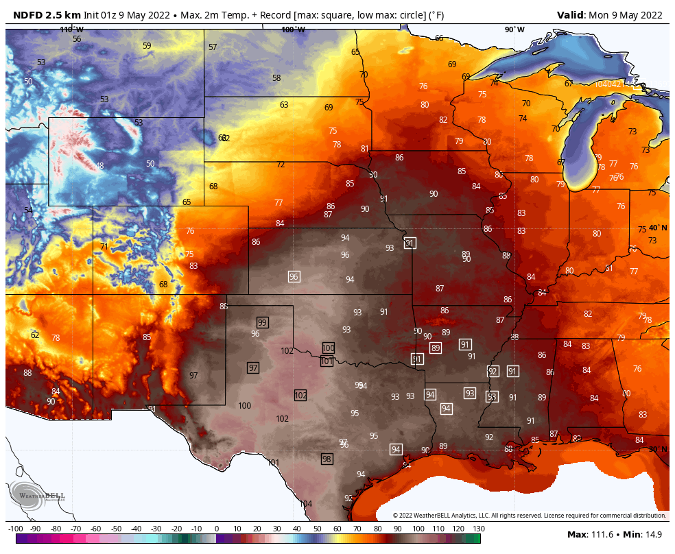
A large ridge of high pressure will dominate the eastern two thirds of the nation this week, resulting in very warm to hot weather for much of the region. High temperatures well into the 80s and 90s are likely from the Plains States into the Mississippi Valley over the next few days, with dozens of record highs likely. Triple-digit temperatures are possible across parts of Texas. As the week goes on, the heat will spread to the East Coast. By the end of the week and start of next week, temperatures in the 80s are expected as far north as parts of Quebec and Ontario.
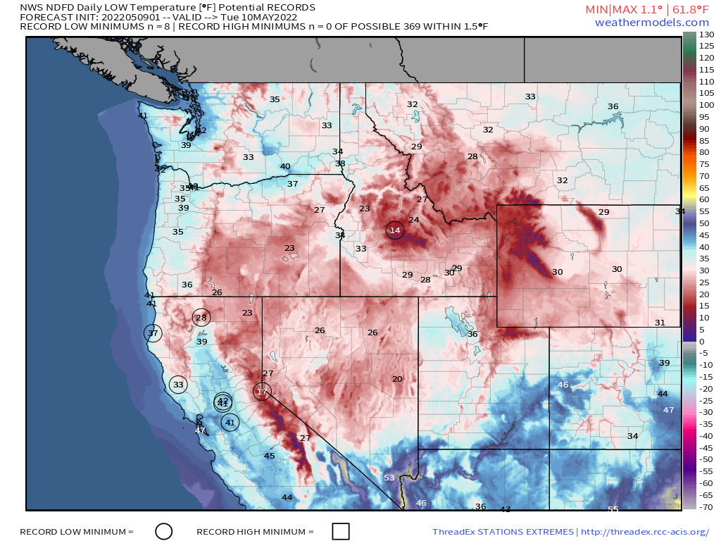
Meanwhile, much colder air will settle into the West. Temperatures will be 10-20 degrees below normal across much of the region through mid-week, with record lows possible in many locations. The chilly weather will be accompanied by rain and mountain snow from the Northwest into northern California. This is good news after a dry winter, as it will help build up the snowpack before the melt season begins in earnest.
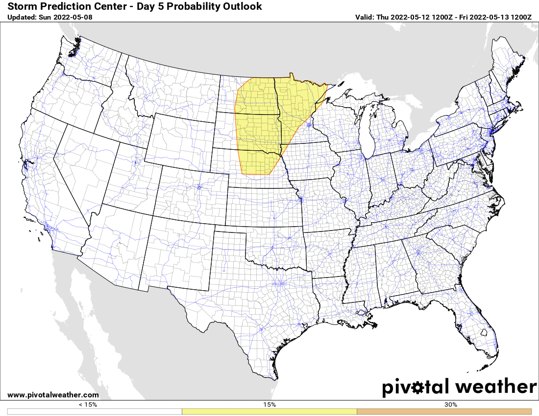
By Thursday, severe weather will be possible across parts of the Northern and Central Plains as a low pressure system moves into the region. Some of the storms that develop could produce hail, strong winds, and tornadoes. In addition, heavy rain is likely to accompany the system, which will exacerbate flooding across the region, particularly in the Red River Valley, where major flooding continues to occur.
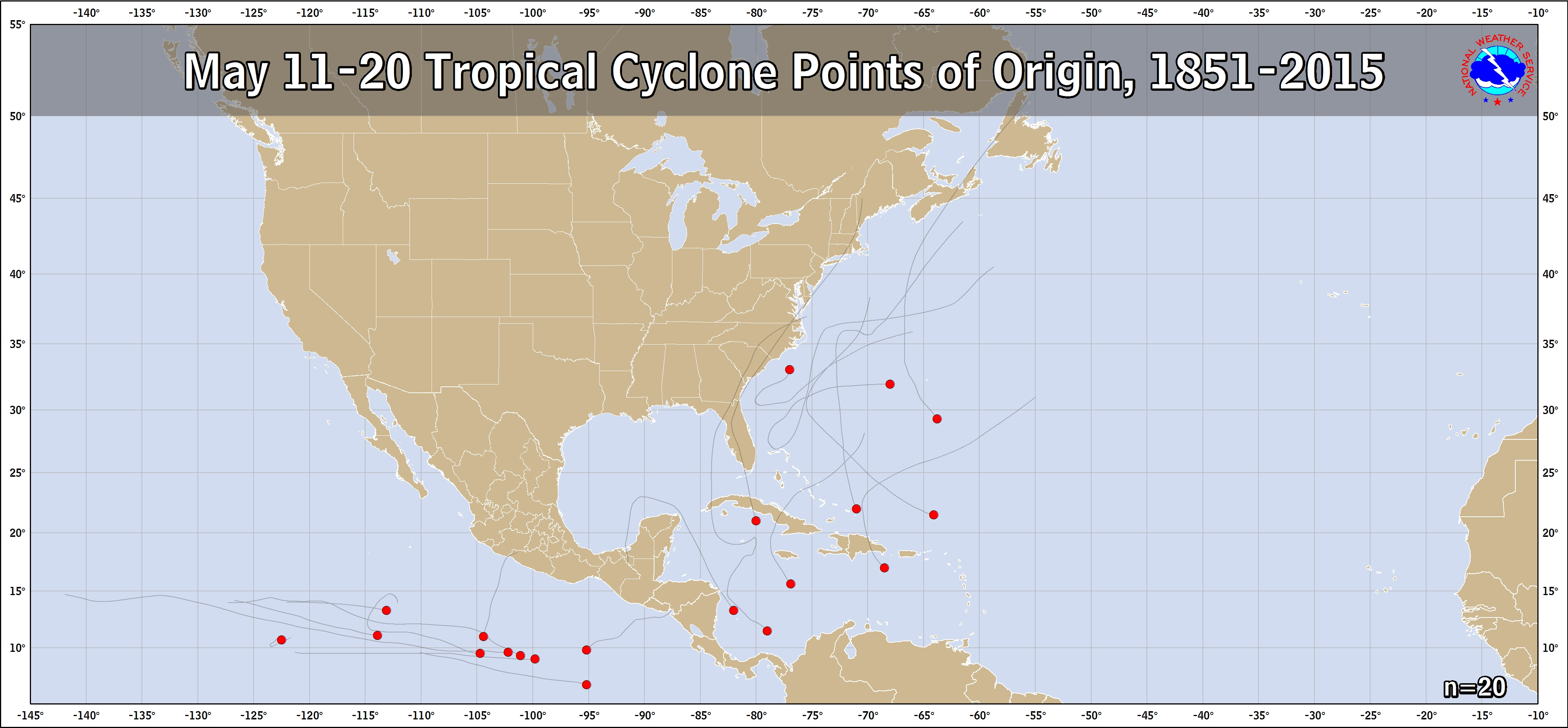
The other thing we’re keeping our eyes on is the low pressure system that brought heavy rain and cool conditions to the Mid-Atlantic states over the weekend. It has moved offshore, and is expected to slowly drift southward over the next few days, milling around off the Carolina coast by mid-week. It could produce a few showers right along the coast, but for the most part, it should remain offshore. However, by later in the week, it will start to drift westward, towards the Southeast coast, spreading some rainfall toward the region. Some of the forecast models are showing the potential for it to acquire some tropical or subtropical characteristics as it does so. Sea surface temperatures are still a bit on the cool side (72-77F) for any tropical development, but in recent years we’ve seen some subtropical systems develop over the western Atlantic as we head into mid-May (whether they were actually subtropical or not is a debate we won’t get into at this time). Hurricane Season officially begins June 1 in the Atlantic.