April will end on a fairly quiet note across much of the nation.
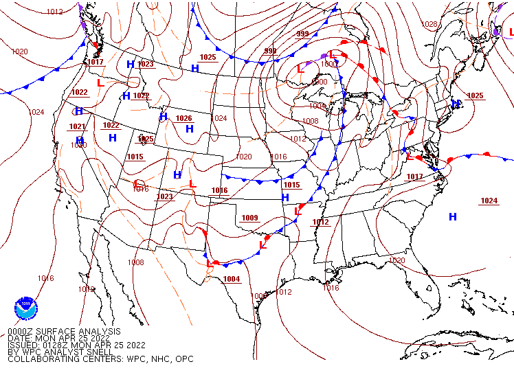
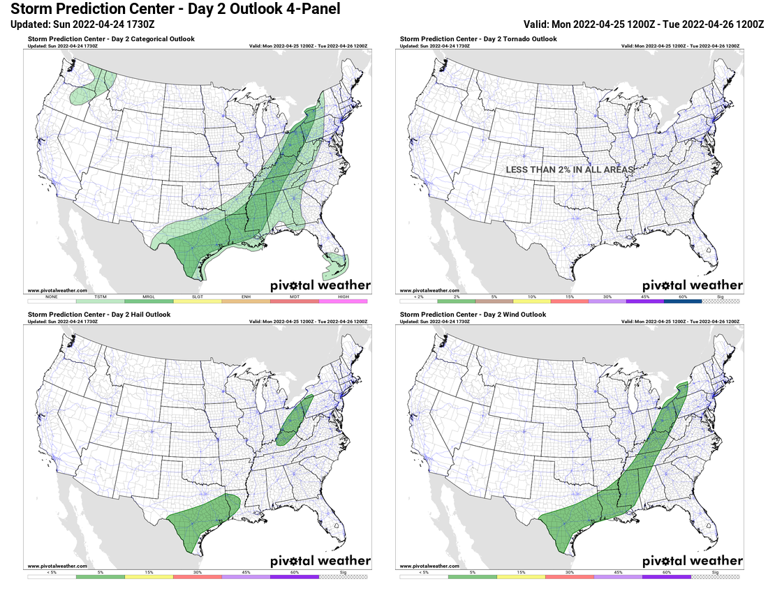
A strong cold front will move across the Eastern US over the next day or two. It may produce some strong to severe thunderstorms today from Texas to the Great Lakes, but a widespread severe weather event is not expected. Some storms may produce gusty winds, hail, heavy downpours, and possibly a tornado. As the system reaches the East Coast on Tuesday, it will produce some showers and thunderstorms, but again, severe weather is not likely.
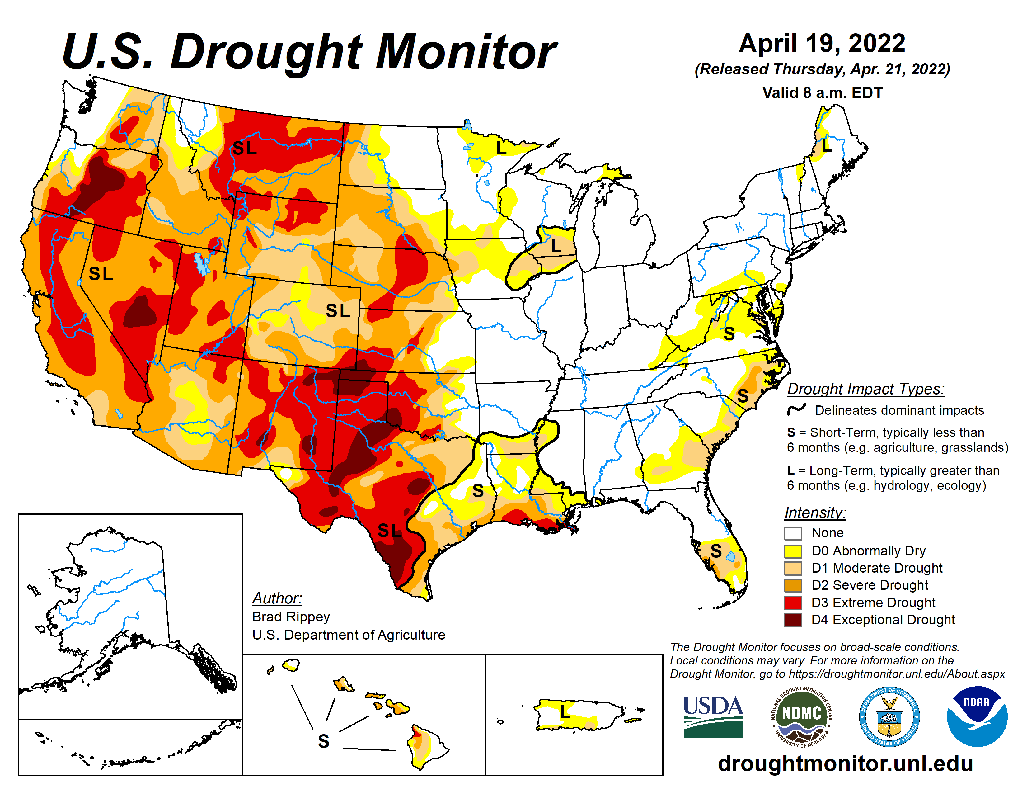
Across the West, the lack of rain will be cause for concern this week. The rainy season is nearly over, and little to no rainfall is expected this week across much of the Southwest, Great Basin, and California. A severe drought remains in progress across the region, and the lack of rainfall, combined with gusty winds later this week, will result in an increased threat for wildfires. Several large fires are already burning in parts of the region, and the dry weather will not help.
The other thing we’re watching this week is some unseasonably cool weather that will spread across the eastern two thirds of the nation. The chilly weather will continue across the Plains states today in the wake of this past weekend’s storm system. Temperatures will be 10 to 20 degrees below normal from parts of Texas to the Great Lakes today. with parts of the Dakotas and Minnesota seeing temperatures as much as 30 degrees below normal. While the chilly air will persist in the Northern Plains for the next few days, temperatures will start to moderate across the Central and Southern Plains while the chilly air slides eastward while moderating. The colder air will settle into parts of the Great Lakes and Northeast by Wednesday, and may remain in place through the weekend, though the coldest days look to be Wednesday and Thursday, when anomalies of 10-15 degrees below normal are likely across the region. A few record lows are possible each morning this week.