We’ve got elements of Spring, Summer, and Winter coming up across parts of the nation this week.
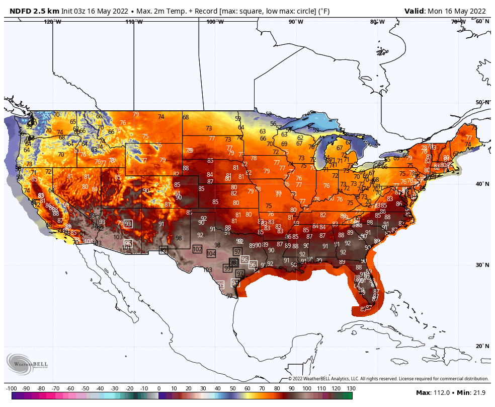
Record heat is likely from the Southern Plains into Texas over the next couple of days, spreading across the Gulf Coast and into the Southeast by midweek, then spreading up into the Mid-Atlantic states later this week and into the Northeast by the end of the week. High temperatures will be well into the 90s, with triple digits expected across portions of Texas and New Mexico, and possibly into southern Oklahoma as well. Relief may arrive across parts of the Southern Plains and Texas by the weekend, but until then mid-summer heat and humidity are expected.
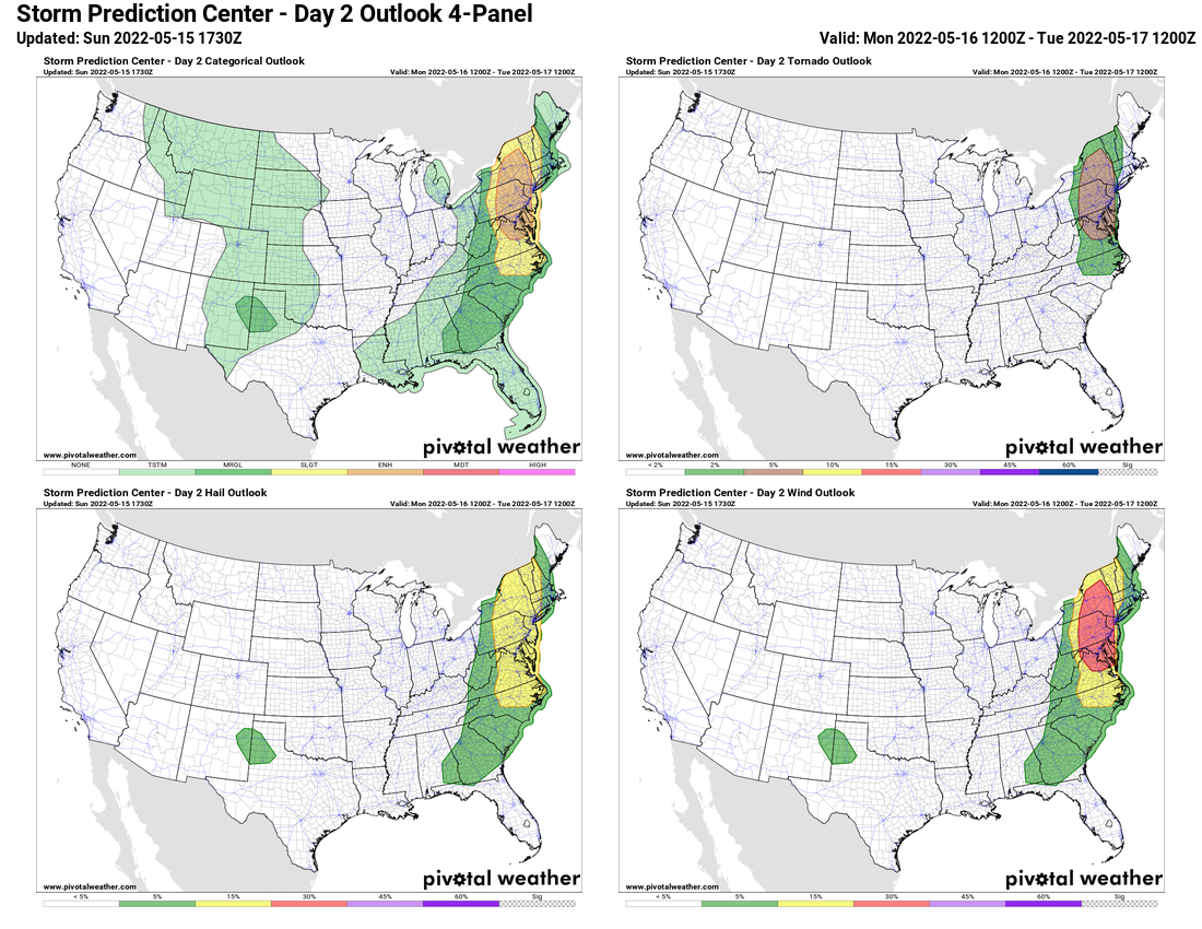
Across the Northeast and Mid-Atlantic states, today will be a warm day, but not as warm as later in the week. However, a strong cold front will be approaching the region, with a severe weather outbreak expected ahead of the front. Thunderstorms will likely move across the Appalachians during the morning, reaching the I-95 corridor during the late afternoon hours, before the cold front moves offshore during the evening. Any storms that do form may produce hail, damaging winds, heavy downpours, and tornadoes, especially from the Virginia Tidewater northward into parts of eastern New York and western New England.
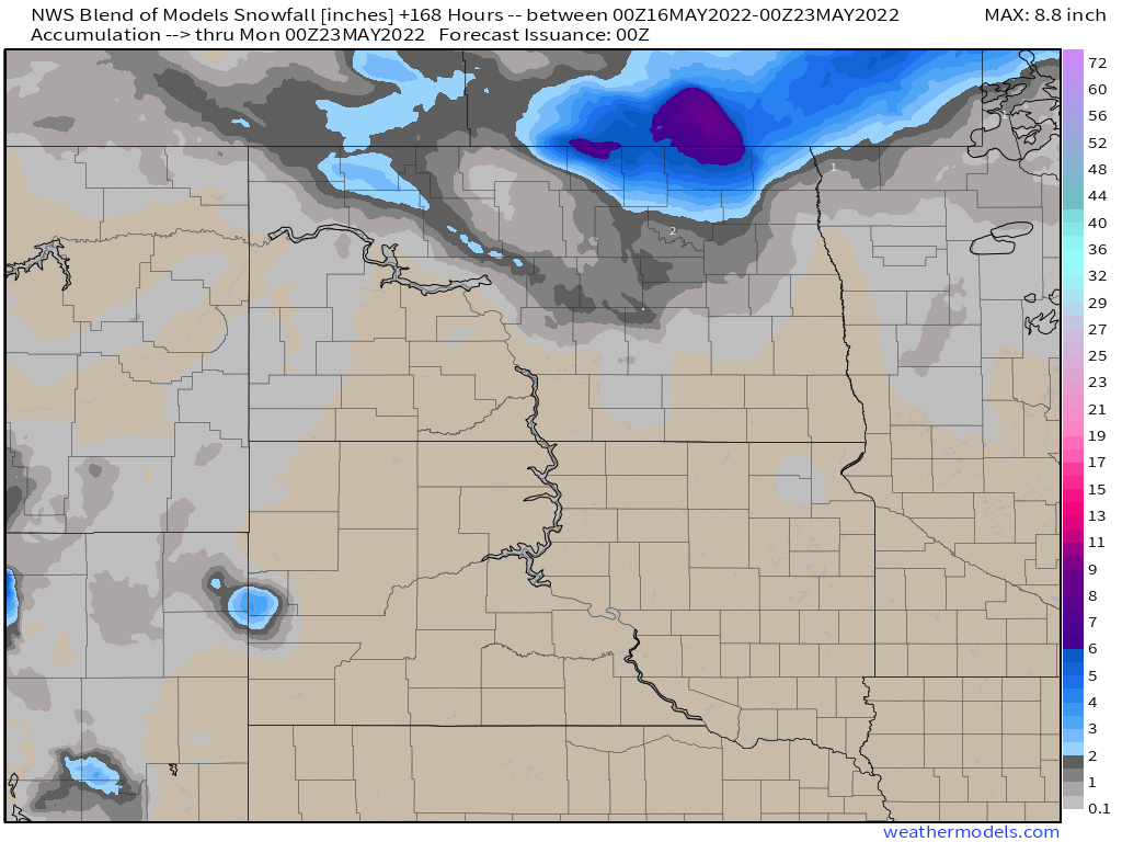
Another storm system will bring some rain and mountain snow into parts of the Pacific Northwest by midweek. While the rain won’t be exceptionally heavy, every little bit helps, as drought conditions persist, especially east of the Cascades. As that system moves eastward, it will bring rain into parts of the Northern Plains late this week. Unlike the Northwest, drought is not a problem there, but flooding is, so the rain will not be welcome. Many rivers remain above flood stage across the Dakotas, especially the Red River, so the rain, which could total an inch or more, will worsen flooding across the region. As the system passes by, colder air settles in behind it, with some snow possible in parts of North Dakota. While this is getting very late in the season for snow, it has happened before, with many locations in northern and eastern North Dakota recording measurable snow as late as the final week of May in the past.