A rather active week is expected across much of the nation for the first full week of meteorological autumn.
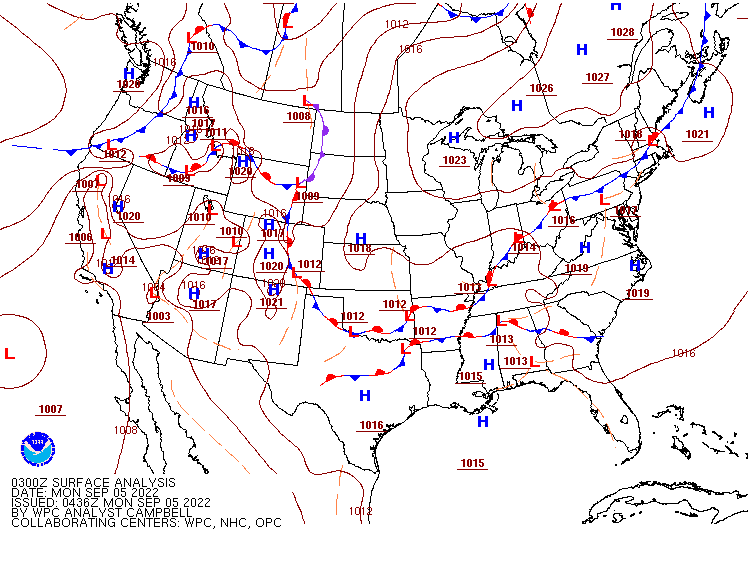
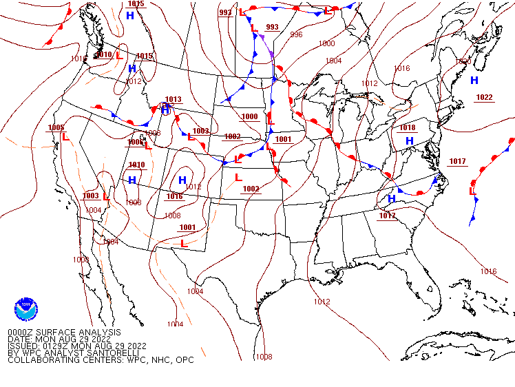
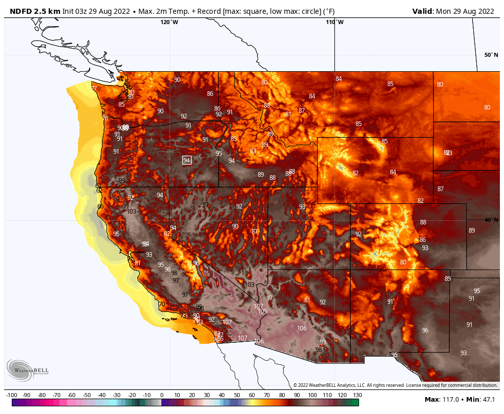
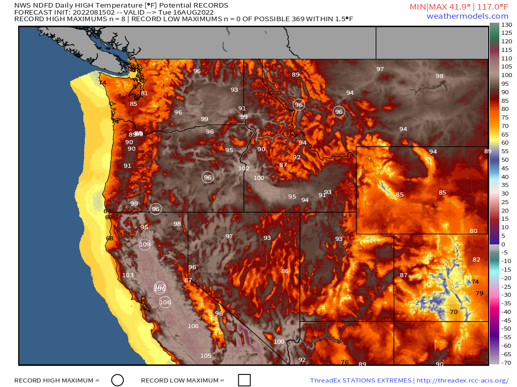
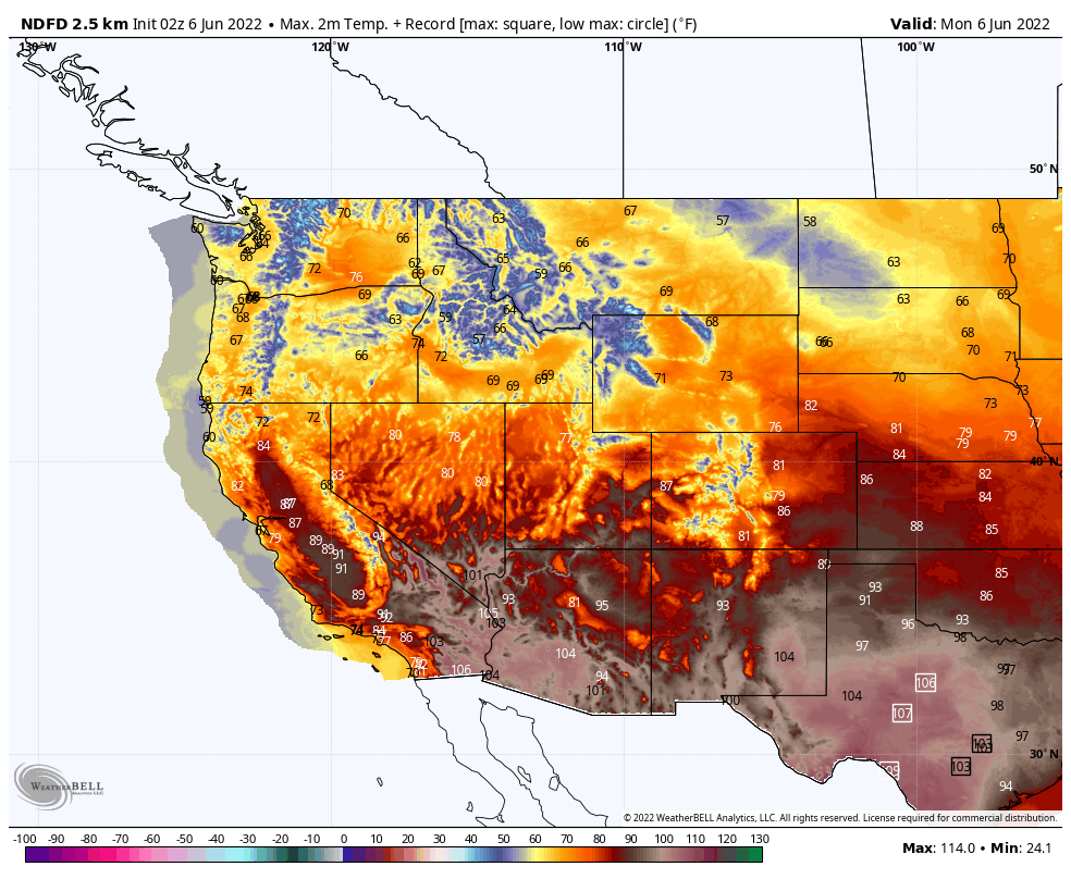
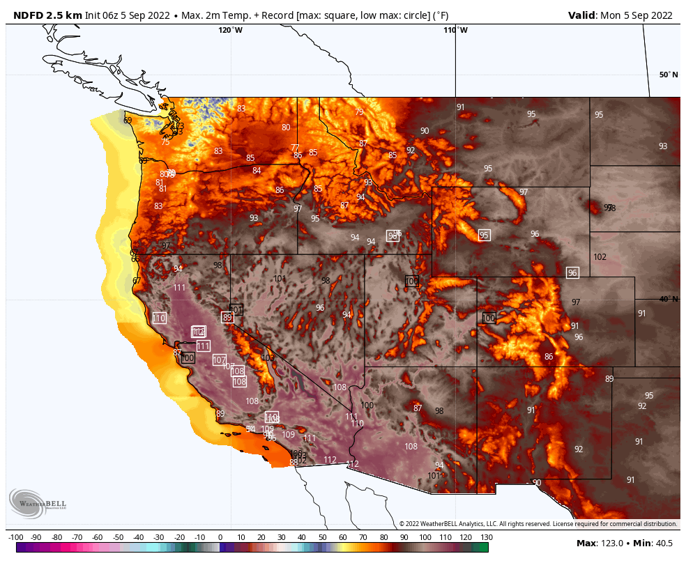
A large ridge of high pressure remains in place across the West for a good portion of the upcoming week. As a result, the intense heat wave will continue from the Front Range of the Rockies westward to the Pacific Coast. Daily high temperatures well into the 90s and 100s are expected across the region, with many places across parts of interior California and the Southwest likely topping 110 degrees. Dozens of record highs are expected during each of the next several afternoons. Excessive Heat Warnings and Heat Advisories remain in effect for many locations. The heat, combined with low humidity and gusty winds will also result in a high fire danger for many areas. Fire Weather Watches and Red Flag Warnings are in effect for parts of the region. In addition to some of the ongoing fires, any new ones that develop could rapidly spread in this pattern.
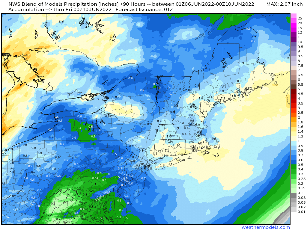
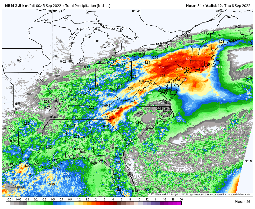
Meanwhile, a slow-moving frontal system will bring some heavy rain from the Tennessee and Ohio Valleys into parts of the Mid-Atlantic states and the Northeast over the next few days. Many places could receive 1-3 inches of rain over this time frame, with some heavier totals possible. In the Ohio and Tennessee Valleys, this is not good news, as it will likely result in flooding in many locations. Flood Watches are in effect for parts of the area. From the Mid-Atlantic into the Northeast, the rain will be very welcome, despite much of it falling on Labor Day, as much of the region has been under a severe to extreme drought for the past few months. Any rain that falls is welcome, as it will help to replenish the rivers, lakes, ponds, and reservoirs across the region. With all of the cloud cover and rain, temperatures will be as much as 6-12 degrees below normal across parts of the area today and again on Tuesday.
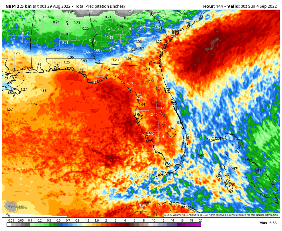
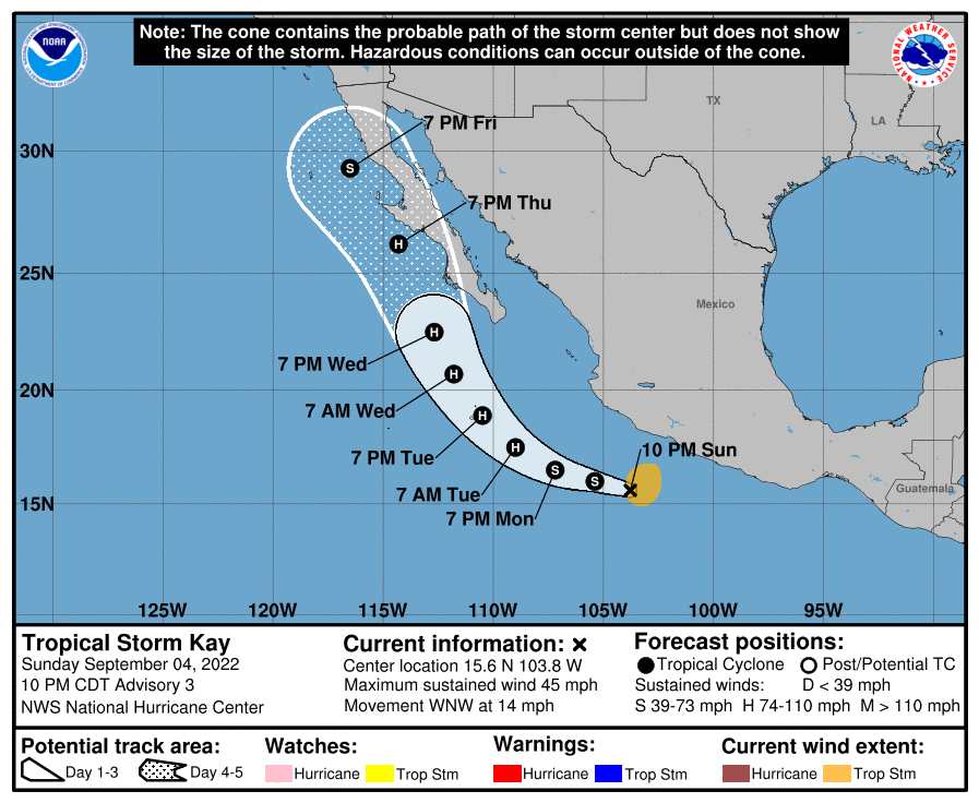
Across the Southwest, what has been a very wet monsoon season thus far has slowed day in recent days, but that could change later this week. Tropical Storm Kay developed off the southwest coast of Mexico on Sunday. The current forecast calls for it to strengthen into a hurricane in the next few days while turning northwestward, paralleling the coast of Mexico. It could impact parts of the Baja California peninsula later this week. By the end of the week, the moisture from the system (or what’s left of it), may spread into parts of the Southwest, enhancing the monsoon once again and bringing the threat for flooding to parts of Arizona and southern California.
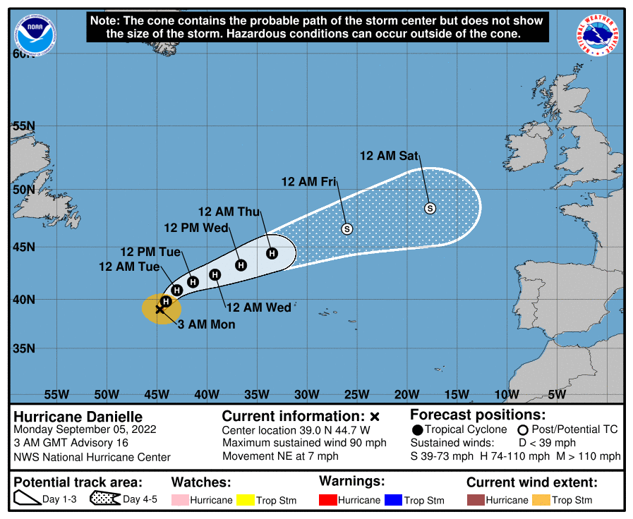
Elsewhere in the tropics, we have two named systems in the Atlantic – Hurricane Danielle and Tropical Storm Earl. Danielle is centered about 950 miles west of the Azores, but should start heading off toward the northeast and east over the next few days. Maximum sustained winds are near 90 mph, but as it moves over colder waters over the next few days, it will weaken and likely will become extratropical later this week. It may bring gusty winds and heavy rain to parts of the British Isles by the end of the week, after the system currently doing the same weakens and moves away from the UK.
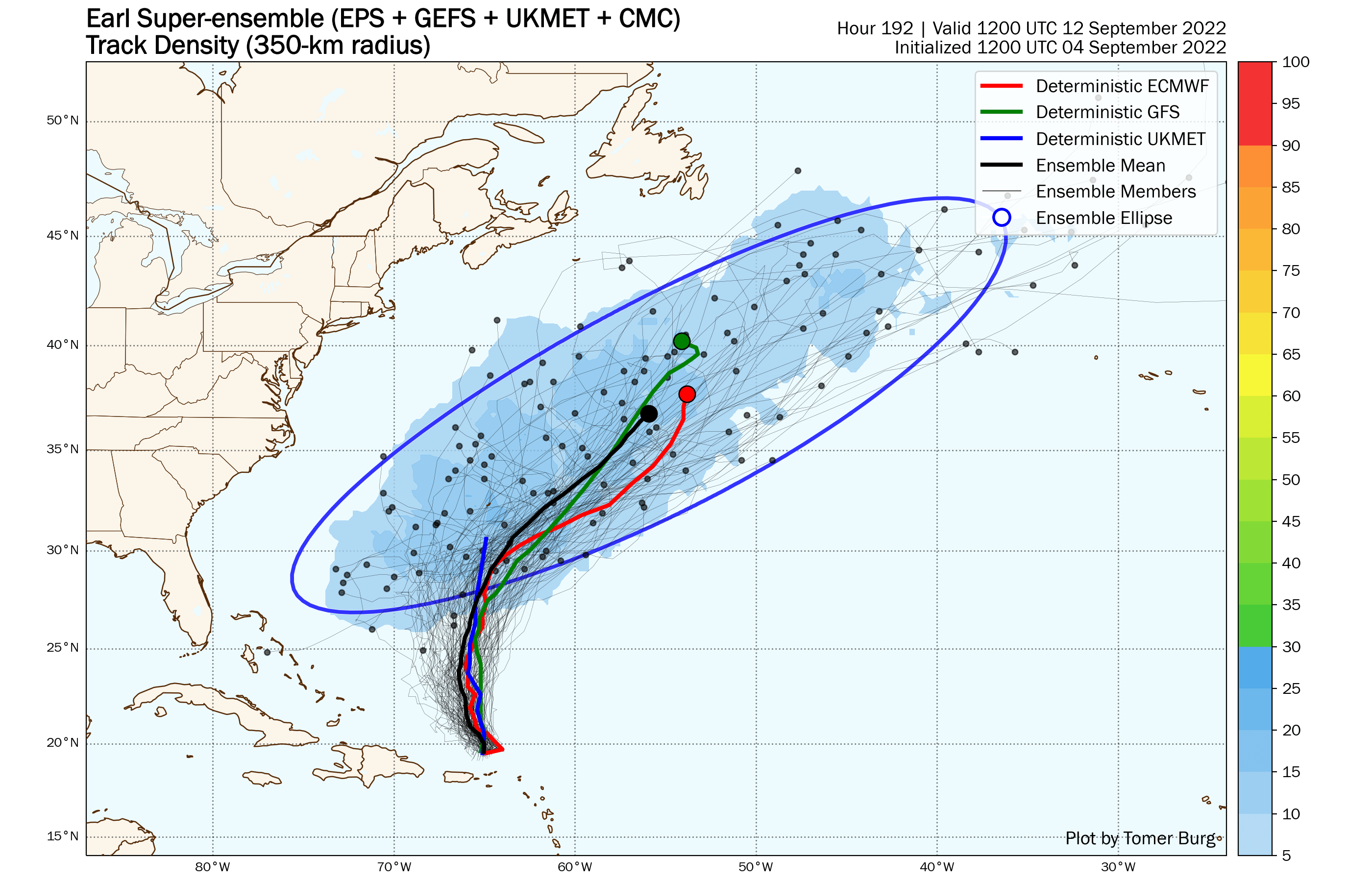
Meanwhile, Tropical Storm Earl is gradually strengthening in the waters north of Puerto Rico and the Virgin Islands. Heavy rain and gusty winds will wind down across the islands today as Earl pulls away to the north. The forecast for Earl is fairly simple of the next day or two – it will continue in a general northerly direction while strengthening, and could become a hurricane. Beyond that, there is some uncertainty. Most of the models show an upper-level trough moving across the central Atlantic pulling Earl off toward the northeast and out into open water. However, if that trough does not pull Earl out to sea, it could continue northward or even northwestward, which would increase the threat Earl may pose to Bermuda, before another trough comes along and eventually does send Earl out to sea.
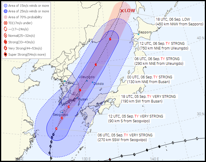
In the Western Pacific Ocean, Typhoon Hinnamnor will pass close to or across southeastern portions of South Korea today, with top winds likely still in the 100-110 mph range. Storm surge will likely be confined to just a small portion of the South Korean coastline, but that area includes the city of Busan, the 2nd most populous city in South Korea. Busan is also the 6th busiest port in the world. Heavy rain and gusty winds are likely across much of the Korean Peninsula, but also could impact parts of Japan over the next few days as the system heads northeastward while weakening and becoming extratropical.