Tropical Update – September 14, 2023

Hometown Forecast Service Tropical outlook
Forecast prepared: Thursday September 14, 2023 11 AM EDT
Meteorologist: Rob Carolan

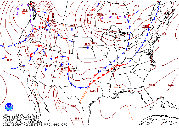
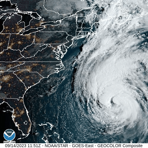
Hurricane Lee is currently located at 30.4 N and 68.3 W which is 750 miles south
of Nantucket, MA. The storm is currently moving north at 14 mph. Top winds
have weakened to 90 mph. A tropical storm warning is in effect from Woods
Hole, MA to Hull, MA while a tropical storm watch is in effect from west of Woods Hole to Watch Point, RI and from Hull, MA to Stonington, ME.

Satellite loop showing Hurricane Lee off the East Coast. Loop provided by NOAA.

Guidance from the latest computer models and the National Hurricane Center
suggest that Lee will continue to move northward today and begin to accelerate
as it is affected by a cold front moving off the East Coast. Shearing, cooler water
temperatures and the faster motion should all lead to further weakening of the
storm between now and the time it makes landfall somewhere in Atlantic Canada
Saturday morning. The storm may shift a little west of north in its motion Friday
night while it’s near the Gulf of Maine but most of the projected course until
landfall is either towards the north or north-northeast. The core of the storm will
pass well east of New England resulting in the region being on the western side
of the storm which is the weaker side. Conditions across the area will start to
turn wetter tomorrow evening and any rain with the system should end by midday or early afternoon on Saturday. Winds will gradually increase Friday night before peaking Saturday midday. Most areas of the southern New England coast could see wind gusts over 35 mph but the Cape and Islands will likely see gusts over 50 mph. The guidance earlier this morning showed yet another shift of the track further east which should continue to result in the worst of the weather with Lee out over the Atlantic to the east of southern and central New England. However due to the past several months of unusually wet weather, there’s a higher threat of power outages due to downed trees. It will be easier with the soil being so saturated and trees fully in leaf for some trees to be pushed over by the winds we will see out of the north from Friday night and into Saturday afternoon. Based upon the latest guidance 1-2 inches is possible east of the Cape Cod Canal with much lighter amounts to the north and west. Steadiest and heaviest rains will be across Cape Cod and the Islands.

Forecast track for Hurricane Lee. Image provided by the National Hurricane Center.

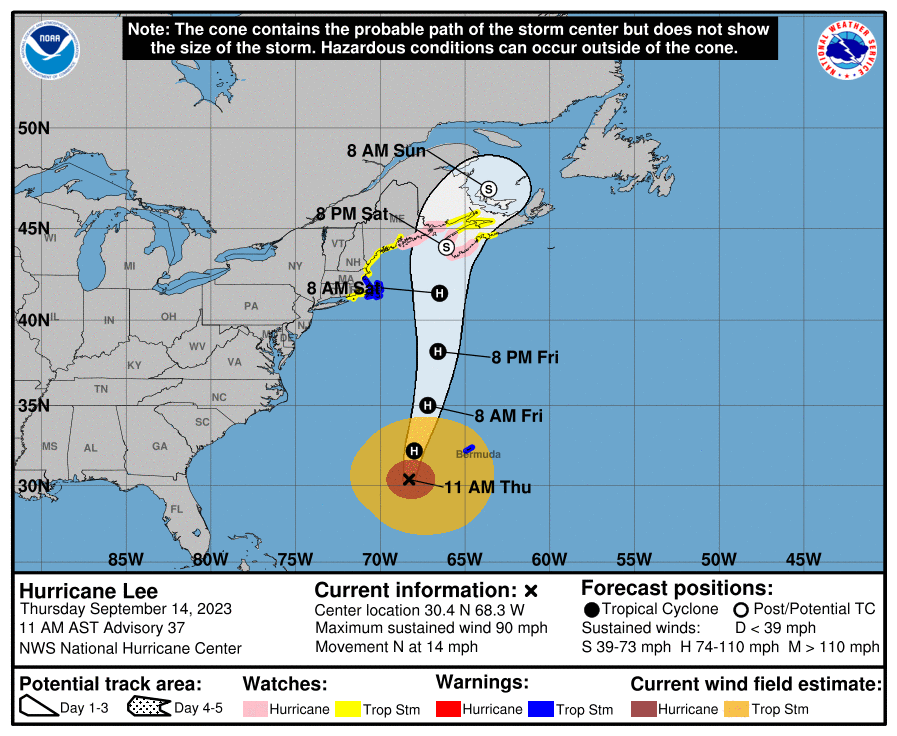
Storm is currently located: Hurricane Lee is located at 30.4 N and 68.3 W,
750 miles south of Nantucket, Massachusetts

Potential risk areas for landfall next 24 hours: None

Strength at time of landfall Nova Scotia or New Brunswick, Canada: Strong
extra-tropical storm

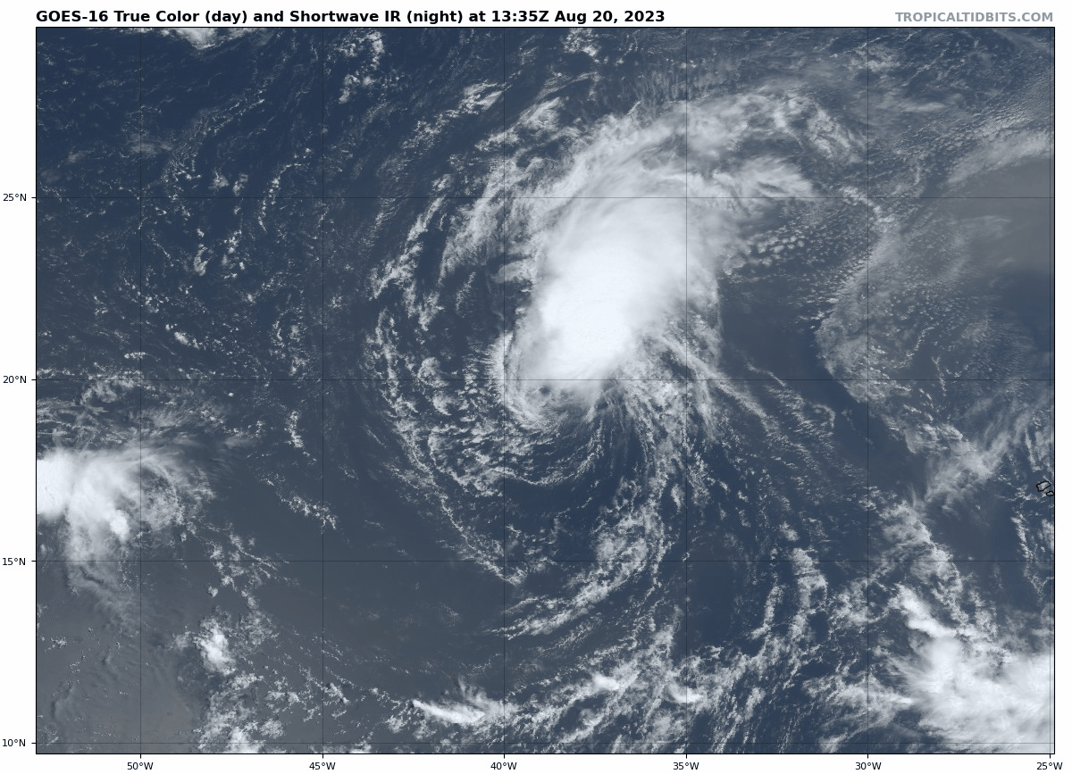
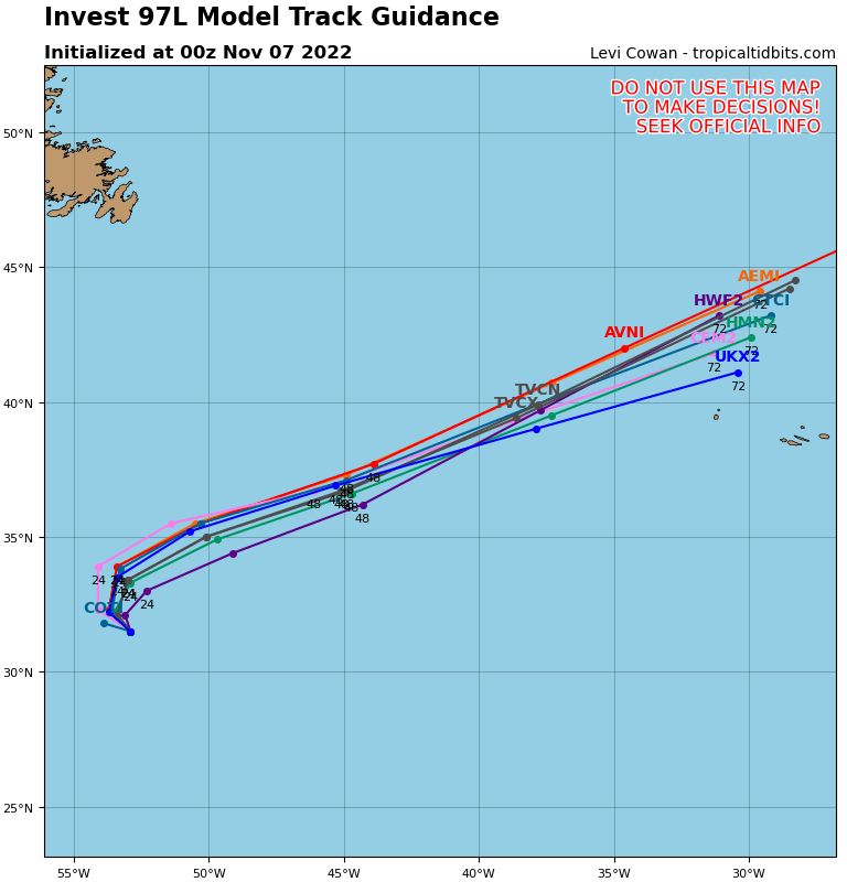
Development outlook for the next 24 hours: A new tropical depression may
develop in the Atlantic by Friday evening to the west of 45W.

Seasonal outlook: Above normal activity is expected for the remainder of the
season

Hilary Nears the Mexican Coast, The Atlantic is Waking Up

The Pacific continues to grab the headlines, but the Atlantic is getting active as we get closer to the peak of the season.

Hurricane Hilary has been downgraded to a Tropical Storm as it continues northward very close to the coast of the Baja California peninsula. As of 11am EDT, Hilary was centered about 220 miles south-southeast of San Diego, moving toward the north-northwest at 25 mph. Maximum sustained winds are near 70 mph. Tropical Storm Warnings remain in effect for northern portions of the Baja California peninsula, as well as the southern California coast from the Mexican border northward to Point Mugu, including Catalina Island.

Satellite loop of Tropical Storm Hilary. Loop provided by NOAA.


Hilary is expected to continue weakening today as it passes very close to the Baja coastline and into southern California. Hilary will produce gusty winds and storm surge along the coast, with a few tornadoes possible across parts of the Southwest, but heavy rain and the resultant flooding are the most significant threat with this storm. Rainfall totals of 3-6 inches are likely across many locations in southern California and Nevada, with some totals in excess of 10 inches possible. In some of the desert locations, including Death Valley, this is more rain than they normally receive in an entire year. Widespread flooding is likely, including the San Diego, Los Angeles, and Las Vegas metropolitan areas. As Hilary continues to push northward and weakens, heavy rain will spread across the Great Basin, and Inland Northwest, with rainfall totals of 1-3 inches possible, likely producing some flooding in these areas as well.

Very heavy rainfall is expected across California and Nevada over the next few days. Image provided by Weathermodels.com


In the Atlantic, Saharan Dust has suppressed activity for the past few weeks, but now that it has moved out, there are several areas of interest, including a pair of storms.

The Atlantic has become quite active over the past few days. Images provided by the National Hurricane Center.


Tropical Storm Emily has developed about 1000 miles west-northwest of the Cabo Verde Islands, moving toward the west-northwest at 10 mph. Maximum sustained winds are near 50 mph. Emily is expected to continue toward the west-northwest for the next day or two, but conditions will become increasingly hostile, with wind shear increasing over the next few days. This will result in steady weakening of Emily, with it likely become extratropical on Monday or Tuesday. After that it will turn toward the northwest and north, heading out into the open waters of the Atlantic, without impacting any land areas.

Satellite loop of Tropical Storm Emily. Loop provided by Tropical Tidbits.


Tropical Depression Six is barely hanging on as an organized system about 625 miles east of the Northern Leeward Islands. Top winds are near 35 mph, and it is moving toward the west at 12 mph. Wind shear is ripping this system apart, and it is expected to dissipate over open water later today or tonight.

Forecast track for Tropical Depression Six. Image provided by the National Hurricane Center.


Another area of low pressure is moving across the southeastern Caribbean Sea this afternoon, producing numerous showers and thunderstorms across the eastern Caribbean. It should continue toward the west-northwest for the next day or two, and conditions are favorable for it to continue to develop. Reconnaissance aircraft are scheduled to investigate this system during the afternoon to check on the structure and strength of the system. It will continue to produce heavy rain and gusty winds across the northern and eastern Caribbean for the next few days, but it should turn more toward the north early this week, which will increase the threat to some of the islands, depending on when the turn occurs. Right now, it looks like Hispaniola will have the biggest threat, but this is predicated on when (or if) that turn occurs. It should eventually move north of the islands, possibly near the Turks and Caicos Islands, before heading out into the Atlantic. Once into the open waters of the Atlantic, it could become a potent storm system, but again, this is dependent on what it does in the next few days first.

Ensemble forecast tracks for the system in the eastern Caribbean. Image provided by Tomer Burg.


An area of low pressure that brought heavy rain and thunderstorms to the Bahamas and southern Florida has moved into the Gulf of Mexico this afternoon. It is expected to continue westward across the Gulf over the next few days, with some development possible. It could become a tropical depression toward midweek before approaching the Texas coastline. Whether it develops or not, it should bring some much-needed heavy rain to parts of central and southern Texas later this week, helping to not only put a dent in the ongoing drought in the region, but also provide some relief from the heat.

A system will bring much needed rainfall to parts of Texas this week. Image provided by Pivotal Weather.


Yet another tropical wave has moved off the African coast and into the eastern Atlantic. Conditions will be favorable for development over the next several days, and it could become a tropical depression later this week. If it does develop, it is expected to remain over open water, with no impact to land areas through at least next weekend.

The Week Ahead: November 14-20, 2022

Winter will finally make an appearance across a large portion of the nation during the upcoming week.

Low pressure moving across the Southwest will have a large impact on a good portion of the nation this week. Image provided by NOAA.


Low pressure will move out of the Southwest and across the Southern Plains today, before heading across the Deep South and then off the Mid-Atlantic coast by midweek. To the south, it will produce showers and thunderstorms across parts of Texas and eventually the Gulf Coast and the Southeast over the next few days. Some strong storms are possible, but a severe weather outbreak is not expected. The bigger story will be what takes place north of the system. Some light snow or a wintry mix will move across the Plains states today and into the Mississippi Valley tonight and Tuesday. While the snow won’t be heavy, a few inches could accumulate in some spots, which will be the first accumulating snow of the season for some locations.

Some locally heavy rain is possible along the Gulf Coast over the next few days. Image provided by Weathermodels.com


By later Tuesday, as the low moves off the Mid-Atlantic coast, a second, weaker low will also move across the Midwest, producing some light snow across this region, with rain across the Tennessee Valley. As both of these lows head eastward, precipitation will move into the Northeast. Precipitation may start as a wintry mix early Wednesday across the northern and western suburbs of New York and Boston, but for the cities of the I-95 corridor, this will be mostly a rainstorm. Farther inland, from central Pennsylvania into much of Upstate New York, and Northern New England, several inches of snow could accumulate before any potential changeover to rain. As the storm intensifies off the East Coast, heavier snow is possible in parts of northern and eastern Maine and into Atlantic Canada.

A swath of light to moderate snow is expected from the Southern Plains to the Northeast over the next few days. Image provided by WeatherBell.


While temperatures are currently below normal across most of the nation, even colder air will spill southward from Canada behind this storm. By the end of the week, some record lows are possible, especially in parts of the Plains States and Northern Rockies, where some sub-zero temperatures are possible. By the end of the week, below normal readings are likely across most of the nation except for the immediate West Coast, and parts of southern Florida. From the Appalachians westward to the Rockies, temperatures will be 15 to 30 degrees below normal for the end of the week and into next weekend.

Very cold air will invade much of the nation late this week. Image provided by Weathermodels.com.


As that cold air pours over the Great Lakes, some lake-effect snow is expected. Locations downwind of Lakes Superior and Michigan could see several inches of snow by mid-week, similar to what they had over the weekend. However, it’s the areas downwind of Lakes Erie and Ontario that could see some exceptionally heavy amounts. Totals could exceed a foot from Buffalo to Cleveland, with the location of the heaviest snowfall obviously dependent on the wind direction, but its the area east of Lake Ontario, specifically the Tug Hill Plateau of northern New York that could see the heaviest amounts.

Parts of northern and western New York could see some hefty snow totals later this week. Images provided by Pivotal Weather.

The Week Ahead: November 7-13, 2022

A very active week is expected across the nation this week, with everything from hurricanes to blizzards, and record highs to record lows expected.

The week is starting out active and will remain that way for the next several days. Image provided by NOAA.

Low pressure is moving into the Pacific Northwest this morning, with rain strong winds, and mountain snow expected. As this storm spreads inland, heavy rain will spread across most of the West, including all of California, with heavy snow across the higher elevations and through the Great Basin and into the Rockies. Winter Weather Advisories, Winter Storm Warnings, and High Wind Warnings are in effect for many locations already. Rainfall totals of 1-2 inches and locally heavier will be welcomed across California, helping to put a dent into the drought and aiding efforts to extinguish the many wildfires still burning across the West. Across the mountains, snowfall totals of 1-2 feet and locally heavier are expected in parts of the Cascades and Sierra Nevada, with up to a foot possible across the mountains of the Interior Northwest and Northern Rockies.

Heavy rain is expected across most of California over the next few days. Image provided by WeatherBell.


By Thursday, the system will move into the Plains and toward the Great Lakes. Ahead of the storm, record high temperatures are possible once again, with the threat of some severe weather in the Mississippi Valley. However, it’s across the Northern Plains and Upper Midwest where impact will be the greatest. The combination of strong winds, gusting to 40-50 mph, and heavy snow, possibly as much as 8-16 inches across parts of the Dakotas and northern Minnesota as well as the southern Canadian Prairies, will result in blizzard conditions at times later Thursday into Friday.

The models all have heavy snow forecast for the Dakotas and northern Minnesota, but differ on the amounts and placement. Images provided by Pivotal Weather.


Behind the storm, especially with fresh snowcover, some of the coldest air so far this fall will pour into the Rockies and Northern Plains with high temperatures for the end of the week and the weekend only in the teens and 20s, and some subzero low temperatures likely. As that storm continues into southeastern Canada, it will drag a cold front across the eastern third of the nation for the end of the week. By the time it reaches the East Coast late Saturday, nearly the entire nation will experience temperatures that are below normal for mid-November, a rather big change from what the eastern half of the nation has experiences for the past couple of weeks.

By Sunday, temperatures will be below normal across virtually the entire Lower 48. Image provided by Weathermodels.com


While all this is going on, we also need to pay attention to the tropics. Hurricane Season doesn’t officially end until November 30, and we’re keeping an eye on two separate areas at this time. The first is centered a few hundred miles east of Bermuda. As it drifts around over marginally warm waters, it could become a subtropical or tropical storm over the next day or two. It likely won’t last that long, as a strong cold front moving off the East Coast today will absorb this system by midweek and send it out over the colder waters of the North Atlantic.

The models are unanimous that the system east of Bermuda will not be a threat to land this week. Image provided by Tropical Tidbits.


The second area is a much bigger concern. A low pressure area few hundred miles north of Puerto Rico has been producing heavy rain across Puerto Rico and the Virgin Islands for the past few days, with rainfall totals of 5-10 inches producing flooding in some locations. The system is expected to move northwestward while slowly organizing, and could become a tropical depression or storm over the next few days. Eventually, it will turn toward the west, passing close to or over the northern Bahamas, then heading toward the East Coast of Florida. Heavy rain, strong winds, and rough surf are likely across much of Florida as the system draws closer at mid-week. Some models have the storm close to hurricane strength before landfall somewhere across east-central Florida. After landfall, the mostly likely scenario is a turn toward the north and eventually northeast as a strong trough of low pressure moves into the Eastern US.

Ensemble forecasts for the track of a disturbance north of Puerto Rico. Image provided by Tomer Burg.


Once the system makes the turn, it will likely move back into the Atlantic and up the East Coast. While it will lose its characteristics, it will still produce heavy rain, gusty winds, and rough seas from the Carolinas northward to New England. Given its tropical origins, some of the rain could be especially heavy near the coast, with widespread totals of 2-4 inches possible. The strong cold front marching eastward will help kick the system out to sea later Saturday. If it does so early enough, it could result in less rain and wind across parts of New England.

The Week Ahead: September 19-25, 2022

Hurricane Fiona is grabbing the headlines, but it’s not the only area we’re watching this week.

The surface map doesn’t look that busy, but there is plenty going on. Image provided by NOAA.


Hurricane Fiona produced strong winds and catastrophic flooding across parts of the northeastern Caribbean over the weekend, especially Puerto Rico, and today it’s the Dominican Republic’s turn. Once it moves back into the Atlantic later today, a northward track is expected for the next few days. It may bring strong winds and heavy rain to the Turks and Caicos as well as parts of the southeastern Bahamas over the next few days, but as it moves over open water, additional strengthening is expected. By the latter half of the week, it could have Bermuda in its sights. Its still too early to determine what, if any, impact it will have on Bermuda, but anything from a glancing blow to a direct hit as a major hurricane is possible. By the end of the week,, it should be heading out into the North Atlantic and starting to weaken, though residents of Atlantic Canada and Newfoundland should keep an eye on Fiona.

Forecast track for Hurricane Fiona. Image provided by the Bermuda Weather Service.


Out West, an early-season storm will bring some much-needed rainfall to parts of California over the next few days. The rain began Sunday, but will continue into Tuesday or even Wednesday in parts of the state. Some spots could pick up 1-2 inches or more by the time everything winds down. This will help put a small dent in the ongoing drought across the state, but will also be a big help to the firefighting efforts for the numerous wildfires burning across the region.

California will get some much-needed rain over the next few days. Image provided by Weathermodels.com


Heat will return to the nation’s midsection over the next few days, gradually spreading into parts of the Mississippi Valley and the Deep South as the week goes on. High temperatures well into the 90s and possibly lower 100s are expected, which is 10-to-20 degrees above normal for late-September. Many record high temperatures are expected over the next several days.

Record highs are expected in many locations from the Plains to the East Coast this week. Images provided by WeatherBell.


While heat covers much of the nation, late in the week, cool weather will be the story from the Northern Plains to the Northeast. A strong cold front will produce some rain across these areas during the latter half of the week, but behind that front, much cooler air will settle in. Frost and freezing temperatures may bring an end to the growing season from parts of the Great Lakes into northern New England by the end of the week. In fact, as that front moves through, the rain may mix with or even change to wet snow across some of the higher elevations of northern New York and New England Thursday night and early Friday. While this is a bit early, it’s not that unusual for some of the higher peaks to see snow in late September. Atop New Hampshire’s Mt. Washington snow has already been reported a couple of times this month.

Temperatures will be below to well below normal across the Northeast at the end of the week. Loop provided by Pivotal Weather.

The Week Ahead: September 5-11, 2022

A rather active week is expected across much of the nation for the first full week of meteorological autumn.

High pressure dominates the northern tier of states to begin the week. Image provided by NOAA.


A large ridge of high pressure remains in place across the West for a good portion of the upcoming week. As a result, the intense heat wave will continue from the Front Range of the Rockies westward to the Pacific Coast. Daily high temperatures well into the 90s and 100s are expected across the region, with many places across parts of interior California and the Southwest likely topping 110 degrees. Dozens of record highs are expected during each of the next several afternoons. Excessive Heat Warnings and Heat Advisories remain in effect for many locations. The heat, combined with low humidity and gusty winds will also result in a high fire danger for many areas. Fire Weather Watches and Red Flag Warnings are in effect for parts of the region. In addition to some of the ongoing fires, any new ones that develop could rapidly spread in this pattern.

Many record highs are expected across the West during the next several afternoons. Images provided by WeatherBell.


Meanwhile, a slow-moving frontal system will bring some heavy rain from the Tennessee and Ohio Valleys into parts of the Mid-Atlantic states and the Northeast over the next few days. Many places could receive 1-3 inches of rain over this time frame, with some heavier totals possible. In the Ohio and Tennessee Valleys, this is not good news, as it will likely result in flooding in many locations. Flood Watches are in effect for parts of the area. From the Mid-Atlantic into the Northeast, the rain will be very welcome, despite much of it falling on Labor Day, as much of the region has been under a severe to extreme drought for the past few months. Any rain that falls is welcome, as it will help to replenish the rivers, lakes, ponds, and reservoirs across the region. With all of the cloud cover and rain, temperatures will be as much as 6-12 degrees below normal across parts of the area today and again on Tuesday.

Heavy rain is expected across parts of the East today and Tuesday. Image provided by WeatherBell.


Across the Southwest, what has been a very wet monsoon season thus far has slowed day in recent days, but that could change later this week. Tropical Storm Kay developed off the southwest coast of Mexico on Sunday. The current forecast calls for it to strengthen into a hurricane in the next few days while turning northwestward, paralleling the coast of Mexico. It could impact parts of the Baja California peninsula later this week. By the end of the week, the moisture from the system (or what’s left of it), may spread into parts of the Southwest, enhancing the monsoon once again and bringing the threat for flooding to parts of Arizona and southern California.

Forecast track for Tropical Storm Kay. Image provided by the National Hurricane Center.


Elsewhere in the tropics, we have two named systems in the Atlantic – Hurricane Danielle and Tropical Storm Earl. Danielle is centered about 950 miles west of the Azores, but should start heading off toward the northeast and east over the next few days. Maximum sustained winds are near 90 mph, but as it moves over colder waters over the next few days, it will weaken and likely will become extratropical later this week. It may bring gusty winds and heavy rain to parts of the British Isles by the end of the week, after the system currently doing the same weakens and moves away from the UK.

Forecast track for Hurricane Danielle. Image provided by the National Hurricane Center.


Meanwhile, Tropical Storm Earl is gradually strengthening in the waters north of Puerto Rico and the Virgin Islands. Heavy rain and gusty winds will wind down across the islands today as Earl pulls away to the north. The forecast for Earl is fairly simple of the next day or two – it will continue in a general northerly direction while strengthening, and could become a hurricane. Beyond that, there is some uncertainty. Most of the models show an upper-level trough moving across the central Atlantic pulling Earl off toward the northeast and out into open water. However, if that trough does not pull Earl out to sea, it could continue northward or even northwestward, which would increase the threat Earl may pose to Bermuda, before another trough comes along and eventually does send Earl out to sea.

Track forecasts for Tropical Storm Earl from several ensembles. Image provided by Tomer Burg


In the Western Pacific Ocean, Typhoon Hinnamnor will pass close to or across southeastern portions of South Korea today, with top winds likely still in the 100-110 mph range. Storm surge will likely be confined to just a small portion of the South Korean coastline, but that area includes the city of Busan, the 2nd most populous city in South Korea. Busan is also the 6th busiest port in the world. Heavy rain and gusty winds are likely across much of the Korean Peninsula, but also could impact parts of Japan over the next few days as the system heads northeastward while weakening and becoming extratropical.

Forecast track for Typhoon Hinnamnor. Image provided by the Korean Meteorological Administration.

The Week Ahead: August 29 – September 4, 2022

The weather pattern across the US isn’t that active at the moment, but the Atlantic may be starting to get active finally.

Despite a couple of wavy fronts, the weather across the US isn’t that active. Image provided by NOAA.

A persistent trough of low pressure will remain in place across the Southeast and Florida for the next few days. This will act as a focus for shower and thunderstorm activity across the region. Severe weather will be very isolated in nature, but some heavy rainfall totals are possible, especially across much of Florida, southern Georgia, and coastal portions of the Carolinas. Many locations will receive 1-3 inches of rain over the next several days, with isolated totals in excess of 5 inches possible in spots. This will likely lead to some flash flooding.

Some heavy rain is expected across parts of Florida and the Southeast this week. Image provided by WeatherBell.

Out West, where the monsoon has been quite active this summer, it will slow down this week, allowing heat to return. Excessive Heat Watches have been issued for parts of the Desert Southwest and Southern California. Triple digit highs are likely across the Southwest and interior California several days this week, as well as portions of the interior Northwest. Highs will soar well past 90 across much of the remainder of the West through the week, with numerous record highs possible each afternoon into next weekend.

Record highs are possible every day this week across the Western US. Image provided by WeatherBell.

Meanwhile, as we enter the peak of hurricane season, the Atlantic appears to be awakening from its 2 month slumber. There are several areas that the National Hurricane Center is keeping an eye on, but the most immediate threat appears to be a tropical wave and associated low pressure area several hundred miles east of the Lesser Antilles. The area is showing signs of organization, and conditions are somewhat favorable for development over the next few days. Most of the forecast the system to head northwestward for the next few days, passing north of the Lesser Antilles toward the end of the week. In terms of strength, several models either keep the system very weak or don’t develop it at all, and others do allow for some significant development. It could become a tropical depression later this week, but there are still significant questions as to the future of this system or if it even has a future.

Most of the models bring the disturbance in the central Atlantic on a northwestward course. Image provided by Tropical Tidbits.

There are a couple of other tropical waves we’re keeping an eye on. One of them is in the western Caribbean, and will bring some heavy rain and gusty winds to parts of the Yucatan and Central America today and tomorrow. Once it moves into the Gulf of Mexico, some forecast models show the potential for development, but others do not, so that wave will need to be monitored. Another wave will move off the coast of Africa tonight, and take its time crossing the Atlantic this week. Again, there are some models that show the potential for development, but others that don’t, so it will need to be monitored as well.

The Week Ahead: August 15-21, 2022

A fairly quiet week is expected across much of the nation this week.

The surface map looks somewhat busy, but there’s not a lot going on to start the week. Image provided by NOAA.


A weak low pressure system in the western Gulf of Mexico over the weekend moved into southern Texas late Sunday. If it had another 6-12 hours over water, it could have become a tropical depression. It will continue to push inland over the next few days, bringing some heavy rain to parts of southern Texas and northern Mexico. Many locations could receive 1-2 inches over the next few days, with some heavier amounts possible, especially in northern Mexico. Some localized flooding is possible, but the rain will also help with the ongoing severe drought across the region. Significantly more rainfall is needed to help put a dent in the drought, but every bit helps.

Heavy rain is expected in south Texas and northern Mexico over the next few days. Image provided by WeatherBell.


Hot weather will return to much of the West and the Pacific Northwest over the next few days as a ridge of high pressure builds in. Triple digit heat is likely across interior California, with some 90s right to the coastline. Temperatures will also soar into the 90s and 100s across the Interior Northwest for much of the week. Record highs are possible each day, with Tuesday and Wednesday the most likely days for the hottest weather. Excessive Heat Watches have already been posted for parts of the region.

Record highs are possible across parts of the West and Northwest this week. Images provided by Weathermodels.com


While the Northwest and West turn hotter, monsoonal moisture will continue to flow into the Southwest, producing more showers and thunderstorms each afternoon. Some of these storms will produce heavy rainfall that will trigger flash flooding in many areas. Flash Flood Watches remain in effect for parts of the region. The rain will also help to keep temperatures below normal. While it will remain seasonably hot, with highs still well into the 90s and 100s in many locations, these readings will be on average 3-6 degrees below normal for mid-August through midweek. By the end of the week, some places in the Southwest could see readings that are 6-12 degrees below normal.

Flash Flood Watches are in effect for the Southwest while Excessive Heat Watches have been posted for interior California. Image provided by Pivotal Weather.


Cool and wet conditions are also likely from the Tennessee Valley and Mid-Atlantic states into the Southeast this week. A frontal boundary will drop southward before stalling out across the Deep South this week. Showers and thunderstorms are likely along this boundary each day. Some of the storms may produce heavy rain, with some localized flooding possible each day. To the north of the front, some rather cool air for mid-August will settle in and remain in place through the end of the week. Temperatures will be as much as 7-14 degrees below normal for the next several days across this region, before they start to moderate next weekend.

Unseasonably cool weather is expected from the Tennessee Valley and Mid-Atlantic states into the Southeast. Images provided by WeatherBell.

The Week Ahead: June 6-12, 2022

A hot week is expected from Texas into the Southwest while the Plains states will be dealing with several rounds of severe weather.

A wavy frontal system in the Plains states will be the focus of severe weather this week. Image provided by NOAA.


A ridge of high pressure will build into parts of the Southwest and Texas over the next several days, resulting in hot and in some cases humid conditions. High temperatures will be well into the 90s and 100s across Texas for much of the upcoming week, with record highs possible in many locations each afternoon. The heat will spread across the Gulf Coast and into the Southeast later in the week, with temperatures reaching the 90s in many areas. However, the record heat will actually spread westward into the Southwest and California as the ridge continues to strengthen. By the latter half of the week, temperatures will top 100 across interior California, with parts of the Desert Southwest, including Phoenix and Las Vegas likely reaching 110 or more, with some records expected. Death Valley could reach 120 by the end of the week.

Record highs are expected over the next several days from Texas to California. Images provided by WeatherBell.


A wavy frontal system will remain in place across the central and southern Plains this week, keeping the heat in Texas, while cooler weather remains in place to the north. As waves of low pressure ride along that front, each one will trigger some showers and thunderstorms. Some of these storms could become strong to severe each afternoon, especially across parts of the southern Plains and into the Middle Mississippi Valley. One wave of low pressure may trigger some strong to severe storms this afternoon and evening, followed by another round of severe weather Tuesday afternoon and evening. A stronger wave, may produce more widespread severe weather in the central and southern Plains later on Thursday, possibly lingering into early Friday.

Several days of severe weather are expected across the Plains States this week. Image provided by Pivotal Weather.


In the Northeast, a dry spring has resulted in drought conditions developing, especially parts of eastern New England. Rainfall totals for the year are running 2-5 inches below normal, with much of that deficit occurring over the past 2 months. A cold front will move into the region on Wednesday, stalling out as it moves through, with a wave of low pressure riding along the front Wednesday night and early Thursday. This should bring some beneficial rain into the area, with widespread totals of 0.50″-1.00″ expected, and some heavier amounts likely.

Much-needed rainfall is expected in parts of the Northeast Wednesday into Thursday. Image provided by Weathermodels.com
Back to top