Northeast Severe Threat

Severe weather doesn’t often make its way to the Northeast to the level that other regions of the country see. When it does, however, it generally comes from one of two directions, from the south along the coast, or from the northwest in southern Canada. The severe weather moving through today and tonight of July is one case of weather coming from the northwest.
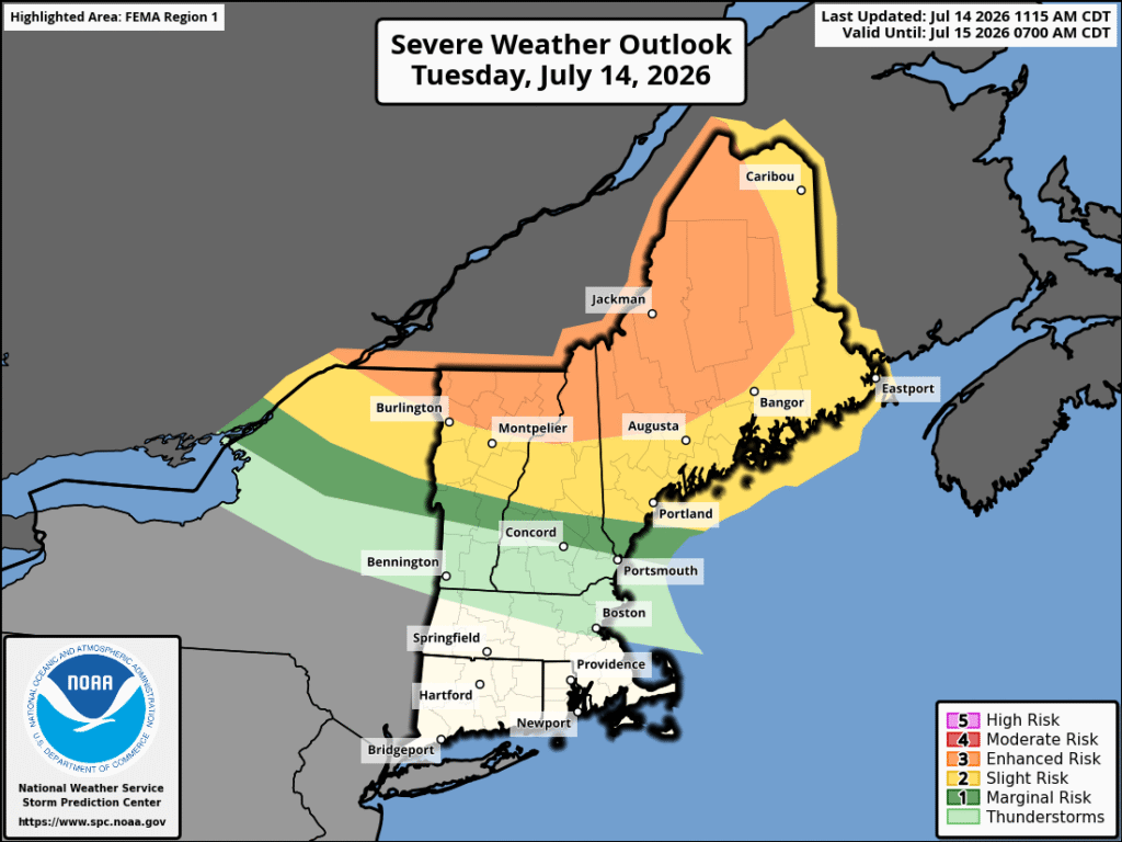
Severe Weather potential for the Northeast on July 14th, bringing a risk of tornadoes, wind, and hail to the region. Image provided by NOAA


Weather from the northwest is generally hindered by a lack of humidity, as the further northward you move, the less available moisture there is. The less moisture, the less available total energy there is for storms to form, whereas weather from along the coast generally is limited by the ocean as systems leave New Jersey and pass over both the ocean and Long Island before impacting parts of New England.
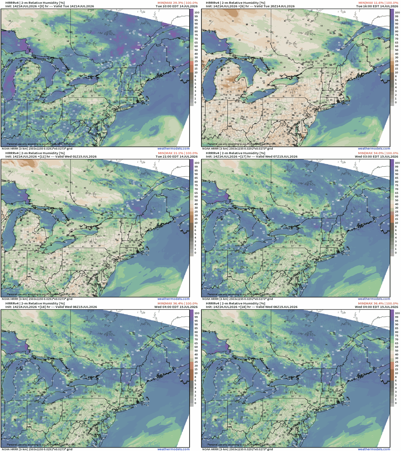
Relative humidity from Tuesday the 14th to Wednesday the 15th. Loop provided by Weathermodels.com


Wildfires also play a part in this, as the smoke from them gets high into the atmosphere, injecting drier air, but they can also promote storm formation if particulate that is released by them manages to mix with more moist air. Wildfires in Ontario are the source of the smoke for the next few days.
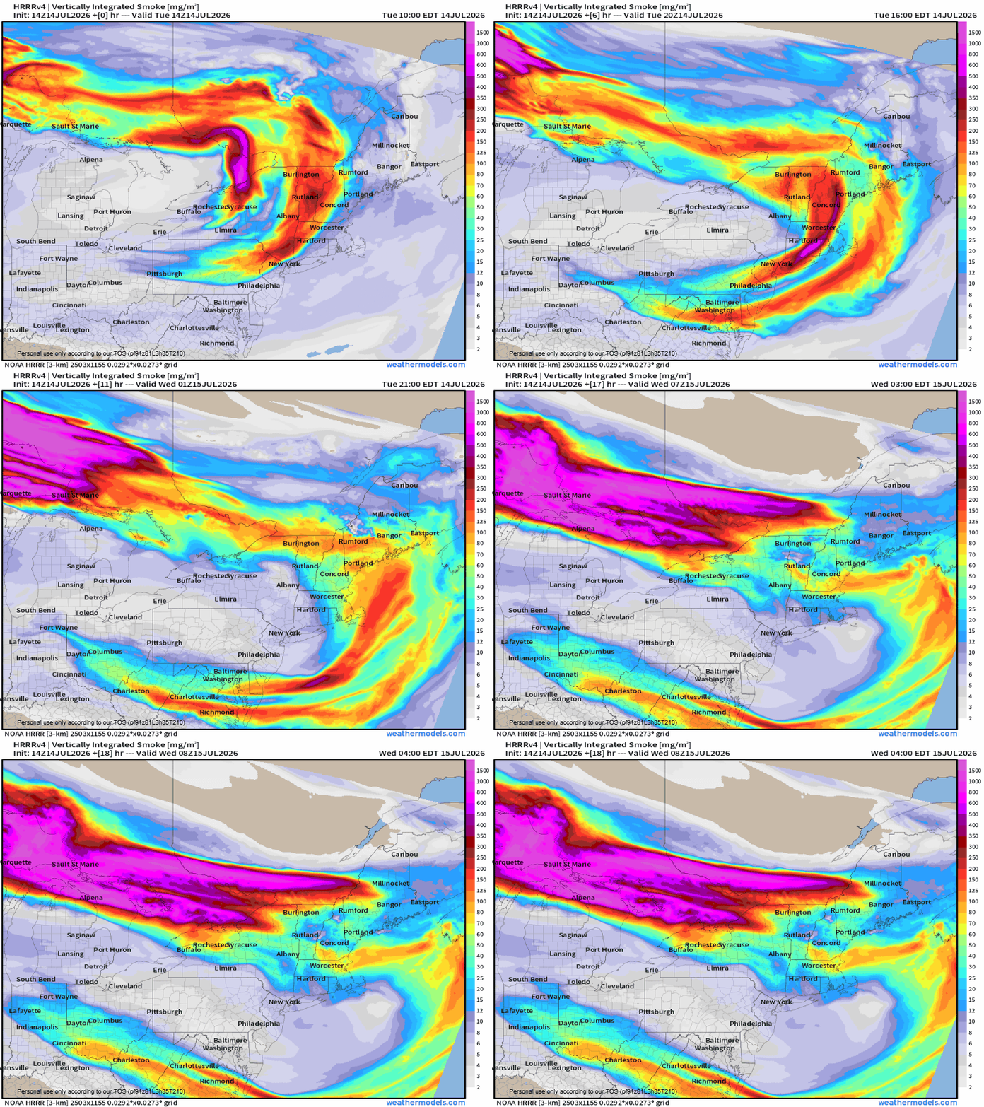
Canadian wildfires lifting dry air and smoke and dry air into the atmosphere, hindering ground heating needed to form significant storms. Loop provided by Weathermodels.com


For the current storms moving through, wind, hail, and tornadoes are all expected to be on the stronger side when they occur. Most of the severe threat is limited to areas that are generally less populated in northern Vermont, New Hampshire and Maine, though this does not mean that severe weather won’t move into more populated regions, and a system could move through southern New Hampshire overnight on the 14th into the 15th, bringing showers and strong winds, with the potential for hail and tornadoes as the night progresses.
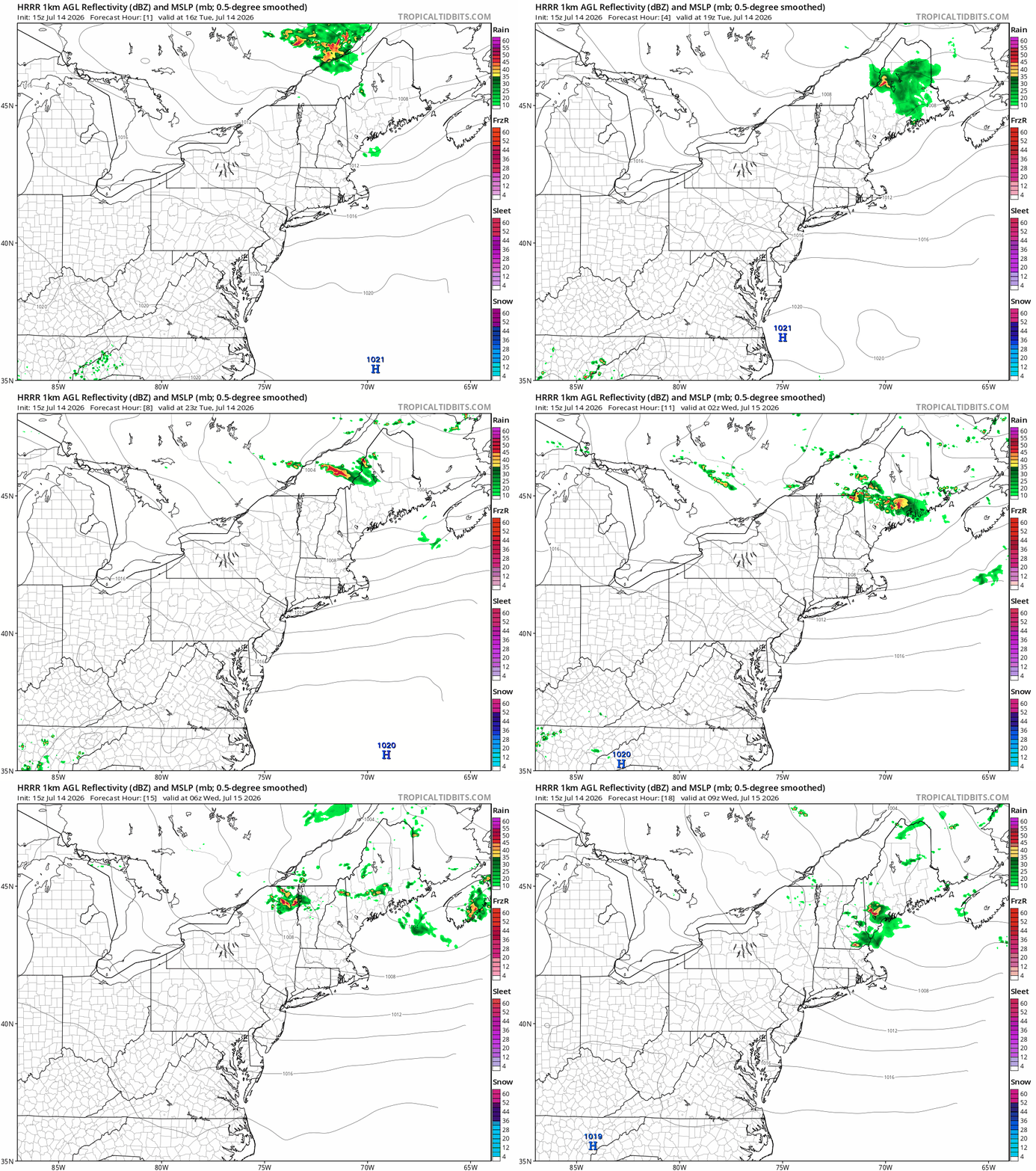
Storms moving through New England on the 14th overnight in to the 15th. Loop provided by Tropical Tidbits


Cooler and drier air will move into New England on July 15 behind a cold front.
Drought and Wildfire Risk in the West

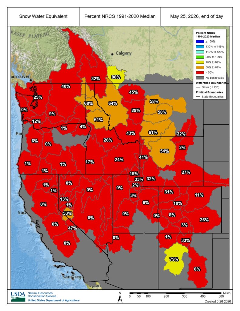
Winter of 2025-2026 left the snowpacks of the Rockies in a dire state. Combined with one of the warmest winters on record and a looming El Nino, most Western states are looking at a worsening drought for the summer. Cities across the West saw record low snowfall and record high temperatures this past winter. Combined with an abnormally warm March, snowpack in the mountains is at the lowest it has been since records were first kept.

Map showing snowpack percent of median from 1991 to 2020 as of May 26. Most of the region is significantly below the average, reporting around or below 40% of the median snowpack. Image provided by the US Department of Agriculture


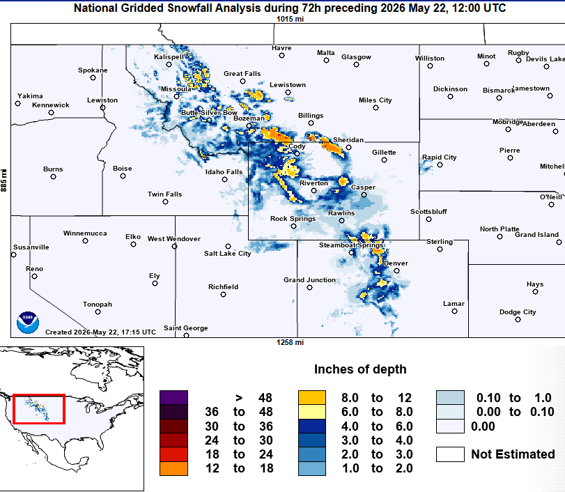
In portions of Colorado, Wyoming, and southwestern Montana, most of the season snowfall occurs during the fall and in the Spring, not in the winter like much of the remainder of the nation. This year, the majority of the snow has fallen in the Spring, with multiple late season snowstorms have helped to replenish the snowpack. Most of this is falling in the mountains, where the majority of the snowpack typically resides.

72 Hour snowfall reports from May 22nd in the Rockies. Parts of western Montana, Wyoming, and Colorado  received at least 8 to 12 inches of snow between May 19 and May 22. Image provided by NOAA


Low snowpack in the West, combined with warmer temperatures earlier in the year, have detrimental effects going into both Spring and Summer. Normally, warmer temperatures arrive in during May and June, allowing the snowmelt to provide a semi-constant source of water, keeping soils moist and vegetation wetter into the warmer months. With the snowpack being at effectively zero this year, it creates an environment that is prime for wildfires, as vegetation and soil dry out early in the season.

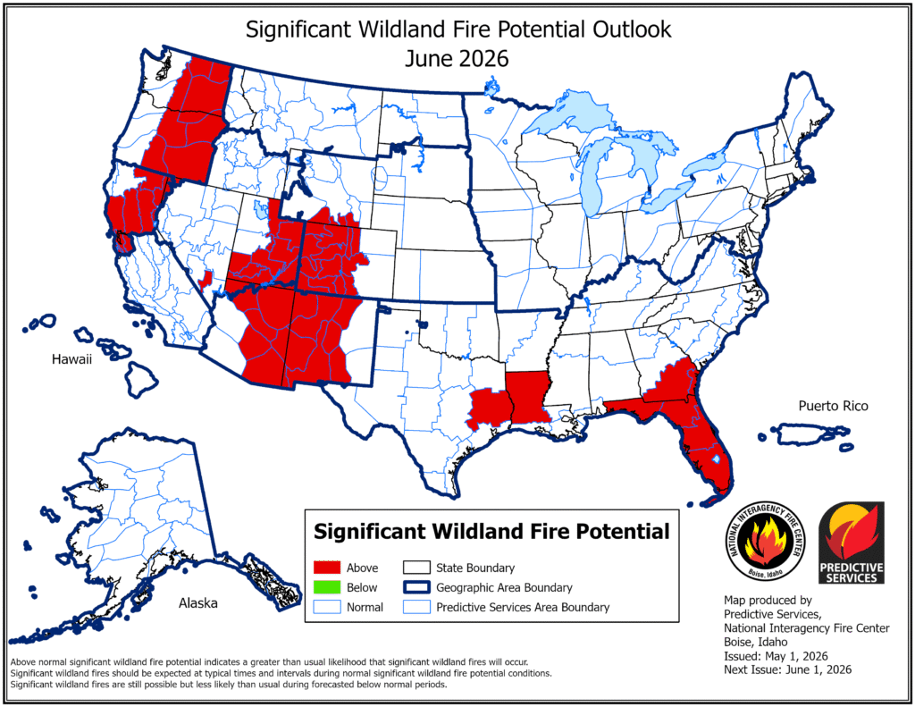
An above average significant wildlands fire potential exists for Florida, the mid-southwest, and northwest for June 2026. Image provided by the National Interagency Fire Center.


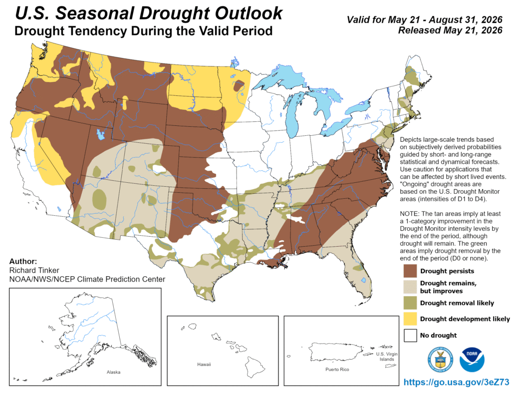
With below average precipitation and above average temperatures expected in the coming months, the drought that has been gripping the region is also expected to expand, further increasing the risk of wildfires. Alongside the increased risk of wildfires as the season starts earlier comes the increased risk of more severe wildfires as more vegetation becomes drought stressed.

While drought conditions may improve in the Southwest, they will likely worsen across much of the remainder of the West over the next few months. Image provided by NOAA


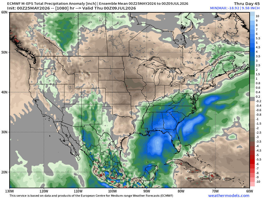
Over the several weeks, precipitation across most of the Central and Northern US is expected to be below normal. Rainfall should continue across much of the Southeast, alleviating drought concerns there. Similar conditions are also expected in the Southwest as the annual monsoon develops.

Precipitation is expected to be below normal for much of the Central and Western US, with the Southeast and parts of the Southwest seeing some relief. Image provided by Weathermodels.com


With a developing El Nino, more rainfall is expected across the southern tier of states over the coming months, with drier conditions to the north.

Back to top