Hurricane Erin is pulling away from Puerto Rico and the Virgin Islands, but remains a powerful storm.
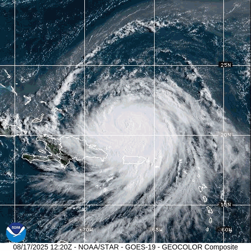
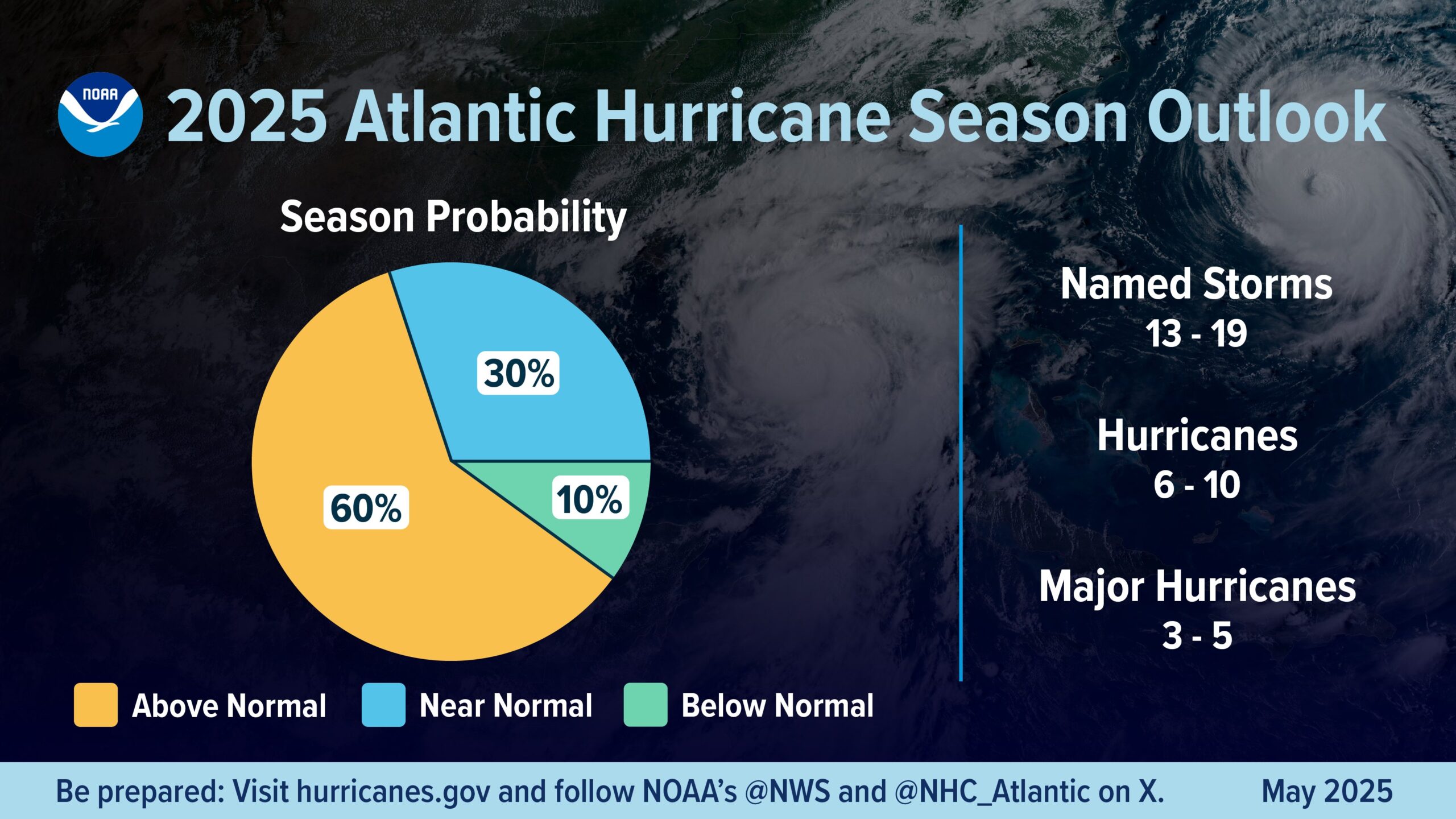
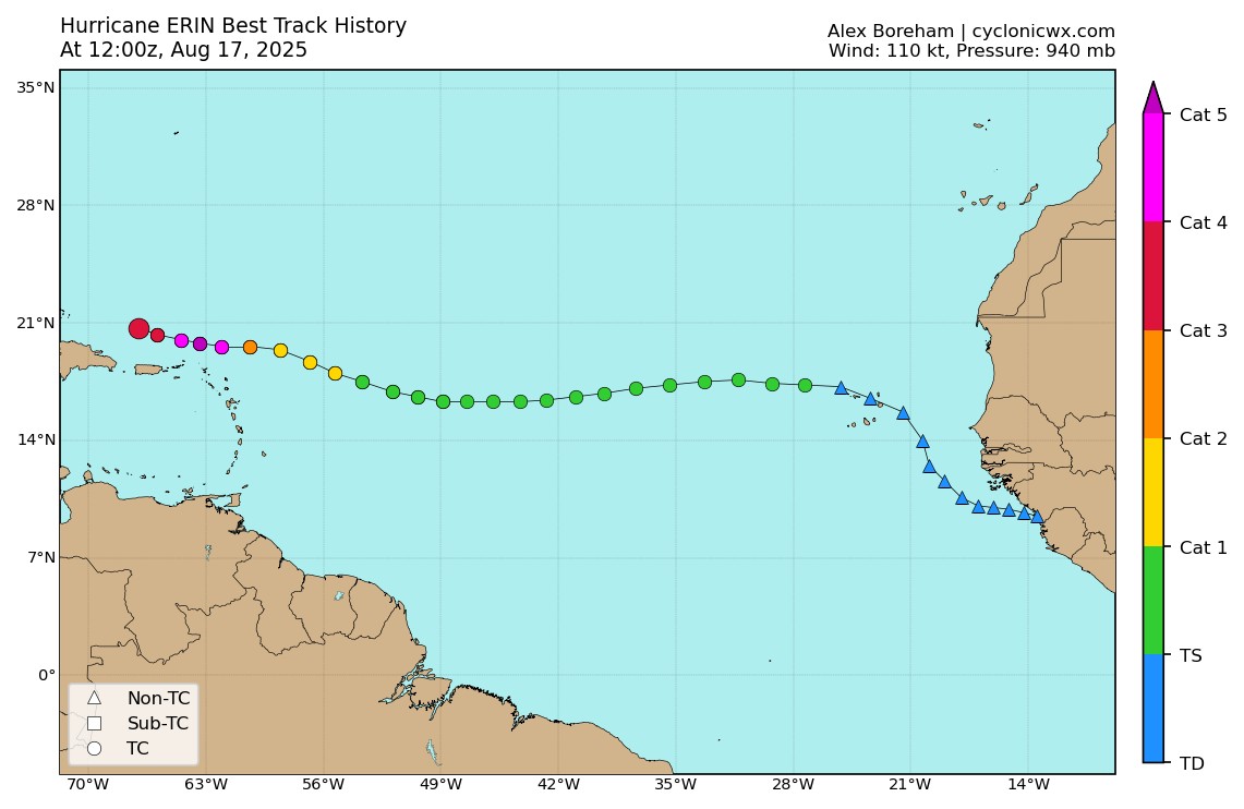
A tropical wave that moved off the west coast of Africa last weekend developed into Tropical Storm Erin as it crosses the Cabo Verde Islands on Monday. For much of last week Erin quickly crossed the tropical Atlantic, fighting off dry air from Saharan Dust and cooler sea surface temperatures while slowly gathering strength. By midday Friday, Erin finally had strengthened into the first hurricane of the 2025 season, about a week later than average date for the first hurricane of the year. Erin quickly made up for lost time though, taking advantage of favorable conditions to explosively develop into a Category 5 hurricane on Saturday, just the 43rd Category 5 storm on record in the Atlantic, dating back to 1851, the 9th one to form before September 1.
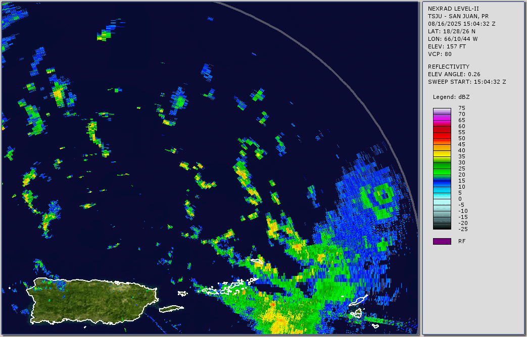
The center of Erin passed about 150 miles north of the Virgin Islands and Puerto Rico on Saturday, but the outer bands of the storm brought adverse conditions into the Virgin Islands. Observations from the British Virgin Islands indicate that over 9 inches of rain fell in about 18 hours on Saturday, along with wind gusts in excess of 60 mph. In the United States Virgin Islands and Puerto Rico, rainfall totals of up 5 inches resulted in flooding in many areas, with wind gusts to 50 mph resulting in downed trees and power lines.
As of 2pm Sunday, Erin was still a Category 3 hurricane was maximum sustained winds near 125 mph, down from its peak of 160 mph on Saturday. Erin was centered about 200 miles east of Grand Turk Island, moving toward the west-northwest at 13 mph. Tropical Storm Warnings are in effect for the Turks and Caicos Islands as well as the southeastern Bahamas.
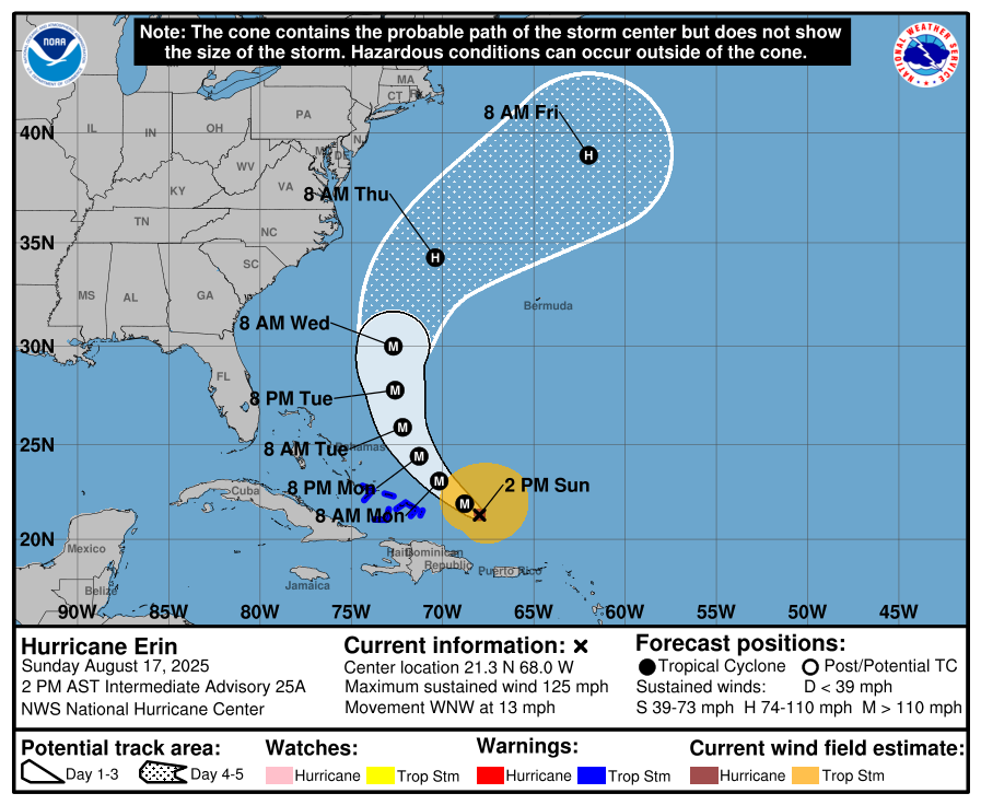
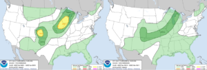
The forecast for Erin is fairly simple at this point. Erin is expected to turn more toward the northwest and then north over the next day or two as it reaches the western edge of a ridge of high pressure. This will turn the storm away from the Bahamas and the East Coast, while also passing west of Bermuda. Erin may restrengthen a little, but it will also become a much larger storm. As a result, some of the outer bands of the storm could bring some squally weather to parts of the Bahamas and Turks and Caicos Islands today and Monday, and possibly to Bermuda and the Outer Banks of North Carolina towards mid-week. Erin should turn more toward the northeast during the latter half of the week, heading out into the open Atlantic well southeast of New England and Nova Scotia.
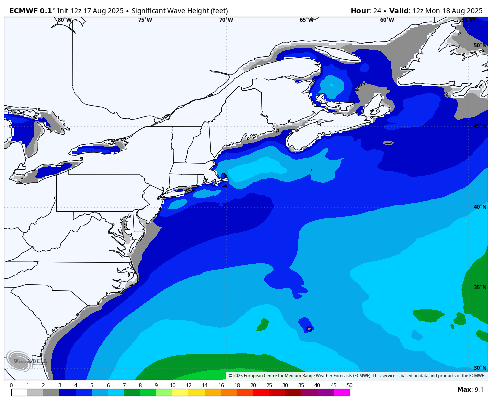
Erin will generate rough surf and large waves for much of the East Coast for a good chunk of the upcoming week, increasing the threat of riptides for much of the region. With a new moon next weekend, tides will be astronomically high later this week, so coastal flooding could be an issue near high tide across parts of the Northeast US and Atlantic Canada.
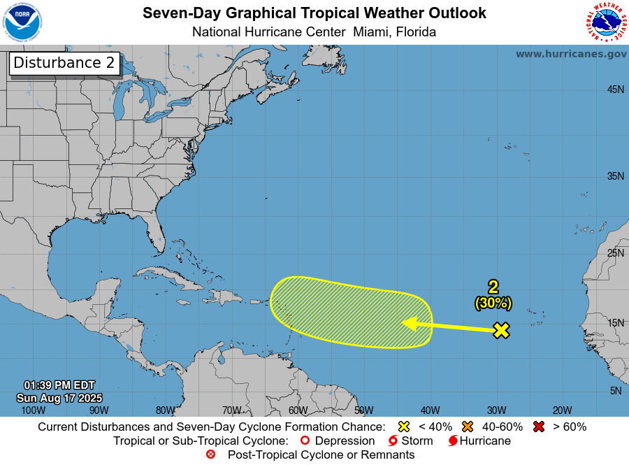
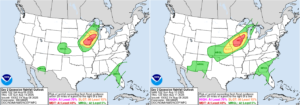
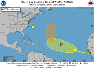
As we head towards the peak of Hurricane Season there will be more systems to watch, and we already have another one to keep an eye on. A tropical wave is producing disorganized showers and thunderstorms near the Cabo Verde Islands today. It will quickly head westward across the Atlantic this week. Conditions are not that favorable for development at this time, but could improve later this week as it gets into the central Atlantic. Some of the forecast models do show this system developing later in the week, so we’ll keep an eye on it this week.