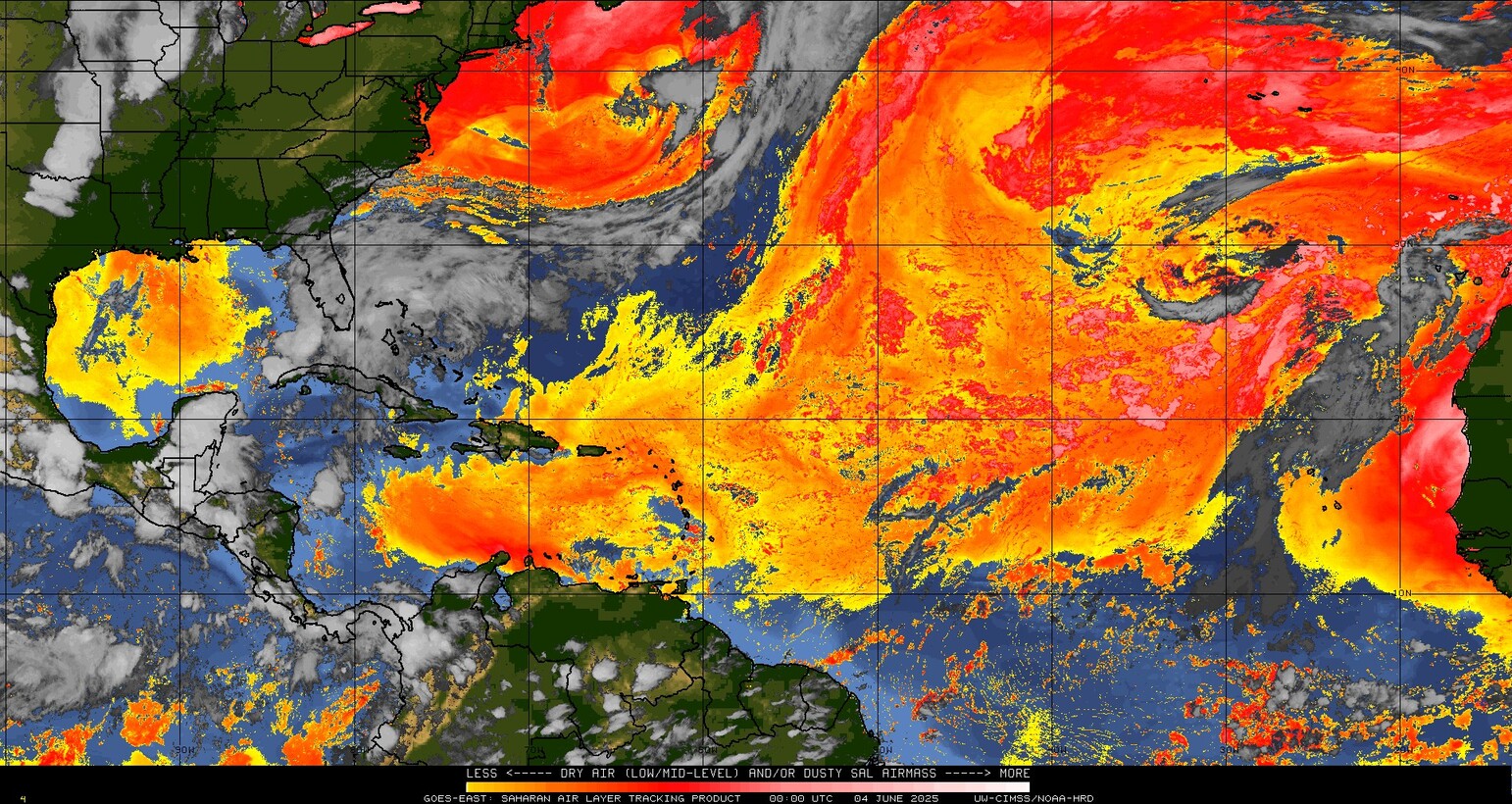
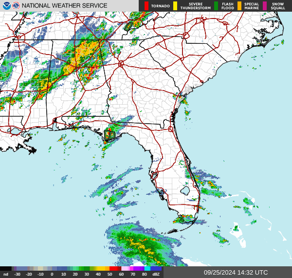
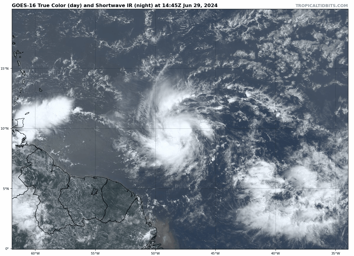
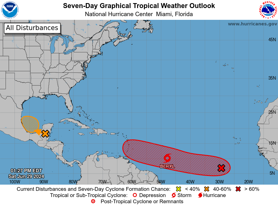
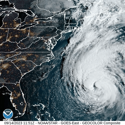
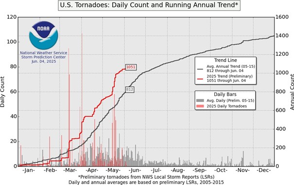
The United States is notorious for its crazy weather, especially during the spring. There are dozens of tornado outbreaks yearly, especially through the Midwestern region, otherwise known as Tornado Alley. As of June 4th, more than 1,000 tornadoes have been reported to the Storm Prediction Center. One significant outbreak of this year occurred between May 15th and 16th.
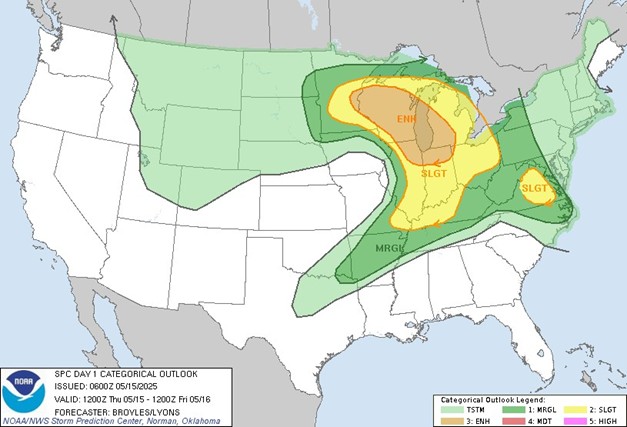
On May 15th, a low-pressure system was developing in the Central Plains, with two fronts extending from this system: a warm front moving from the Ohio Valley to the Great Lakes and a cold front moving into the Mississippi Valley from the Central Plains. The moderate instability between these fronts led the Storm Prediction Center to issue an outlook with an enhanced risk for severe weather for eastern Minnesota, central Wisconsin, Lake Michigan, northern Indiana, and northeastern Illinois.
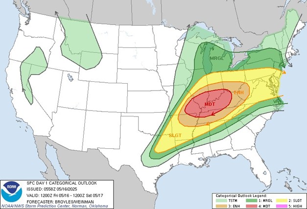
The severe weather threat continued the following day as the system moved from the Northern Plains into the Upper Mississippi Valley with the area of instability over the Ohio and Tennessee Valleys. The Storm Prediction Center issued an outlook with an enhanced risk of severe weather for most of the Ohio and Tennessee Valleys and eastern areas of the Lower Mississippi Valley, along with a moderate risk for much of Kentucky, northwestern Tennessee, southeastern Missouri, southern Illinois and Indiana.
By the end of this outbreak, 56 confirmed tornadoes had occurred, including three EF-3 and two EF-4 tornadoes. Unfortunately, 27 confirmed fatalities and more than 60 reported injuries were reported. The longest and deadliest tornado occurred near the end of the outbreak in Eastern Kentucky.
At 10:27 pm EDT on May 16th, the tornado touched down northeast of Jamestown, Kentucky, located in Russell County, and near Kentucky State Route 619. According to the NWS, the tornado may have briefly lifted for a few hundred yards due to the sporadic damage near the initial touchdown point. The tornado continued east as it intensified, crossing through several communities and leaving high-end EF-1 to EF-2 damage in its wake before crossing into Pulaski County. Here, it caused significant damage, especially in the towns of Fabush and Nancy, before continuing east into Somerset. In this community, the tornado gained enough strength to be rated an EF-3. With this strength, it continued toward the Daniel Boone National Forest, and satellite imagery across this region showed that the tornado was almost a mile wide. As the tornado exited the National Forest, it moved into the south side of London, where it continued strengthening. This densely populated area was where the heaviest damage and most casualties occurred. The tornado crossed through the Sunshine Hills subdivision, causing several homes to be removed from their foundations. Surveyors in this area had agreed that at this time, the tornado had once again gained enough strength to increase its rating to an EF-4, with up to 170 miles per hour wind speeds. The tornado continued toward the London-Corbin Airport, losing strength and being downgraded to an EF-3. Beyond the airport, where several aircraft and hangars were damaged and destroyed, it lost significant strength while still leaving a path of destruction at the Crooked Creek Golf Course, Laurel County Fairgrounds, and neighboring subdivisions. The tornado finally lifted off the ground just before midnight EDT, leaving a nearly 60-mile path of destruction, with 19 fatalities.