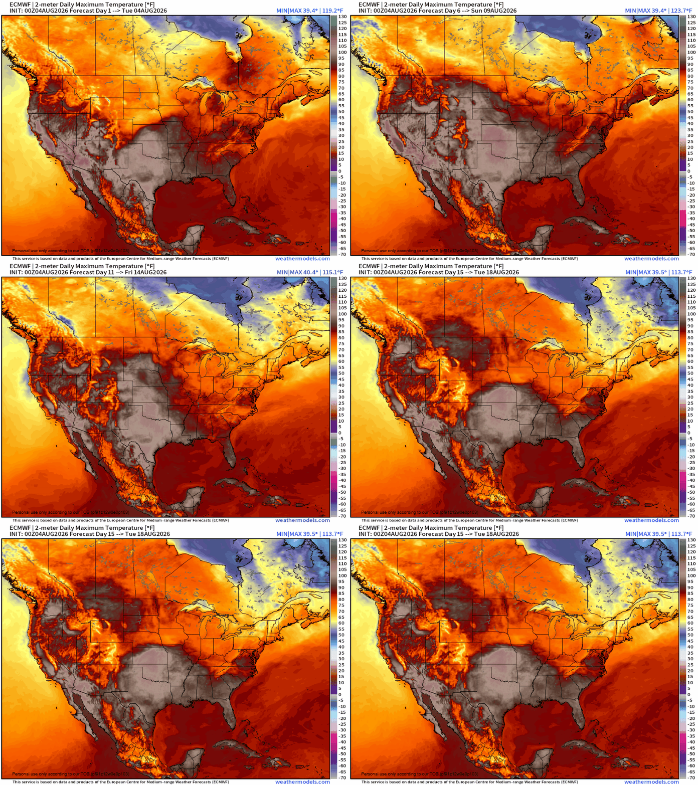
As August begins, a persistent upper level ridge is looking to settle over the Western US, bringing extreme heat and fires as the explosion of vegetation through the summer dries out.
Rainfall is always welcome in warm, arid climates, as it provides needed relief from the temperature and assists in refilling reservoirs that might be in need of water – especially after a drought – and promotes explosive vegetation growth, mostly of small grasses and wildflowers. Following a drought, this rainfall also brings hazards of its own. More well known hazards are flooding and land or mudslides, but that rapid vegetation growth can become a big risk depending on how conditions change in the following weeks.
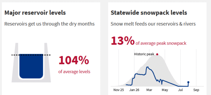
California (and other Western states) bases its precipitation on a slightly different scale than Eastern states, known as the Water Year, and it runs from October 1st to September 30th every year. This water year, totals across the state are just below to around normal in the northern regions of the state, while central and southern portions have been near to well above average. Given that this year had record low snowpack development, the above average rainfall has maintained reservoir levels at around normal across the state, and promoted the growth of vegetation.
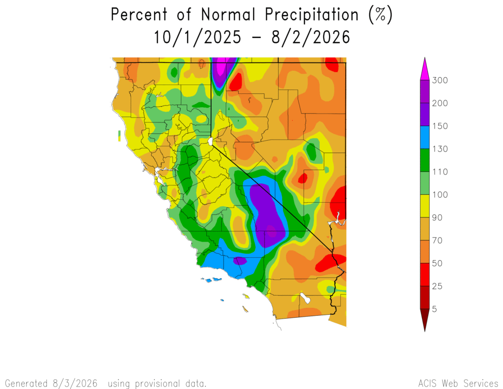
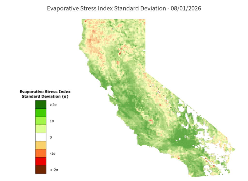
One location of note; Death Valley received 3.5 inches of rain this water year. This might not seem like much, but when you consider that the average yearly rainfall here is only 2.2 inches, that is 160% of the average rainfall, and it lead to a super-bloom of wildflowers. In fact, much of the area between the Mojave Desert and Los Angeles has reported above 120% of their yearly rainfall, causing impressive vegetation growth. Though this growth comes with a major risk as it dries out: Wildfires
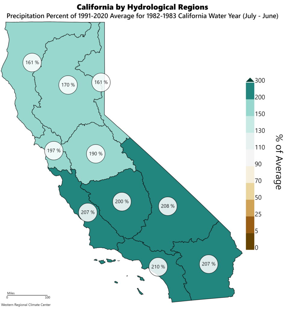
Southwest US and California droughts are very closely tied to the ENSO cycle. In El Nino years, Southern California across into Texas see well above average precipitation. As an example, the 1982-83 El Nino brought rainfall totals to California that were 150 to 200% above normal compared to the 1990 to 2020 normals. As El Nino changed to La Nina the following year, California experienced a drought that saw three hundred thousand acres of land burned.
As we head into a very strong El Nino in the 2026 through 2027 fall and winter, California is likely to see at or above normal precipitation. The South Central US is already well above normal, and this could continue through winter.