A persistent upper level high will keep the west sweltering this weekend, while the south-central and eastern US sees cooler temps and scattered showers.
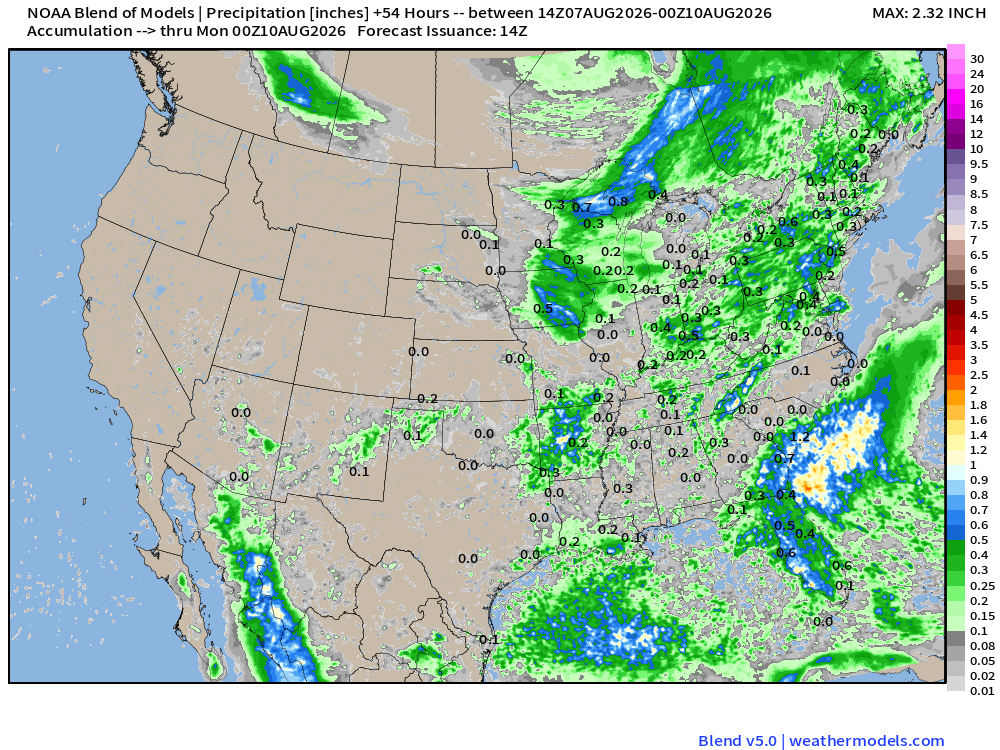
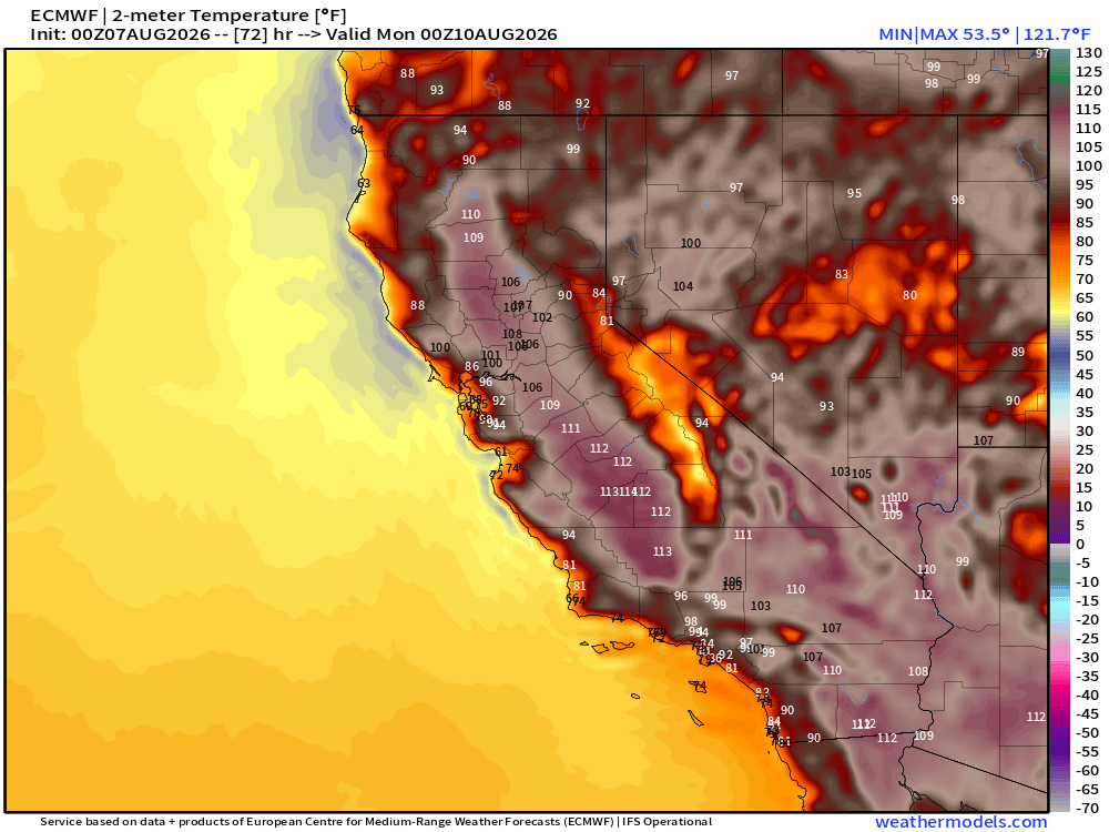
Starting on Saturday, extreme heat warnings and heat advisories will persist through much of the Western US as an upper level high pressure persists. Heat indices will be in the 90s and 100s across the southwestern US and the Central Valley in California, with temperatures in the 100s and 110s, with the Mojave Desert potentially reaching the 120s. Overnight lows will be in the 60s and 70s in Central and Northern California, while only reaching the 80s in Southern California, providing little relief. Northern coastal cities won’t get as hot, looking to only reach the upper 60s during the day, and lower 50s overnight, though offshore winds will keep the relative humidity in the upper 60s and 70%. As with any extreme heat, limit outdoor activity when possible, and drink lots of fluids to keep hydrated.
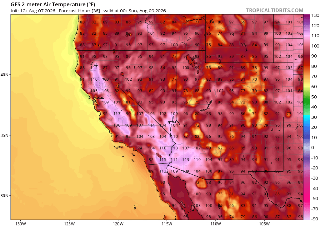
The main hazard in the northwest will be air quality and fire weather through Saturday. With fires already active and very little air movement in the region, smoke can build up to unsafe levels for most people. Additionally, dry conditions inland combined with temperatures in the 80s and 90s will allow for even the smallest fire to quickly expand.
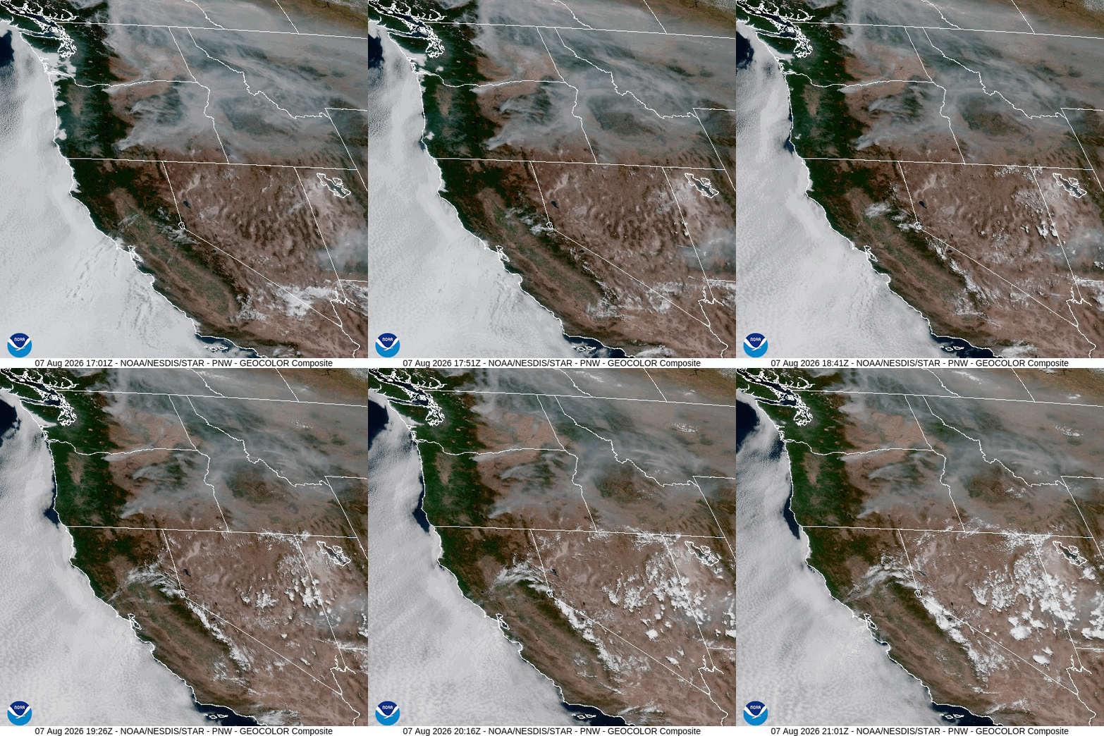
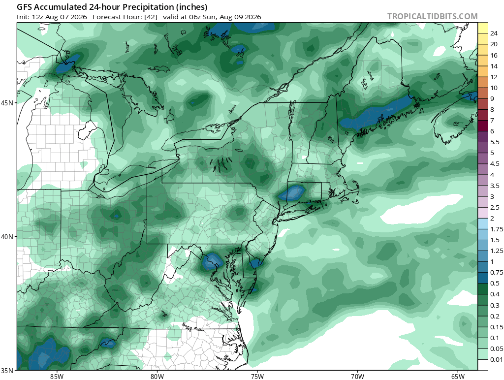
The central US will also experience highs in the 90s and 100s, though no heat advisories have been issued. Dew points will generally be in the 40s to 60s, creating dry conditions, and as such no rain is expected for much of the north-central US. New Mexico and the Texas panhandle could see a light shower or two, but accumulation should remain below half an inch. The Ohio Valley through to the Northeast could see scattered showers, though totals shouldn’t be more than half an inch. Highs in the Northeast and Mid-Atlantic will be around the 80s and 90s.
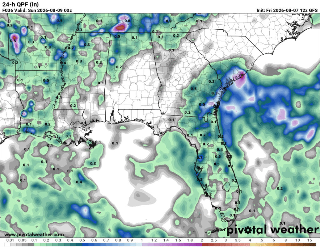
In the southeast, Highs will remain consistent in the 80s and 90s. As an offshore convective system makes its way towards the coast, Coastal Eastern Florida, Georgia, and South Carolina could see precipitation totals from isolated showers around .75 inches with localized totals of 1+ inches.
Sunday will see some relief from the heat in the Northwest as high temperatures dip into the 80s and 90s, and lows in the 50s and 60s. Air Quality advisories will persist through Sunday as surface winds remain low, while upper level winds carry lofted smoke downwind. Heat advisories and warnings will remain active in the southwest, with highs in the 90s and 100s, with the Mojave reaching 110+.
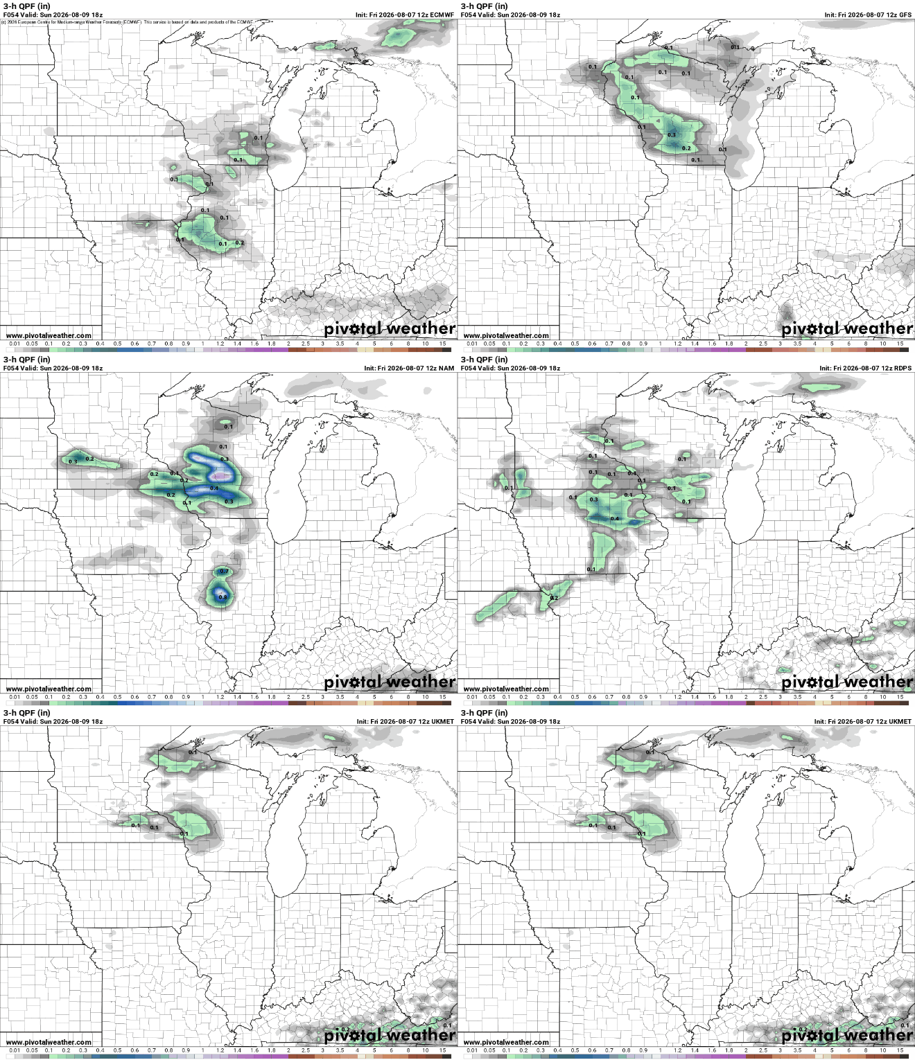
The Northern Central Plains could see some severe weather on Sunday as a system quickly moves through the central and northern plains into the southern Great Lakes. The primary risk will be localized heavy rain, with hail and wind also possible, though the precise timing and location of the system is still uncertain. Highs in this region should remain in the mid 70s to low 80s across the region. The Eastern US overall will see highs continue to be in the 80s and 90s. Scattered showers are possible in the southwest into the south-central, with accumulations of around a third of an inch, with localized higher amounts possible along the Gulf.
Through the rest of the week, relief from the heat is in sight for the southwest as the upper-level ridge weakens, though the southwest will now be under its own, bringing highs into the 90s and 100s. The northern Great Plains and Northeast could get the first taste of fall as overnight lows drop into the 40s and 50s, though highs will remain in the 70s and 80s.