As the climatological peak of the 2015 Hurricane Season draws closer, things are starting to get more active in the Atlantic.
At 11am, Tropical Storm Danny was upgraded to a hurricane with top winds near 75 mph. Danny was located about 1100 miles east of the Lesser Antilles and heading towards the west-northwest at 12 mph. The future of Danny is still a bit uncertain. It should continue to head on a west-northwesterly heading for the next few days, likely reaching the Lesser Antilles late Sunday or early Monday. How strong it will be at that time is the big question. The official forecast from the National Hurricane Center calls for Danny to cross the Antilles as a hurricane, then weaken to a tropical storm as it nears Puerto Rico and the Virgin Islands. However, many of the computer models are indicating that Danny weaken back to a tropical storm before reaching the islands, and several have it degenerating to a tropical wave shortly after moving into the Caribbean.
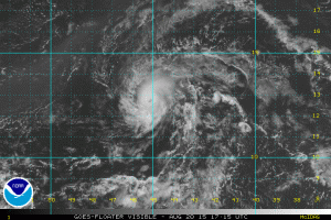
Meanwhile, an area of disturbed weather southwest of Bermuda is producing shower and thunderstorm activity this afternoon. Conditions are favorable for the system to gradually acquire some tropical or sub-tropical characteristics over the next few days. Most indications are that it should remain over open waters, but it could increase the surf along the East Coast through the weekend.
In the Pacific, Tropical Depression 3-C has formed about 700 miles southeast of Hilo, Hawaii. The forecast for the depression is steady strengthening while continuing on a general northwesterly course for the next day or two. The storm
should start to turn more towards the north, and could threaten portions of the Hawaiian Islands this weekend or early next week. While the system will likely become a tropical storm (and given the name Kilo), how strong it eventually gets is a question mark. Some models keep it just a tropical storm, while many of them to strengthen it into a hurricane. Residents of the 50th state should keep a close eye on this system’s progress over the next few days.
Farther to the west, there are twin typhoons in the Western Pacific. The more immediate concern is Typhoon Goni. As of midday Wednesday (EDT), Goni was located just northeast of the northern tip of the Philippines with top winds of 135 mph, and was moving towards the west at 7 mph. Goni is expected to make a turn towards the north later today and eventually northeast over the enxt few days. This would bring Goni east of Taiwan, but also heading right towards southwestern Japan. Some of the islands east of Taiwan and south of Japana, including Okinawa, could be directly in the path of the storm.
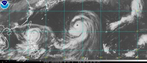
Farther east is Super Typhoon Atsani. Atsani has top winds near 150 mph and is located about 450 miles southeast of Tokyo, moving northwest at 10 mph. Atsani is expected to turn more toward the north and northeast, heading out into the open Pacific while steadily weakening.
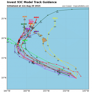
There are a few other areas of disturbed weather being monitored for development, including a system in the eastern Pacific about 1000 miles southwest of the southern tip of Baja California and another Atlantic tropical wave just emerging from the coast of Africa. With the climatological peak of hurricane season still a few weeks away, conditions should remain active for a while.