A developing system in the Gulf of Mexico will bring heavy rain and flooding to parts of the Gulf Coast and Deep South over the next few days.
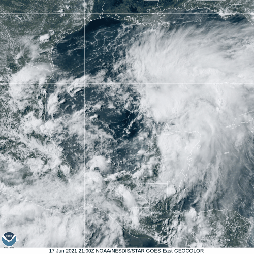
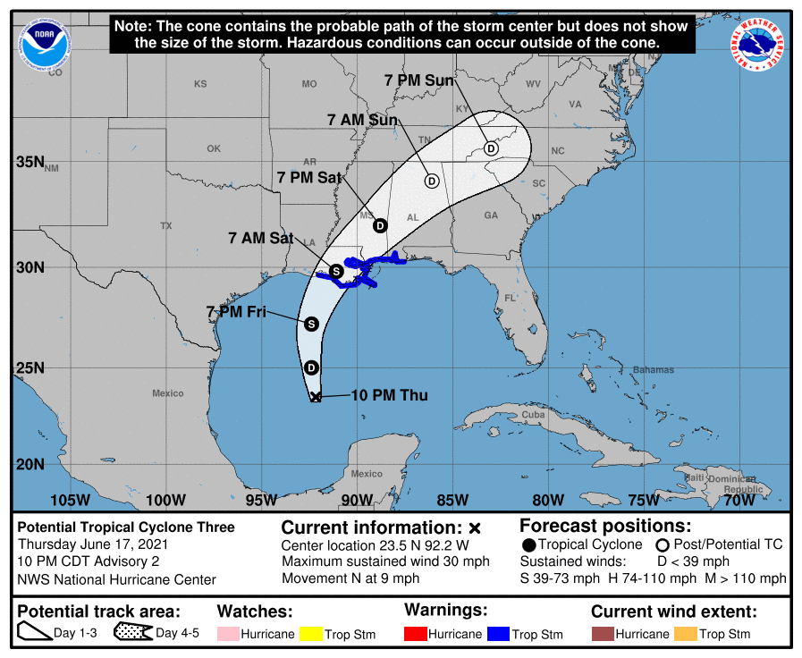
A broad area of low pressure has been meandering around in the Bay of Campeche for much of this week. The system started moving northward on Thursday and is getting better organized. Conditions are favorable for further development as the system continues moving northward on Friday. The system is expected to produce tropical storm conditions for part of the Gulf Coast on Friday, and with that expectation, the National Hurricane Center declared the storm to be Potential Tropical Cyclone Three Thursday afternoon. This allowed the issuance of a Tropical Storm Warning from Intracoastal City, Louisiana to the Alabama/Florida border. This includes Lake Maurepas, Lake Pontchartrain, and the New Orleans Metropolitan area.
As of 11pm EDT, the system was centered about 435 miles south of Morgan City, Louisiana, moving toward the north at 9 mph. It is expected to speed up on Friday, with the center expected to make landfall in southern Louisiana early Saturday morning. The system is expected to continue organizing, and could become a tropical depression or storm on Friday. If it does reach tropical storm strength, it will be named Claudette.
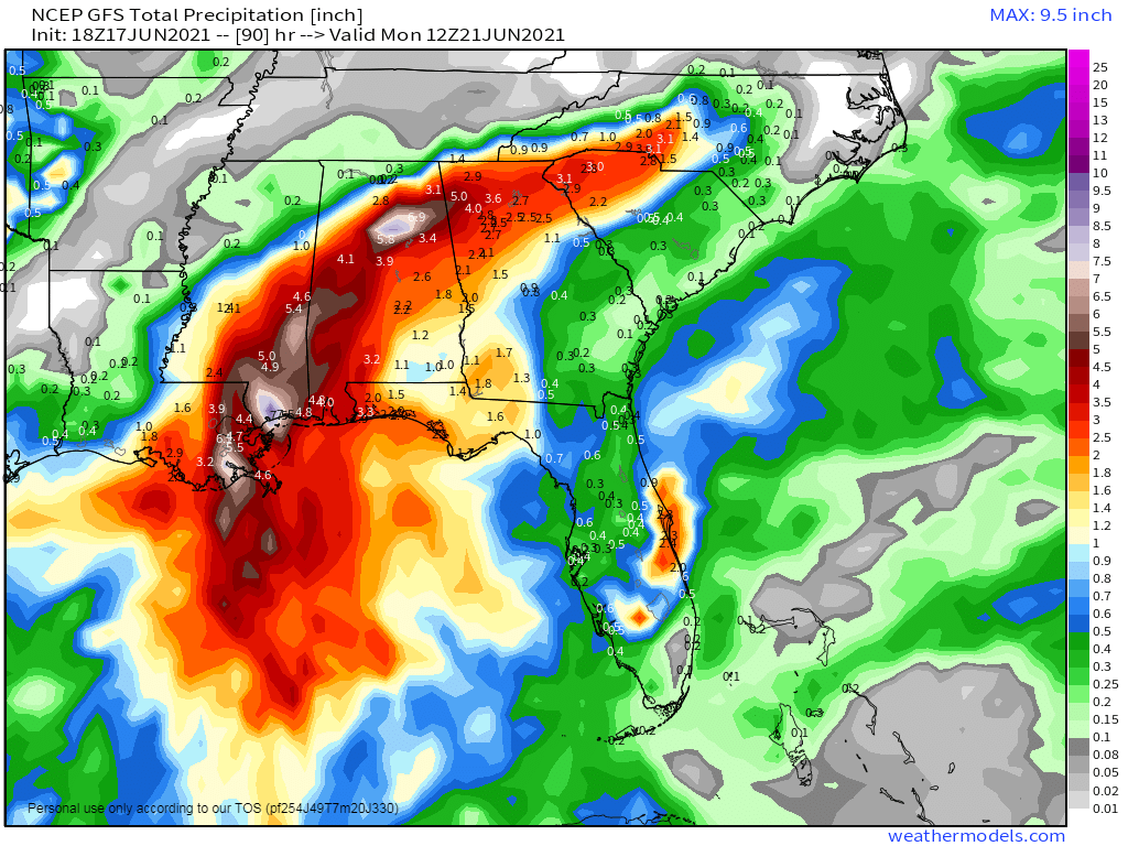
While this system will bring some gusty winds and a minor storm surge to coastal areas, flooding from heavy rain is by far the biggest threat. The storm will likely produce 4 to 8 inches of rain across portions of the Gulf Coast and inland across the Deep South, with isolated totals of 10 to 15 inches possible.
It’s been a very wet spring across this region already, so additional heavy rainfall is not good news. Over the past 90 days much of the area has received 15 to 30 inches of rain, with as much as 45 inches in parts of southeastern Louisiana. This is 1.5 to 2.5 times the normal amount that usually falls. This has led to flooding across the area at times, and additional rain this weekend will produce more flooding. Flash Flood Watches have already been issued for parts of the area.
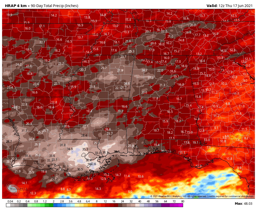
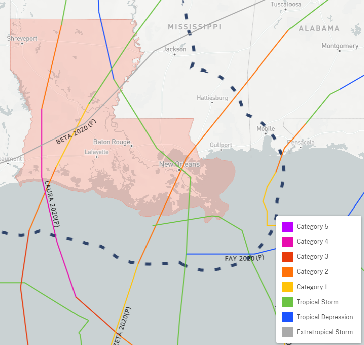
Louisiana is no stranger to tropical cyclones, but during the record-setting 2020 hurricane season, Louisiana suffered a direct-hit from a record 5 different storms. Tropical Storm Cristobal, Hurricane Laura, Tropical Storm Marco, Hurricane Delta, and Hurricane Zeta all made landfall in the Pelican State, causing billions of dollars in damage. Recovery efforts still continue to this day, so the heavy rain this spring has not been welcome.
Elsewhere, the Atlantic remains quiet, with no systems expected over the next week. In the Eastern Pacific, a tropical depression is expected to develop just off the south coast of Mexico in the next few days. While the system is expected to remain weak, it will bring heavy rain to southwestern Mexico this weekend. Rainfall totals of 10-20 inches will likely produce flooding and mudslides across the area.