The tropical disturbance that brought heavy rain to parts of the Lesser Antilles, Virgin Islands, and Puerto Rico over the past few days developed into Tropical Storm Fred late Tuesday night.
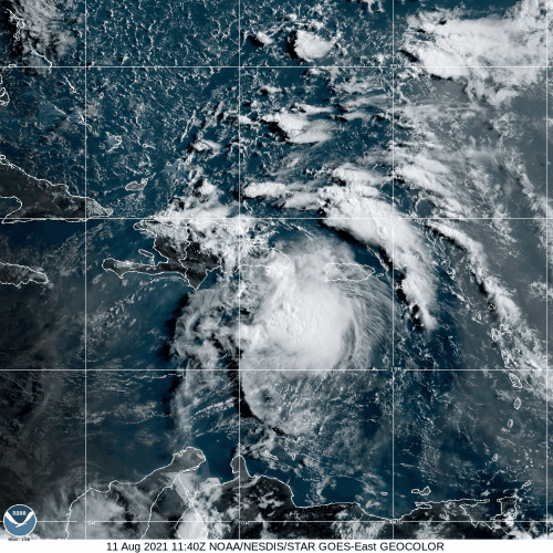
As of early Wednesday afternoon, Tropical Storm Fred was centered about 30 miles west of Santo Domingo, Dominican Republic, moving toward the west-northwest at 16 mph. Maximum sustained winds were near 45 mph, but some weakening is likely over the next 12-24 hours with the center over land. A Tropical Storm Warning remains in effect for much of the Dominican Republic, with Tropical Storm Watches in effect for parts of Haiti, eastern Cuba, the Turks and Caicos Islands, and the southeastern Bahamas.
The combination of the center crossing the mountainous terrain of Hispaniola and westerly wind shear will keep Fred weak for the next day or two as it heads west-northwestward across Haiti and close to the coast of Cuba. Whether the center stays offshore of Cuba or near or just onshore will have an impact on how much the storm starts to re-strengthen. It will produce gusty winds and heavy rain across Hispaniola, eastern Cuba and parts of the Bahamas, leading to flooding and mudslides. Rainfall totals of 3-6 inches and locally heavier are likely across these areas.
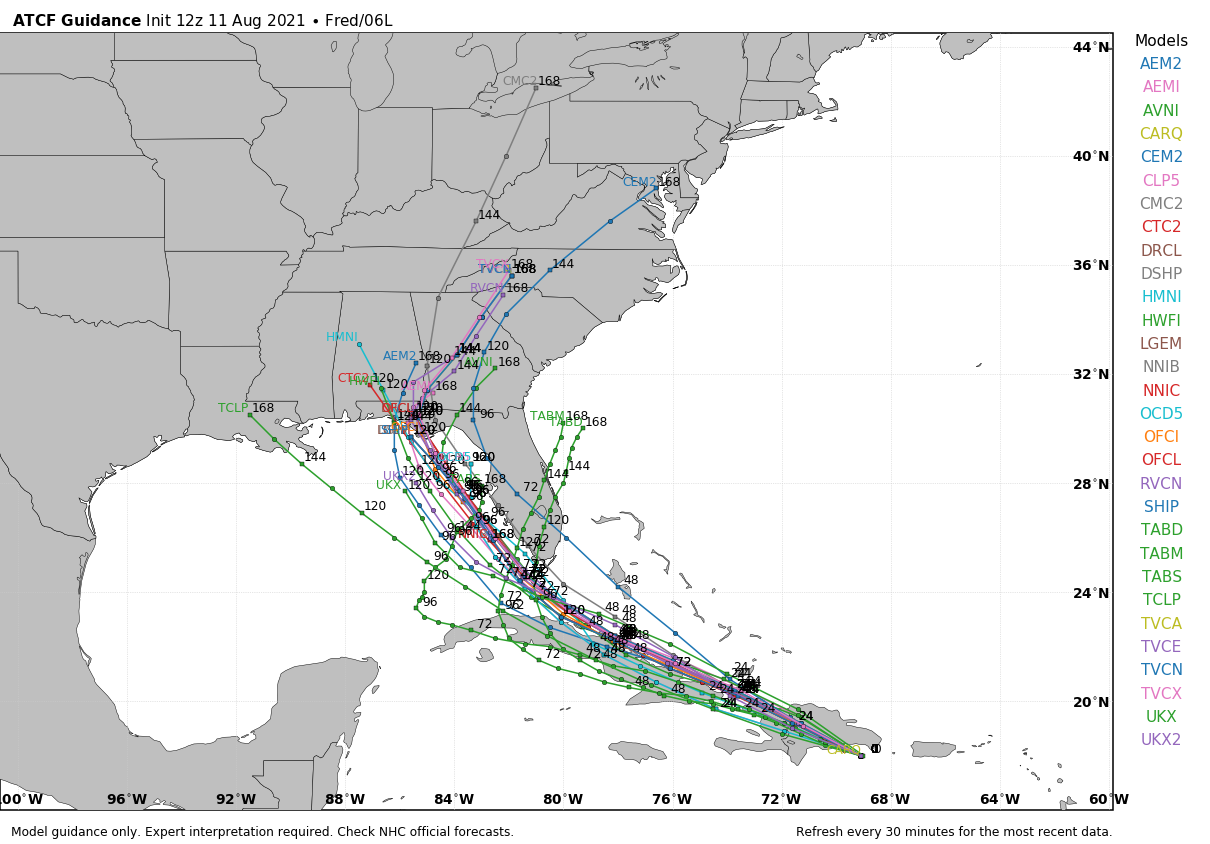
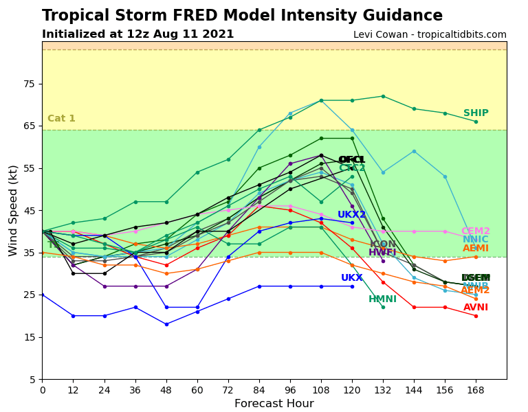
By late Friday or early Saturday, Fred will start to turn more toward the northwest as it rounds the edge of a large ridge of high pressure over the Atlantic. This should bring the storm across the Florida Keys early Saturday, and then into the eastern Gulf of Mexico. It should start to strengthen again over the warm waters of the Gulf as it heads toward the northern Gulf Coast. The current forecast from the National Hurricane Center calls for Fred to make landfall in the Florida Panhandle early Monday as a strong tropical storm. However, given the average errors in a typical forecast for a tropical system, it wouldn’t be a surprise if Fred was a hurricane by then. Landfall could also take place as far west as Louisiana if the northerly turn takes place a little later, or the system could turn earlier and impact southern or even southeastern Florida. A lot of these variables should become a bit clearer once Fred emerges from Hispaniola early Thursday. It does seem likely that heavy rain will impact at least parts of southern Florida this weekend, with flooding likely. Tropical Storm Watches will likely be issued for at least the Florida Keys, if not parts of southern Florida as well, late tonight or early Thursday.
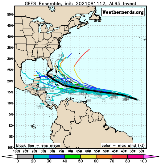
Fred is the only named storm in the Atlantic right, but there’s a tropical wave several hundred miles west-southwest of the Cabo Verde Islands that bears watching. That wave will make its way across the Atlantic over the next several days. It is disorganized at the moment, but conditions should become more favorable for development over the next few days. Some models show to potential for it to become a tropical depression as it nears the Lesser Antilles this weekend. This wave will be monitored closely over the next few days as it continues its trek westward.
The Atlantic isn’t the only active basin at the moment. In the Eastern Pacific, Tropical Storm Kevin is a few hundred miles west-southwest of Baja California, but it is expected to dissipate over open water in the next few days. There is also Tropical Storm Linda, located a few hundred miles off the southwest coast of Mexico. Linda is expected to become a hurricane tonight or Thursday, but will head west-northwestward away from land for the next several days. In the Western Pacific, Tropical Depression 16W is located just west of the International Dateline, but should remain fairly weak as it heads westward over the next few days. It could impact a few islands, such as Enewetak, with squally conditions over the next few days, but in general, it isn’t much of a threat.