We’re only two weeks into Hurricane Season, and the peak of the season is still three months away, but activity is starting to ramp up in the Atlantic.
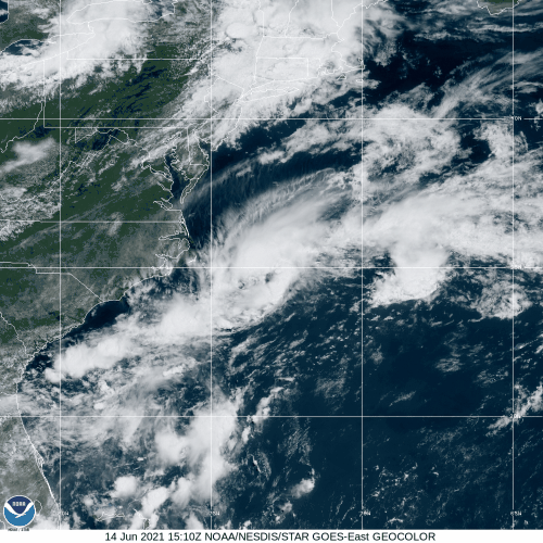
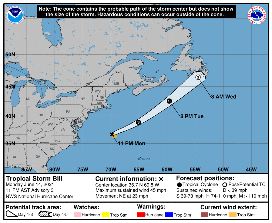
Tropical Depression Two developed off the North Carolina coast on Monday. As of 11pm Monday, it had strengthened into Tropical Storm Bill, and was centered about 335 miles east-northeast of Cape Hatteras, NC, moving toward the northeast at 23 mph. Maximum sustained winds were near 45 mph. The system remains weak, and there is not a lot of thunderstorm activity with it at the moment, but it is moving over the warm waters of the Gulf Stream, so there is a small window for the system to intensify over the next 12-18 hours. After that, it will be moving over colder water, and will weaken before bringing some gusty winds and rainfall to parts of Newfoundland and possibly Nova Scotia later this week.
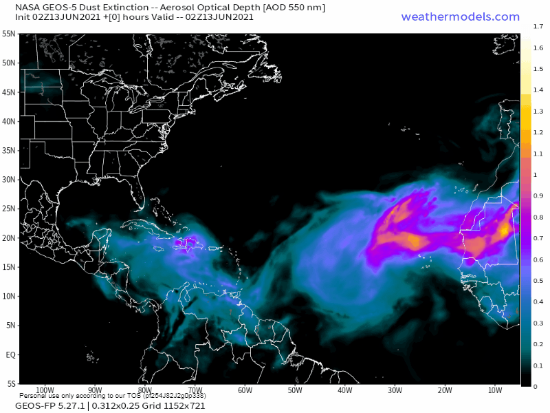
In the eastern Atlantic, a strong tropical wave has moved off the west coast of Africa, passing south of the Cabo Verde Islands tonight. While this system may develop a little over the next day or two, the combination of unfavorable upper-level winds and dry air will limit any development once the system reaches the central Atlantic Ocean. Once we get a little deeper into hurricane season, conditions should become more favorable as more and more waves roll off of Africa and cross the Atlantic. Some of these storms historically have become powerful systems, as they have plenty of time to develop over open water.
In the Bay of Campeche, a cluster of showers and thunderstorms continues to meander around associated with a broad area of low pressure. While this will produce some heavy rain across parts of Mexico and Central America, it is not expected to develop over the next few days. By late in the week, the system will start drifting northward, and conditions will become more favorable for development. It could become a tropical depression by the weekend, then it may head toward Louisiana or Texas.
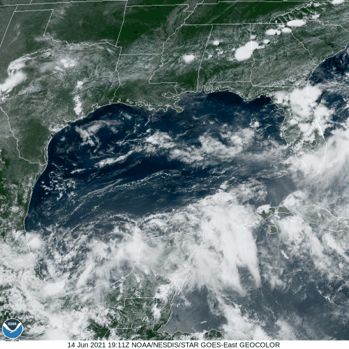
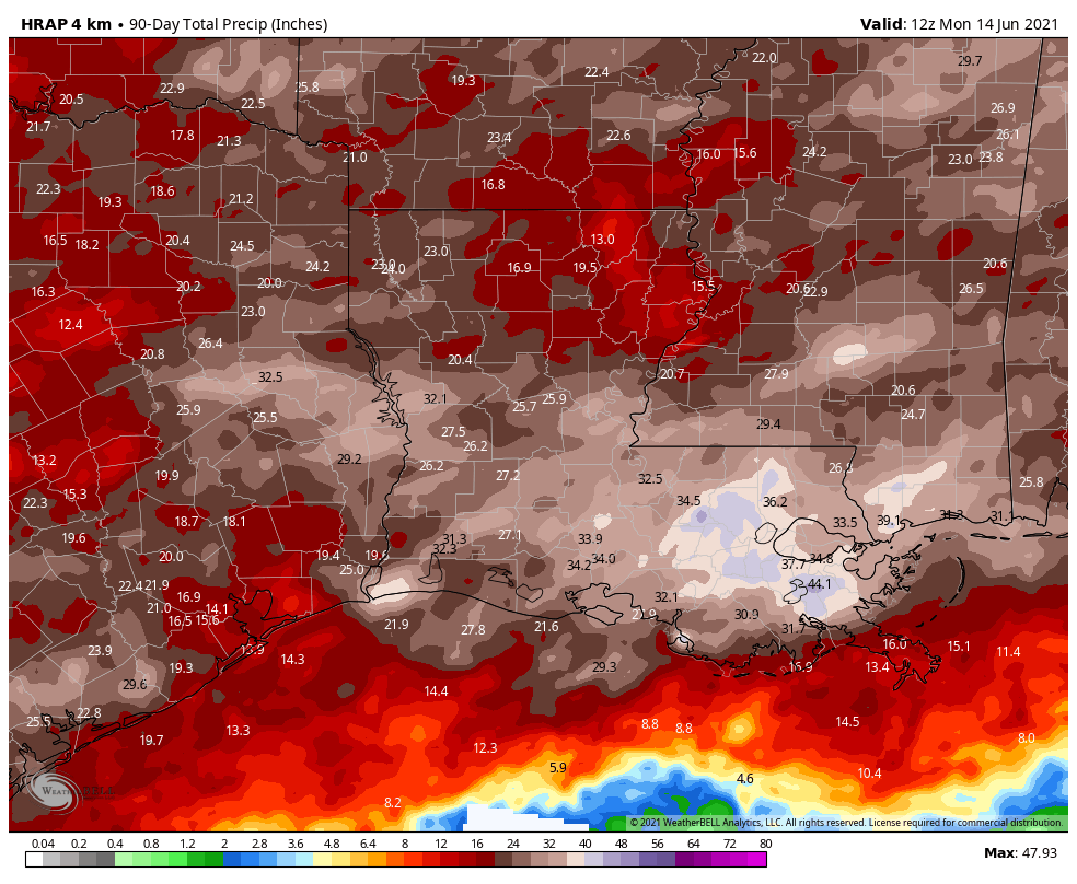
While it’s still a little early to speculate on any potential track or strength for this system, most of the models are in agreement that most of the rain from this system will head towards Louisiana. Much of southern Louisiana and Mississippi has received 30 to 45 inches of rain over the past 90 days, which is more than twice the normal amount they receive in that time frame. This has led to widespread flooding in areas still attempting to recover from several direct hits during the 2020 hurricane season. A tropical system, even a weak one, could drop 10 or more inches of rain on this area, leading to even more flooding.
Elsewhere, the only other active system in the tropics is Tropical Depression Carlos in the Eastern Pacific, but it is expected to dissipate on Tuesday over open water.