As we get into the middle of August, there are now three active systems in the Atlantic and two more in the Pacific, and all but one are a threat to land.
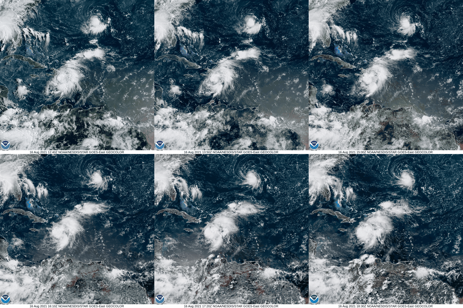
The most immediate threat is Tropical Storm Fred. After sputtering over Cuba this past weekend, Fred emerged into the eastern Gulf of Mexico and has become better organized. As of early Monday afternoon, Fred was centered about 35 miles southwest of Apalachicola, Florida, moving toward the north at 10 mph. Maximum sustained winds have increased to 65 mph. Tropical Storm Warnings and Storm Surge Warnings are in effect for parts of the Florida Gulf Coast. Fred may strengthen a little more before it makes landfall late this afternoon. Once inland, it should rapidly weaken. The main threats from Fred are strong winds, heavy rain, and storm surge, along with the possibility of a few tornadoes.
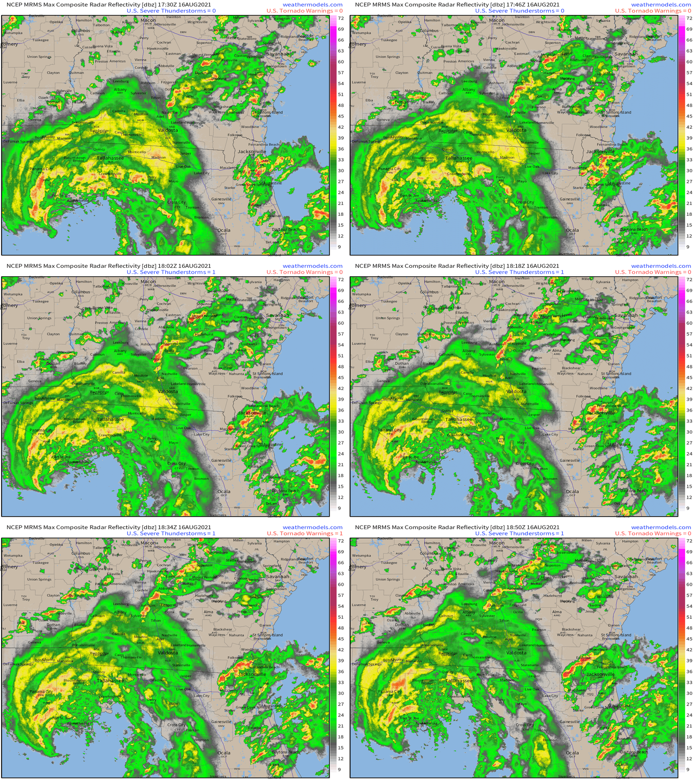
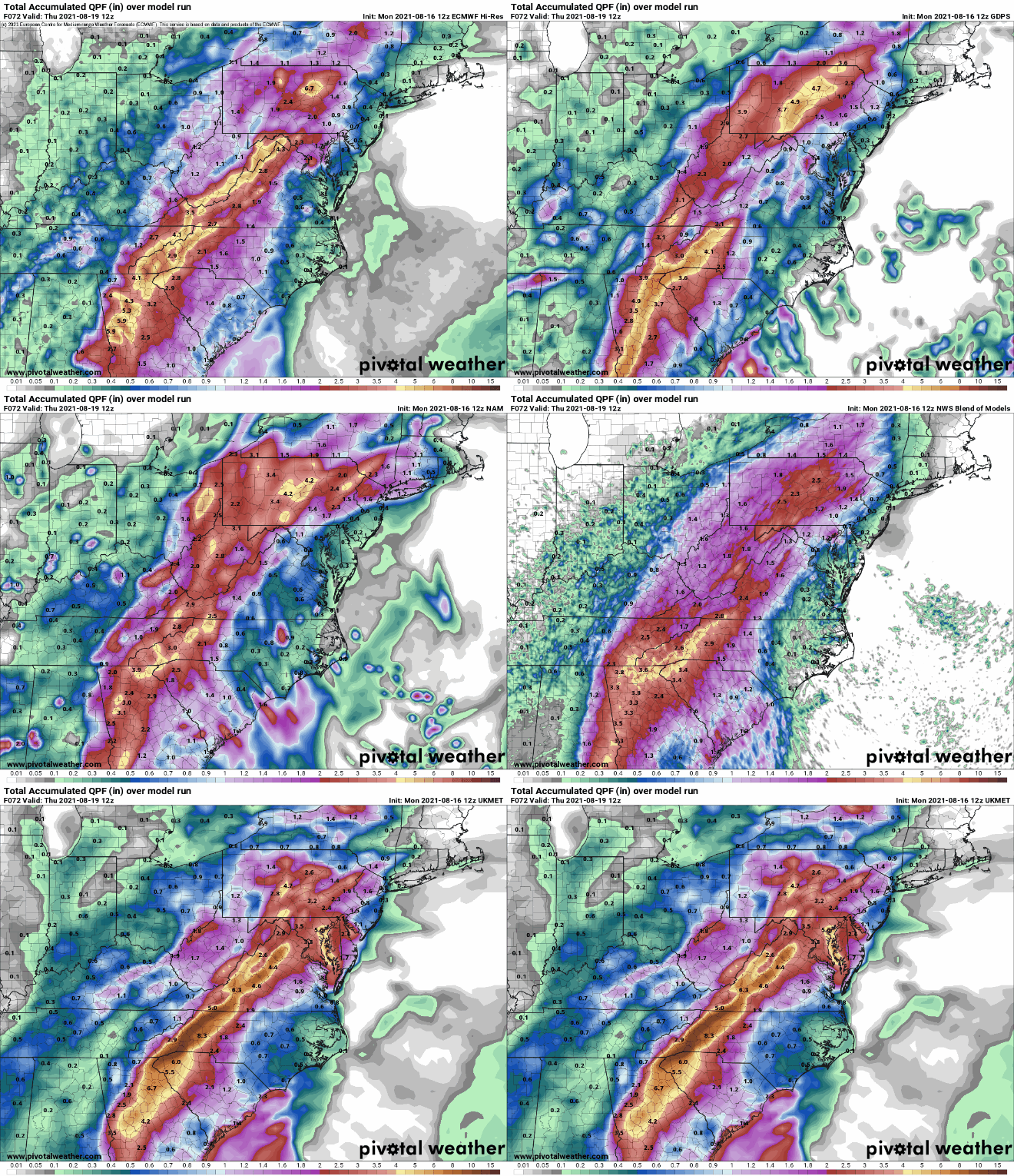
Fred will produce 4-8 inches of rain across parts of Florida and southern Georgia, with some locally heavier amounts. As it moves inland and weakens, the moisture will start to interact with a frontal system, bringing heavy rain to parts of the Southeast, Mid-Atlantic States, and the Appalachians. In these areas, rainfall totals of 3-6 inches and locally heavier will likely lead to flooding over the next few days.
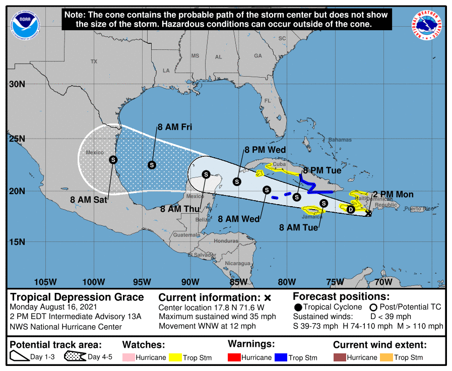
While Fred heads for Florida, Grace may be starting to get its act together near Haiti Grace brought heavy rain to parts of the northeastern Caribbean this weekend, but was very poorly organized. It looks a bit healthier this afternoon as it nears the south coast of Haiti. It was centered about 70 miles southeast of Port-au-Prince, Haiti early Monday afternoon, moving toward the west-northwest at 12 mph. It is still a tropical depression with maximum sustained winds near 35 mph. A Tropical Storm Warning is in effect for parts of southern Cuba and the Cayman Islands, while Tropical Storm Watches are in effect for Haiti, Jamaica, and parts of southern Cuba.
Grace is expected to continue on a general west to west-northwest course for the next few days. As it pulls away from Haiti late tonight, it should move over the warm waters of the northwestern Caribbean south of Cuba, and gradual strengthening is expected. The current forecast calls for it to be a strong tropical storm as it approaches the northern Yucatan Peninsula by the middle of the week. Beyond that, a track into the Gulf of Mexico seems likely at this point.
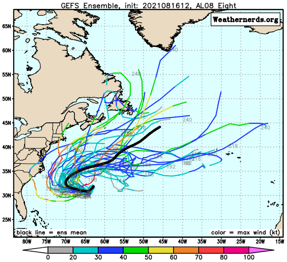
Out in the central Atlantic, Tropical Depression Eight developed late Sunday night. As of early Monday afternoon, it was centered about 140 miles southeast of Bermuda, moving toward the south at 9 mph. Max sustained winds were near 35 mph. A Tropical Storm Watch is in effect for Bermuda. The system is expected to become a tropical storm later today or tonight as it turns westward and rides around a ridge of high pressure. Eventually, it will turn back to the north and northeast and head out into the open Atlantic. There is a slight chance that it could impact the East Coast, depending on how quickly it makes the turn. It should bring some rough seas to the coastal waters from the Carolinas to New England later this week.
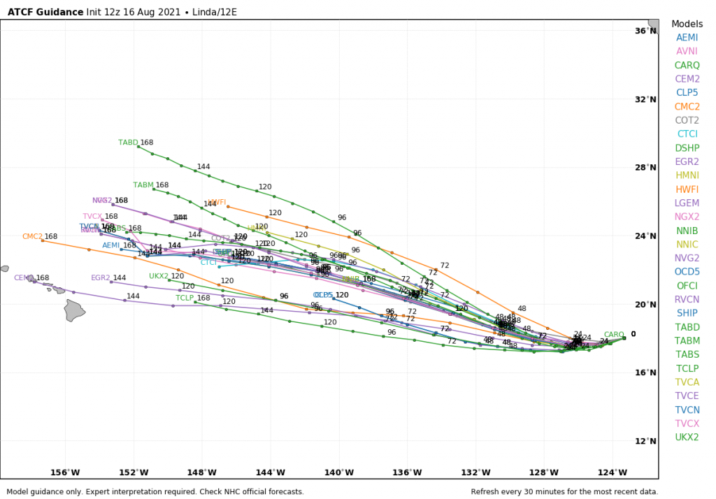
In the Eastern Pacific, Hurricane Linda still has maximum sustained winds near 105 mph at midday. It was centered about 955 miles west-southwest of Cabo San Lucas, Mexico, and moving toward the west-southwest at 9 mph. Linda reached Category 4 strength over the weekend, but now is gradually weakening over open water. It should continue on a general west to west-northwest track this week while slowly weakening. It should pass well north and east of Hawaii late this week as a weakening extratropical system, with little impact other than some rough surf.
In the Western Pacific Ocean, Tropical Depression 16W remains fairly weak. It only has maximum sustained winds near 25 mph, and is centered about 180 miles east of Guam, moving toward the west at 18 mph. It will bring heavy rain and some gusty winds to the Northern Mariana Islands over the next 24 hours as it passes very close to Guam.
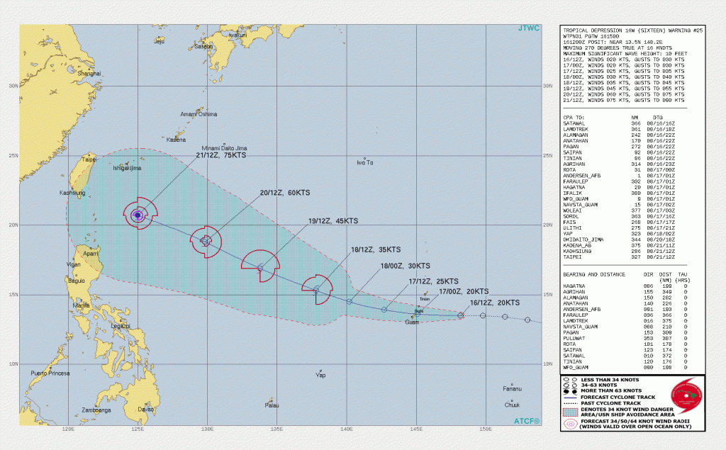
The system may start to strengthen once it gets past the Northern Marianas and turns a bit more toward the northwest. Some forecasts call for it to become a tropical storm, and possibly a typhoon by the end of the week. Where it will go is highly uncertain at this point. While the official forecast from the Joint Typhoon Warning Center has it heading towards Taiwan, various models have it continuing westward to the Philippines, continuing west-northwestward toward Taiwan and/or eastern China, or turning northward and heading toward Japan. It will have to be watched closely later this week.