A rather active week is expected, especially across the eastern two-thirds of the nation.
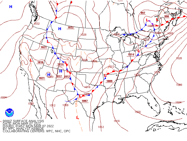
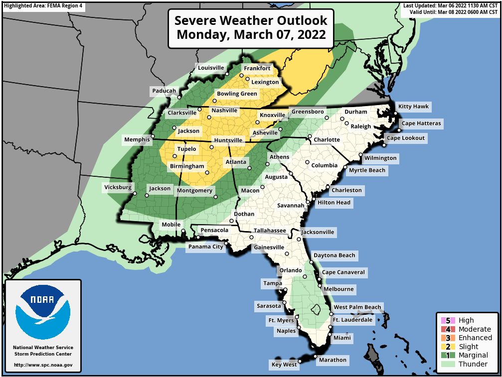
Low pressure will move across the Ohio Valley and into the Northeast today, providing a variety of weather for the eastern half of the nation. The most impactful weather will be strong to severe thunderstorms, especially from the Deep South across the Tennessee Valley and into the Appalachians. Some of the storms may produce damaging winds, heavy downpours, and possibly tornadoes. In addition to the severe weather, heavy rain is expected across the Ohio Valley. Widespread rainfall totals of 1-2 inches and locally heavier are expected, resulting in Flood Watches being issued for much of the region.
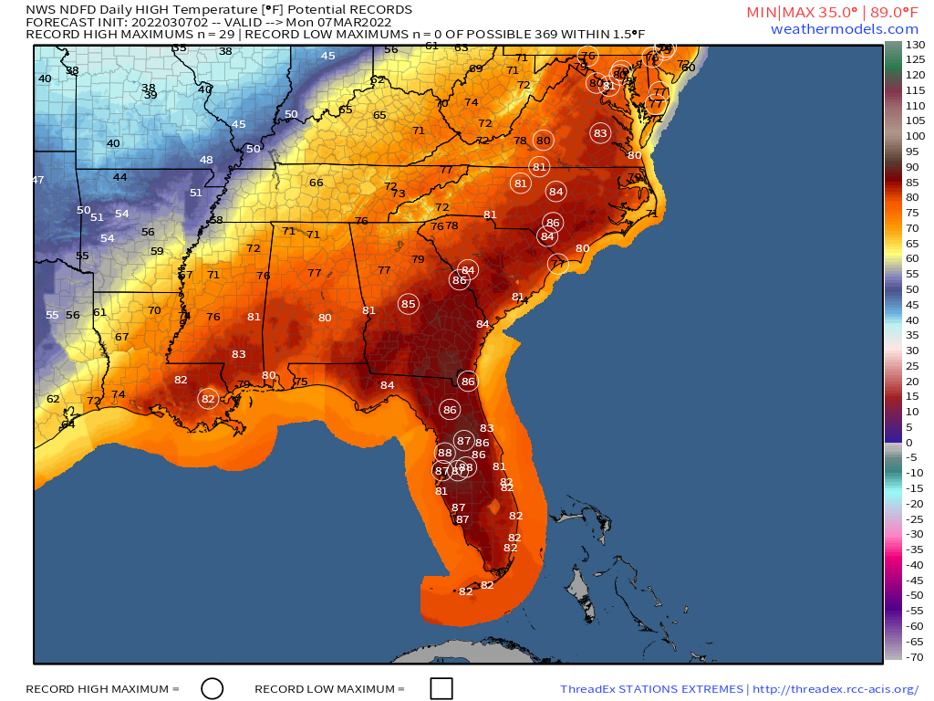
Ahead of the storm, unseasonably warm weather will remain in place today from the Gulf Coast into the Mid-Atlantic states and parts of the Northeast. High temperatures should reach 80 or higher from Washington, D.C. southward, with 70s into the Mid-Atlantic states. Dozens of record highs are expected to be set once again.
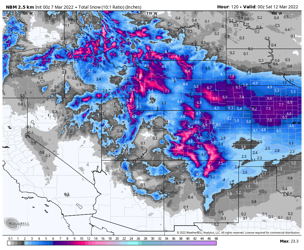
Later this week, another low pressure system is expected to develop across the West. It will bring a snowstorm to parts of the Rocky Mountains and into the Plains states. Snowfall totals of 4-8 inches will be widespread, with many locations, especially at the higher elevations, possibly seeing more than a foot. Snowfall has been below normal across the region this year, and parts of the region rely on the snowmelt for water in the spring/summer, so any snow that falls now is welcome.
Once it moves away from the Rockies, that system could become a rather potent storm system as it heads eastward. Ahead of the system, heavy rain and possibly more severe weather may impact parts of the Gulf Coast, Deep South, and Southeast towards the end of the week and into the weekend, with heavy snow possible north and west of the system from the Plains states into the Great Lakes and parts of the Northeast. There are some indications that it could become rather strong as it moves into the Northeast, with the potential for strong winds across much of the East Coast. This will be something to keep an eye on later this week.