A developing storm system will impact much of the nation over the next few days with a variety of weather.
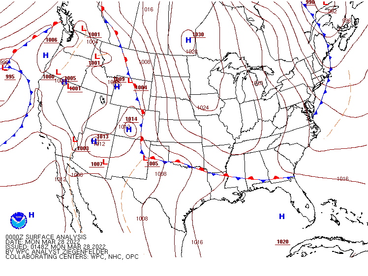
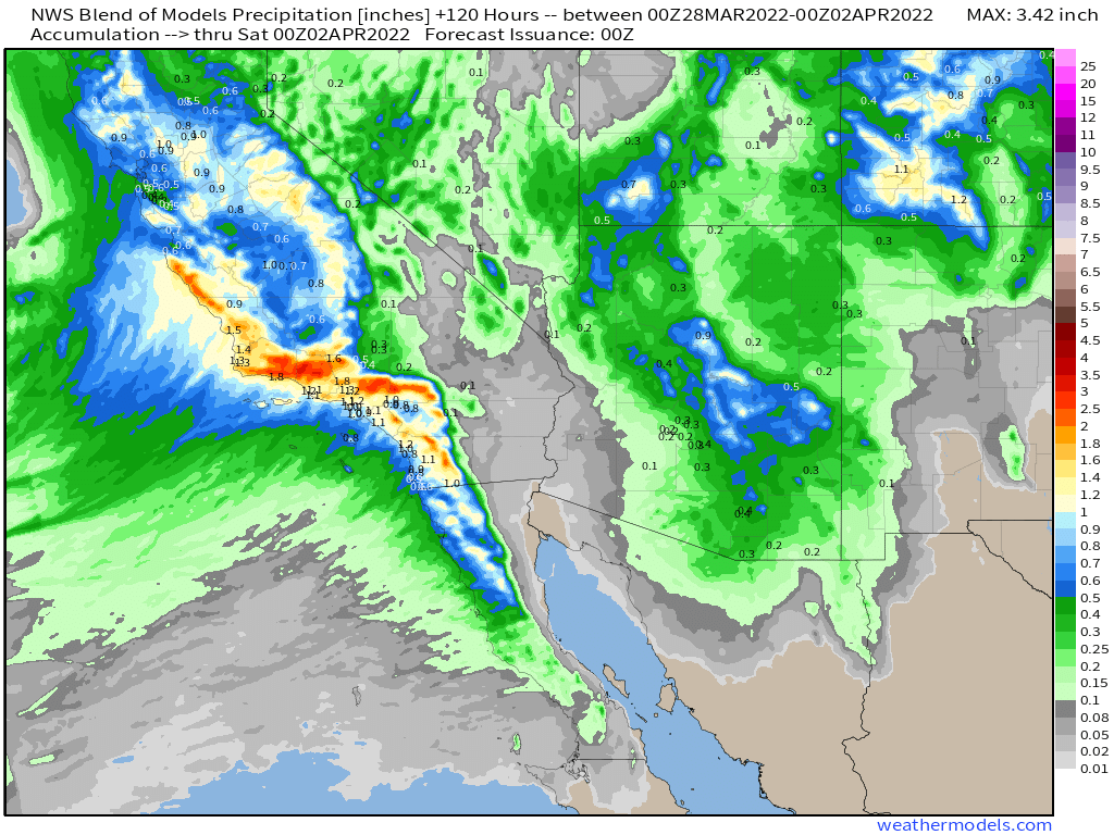
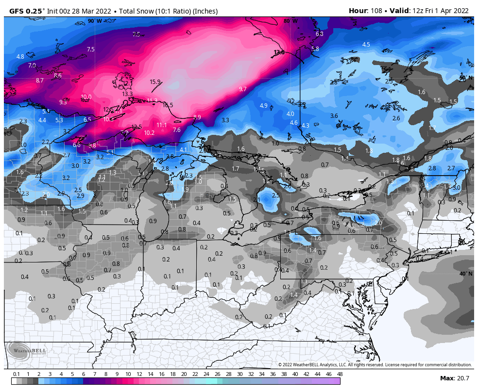
Low pressure will move into the West Coast today, bringing some much needed heavy rain and mountain snow to California today, spreading into the Southwest and Great Basin tonight, and then the Rocky Mountains on Tuesday. Rainfall totals of up to an inch will be common, with 1-2 inches or more likely near the coast of central and southern California. Snowfall totals of 1-2 feet are expected in the Sierra Nevada and the mountains of southern California. Across the higher elevations of the Intermountain West and the Rockies. many locations will receive 6-12 inches of fresh snow.
As the storm moves into the Plains states on Tuesday, it will begin to strengthen, drawing warm and humid air northward from the Gulf of Mexico. This will help to trigger strong to severe thunderstorms on Tuesday from the Central Plains into Texas. Some of the storms may produce large hail, damaging winds, and possibly some tornadoes. As the system heads toward the Great Lakes on Wednesday, the threat for severe weather will shift into the Mississippi and Tennessee Valleys, eventually reaching the Mid-Atlantic states and the Carolinas on Thursday as the storm drags a strong cold front toward the East Coast.

In addition to the severe weather, heavy rain is likely from the Gulf Coast to the Great Lakes ahead of the storm, with many locations seeing 1-2 inches of rain, possibly producing some flooding in some areas. To the north of the system, some heavy snow is expected in parts of the Upper Midwest. Parts of Minnesota, Wisconsin, and the Upper Peninsula of Michigan may be digging out from 6-12 inches of snow by Friday morning.
Before the storm reaches the East Coast, a rather chilly airmass will be in place across the Northeast to start the week. Temperatures will be 15-25 degrees below normal today, with high temperatures only in the 20s and 30s north of the Mason-Dixon line. Record low high temperatures are possible in dozens locations today. Temperatures will drop into the teens and 20s tonight, with record lows possible Tuesday morning in many spots. Temperatures will start to moderate a bit on Tuesday as high pressure moves offshore. Even milder air will move in for Wednesday and Thursday as a warm front extending from the previously mentioned storm system moves across the region. By Thursday afternoon, much of the region east of the Appalachians will have temperatures that are 5-15 degrees above normal for the first day of April. A few record highs are possible, especially in the Southeast and Florida, where temperatures should be well into the 80s or even lower 90s.