Astronomical spring begins next Sunday at 11:33am, and right on cue, severe weather season will start to ramp up across the southern tier of states.
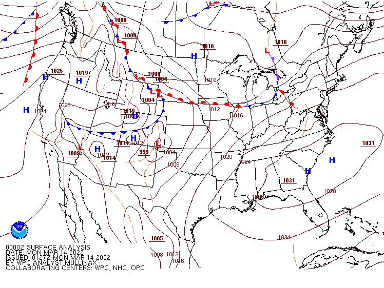
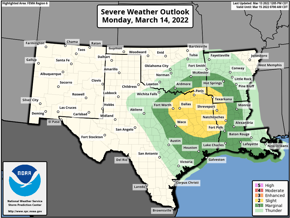
A low pressure system will move into the southern Plains and Texas on Monday, drawing warm and humid air northward from the Gulf of Mexico. This will help fuel some strong to severe thunderstorms during the afternoon and at night across portions of eastern Texas and into the Lower Mississippi Valley. Some of the stronger storms may produce large hail and damaging winds, with a few tornadoes possible, especially in parts of northeastern Texas. As the storm moves eastward. the severe weather threat will shift with it, spread into parts of the Gulf Coast and northern Florida on Tuesday, where damaging winds will be the main threat.
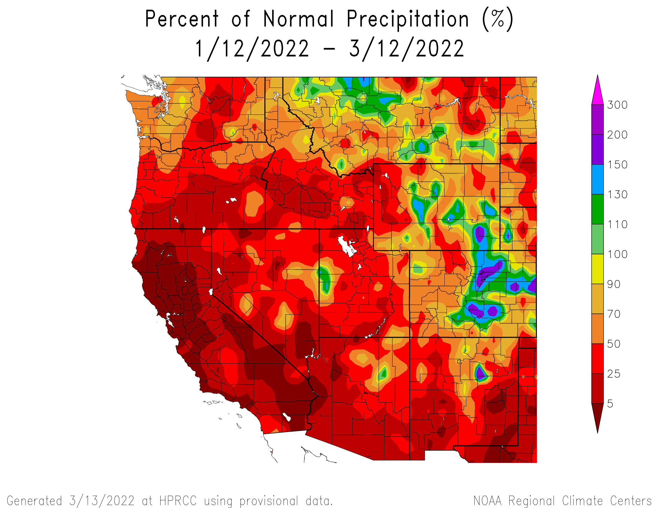
Out West, some much-needed rainfall will return later this week. After a very wet end to 2021, much drier weather has settled into the West Coast for the first 10 weeks of 2022, during what is normally the rainy season. A series of storms systems will move in this week, bringing some rain and mountain snow to parts of Washington, Oregon, and at least northern portions of California, as well as parts of Idaho and western Montana. Over the next seven days, many locations could receive 1-2 inches of rain, with significantly heavier amounts possible west of the Cascades and along the coast. Significant snow is possible in the mountains, especially the Cascades. None of these systems are expected to produce exceptionally strong winds, except perhaps right at the coastline.
The other area we’re keeping an eye on stretches from the Northern Plains into the Northeast. Temperatures will be quite mild for much of the upcoming week. Temperatures will be 10 to 20 degrees above normal across much of the region through at least Thursday in the Plains, and Friday across the Great Lakes and Northeast. A few record highs are possible, especially toward the end of the week across the Northeast.