The first snowstorm of the season is expected across the Mid-Atlantic States and stormy weather will continue across the Northwest this week.
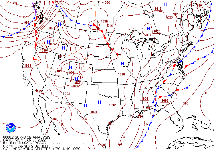
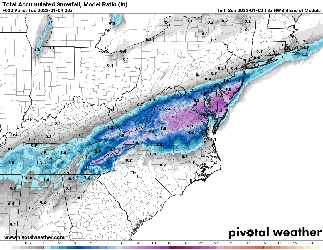
A strong cold front crossed the Northeast and Mid-Atlantic on Sunday, bringing an end to the mild weather the region had been experiencing. An area of low pressure will ride along the front today, bringing the first measurable snow of the season to parts of the Mid-Atlantic states, with some moderate to heavy snow in parts of the region. Snow will have a significant impact on the morning commute for Washington and Baltimore, and possibly Philadelphia and Richmond as well. The system will be moving along quickly, with snow ending during the afternoon, but a general 5-10 inches is expected from the central Appalachians to the Mid-Atlantic coast, with some heavier amounts possible. The system will also produce some heavy rain from the Tidewater of Virginia into the Carolinas, with a few strong thunderstorms possible as well.
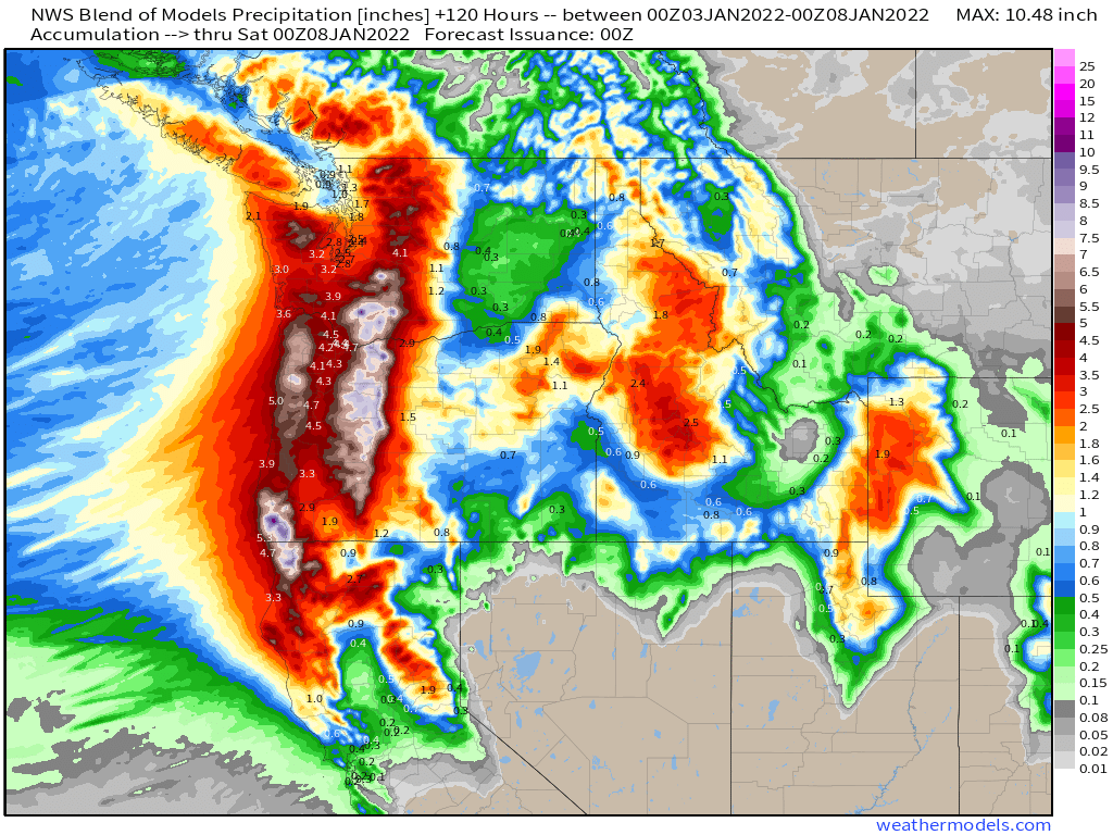
Out West, a stormy pattern will bring a series of low pressure areas into the West Coast over the next several days. Heavy rain is likely along the coast of Washington and Oregon, with rain also spreading southward into northern and perhaps central California. Rainfall totals of 1 to 4 inches and heavier will likely lead to flooding in some areas. Inland, heavy snow is likely across the higher elevations of the Cascades with several feet of snow likely. Snow will also spread into the Sierra Nevada, but the bulk of the snow will stay to the north.
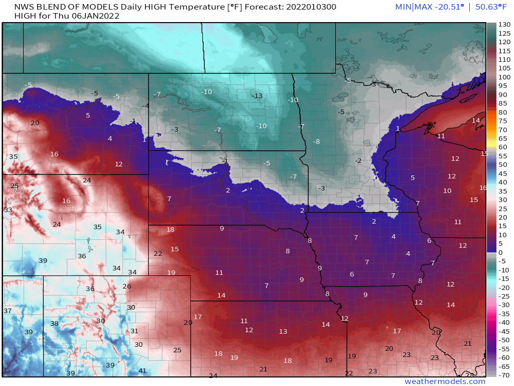
In between, a storm system will bring some snow into parts of the Northern Plains on Tuesday. Amounts shouldn’t be exceptionally heavy, but behind the system, another surge of arctic air is expected across parts of the Northern and Central Plains and the Upper Midwest. While temperatures won’t be anywhere near as cold as they have been over the past several days, temperatures will be 20 to 40 degrees below normal, with many locations likely staying below zero, even during the daytime, during Wednesday and Thursday.
The other item we’ll be watching this week is the potential for another snowstorm in parts of the Mid-Atlantic states and the Northeast toward the end of the week. There is considerable disagreement among the forecast models in regards to the evolution of this system and what impacts, if any, it will have of the region, but it has the potential to bring snow to the I-95 corridor from Washington to Boston Thursday into Friday.