The storm system that has impacted much of the nation from the Plains states to the Southeast over the past few days will move into the Northeast today.
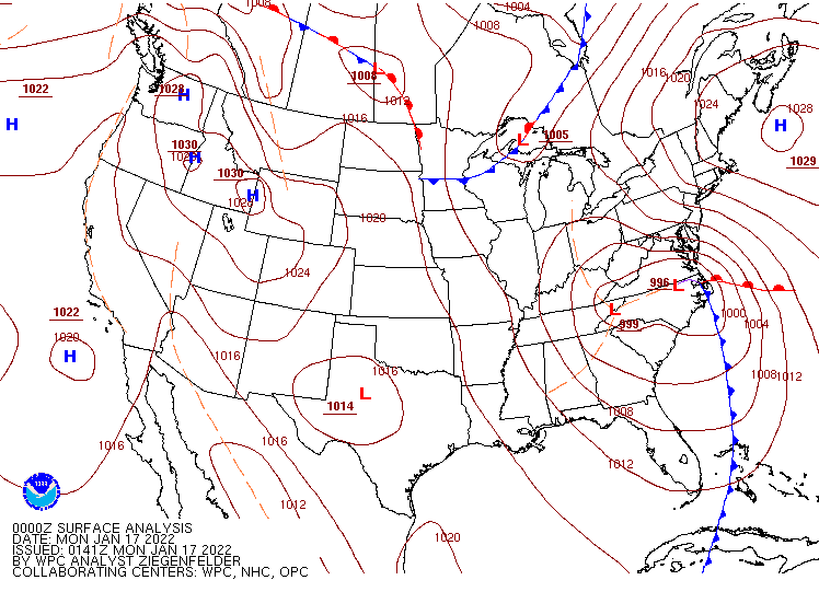
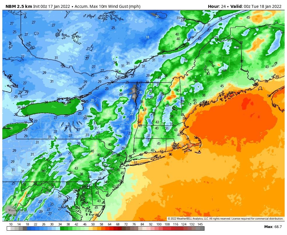
Low pressure will move up the Appalachians today and across New England, bringing some heavy rain and strong winds to the I-95 corridor from Philadelphia City to Boston, with heavy snow from the eastern Great Lakes into parts of northern New England. Rainfall totals of 1-2 inches are expected from the Mid-Atlantic states into southern New England this morning and early afternoon. The rain will be accompanied by strong winds. Sustained winds of 20-30 mph are likely across a large swath of the region, with gusts of 50-60 mph expected, especially near the shoreline. With tides at astronomical highs, the onshore winds will help to produce some minor to perhaps moderate coastal flooding, especially from Long Island into eastern New England.
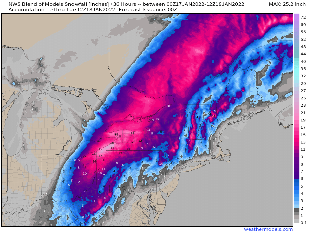
North and west of the track of the low pressure system, heavy snow is likely, especially across the eastern Great Lakes. Snowfall totals of 12-18 inches and locally heavier are expected from northeastern Ohio into northwestern Pennsylvania and western New York. This includes the Cleveland and Buffalo metro areas. Farther east, snow is likely across interior parts of New England, with some places picking up 4-8 inches of snow before a change to sleet, freezing rain and possibly plain rain occurs.
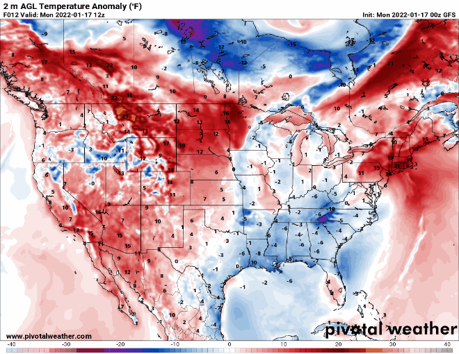
Much of the remainder of the country will remain quiet this week, though another surge of arctic air will impact a large swath of the nation during the latter half of the week. The arctic air will drop into the Northern Plains by Wednesday, where temperatures will be 20 to 40 degrees below normal. As it spreads across the remainder of the eastern half of the nation for Thursday and Friday it will modify a bit, but temperatures will still be 15 to 25 degrees below normal across a wide area.