A much more tranquil weather pattern is expected across the nation over the next several days.
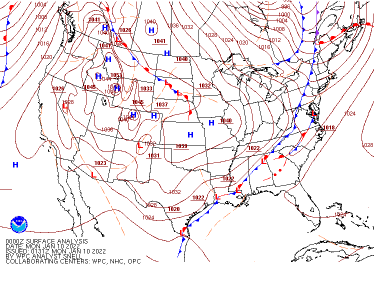
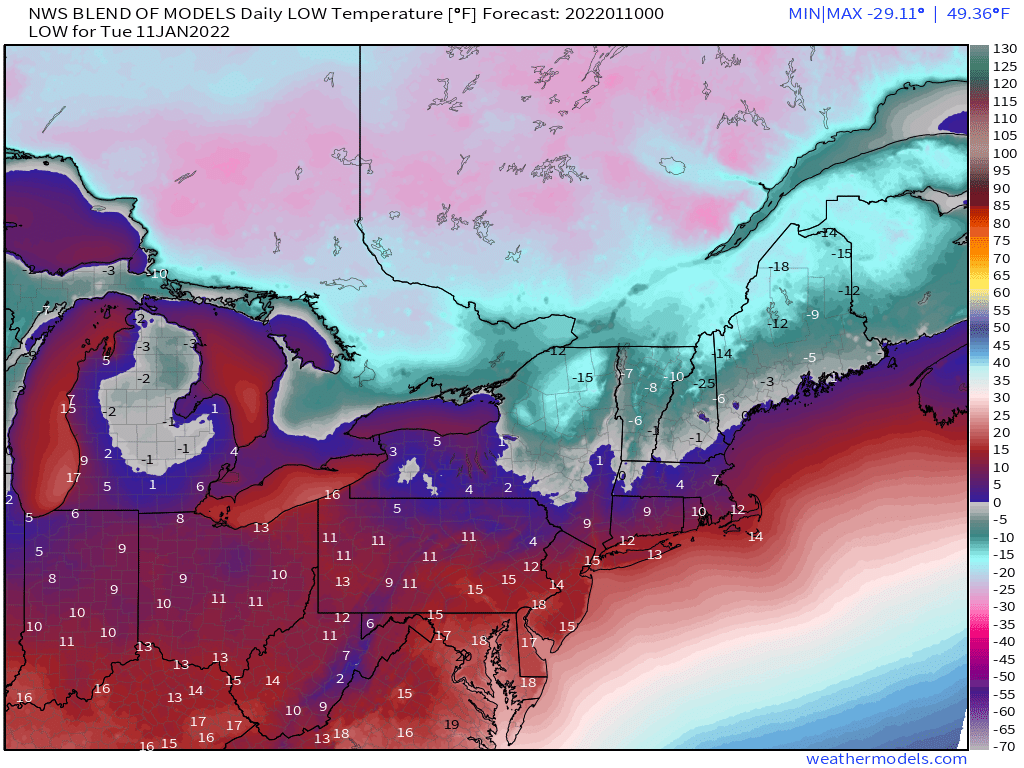
Arctic air will move out of the Northern Plains and into the Great Lakes today, then into the Northeast on Tuesday. Temperatures will be 20 to 30 degrees below normal, with a few record low temperatures possible. Subzero low temperatures are likely in much of the Upper Midwest this morning, and across northern parts of New York and New England both Tuesday and Wednesday mornings. High temperatures across the Northeast on Tuesday will only be in the single numbers in places such as Albany, NY and Worcester, MA, with teens likely closer to the coast including Boston and New York City. Temperatures should quickly moderate on Wednesday as high pressure slides offshore.
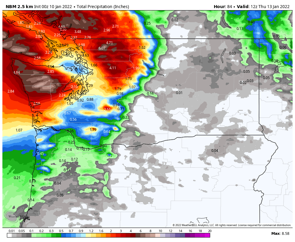
A low pressure system will move into the Pacific Northwest for Tuesday into Wednesday. Heavy rain is likely in parts of British Columbia, Washington, and northwestern Oregon. Rainfall totals of 3 to 5 inches are expected with some heavier totals possible. This will likely lead to flooding in parts of the region. Across the higher elevations of the Cascades, snowfall totals of 1-3 feet are possible.
There is one other item we’re keeping an eye on this week. Many of the forecast models are showing the potential for a powerful storm to develop off the East Coast late in the week or next weekend. While the models have not performed all that well beyond 2 or 3 days, the fact that they are all showing something similar increases confidence a little. However, they don’t agree on the rest of the details, including, where the system will develop, how far offshore it will be (if at all), where it will track, how strong it will be, and what, if any, impacts it will have on land areas. We’ll monitor this as the week goes on.