A rather active week is expected across the nation, with heavy rain and snow in the West and the Rockies, record heat and potentially severe weather in the South, and heavy snow and bitterly cold temperatures for the Northern Plains.
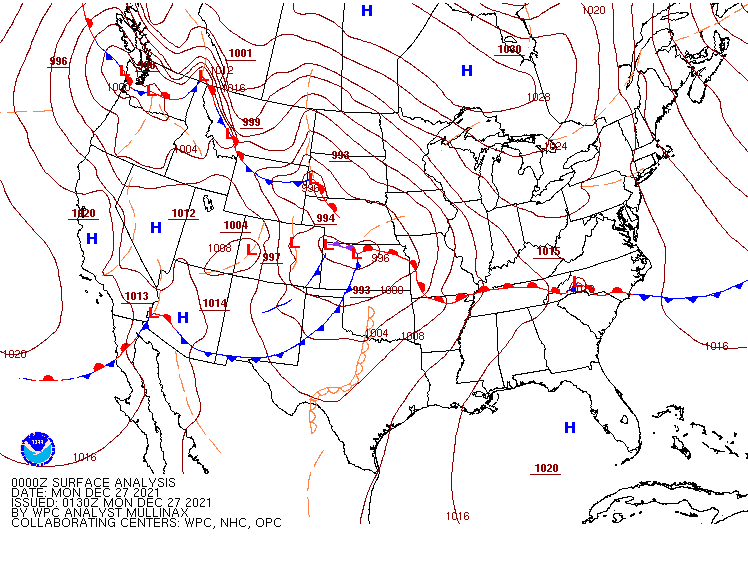
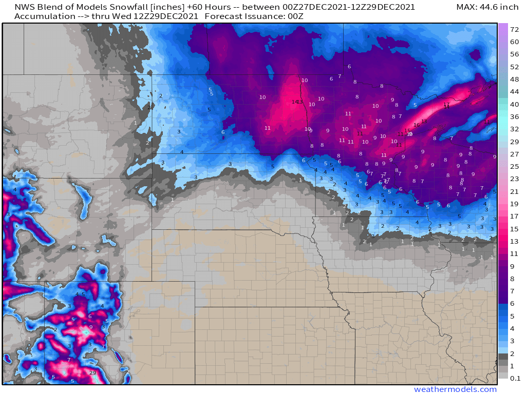
Low pressure will move across the Northern Plains and into southern Canada today, with heavy snow across the Dakotas and into Minnesota as well as parts of Manitoba and Ontario. Winter Storm Warnings are in effect on the US side of the border, with Snowfall Warnings on the Canadian side. Snowfall won’t be exceptionally heavy, but many locations will pick up 6-12 inches. gusts of 35-45 mph are possible, which may result in near-blizzard conditions at times. Snow should wind down tonight, but another system passing south of the region on Tuesday may bring more snow into the region.
Later in the week, bitterly cold air will drop southward from Canada into parts of the Northern Plains and Northern Rockies, as well as the interior Northwest. Temperatures will be 15 to 25 degrees below normal across the interior Northwest, and as much as 20 to 40 degrees below normal in parts of Montana, the Dakotas, and northern Minnesota. Daytime highs will likely stay below zero for several days near the Canadian border, with low temperatures as low as 20 to 30 degrees below zero in parts of Montana and North Dakota.
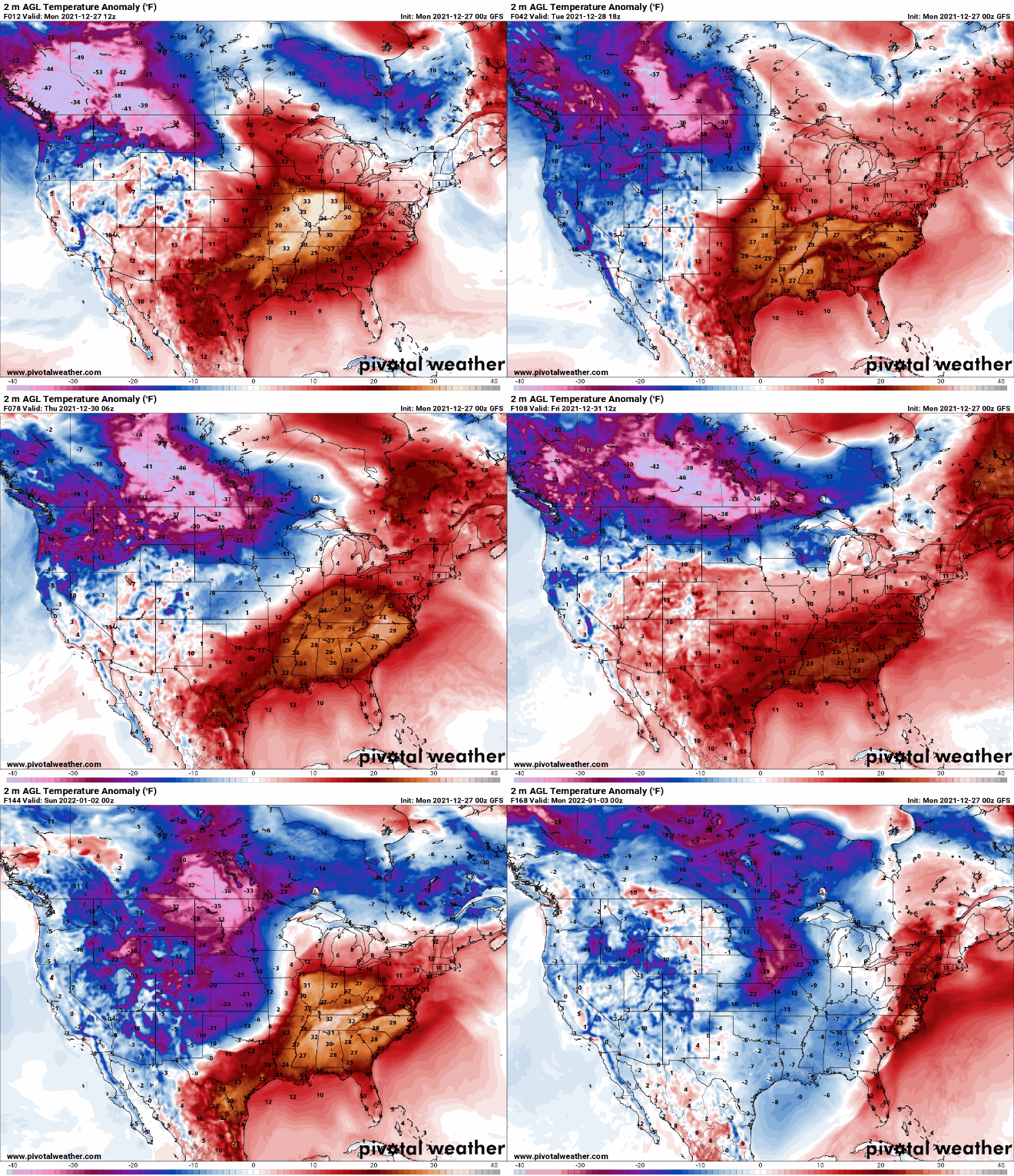
While bitterly cold air settles into the North, unseasonably warm weather is expected across the South. High temperatures will reach the 70s and 80s from Texas to the Southeast over the next several days, which is 20 to 30 degrees above normal. Dozens of record highs are likely to be set across the region.
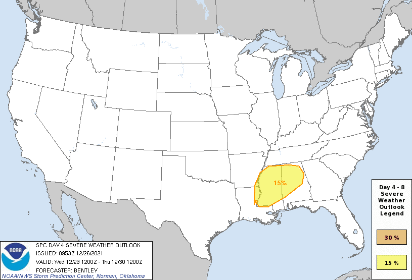
Low pressure will move into the Mississippi Valley by mid-week. With a warm, humid airmass in place, showers and thunderstorms are likely ahead of the system. Conditions could be ripe for some severe weather Wednesday into early Thursday, especially in parts of Louisiana, Alabama, and Mississippi.
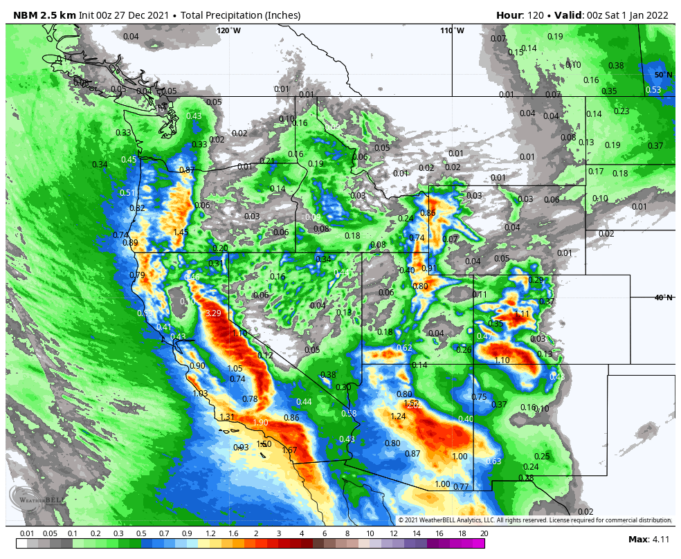
Meanwhile, out West, heavy rain and snow will continue across the region. With colder air in place, snow was observed right to the coastline in parts of Washington and Oregon on Sunday. The Seattle metropolitan area received 3-6 inches of snow, with 1-2 inches in the Portland area. As the low pressure area that produced the snow moves inland, more snow is likely, especially in the Cascades and Sierra Nevada, with rain into the lower elevations of California. Another system will follow right behind, with more heavy rain and mountain snow for the West Coast later this week. Rainfall totals of 1-3 inches and locally heavier will result in flooding in some areas, especially Southern California. Across the Sierra Nevada, snowfall totals of 3 to 6 feet are possible.
Right now, First Night festivities in New York City shouldn’t have any weather problems. In fact, it looks rather nice for revelers heading to Times Square to watch the ball drop. Right now, it looks like skies will be partly cloudy with temperatures around 40 degrees at midnight Friday night.