As we approach Christmas, a stormy pattern will continue across the West while another warmup is expected in the Plains.
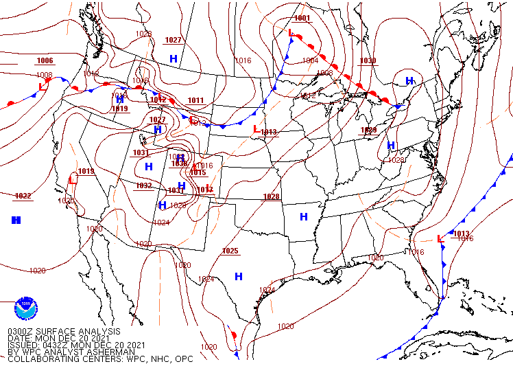
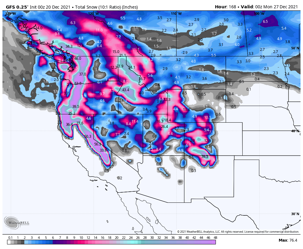
Rain and mountain snow will continue from the Northwest into the Northern Rockies today as low pressure moves across the region, but drier weather should settle in for Tuesday. After that, a series of low pressure areas will bring heavy rain and mountain snow to much of the West from Wednesday into the weekend. Rainfall totals of 2-4 inches and locally heavier are likely from British Columbia southward to southern California, which will likely lead to flooding in some areas by late in the week. The bigger story will be the snow in the mountains. The snowpack in the Sierra and Cascades is still below normal, but that is likely to change later this week. The potential exists for some places to receive as much as 5 to 10 FEET of snow over the next 7 days. This will result in travel problems crossing the mountains. By the end of the week, as colder air settles into the Northwest, snow is possible at the lower elevations, including the Seattle and Portland metropolitan areas.
The other thing we’re watching is the return of warm weather to the Southern Plains and parts of the South and East later this week. By the middle of the week, temperatures will be 15 to 30 degrees above normal across the central and southern Plains. That warm will spread eastward, but will be modified a bit as it does so, with well above normal temperatures moving toward the East by the end of the week. A few records are possible across parts of the region. Another burst of warm air may move back into the Southern Plains and Texas next weekend.
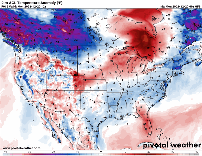
Meanwhile, bitterly cold air will build across western Canada this week. Temperatures could be as much as 25 to 50 degrees below normal in many areas later this week. Daytime highs of -30 to -40C are possible in parts of the Yukon, Northwest Territories and northern British Columbia. Some of that arctic air may spill southward into parts of Montana and the Dakotas for Christmas weekend.