After a quiet start to the hurricane season, things have gotten active across the Atlantic and also in the Pacific.
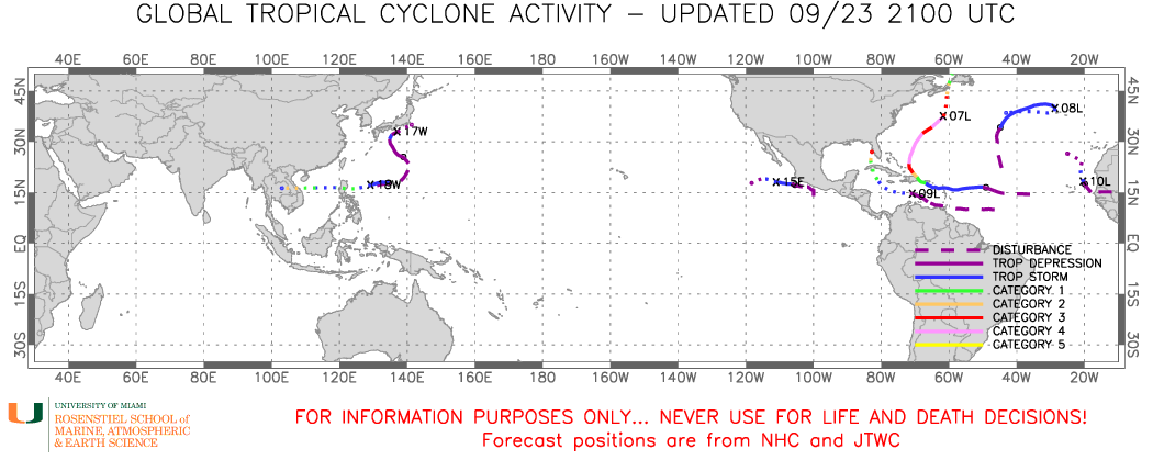
The tropics are very active right now. Image provided by Brian McNoldy, University of Miami, Rosenstiel School.
We’ll start off with Hurricane Fiona, as it is the strongest one of the four and also the biggest threat. As of 5pm EDT, Fiona was centered about 370 miles south-southeast of Halifax, Nova Scotia, moving toward the north-northeast at 40 mph. Maximum sustained winds were near 125 mph, making Fiona a high-end Category 3 storm. Hurricane Warnings and Tropical Storm Warnings are in effect for much of Atlantic Canada. An upper-level trough across the eastern US will pull Fiona a bit more toward the north later today and tonight. Fiona is expected to steadily weaken and become extratropical as it moves over cooler waters, but this is both good and bad. It’s good because it will be a weaker storm, but it’s bad because the extratropical transition means that the wind field will spread out, bringing stronger winds to a much larger area. Fiona is expected to make landfall in eastern Nova Scotia early Saturday as an extratropical system with the equivalent strength of a Category 2 hurricane. While Atlantic Canada is no stranger to powerful extratropical storms from the Fall into the Spring, this one will be much stronger than most of those storms. Widespread wind damage is likely as well as storm surge flooding near the coastline. Freshwater flooding won’t be as much of a concern as the system will be moving too quickly to drop excessive rain in many locations. Across parts of Labrador and eastern Quebec, cold air on the backside of the storm will allow the rain to change to snow, with several inches of accumulation possible in spots.
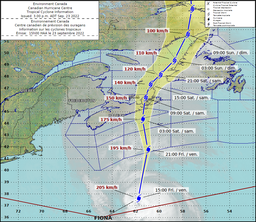
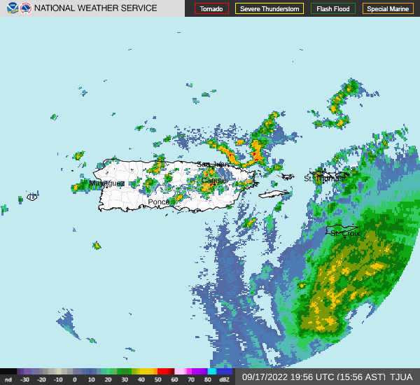
Fiona has already left a trail of destruction in its wake, and will almost certainly have its name retired after the season ends. It crossed the Lesser Antilles a week ago, producing some wind damage and flooding across Guadeloupe and nearby islands. Heavy rain and strong winds buffeted the Virgin Islands next, especially across St. Croix, but Puerto Rico and the eastern Dominican Republic were the beneficiaries of Fiona’s full fury. Torrential rainfall led to widespread severe flooding, and wind gusts in excess of 115 mph resulted in widespread damage across the region. At one point, the entire island of Puerto Rico was without power. Many locations in this region are still trying to recover from Hurricane Maria back in 2017. After leaving the Great Antilles, Fiona brought strong winds and heavy rain to parts of the Turks and Caicos Islands and the nearby southeastern Bahamas. Finally, Fiona passed just west of Bermuda late last night and early this morning. Although the core of the storm missed the island, there were still reports of wind gusts to 100 mph. Large swells from Fiona have been impacting the Eastern US for the past few days and will gradually subside through the weekend.
Next up is Tropical Storm Gaston. As of 5pm EDT, Gaston was centered about 70 miles north of Faial Island in the Central Azores, moving toward the south at 9 mph. Maximum sustained winds were near 60 mph. Tropical Storm Warnings are in effect of the islands of the Western and Central Azores. Gaston is expected to turn more toward the southwest, then west over the next day or two. This will bring the center of Gaston closer to or across parts of the Azores. Gusty winds and heavy rain that could produce flooding and mudslides are expected. Steady weakening is expected, and Gaston will likely become extratropical by Sunday.
Tropical Storm Hermine just formed late this afternoon in the eastern Atlantic Ocean. As of 5pm EDT, Hermine was centered about 290 miles northeast of the Cabo Verde Islands, moving toward the north-northwest at 10 mph. Maximum sustained winds were near 40 mph. Hermine’s forecast calls for a little strengthening tonight, then it’ll weaken as it moves back over cooler water, and it will likely dissipate before the weekend is over. However, it will bring some heavy rain to parts of the Canary Islands over the weekend, with rainfall totals of 2-4 inches and locally heavier possibly resulting in flooding in some spots.
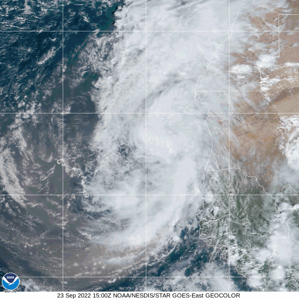
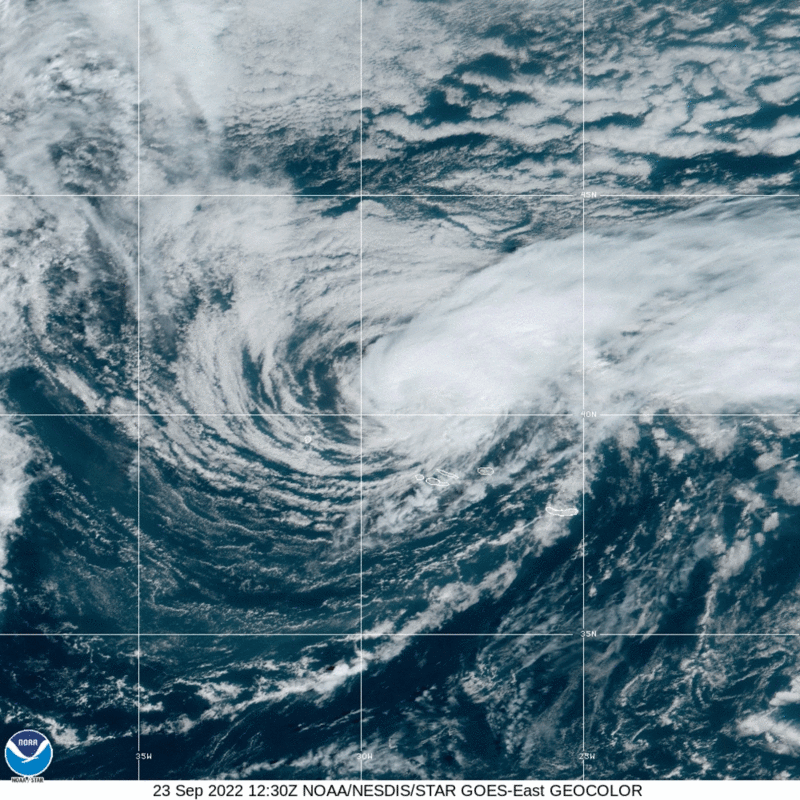
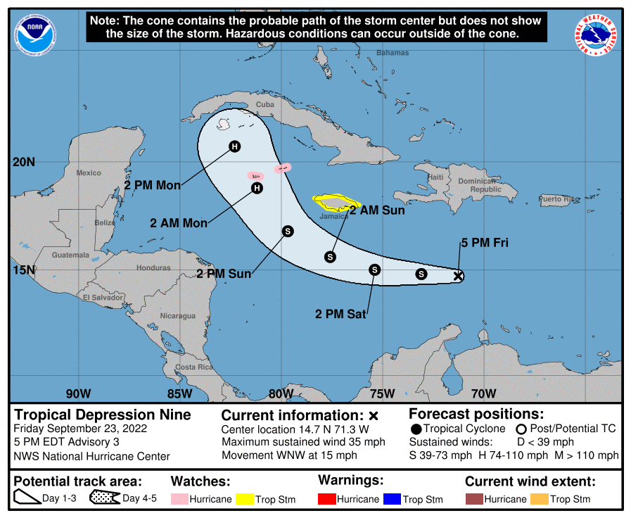
The last storm in the Atlantic. As of 5pm EDT, TD9 was centered about 430 miles east-southeast of Kingston, Jamaica, moving toward the west-northwest at 15 mph. Maximum sustained winds were near 35 mph. The short-term forecast for the depression is fairly simple. It should head more toward the west tonight and Saturday while steadily strengthening. Once it reaches Tropical Storm strength it will be named Ian. A Tropical Storm Watch has been issued for Jamaica, and a Hurricane Watch has been issued for the Cayman Islands. The storm should pass south of Jamaica late Saturday or early Sunday, then turn more toward the northwest and approach the Cayman Islands on Sunday as a strong tropical storm, or possibly a hurricane. It should approach western Cuba on Monday, likely as a hurricane. Heavy rain, strong winds, and storm surge are expected across western Cuba and the Cayman Islands, and to a lesser extent across Jamaica. After that, things get more complex.
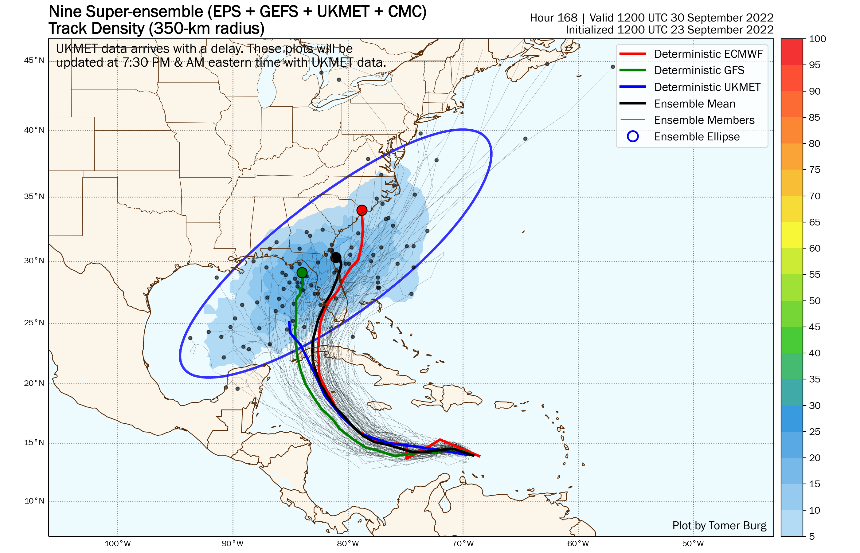
A trough of low pressure will move into the eastern US, which should steer the system northward, and eventually northeastward. When that turn occurs is vital to the forecast. Once the storm moves into the Gulf of Mexico, it should strengthen, and could become a major hurricane, so obviously, where it heads towards becomes an important question. As you can see from the image below, the various model ensemble members do not agree on where that turn happens. Some have it miss the trough and head more toward the northwest, while the majority have it move toward western Florida or the Florida Panhandle. Beyond that, some bring it inland into the Southeast, others have it cross Florida and then become a threat to the East Coast. Some even bring it into New England or Nova Scotia (which would be really bad), and many just head out to sea once back in the Atlantic. Obviously, this is something that we won’t have a better handle on for at least a few more days, but anyone from the Central Gulf to the East Coast should keep an eye on this storm’s progress.
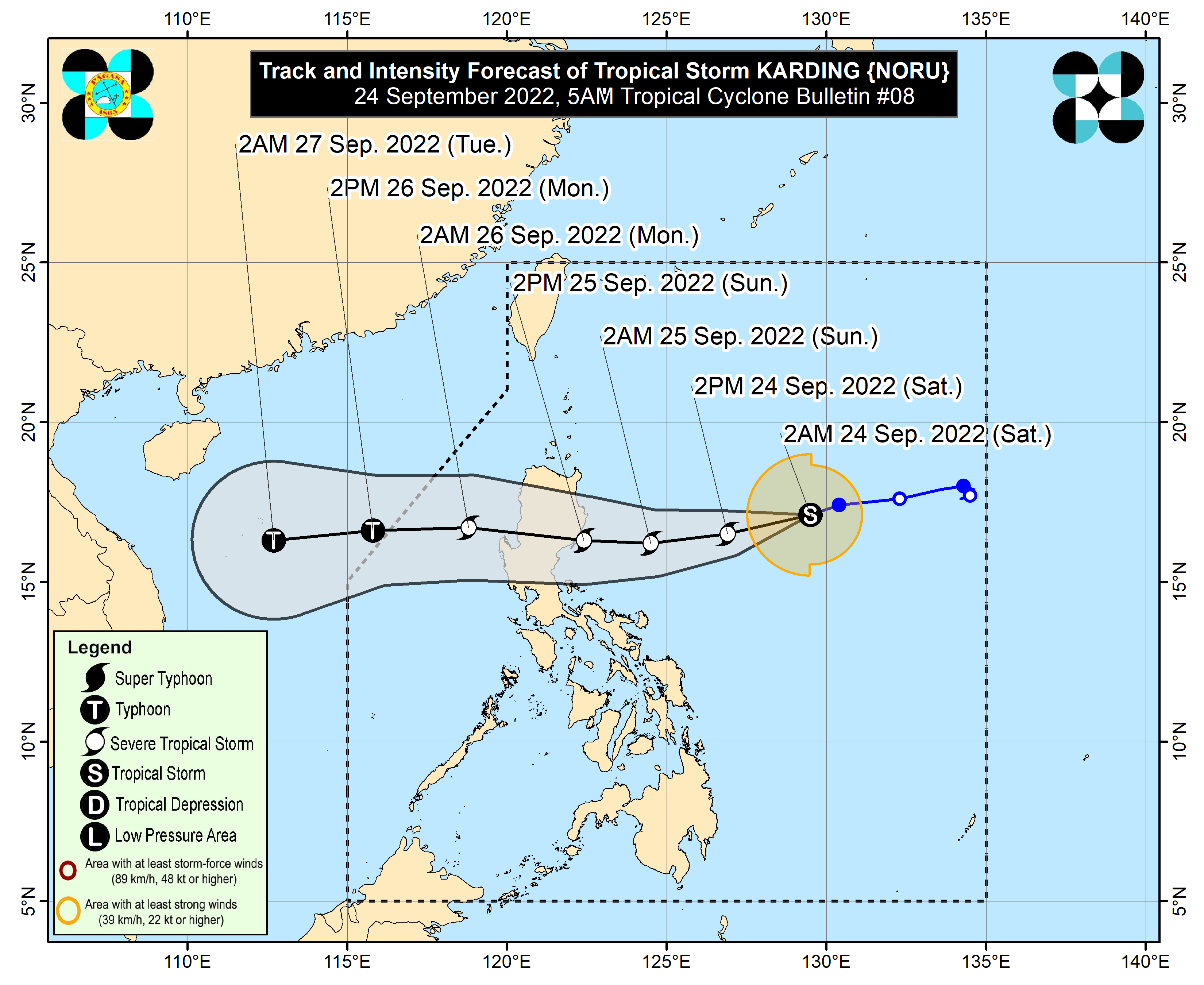
There are a few other active systems in the Pacific as well. Tropical Storm Newton is expected to pull away from Socorro Island off of the Mexican coastline tonight and head out into the open waters of the eastern Pacific where it should weaken and dissipate over the next several days. In the Western Pacific, Tropical Depression Talas is expected to dissipate just off the south coast of Japan on Saturday. Meanwhile, Tropical Storm Noru will become an increasing threat to the Philippines over the next few days. As of Friday evening, Noru was centered about 580 miles east-northwest of Manila, moving toward the west-southwest a 12 mph. Maximum sustained winds were near 50 mph. The forecast calls for steady strengthening, and Noru is expected to cross Luzon early Sunday as a typhoon. It should re-emerge in the South China Sea later in the day, then head westward, gathering strength early next week. It could make landfall in Vietnam by mid-week as a typhoon.