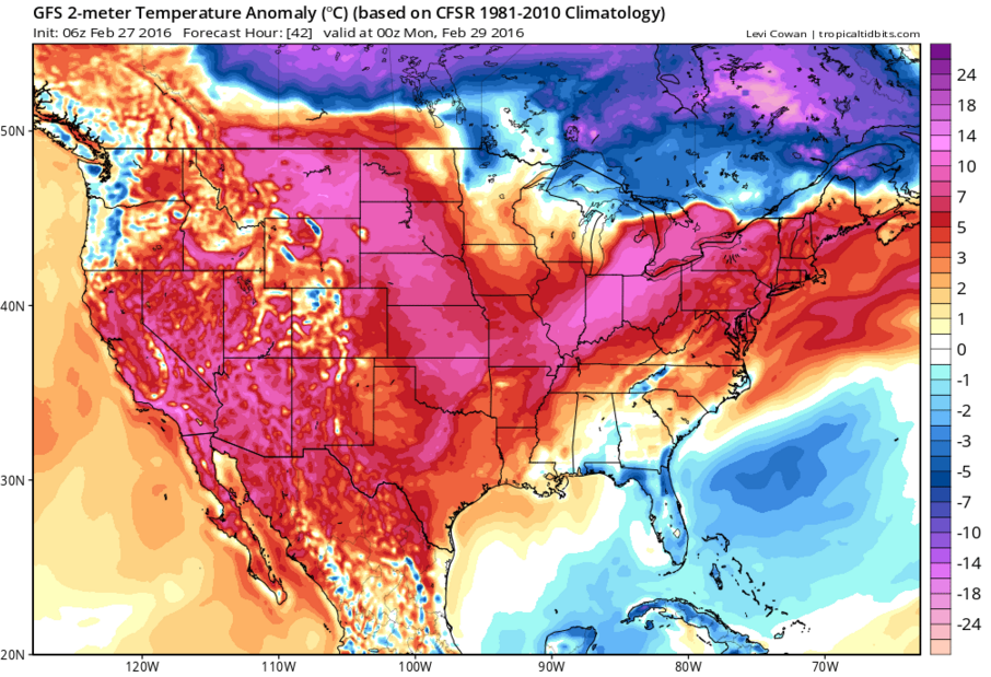
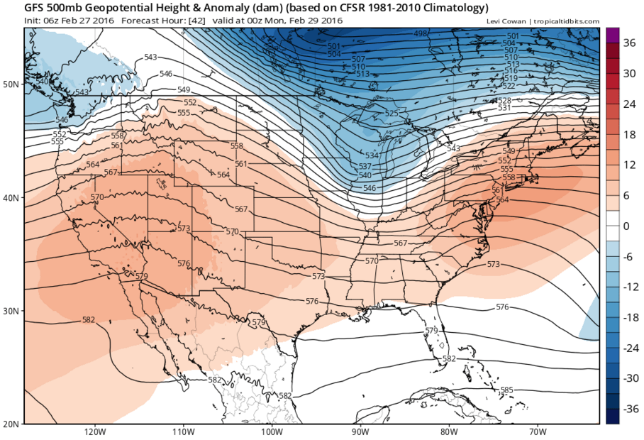
A strong surge of warm air will move east from the Northern and Central Plains into the Mid to Upper Mississippi Valley, Great Lakes, and Ohio River Valley on Sunday. Surface temperatures were forecast to be 15 to 30 degrees above normal for Saturday in the Plains and will be 10 to 20 degrees above normal in the Mid to Upper Mississippi Valley, Great Lakes and Ohio River Valley areas on Sunday. The normal setup for warm air into a region is a pattern of high pressure to the south and low pressure to the north. This allows warm air to come in on the back of high pressure and ahead of a cold front from the low pressure system. Also, with warm air moving into a region, the distance from the ground to a layer with a pressure of 500 mb increases to an above normal height. Above normal heights are forecast for the Mid to Upper Mississippi Valley, Great Lakes and Ohio River Valley areas on Sunday.
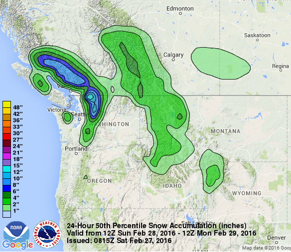
Farther west, a cold front moves ashore in the Pacific Northwest as a low pressure system moves ashore in Western Canada. The aforementioned warmer temperatures were in the Pacific Northwest 24 hours ago, so many places will receive rain from this front, but higher elevations will receive snowfall. Northern portions of the Cascades may receive near 1 foot of snowfall from this frontal system. In addition, the northern portion of the Rockies within Western Montana and Western Wyoming are forecast to receive 2 to 4 inches of snowfall from this system.
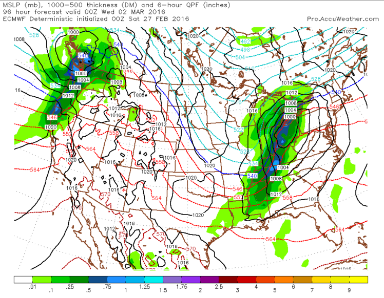
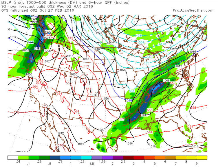
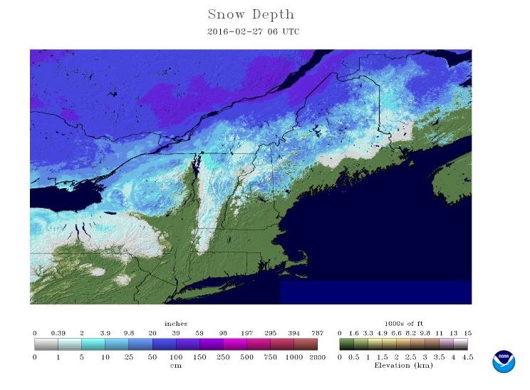
As the energy for the frontal system in the Pacific Northwest moves ashore, an upper level low pressure system in Central Canada will help to steer the energy towards the Northeast. The energy will eject from the Rockies dive south into the Ohio River Valley region. The track of the system after its movement toward the Ohio Valley region is key for the Northeast. Longer range models initialized Friday night show two possible track options for the storm after the track through the Ohio River Valley. A movement across Southern New England (the American GFS model) will allow more cold air to flow into the region. With more cold air and some moisture around the region, an onset of snow or freezing rain is possible along a cold front that would be across portions of New England at that time, especially north of Route 2 in Massachusetts and into Central and portions of Northern New England. However, a shift to more of a northern track (the European model) would allow for less snow, if any, at the onset overnight Tuesday night as the cooler air wouldn’t be able to come into the region as well as the more southern track. With the current snowpack only in the Berkshires and all the way into Central to Northern New England, a push northward of the warm front overnight, as the European model is hinting at may be possible, but temperatures on Tuesday and Tuesday night will have to be assessed to see how far south the below-freezing air will be able to come into Southern New England. If the colder air is able to come far enough south, the front will probably struggle to move northward and some snow or freezing rain would be possible Tuesday night before changing to rain during the day Wednesday and as the low pressure system approaches from the west.