Tropical activity usually begins to increase in August, and right on cue, it is doing so, in both the Atlantic and the Pacific.
After a fairly slow start to hurricane season, conditions are starting to become more favorable for storms to develop, especially across the Atlantic. We’ve had three weak, short-lived storms thus far, which isn’t that unusual for June and July, but activity usually starts to ramp up in August. Saharan dust surges, which are common in June and July, should be starting to slow down over the next few weeks. Water temperatures continue to rise, and now are above the 26C (79F) threshold needed to sustain tropical systems across a large portion of the Atlantic, especially the Main Development Region (MDR). In addition, wind shear has been rather hostile across the tropics, but that is also starting to lessen. The tropical waves moving off the west coast of Africa have been a little more robust over the past few weeks, and although none of them have developed, it is only a matter of time until that changes. This is not the only place we need to watch for storms to develop however.
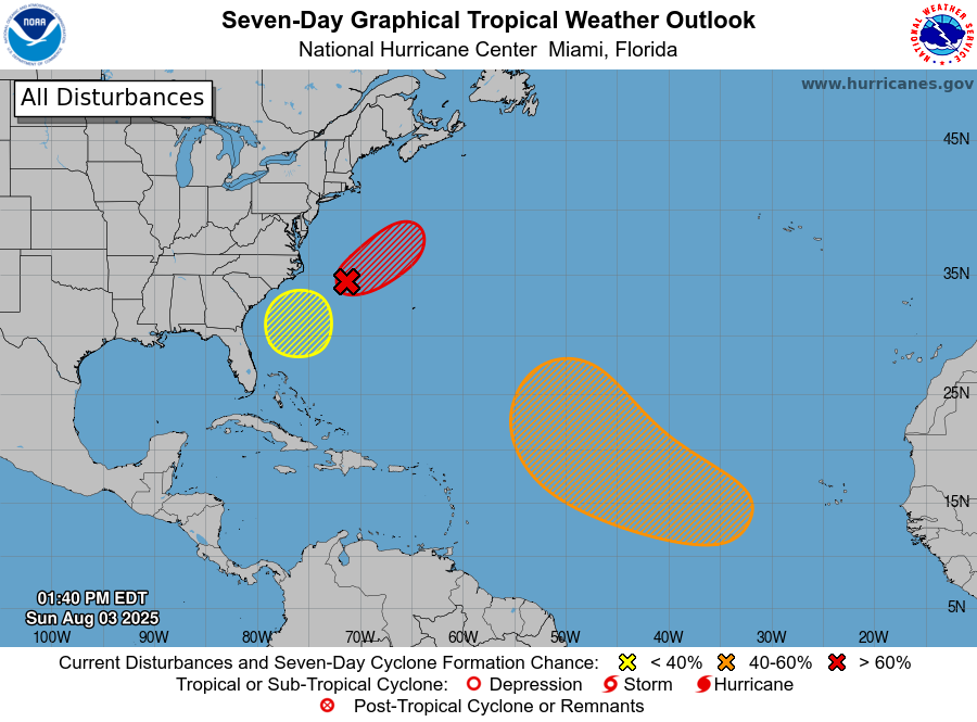
There are now three areas in the Atlantic being monitored for development. Image provided by the National Hurricane Center.
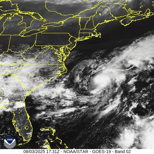
Starting off near the East Coast, a frontal system is stalled out near the Carolinas. A wave of low pressure has developed along the front, a few hundred miles off the North Carolina coastline. It is producing squally conditions in the offshore waters, and should head out to sea over the next few days. However, as it detaches from the front over the next day or so conditions will become favorable for development, and it could become a Tropical Depression or Tropical Storm over the next few days as it heads out to sea, without impacting any land areas.
That might not be the only system we need to keep an eye on near the East Coast over the next week or so. Forecast models are showing the potential for another system to develop off the Southeast Coast later this week. Some models keep the storm weak and have it mill around near the Southeast for a few days, others are more bullish and develop the system and have it head up the East Coast, while other models have it stay offshore and head out to sea harmlessly. It’s too early to determine whether the storm will even form, never mind where it might go, but this is definitely something to keep an eye on as the week goes on.
Elsewhere in the Atlantic, there are a couple of tropical waves crossing the Caribbean, but neither is expected to develop at this time. However, another wave will move off the west coast of Africa on Monday, and this one could bear watching. We already mentioned above how conditions across the Main Development Region are beginning to improve, and this wave could take advantage of those improving conditions. Many of the forecast models, especially the Ensembles, are showing significant potential for this wave to develop as it crosses the Atlantic. We’ve seen plenty of times before where the models are gung-ho with a system, and it doesn’t develop, so this is far from a lock. Even if it does develop, questions of where it goes and how strong it gets cannot be answered at this time, and probably won’t be for at least another week or so, and that’s if it even develops. Nevertheless, we’ll be keeping an eye on this wave in the coming days.
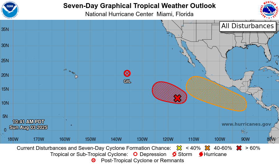
In the Eastern Pacific, where activity has been closer to normal so far this season, more storms are expected this week. Former Hurricane Gil has become extratropical halfway between Mexico and Hawaii, and will no longer be a threat. However, an area of low pressure appears to be developing several hundred miles southwest of Mexico. Conditions are favorable for development, and this system could become a tropical depression by Monday. Forecast models show the potential for it to quickly develop, possibly becoming a hurricane by midweek. After that, it will start to move over cooler water, and should start to weaken fairly rapidly. Its remnants could bring gusty winds and rainfall to parts of Hawaii in a week or so, but that is far from certain.
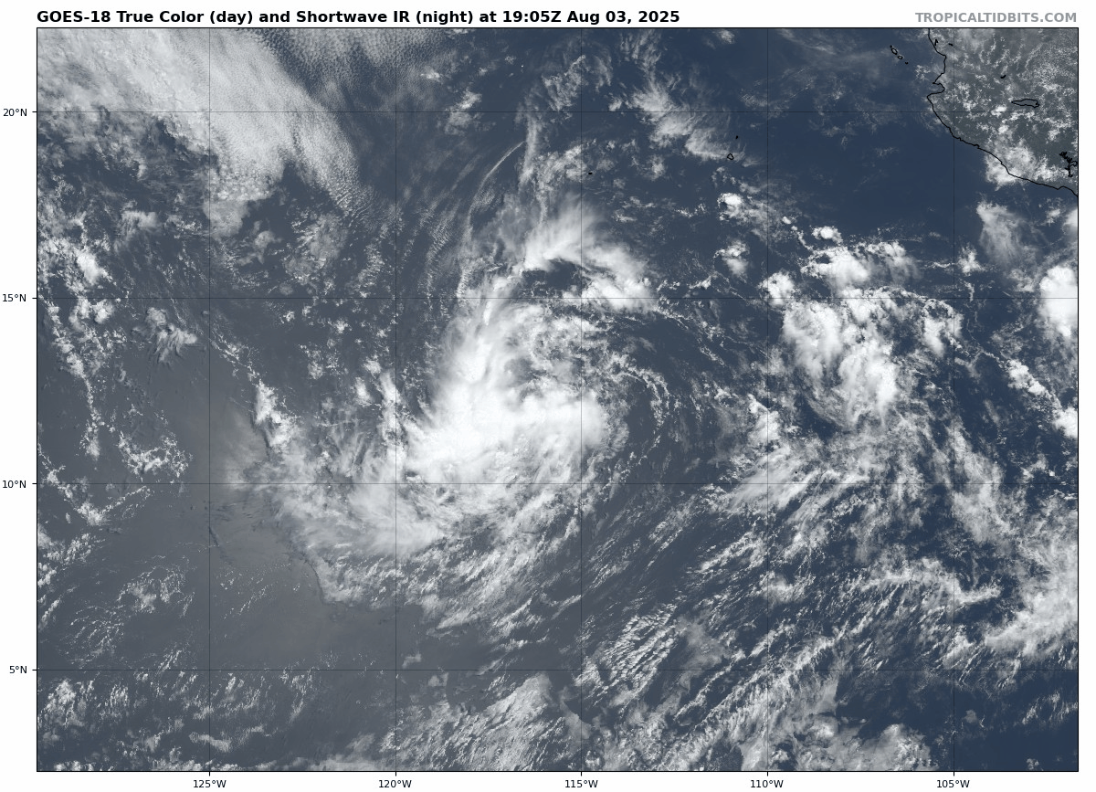
Meanwhile, forecast models show the potential for another system to develop south of Mexico later this week. While the models aren’t quite as bullish on this system as they are on the one mentioned above, they do show the potential for this system to become at least a tropical storm toward the end of the week. The difference with this one is that it will form quite a bit closer to Mexico, and could be a threat to parts of southern Mexico by the end of the week.
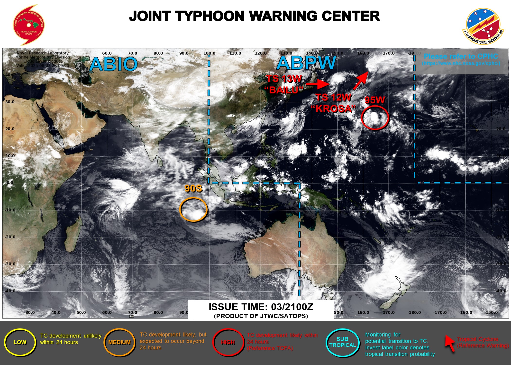
In the Western Pacific there are also a couple of areas to watch. Tropical Storm Krosa is dissipating well northeast of Japan, and is not a threat to any land areas as it heads out into open water. Tropical Storm Bailu has maximum sustained winds near 40 mph, and was centered about 400 miles east-northeast of Tokyo Sunday evening. Bailu should maintain its current intensity for the next day or two, but will head east-northeastward, away from Japan and out to sea, without impacting any land areas. There is also an area of disturbed weather about 500 miles north of Wake Island that is being watched. Conditions are favorable for development, and this could become another tropical depression in the next day or so. Like the other active systems in the Western Pacific, even if this one develops, it will likely stay over open water without threatening any land areas.