The Storm Prediction Center has highlighted the Southern Plains with the potential for severe weather on Monday and Tuesday with Monday’s main hazard being marginally severe hail and Tuesday containing all of the main hazards including wind, hail and tornadoes.
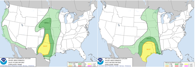
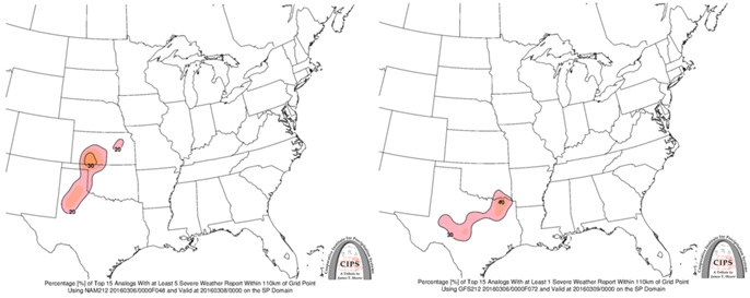
This is a result of a strong low level jet flowing in from the Gulf of Mexico bringing in plenty of warm and moist air. Air with a dew point of 60F or greater moves into eastern Texas toward the end of the day Monday and dew points into the upper 50s exist in parts of the Central Plains. Plenty of turning in the wind, shear, exists in the atmosphere along with plenty of upward motion, CAPE. An area of very dry air exists in the mid levels of the atmosphere, which will act to inhibit weaker storm growth, but in areas where the upward motion is strong, the storms may have the chance to create hail, especially in any supercells that form. Analogs based on the Saturday night run of the short range forecast model, the NAM, have an area from the Panhandle of Texas into central Kansas where at least 5 previous severe weather reports occurred, which is close, but not the same as the SPC forecast severe weather risk, which has its severe area from southern Texas into south-central Kansas. Short range model simulations from the NAM as well as the NCAR ensemble forecast show convection firing in central Texas and eastern Oklahoma and moving into eastern Oklahoma and eastern Kansas as the day turns to night.
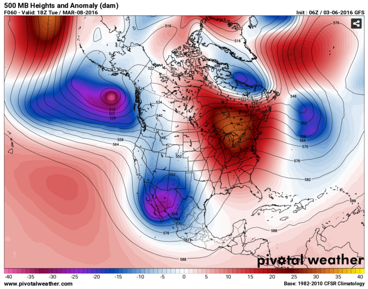
For Tuesday, the strong energy that helped to force along the heavy flooding rain along the West Coast will move south into Mexico. This energy will help to drive more moisture and warm air into Southern Plains on Tuesday. Dew points will be into the 60s in eastern Texas and plenty of CAPE and shear will exist in that region. Plenty more energy around the region will help to spark more storms. With the copious amounts of CAPE and shear, all types of severe hazards will be in play including tornadoes. Towards the end of the day, when the sun’s heating turns off, storms tend to form into a convective line with strong winds or into a large complex with heavy rain and thunderstorms, called an MCS. The Storm Prediction Center hints that an MCS may form towards the end of the day in southern and Eastern Texas. Analogs based on the Saturday night run of the long range forecast, the GFS, have an area from central into northeast Texas where at least 1 previous severe weather report occurred. This is a smaller area of than the Monday setup, perhaps indicating a lesser event or because of the general bias of the shorter range NAM model to having more moisture to enhance storms. The SPC has a slight risk, which is the same severe risk category given for Monday covering eastern Texas and portions of the States bordering Texas. The SPC risk includes the analog risk area. Shorter range model projections have convection in Oklahoma and Missouri.
The severe weather risk continues into the middle and possibly the end of the work week in Southern United States.