For the second weekend in a row, there is a threat for severe weather across parts of the Northeast. Unlike last weekend, when the threat was centered on areas from the Delmarva Peninsula southward to the Carolinas, the threat on Saturday is focused on the Northeast.
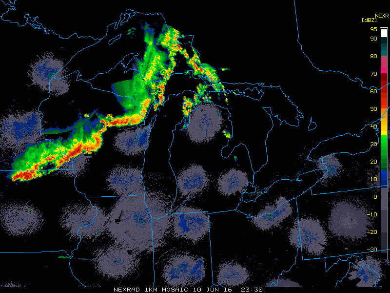
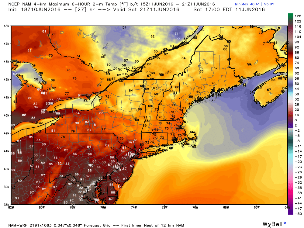
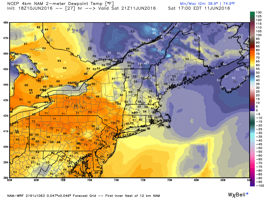
Low pressure is moving across Lake Superior this evening, with a warm front extending east and southeast from the system across the eastern Great Lakes and into Virginia. A cold front trails the system into the Dakotas and Wyoming. South of these two fronts a very warm and humid airmass is in place, with temperatures well into the 80s and 90s on Friday. Dewpoints were in the 60s to lower 70s across much of the region as well. As the cold front moved into the Upper Midwest, it helped ignite a line of strong to severe thunderstorms. These storms produce golfball-sized hail and wind gusts as high as 76 mph as they cross Minnesota and Wisconsin Friday afternoon and evening.
Usually, strong to severe thunderstorms diminish during the evening hours as they lose the heating of the sun. However, with the warm and humid air in place across the Midwest, these storms will likely continue to march eastward overnight ahead of the cold front.
Forecast models indicate that this line of thunderstorms will move across portions of New York and Pennsylvania Saturday morning and afternoon before moving into portions of New England. How far north and east the warm front moves will help determine where the best chance for severe weather will be located.
Right now, it looks like the warm front will only make it into New York and southwestern New England before the cluster of showers and thunderstorms arrives. Some of the stronger storms could produce downpours, strong winds, and hail across portions of New York, Pennsylvania, and New Jersey.
Across New England, the threat for the afternoon seems less, with more typical showers and thunderstorms expected. However, this does not mean that the threat is zero. If the warm front were to make progress farther northward, the threat would increase. The bigger threat in this region could come at night. The warm front should eventually push through during the evening, allowing the warm and humid air to move into Southern New England. As the cold front continues it eastward march, another round of showers and thunderstorms will likely develop along and ahead of it. As these storms move across New England overnight, some of those storms could produce heavy downpours and strong winds.
After the cold front moves through Saturday night, skies should become partly to mostly sunny across the Northeast on Sunday with near-to-below normal temperatures expected. An upper-level low will slowly move across the Gulf of Maine early next week, keep temperatures near or below seasonal normals while heat and humidity dominate the remainder of the eastern two-thirds of the nation.